In brief: Although we cannot be certain at this time, it increasingly looks as though Tropical Storm Beryl is on track to make landfall somewhere between Corpus Christi and Matagorda Bay on Monday. For the greater Houston area this will result in higher winds, some storm surge, and heavy rainfall, with the greatest impacts likely on Monday. This post goes into what to tentatively expect, and when.
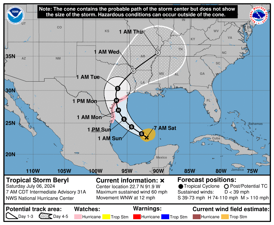
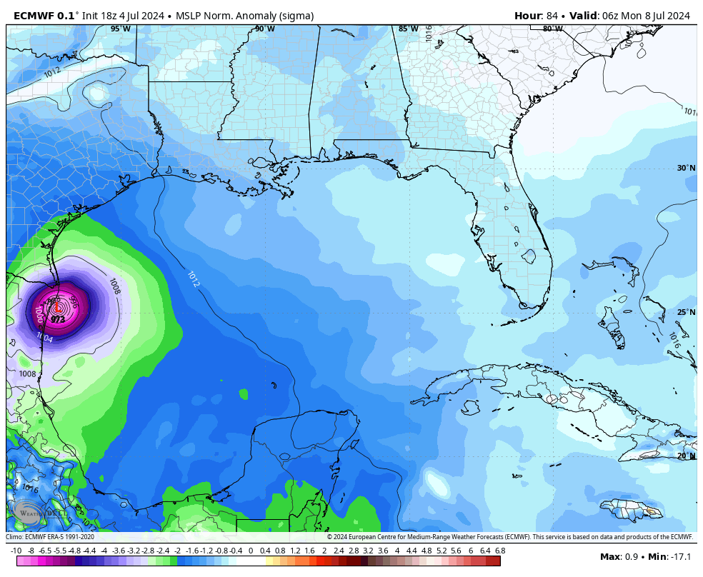
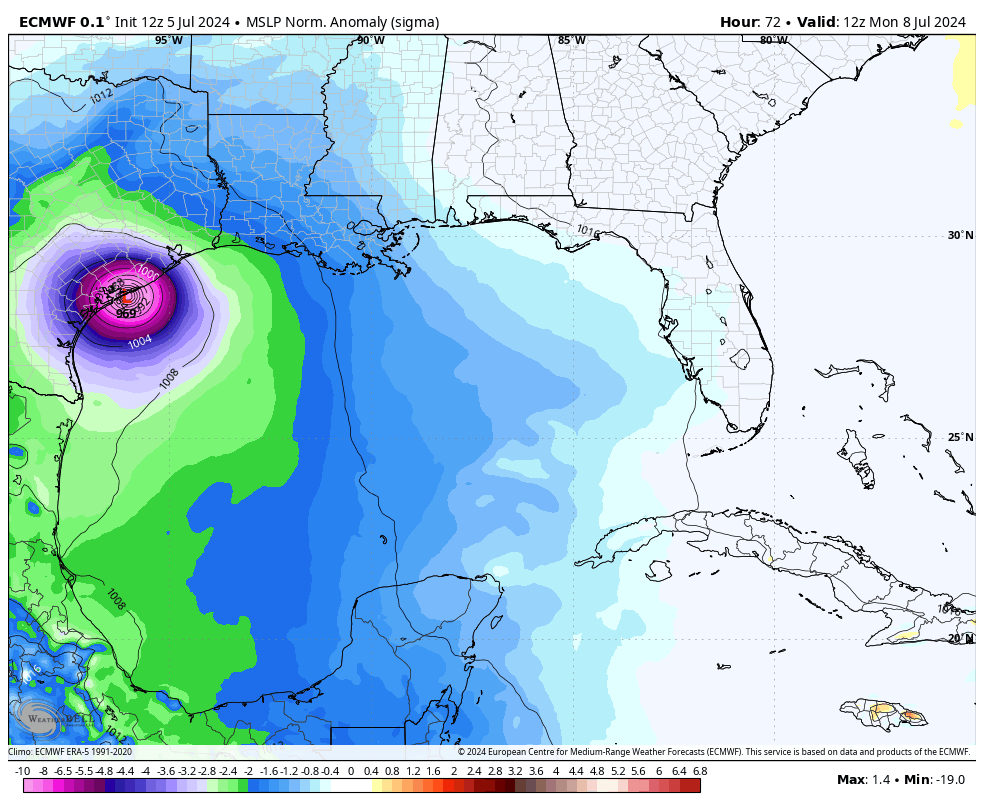
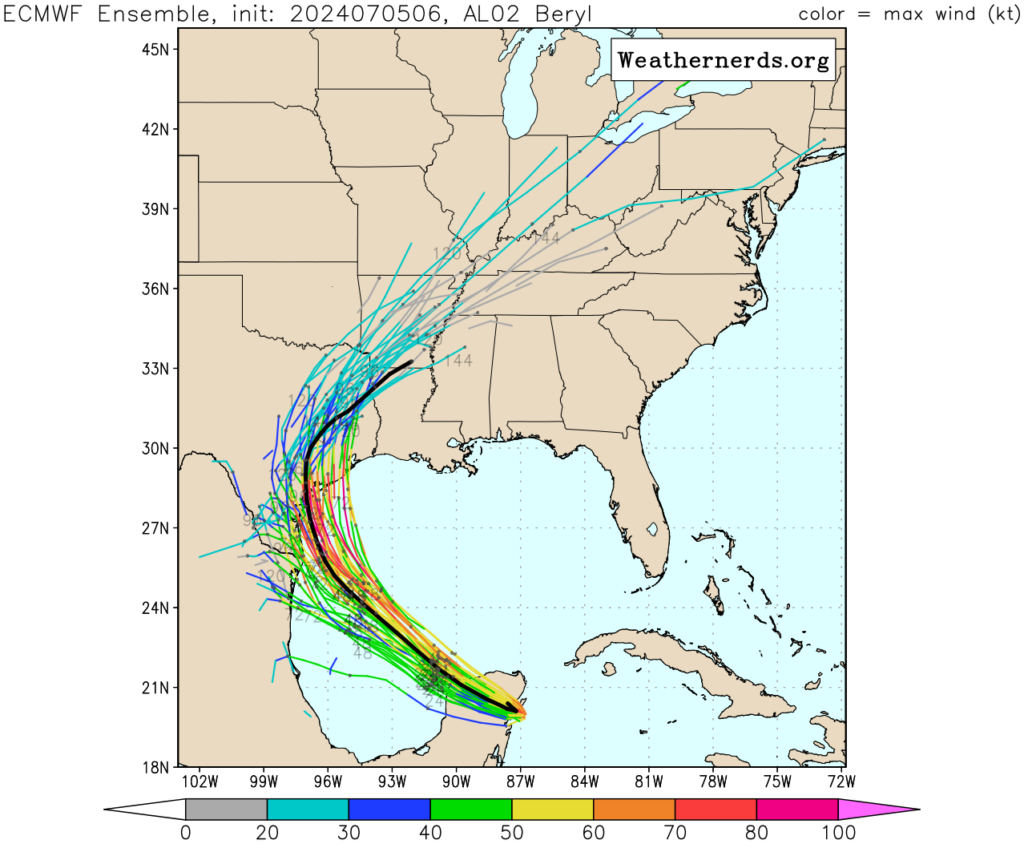
There is understandably a lot of consternation about the forecast for Beryl, which shifted considerably northward during the last day or two toward Houston. However, overnight the majority of our model guidance has stabilized on a landfall along the Coastal Bend of Texas, somewhere between Corpus Christi and Matagorda Bay.
Given the unpredictability of Beryl to date, I don’t blame anyone for being skeptical about this forecast. However there are a couple of reasons for increased confidence. Most importantly, we are only about 48 hours from landfall, and the average track error at this point is approximately 60 miles. And secondly, the models have stopped swinging about wildly and begun to consolidate on a solution.
In this post, we will discuss the effects of this “most likely” storm path on the greater Houston area, from Katy to Baytown, and Galveston to Conroe. For effects across the entire state of Texas, I would point you to The Eyewall. We will update Space City Weather a couple of more times today, and if our thinking on the forecast track changes, I will post immediately.
Hurricane Beryl’s status and track
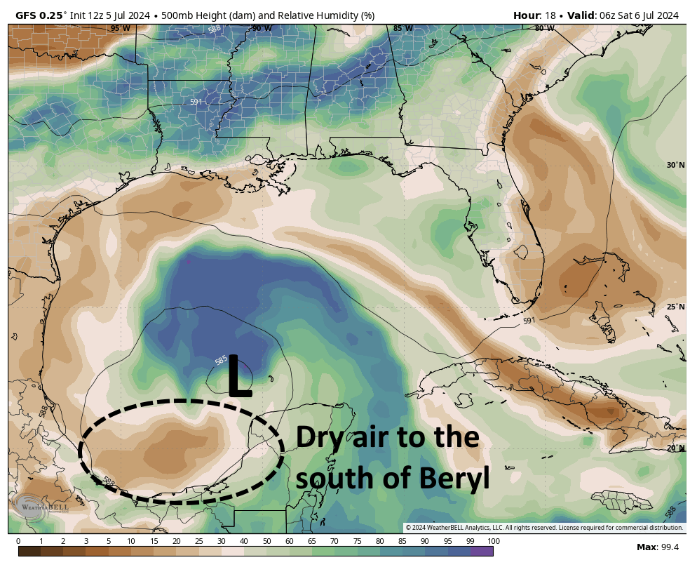
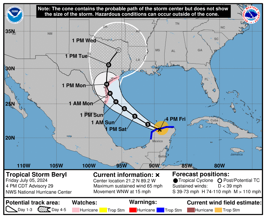
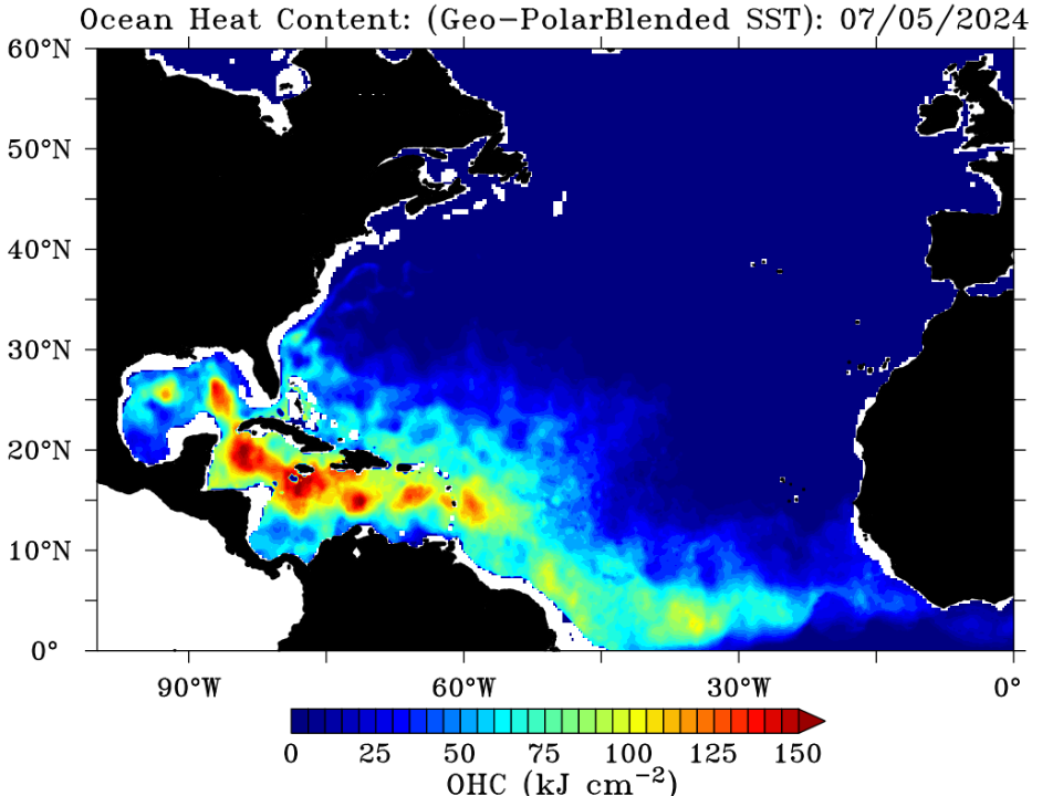
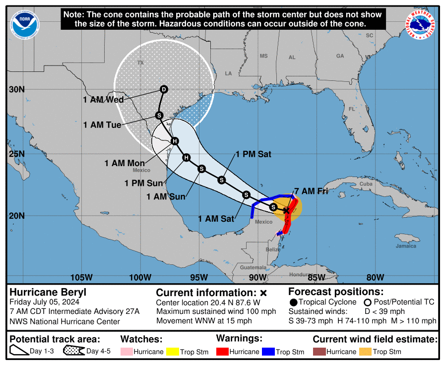
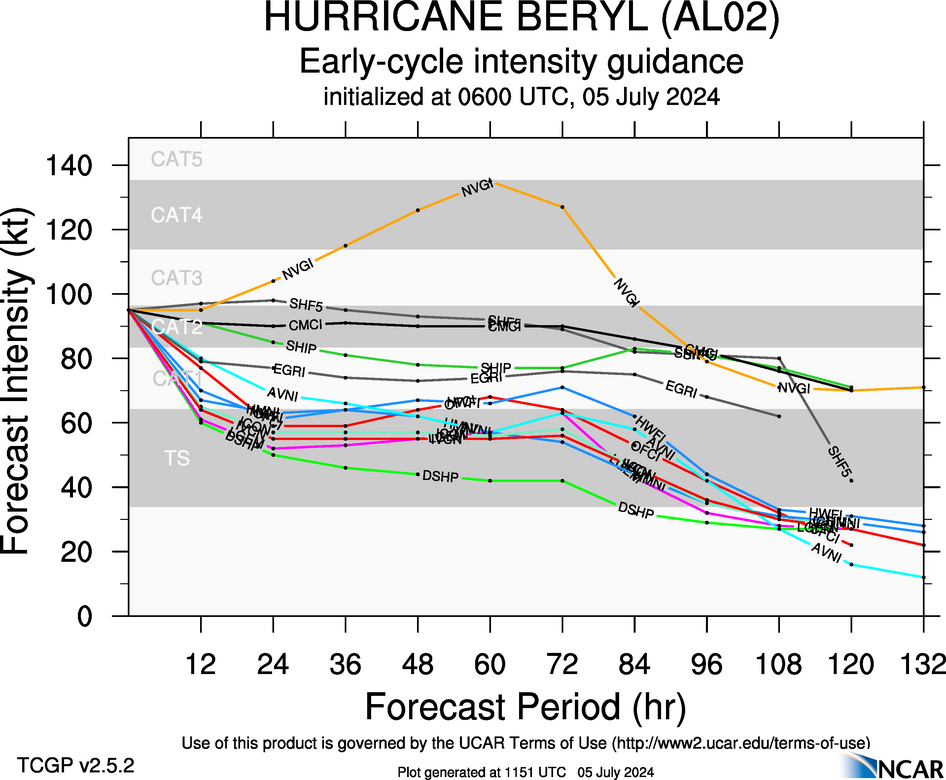
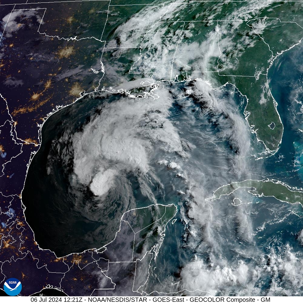
Beryl emerged into the Gulf of Mexico as a ragged storm on Friday evening, and has since been struggling with drier air to its south, and wind shear to its west. As a result, as of 7 am CT, the storm has sustained winds of 60 mph. In terms of intensity, it will take Beryl some time to regain its organization, but by tonight or Sunday, it should move into an area of more moisture and lower wind shear, allowing for strengthening. It’s really a matter of how long it takes Beryl to get its act together, because once it does it will find conditions favorable for intensification. The official forecast calls for a Category 1 hurricane at landfall on Monday, but it could easily be a tropical storm or Category 2 hurricane.
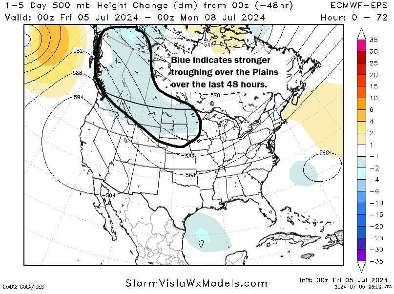
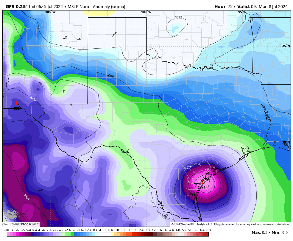
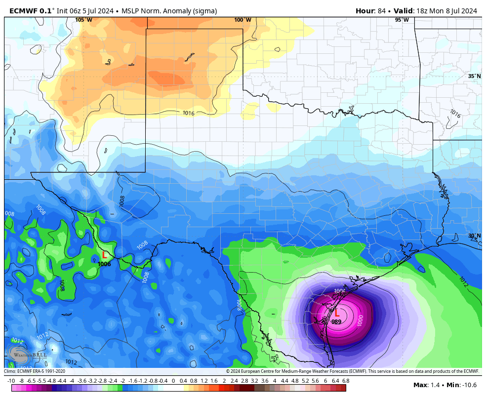
In terms of track, Beryl is moving around the western periphery of a high pressure system, and should gradually turn more and more northwestward until moving due north around the time of landfall. That should come sometime on Monday morning, although the precise time is difficult to predict. The likely landfall location is between Corpus Christi and Matagorda Bay, but for now the greater Houston area remains within the cone of uncertainty.
Effects on Houston
Let’s go over the anticipated impacts on the greater Houston region, including winds, surge, and rainfall.
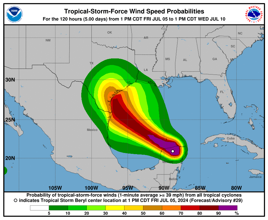
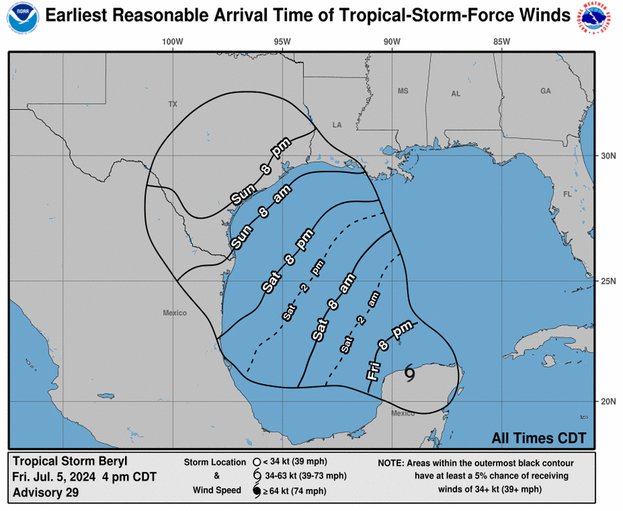
Winds: Along Beryl’s expected track, the system is unlikely to produce significantly damaging winds for much of the Houston area. The greatest risk of tropical storm force winds will be in Southern Brazoria County, and locations such as Freeport and Lake Jackson. Galveston Island will have about a 50 percent chance of tropical storm force winds, with higher gusts. Strong winds would likely arrive late Sunday night, and persist through Monday.
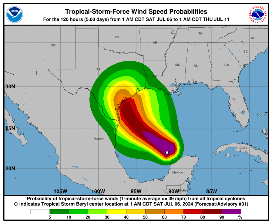
As Beryl moves inland, its center should pass to the west of Houston, so areas such as Sugar Land and Katy will also have a decent chance of seeing tropical storm force winds and higher gusts. If there are power outages, I would expect them to occur to the west of Interstate 45. However, at this time I do not envision a situation in which hundreds of thousands of customers in Houston lose power for a long period of time. Still, it’s something to monitor. The likelihood of seeing hurricane-force winds anywhere in the Houston metro area is virtually zero.
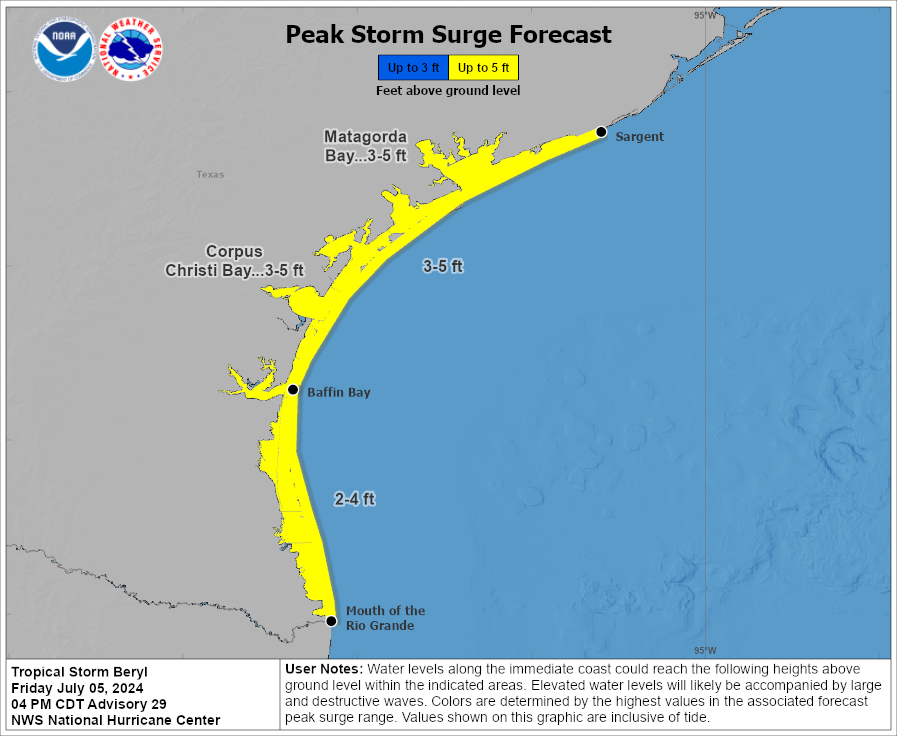
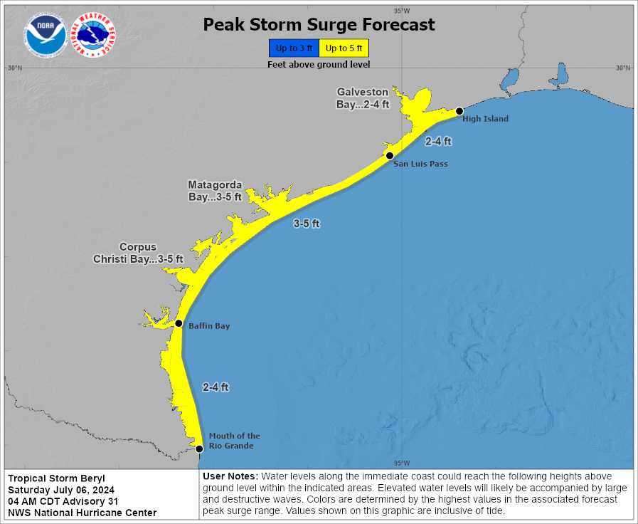
Storm surge: Areas along the upper Texas coast, including Galveston Bay, are likely to see 2 to 4 feet of surge at high tide. This surge should peak on Monday morning. The effect should be similar to what the region experienced with Tropical Storm Alberto a couple of weeks ago.
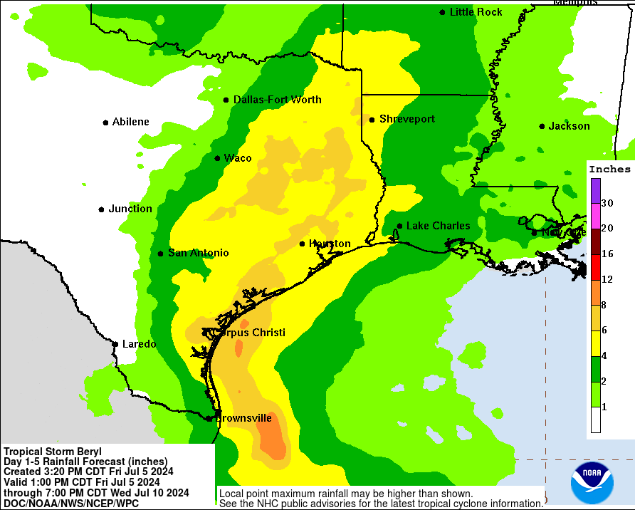
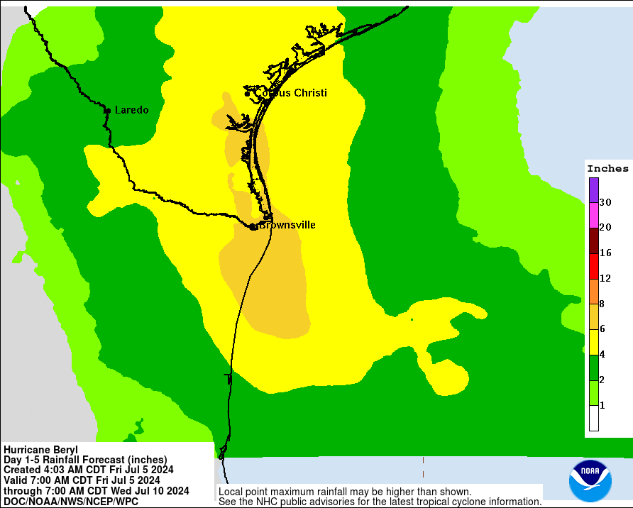
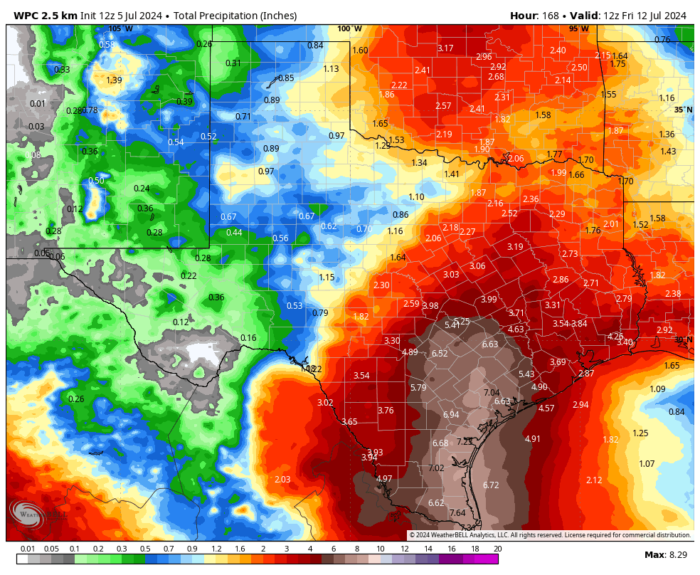
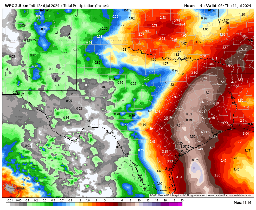
Rains: Beryl will bring plenty of tropical moisture with it, and the Houston region will likely see heavy rainfall on Monday (most likely) and Tuesday. In terms of accumulations, I would expect much of the region to pick up 4 to 8 inches, with higher isolated totals. This could well cause some flooding concerns, and we are initially issuing a Stage 2 flood alert for the Houston region. This means we expect widespread street flooding, and the potential for some homes to flood. As Beryl will continue moving northward after making landfall, I don’t think we’ll need to go higher in our flood stage warnings. We should get a better handle on timing of the most intense rainfall in a day or so.
In summary
Beryl has been, to say the least, a challenging forecast. Fortunately, we are in the home stretch. You have all of today, as well as most of Sunday, to make any final preparations. We will have an additional update on Space City Weather by 5 pm CT today. However, if there are substantial changes in our thinking, we will update before then. Thank you for your patience and trust.