In brief: We’ll have a couple of more afternoons where some scattered showers will be likely, bringing a bit of welcome rain and briefly cooler temperatures. By this weekend we’ll be pushing the upper 90s, with the chance of hitting 100 degrees for the first time this year in Houston. Also, skies will be hazy due to Saharan dust.
Thursday
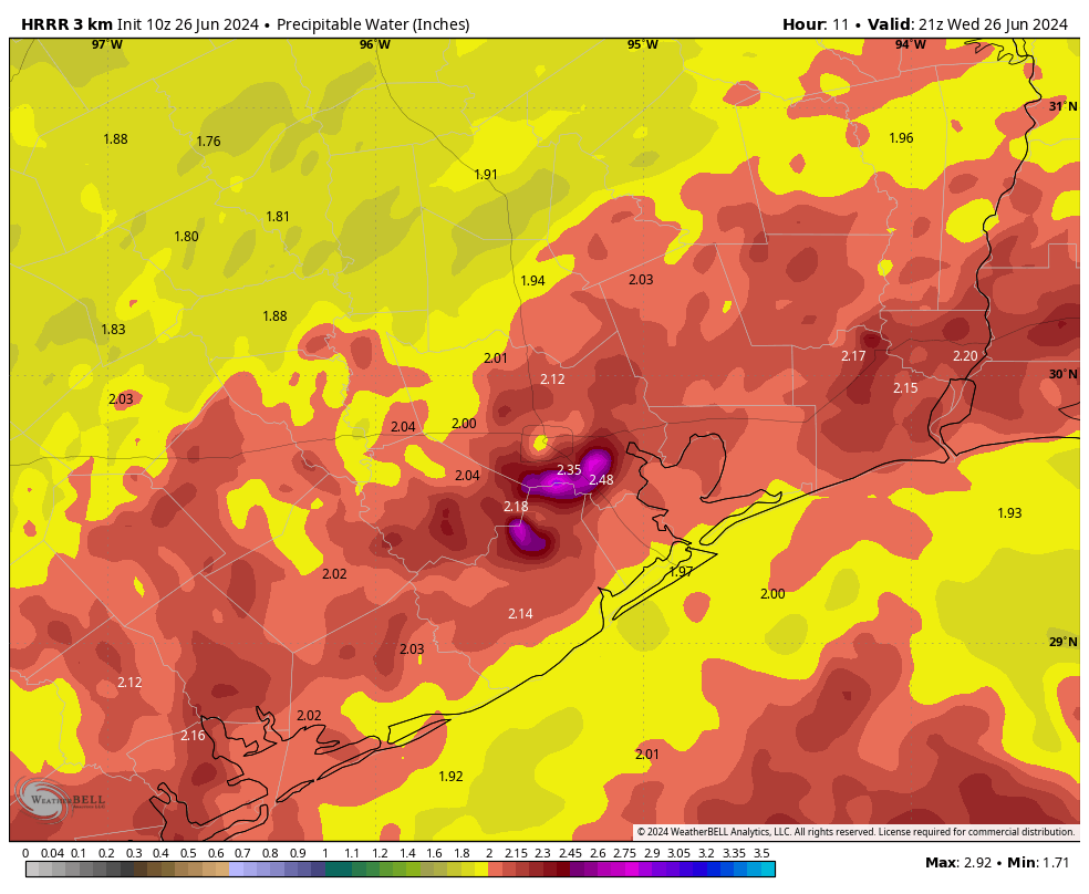
Today will have a similar setup to Wednesday, when we saw the development of some scattered thunderstorms across central and some southern parts of the region (mostly) during the afternoon hours. Again we’ll be on the periphery of high pressure, allowing for the seabreeze and daytime heating to do some work.
Rain chances this afternoon are probably about 30 percent, and some areas could see as much as half an inch of rain beneath stronger thunderstorms. Highs will depend on the extent of showers in your locality, but I still expect much of the region to get up into the mid-90s. Winds will be very light, from the southeast at maybe 5 mph. Lows tonight will only drop to about 80 degrees.
Friday
A similar day to Thursday, although perhaps with slightly less rain coverage. Highs again will push into the mid-90s for the most part, with light southerly winds.
Saturday and Sunday
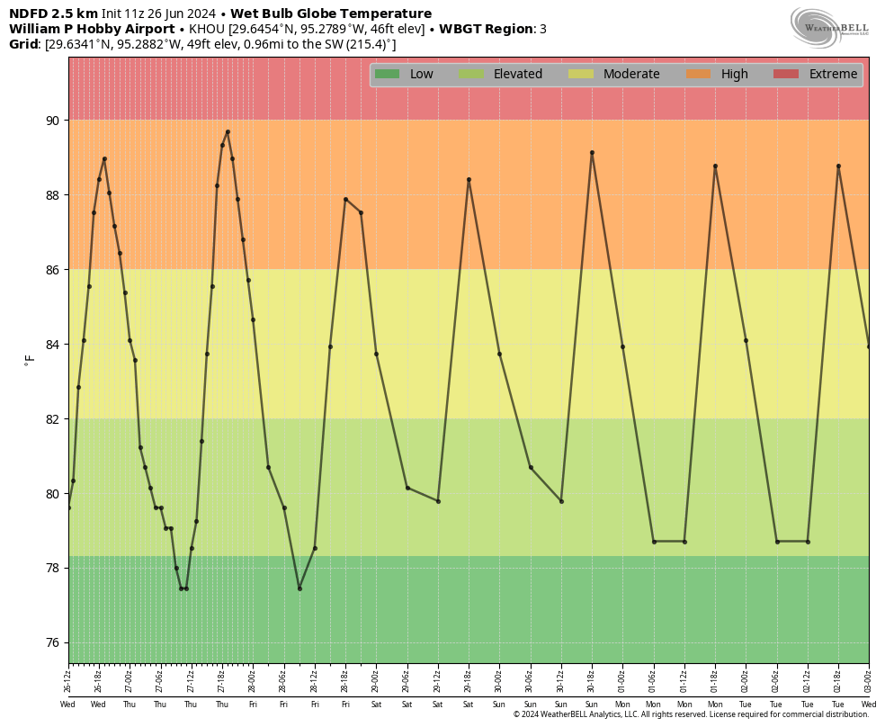
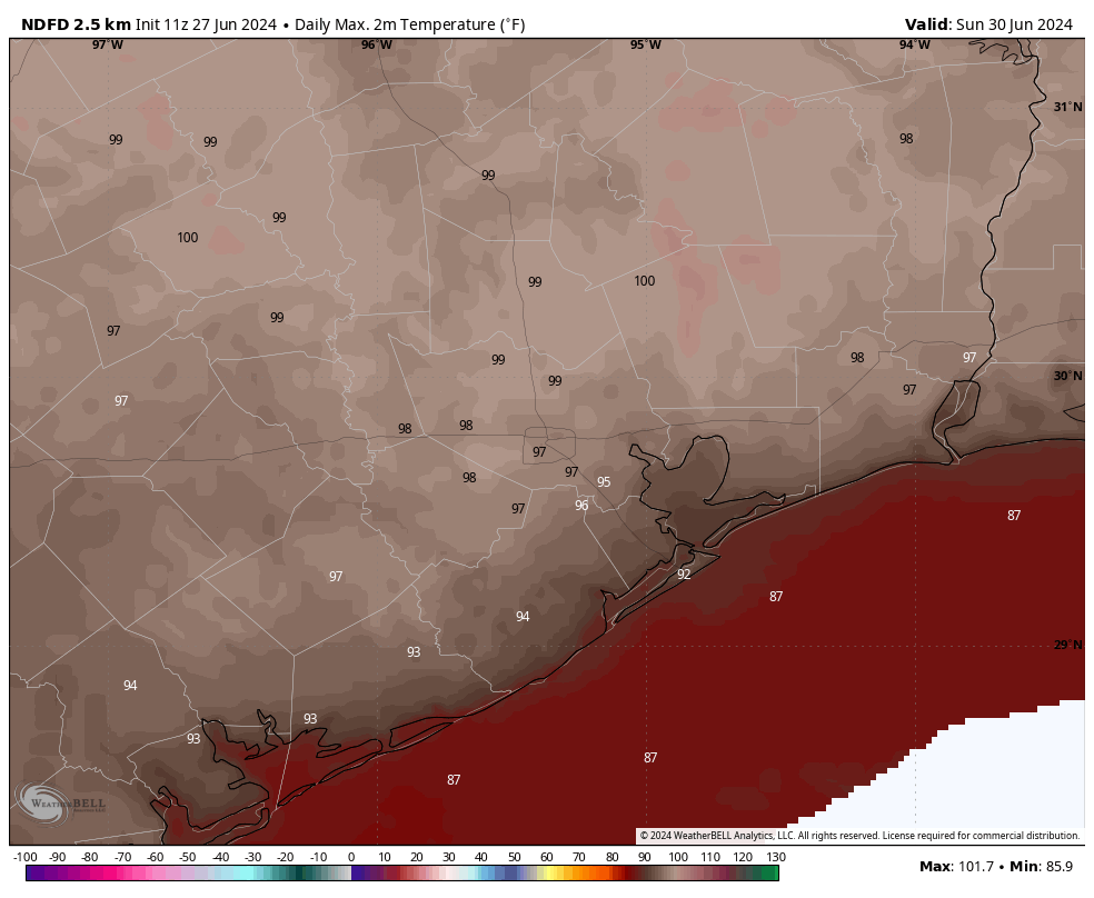
The weekend looks very warm as high pressure becomes a little bit more dominant. Rain chances will go down, close to zero percent on Saturday, and maybe 20 percent or so on Sunday. Daytime highs on Saturday will be in the mid- to upper-90s, and then on Sunday some locations could reach 100 degrees for the first time this year. Please take heat precautions if you’re going to be outside during the middle of the day this weekend.
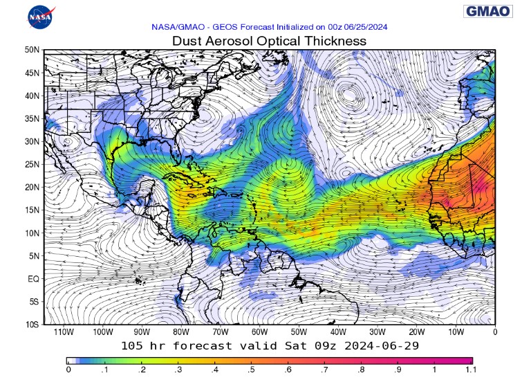
In addition, we’ll see the influx of Saharan dust, which will produce hazy conditions over the Houston region this weekend. For most people this won’t have significant effects, but it could make sunsets more brilliant.
Next week
Monday will be very hot, bringing the region another chance to hit 100 degrees. There also will be a limited chance of rain showers, perhaps 20 percent. Most of next week should be similar, although slightly cooler. Expect highs in the mid- to upper-90s for the most part, with isolated to scattered showers during the afternoon hours along the seabreeze.
Atlantic tropics
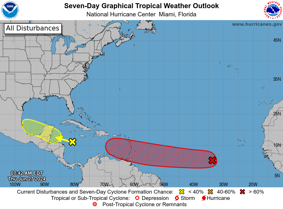
After a (very) brief lull following Tropical Storm Alberto, the Atlantic tropics are starting to come to life. The deep Atlantic seems to be heating up earlier than normal, likely due to the excessively warm temperatures in the main development region of the ocean. We’re starting to see a more active African “wave train,” which is the source of the majority of hurricanes during the Atlantic season. Typically this does not get going for at least another month, but here we are.
There are a couple of active systems, but the one to watch is the trailing disturbance, shown in red on the map above, known as “Invest 95L.” (Invest simply stands for “area of investigation”). We’ll be providing deeper coverage of this system on The Eyewall, but what I would say right now is that there’s a low-end chance this disturbance eventually reaches the Gulf of Mexico in about 10 days time. Really, it’s not something I’d be too concerned about. But we’re keeping an eye on it, just in case.