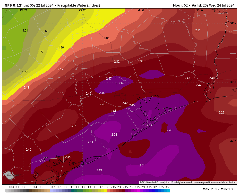
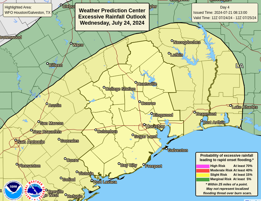
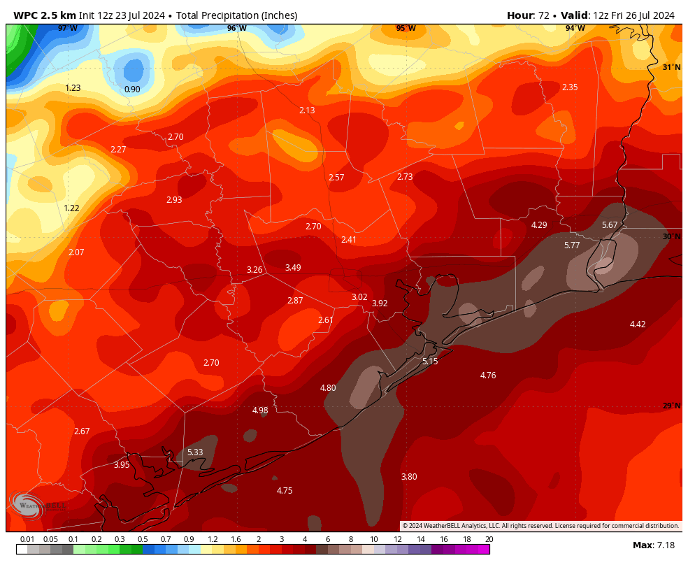
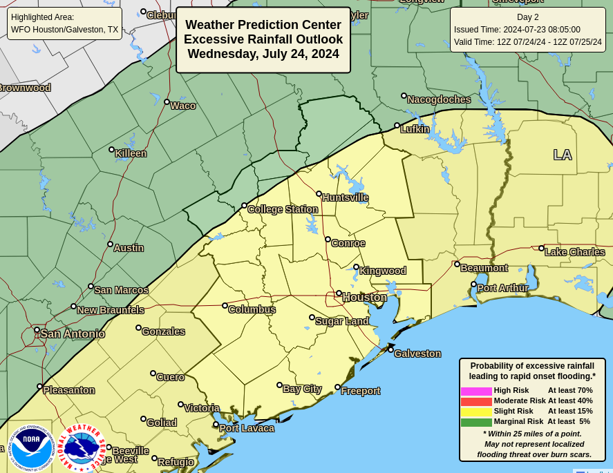
In brief: Houston faces three days of widespread showers, with the potential for heavy rainfall and street flooding, before conditions start to ease heading into the weekend. The entire metro area lies under a Stage 1 flood alert through Thursday, although the potential for heavy rain this week is highest near the coast. That’s where we expect the greatest accumulations, with 6 or more inches possible in some locations.
Tuesday
Showers have developed near the coast this morning, at sunrise, and are making their way inland. Coverage of these storms may widen for areas south of Interstate 10 this morning, and this may prove impactful during the morning commute. Some street flooding is possible. Later today we can expect widespread showers for much of the area, with embedded heavy rainfall through the daylight hours. Please be weather aware as you get out and about today.
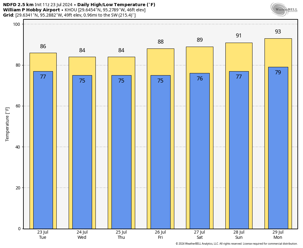
The coverage and intensity of showers today should wane as we get toward sunset, but some light to moderate rain will still be possible overnight. Highs today will get into the mid-80s for most locations, although far inland area (with lesser rain) may reach 90 degrees. Winds will generally be light, from the east, at 5 to 10 mph. Lows tonight will drop into the mid-70s.
Wednesday and Thursday
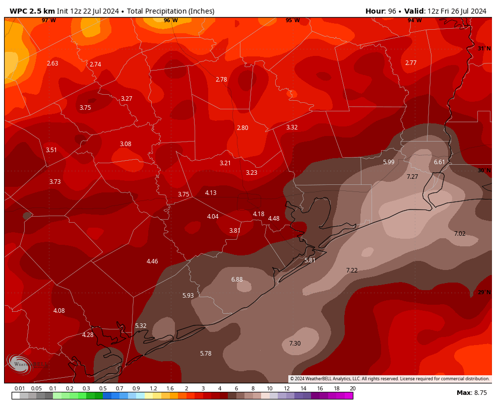
These days will both see widespread coverage of moderate to heavy rainfall, with the highest totals likely along and south of Interstate 10. Most of our modeling continues to paint coastal areas, from southern Brazoria County to Galveston Island, and up the Texas coast to Port Arthur with the greatest accumulations. Heavy rainfall is certainly possible for areas further inland, such as Katy, Tomball, The Woodlands, or Kingwood, it’s just that widespread coverage is less likely. In any case, be prepared for travel delays during the heaviest storms; but also understand that not everywhere is going to see heavy rainfall nor serious impacts.
Rain totals through Thursday night should be on the order of 2 to 4 inches for areas north of Interstate 10, with higher end totals of 6 inches or greater possible south of Interstate 10 and especially along the coast. We should also continue to see quieter nights in terms of storm coverage.
Heavy rainfall remains the big threat this week, with the possibility of damaging winds and other severe impacts much lower. Highs both days should be in the low- to mid-80s for most locations. Evening temperatures will be, dare I say, almost pleasant?
Friday, Saturday, and Sunday
Rain chances remain high for the weekend, albeit with less coverage and storm intensity with each passing day. By Sunday or so, only about half of Houston is likely to see rain, and accumulations should be modest. Daily highs will correspondingly rise from the mid-80s on Friday into the low-90s by Sunday.
Next week
By Sunday or Monday, we’ll start to feel the encroaching high pressure from the eastern United States. This will lead to sunnier days—we can probably expect mostly sunny skies most of the time next week—and warmer temperatures. Highs will likely start out in the low-90s next week, but I suspect we’ll be in the mid-90s by the second half of the week as we enter August. Rain chances are not going to go away entirely, but they’ll be greatly diminished, and likely to only occur during the afternoon along the sea breeze. Summer is going to summer in Houston, as it does in August.