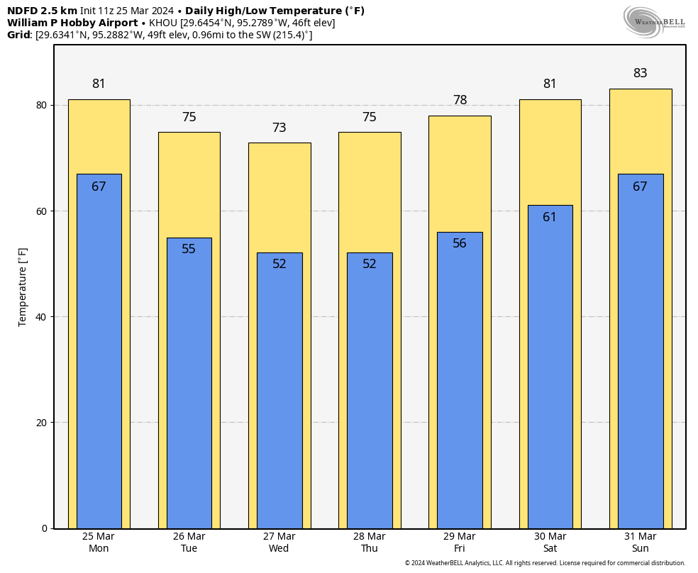
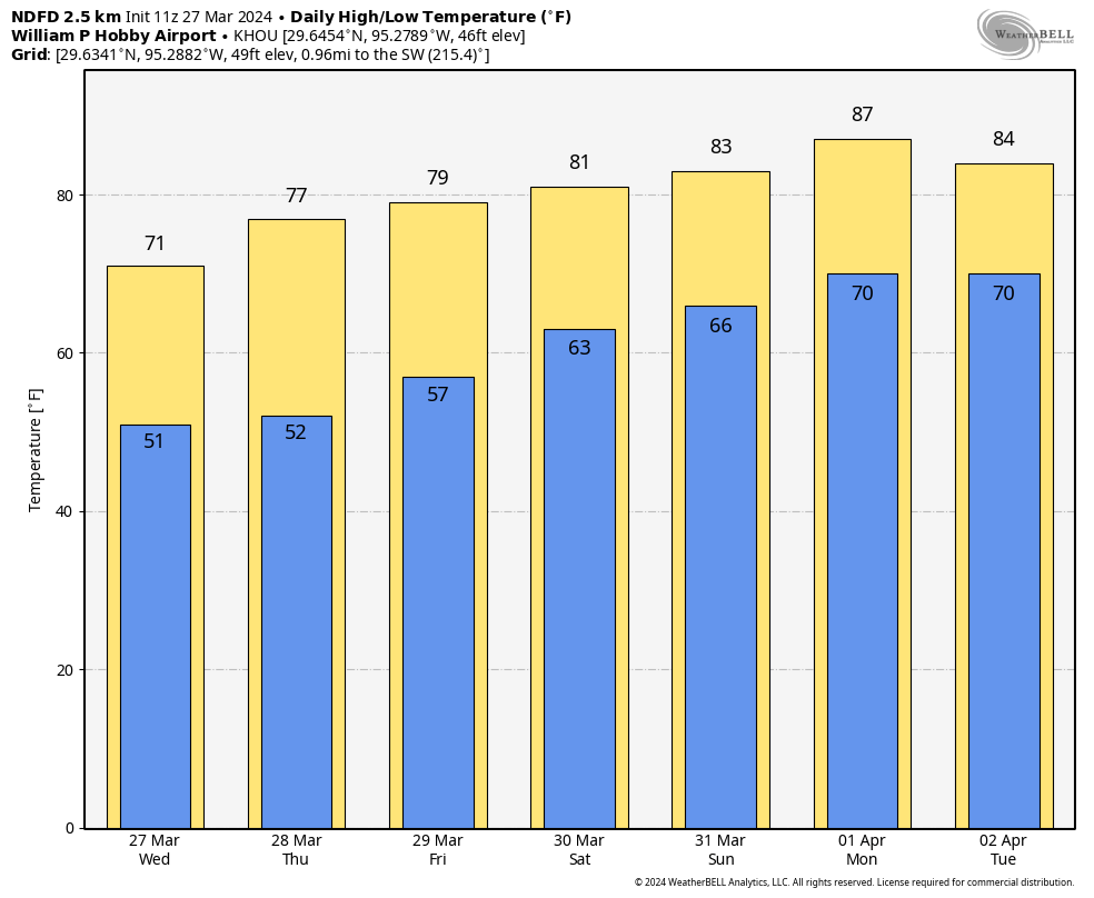
Summary: Tuesday was one of the nicest days of the year in Houston—I don’t think there was anything to complain about at all. We’re going to see some clouds return today, with a slight chance of showers. But then Thursday and Friday look to bring fantastic weather as well. Houston will warm up with some humidity returning this weekend.
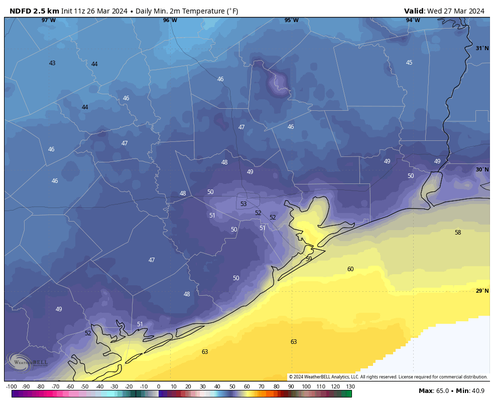
Wednesday
We are going to briefly interrupt our mostly sunny weather with a cloudier day. Typically we see clouds return to Houston with the onshore flow, but in this case we’re still seeing a decidedly northerly flow across the region at the surface, with dry air continuing to move in. So what gives? The answer is that the winds in the mid- and upper-levels of the atmosphere are more southwesterly, and in response to a large upper-level system we’ll see some atmospheric disturbances push through the area today.
This should produce mostly cloudy skies during the daytime hours, and help limit highs to about 70 degrees. It will also allow for a slight chance of rain, perhaps 20 percent, later today. For the most part these showers should be very light. With the dry air in place, and clearing skies, lows tonight should again drop down to near 50 degrees in Houston.
Thursday
The sunny weather is back, with highs in the mid- to upper-70s. As northerly winds shift to come from the south, lows on Thursday night will be a few degrees warmer.
Friday
Another sunny day, with highs in the upper-70s. Southerly winds will be a bit more pronounced, perhaps gusting up to 25 mph. Lows on Friday night will drop to around 60 degrees.
Saturday
The first half of the weekend should bring mostly sunny skies, with highs of around 80 degrees. With the onshore flow in place we’ll see a bit more humidity, but dewpoints will still be far from oppressive. Lows on Saturday night will only drop into the upper 60s.
Sunday
The latter half of the weekend is going to see less sunshine, and more humidity. Look for highs in the low-80s, and a warm night with the temperature falling only to around 70 degrees.
Next week
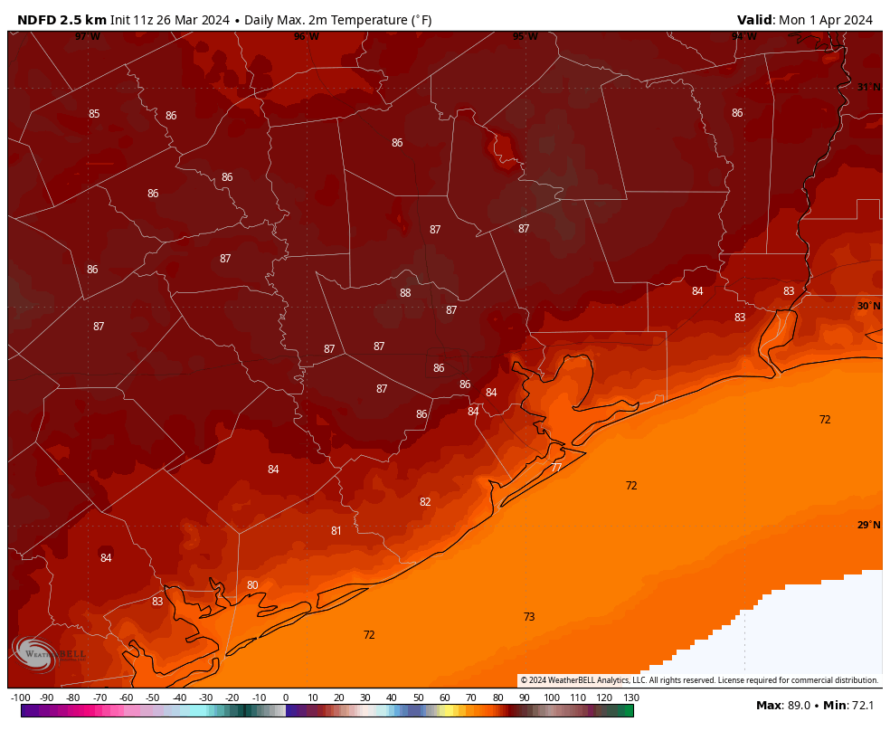
Monday and Tuesday look warm and muggy next week, with highs in the vicinity of the mid- to upper-80s. This will feel like “summer lite” in Houston, but won’t last as it looks like another front will arrive some time on Tuesday. Some moderate rainfall is possible with this front, but I don’t feel confident in the details. We should return to pleasant spring-like weather for the second half of next week.