As promised, we’re providing a p.m update on the cold weather we’re anticipating that will arrive in Houston, beginning Sunday. We’ll be doing twice-a-day updates through the weekend to keep you abreast of what’s happening—this is a fairly dynamic situation, and the forecast is changing as a result.
This afternoon we want to try and provide some clarity on what we think are the three biggest issues: timing of the cold weather onset, chances for wintry precipitation (i.e. freezing rain), and how cold it is going to get early next week. What about electricity? At this time we don’t think there will be widespread power outages with this cold outbreak. While that it is possible, it is beyond our ability to forecast. But given that the Texas power grid held up during the 2022 freeze, there is no credible reason to think it will buckle with this cold weather outbreak.
When will the front arrive
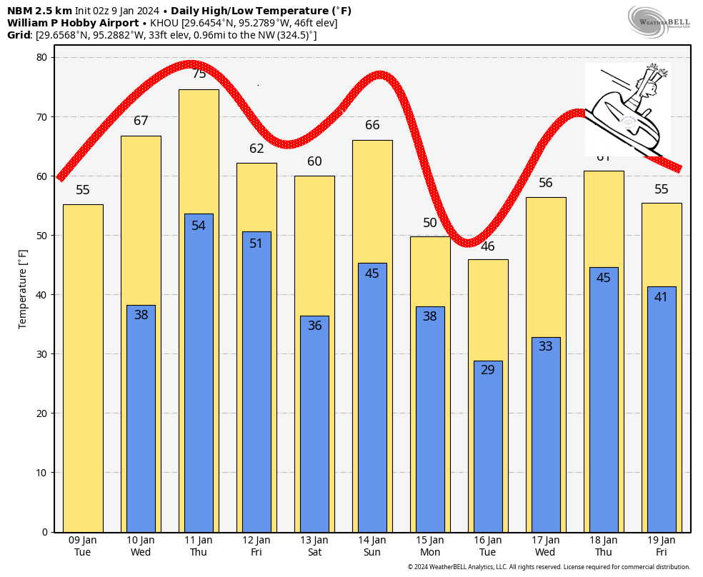
The majority of model data now supports a faster arrival, with the cold front initially reaching the Houston area on Sunday morning. If this ultimately happens, it has implications for the Houston marathon, both the runners and wonderful volunteers. This forecast is still uncertain, but it seems likely that race time temperatures will be in the upper 30s to low 40s. Right now I’d lean toward 30s.
Fortunately, the passage of this front is likely to be dry. There also is no indication, at present, of strong northerly winds. So while there may be gusts on the order of 15 to 20 mph, I don’t see much evidence of crazy strong winds we sometimes get with “blue norther” fronts. So expect partly sunny and cold on Sunday, with daytime temperatures perhaps in the upper 30s. We should have more confidence in these temperatures in a day or so. But confidence is high that it’s going to be cold.
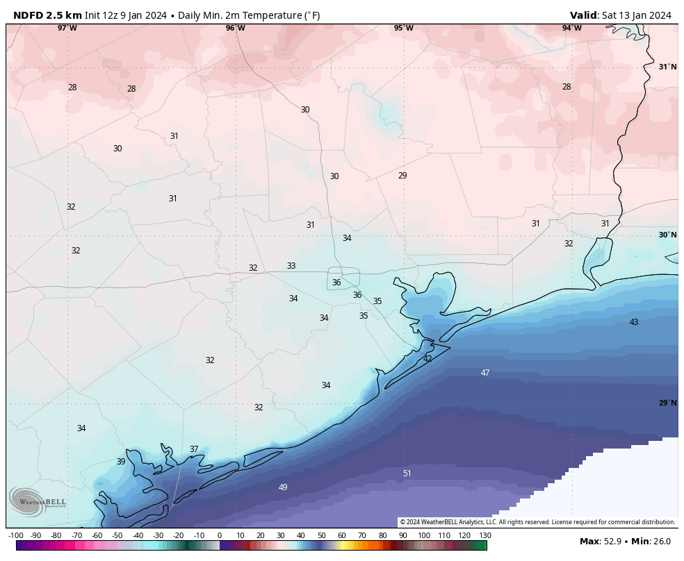
The very coldest air is going to be delayed, so my expectation for Sunday night is that much of the region will probably experience, at most, a light freeze. This really should not raise too much of a concern. Daytime temperatures on Monday should be above freezing for most of the region.
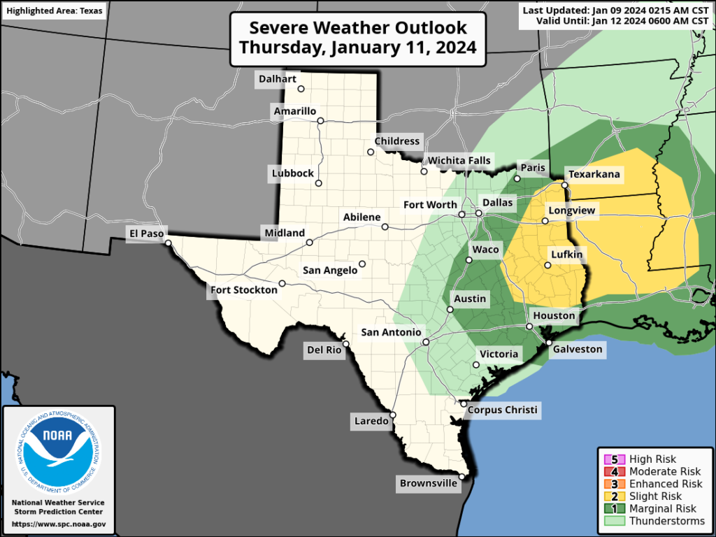
Chances for wintry precipitation
Sunday looks dry, as does Sunday night. After that? Well, quite frankly it’s too early to say too much. There appears to be a chance of freezing rain during the afternoon or evening hours on Monday. My best guess is, at this point, that the freezing stuff stays north of the metro area. It could be an issue for areas along and north of Texas State Highway 105. It could surprise us and come further south.
So I would say this: We need to consider the possibility of icy roads on Monday evening and during the overnight hours into Tuesday morning. I think it’s a fairly low concern within the Houston metro area, that is for The Woodlands and points south. But with that said, it’s far too early to issue any kind of guarantees. We’ll be watching this closely in the coming days, of course.

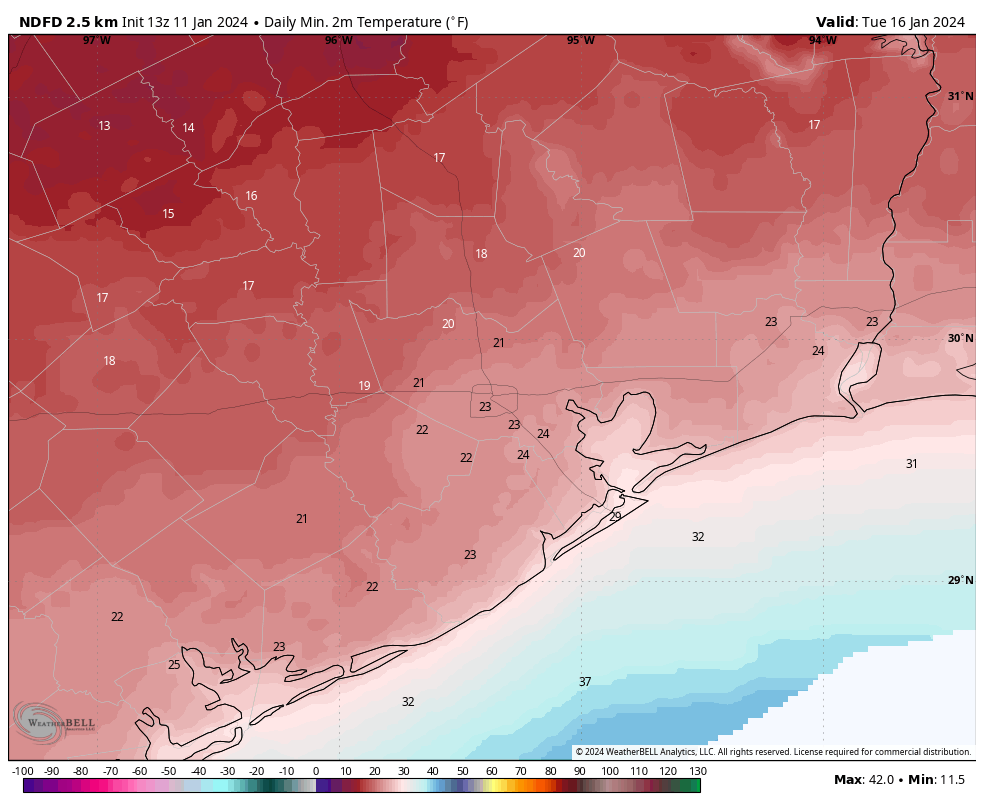
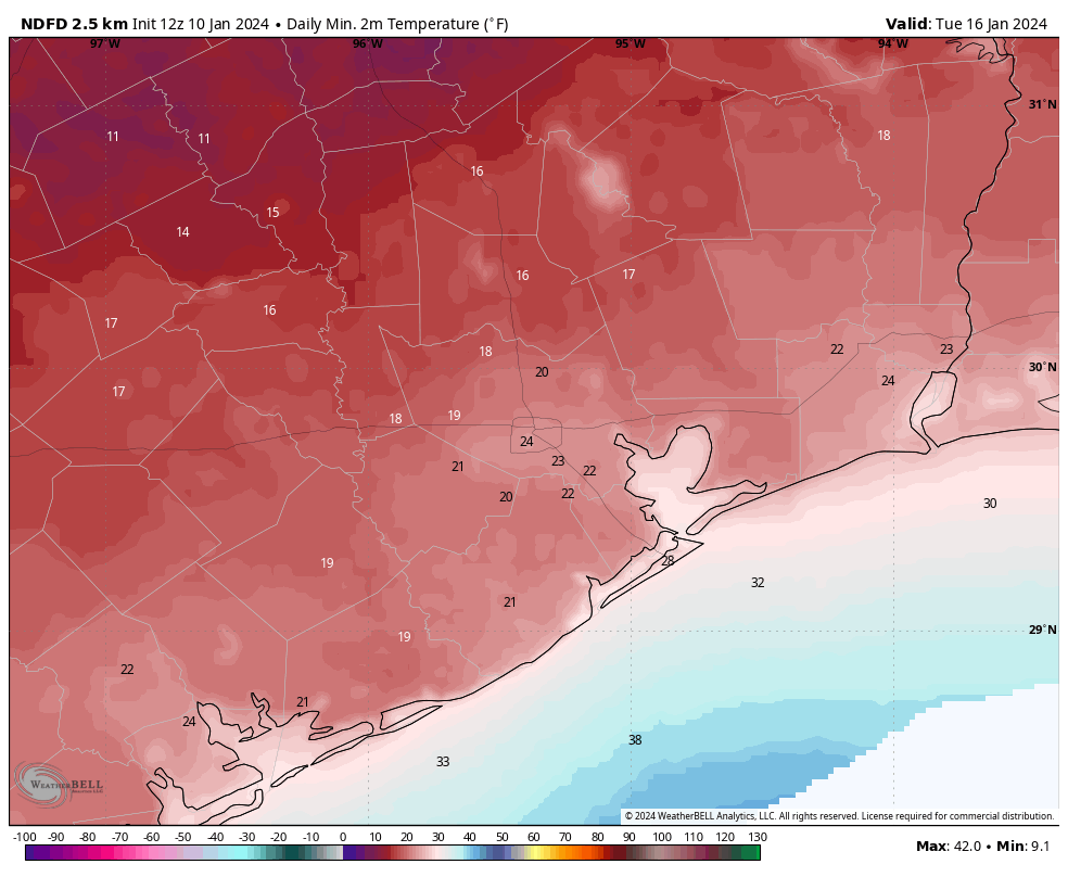
How cold things will get
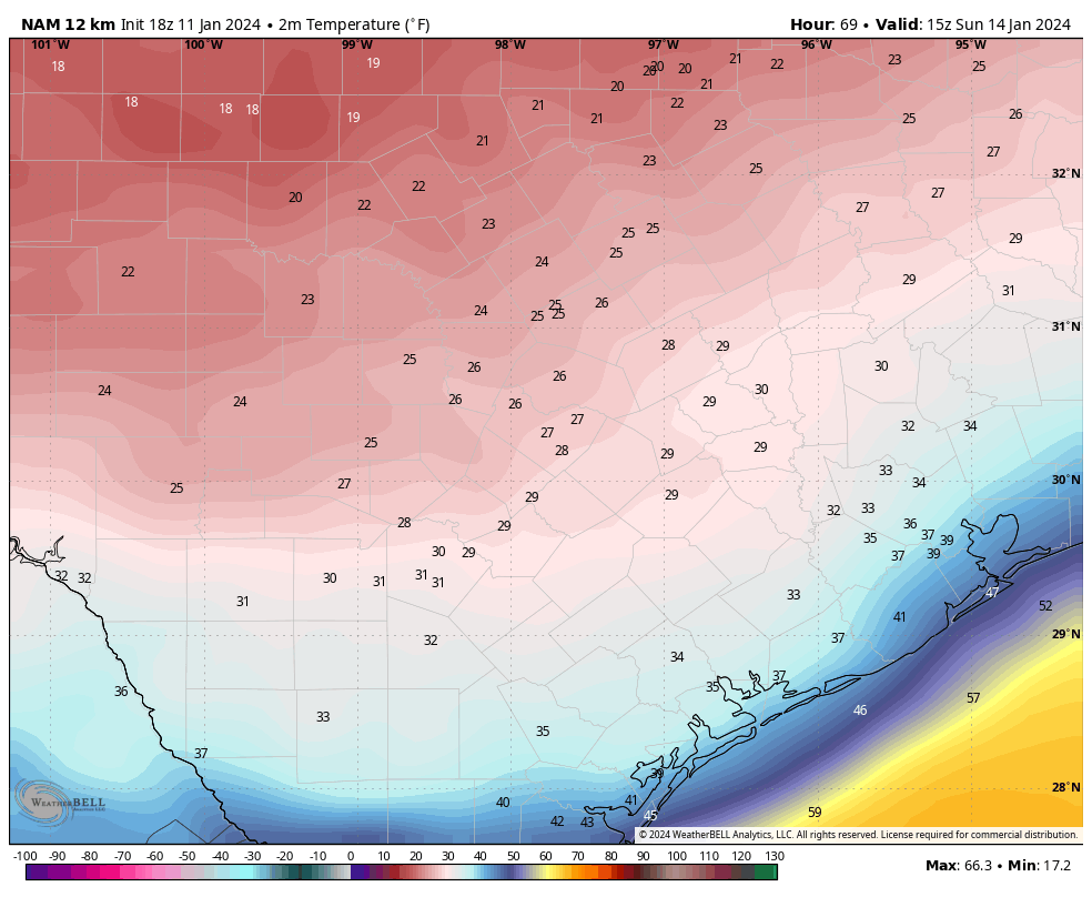
Our real concern for cold will come starting Monday night. Temperatures will bottom out in the morning hours on Tuesday and Wednesday. The forecast remains fuzzy because there are a lot of factors that will go into how low things get, from clouds to winds, to the amount of Arctic air that spills into Texas. But a good guess is that both nights will see lows in the upper teens to low-20s north of Interstate 10, and low-20s south of Interstate 10. The coast may avoid a hard freeze.
Daytime temperatures on Tuesday probably will briefly get above freezing for most of the metro area, but my confidence in that is fairly low. Houston should then warm comfortably above freezing on Wednesday.
We’ll have a comprehensive update for you on Friday morning.