In brief: In today’s post we discuss the potential for setting daily high temperature records this week ahead of a front on Friday. There also will be some rain shower chances on Thursday and Friday. The weekend and next week still look much cooler, with near ideal conditions for the Houston Marathon on Sunday.
Heat records
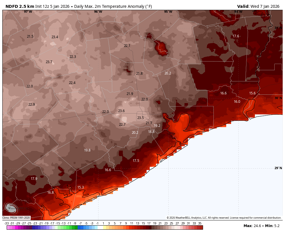
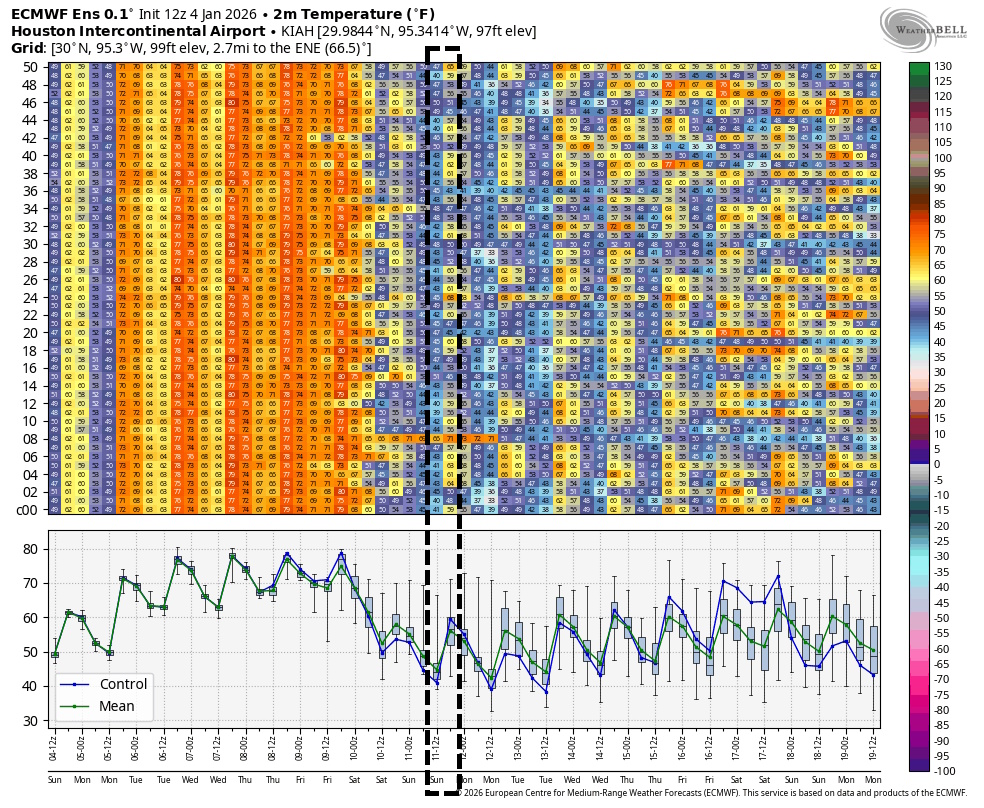
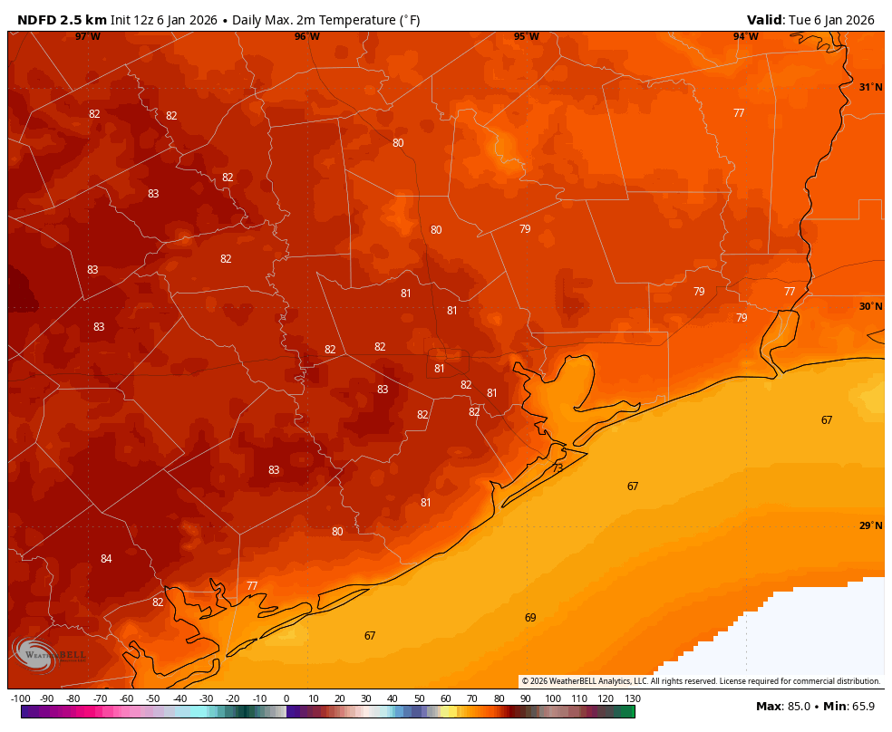
Houston’s high temperature reached 79 degrees on Monday at Bush Intercontinental Airport, marking the beginning of a warmer period that will persist into Friday. The next four days all have a chance to set record highs, depending on the timing of a front on Friday. Here are the forecast highs for each day at Bush, along with the record high.
- Tuesday: 81 degrees (80 degrees, 1989)
- Wednesday: 81 degrees (81 degrees, 2023)
- Thursday: 79 degrees (79 degrees, 2019)
- Friday: 76 degrees (80 degrees, 1974)
By Friday a strong front will sweep into the area, dropping temperatures by about 20 degrees, and returning us to near normal conditions for early January. Although I know plenty of our readers like a warmer winter, it simply is not normal to have a stretch of 80-degree days in January, which is our coldest month of the year.
Tuesday and Wednesday
As dewpoints have risen and winds decreased, we are once again seeing the return of foggy conditions this morning. Such fog will be possible during nights and mornings from now through Friday morning. Dewpoints this morning are in the mid-60s, and that is where they will stay until the front arrives, so we are going to see fairly muggy conditions.
Highs today and Wednesday will be in the vicinity of 80 degrees, perhaps a little warmer for inland areas, and a little cooler right along the coast. Skies will be partly to mostly sunny during the daytime. Winds generally will be from the south, occasionally gusting up to 15 mph or so. Overnight lows will drop into the low- to mid-60s for most of the region.
Thursday
As an upper-level disturbance approaches, we could see some light, scattered showers on Thursday. But for the most part I think we’ll just see mostly cloudy skies. This could shave a couple of degrees of daytime highs, but it will still feel warm and humid outside. Thursday night will again be warm and humid as well, with a chance of fog developing.
Friday
At some point on Friday, perhaps between sunrise and around noon, a cold front will drop down from the northwest. We should have a better handle on the details in the next day or so, but it appears possible that a broken line of showers and thunderstorms may accompany the front. However, at this time I don’t think we are looking at anything particularly severe, and in terms of accumulations I doubt most locations see more than a tenth of an inch of rain, or two. But we’ll see. Daytime temperatures will depend on the timing of the front, but I suspect we’ll drop into the 60s during the afternoon, with lows Friday night falling to around 50 degrees, or lower.
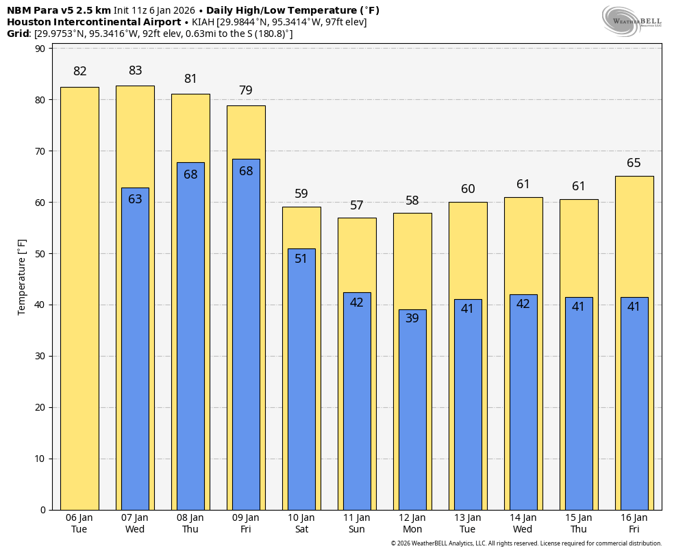
Saturday and Sunday
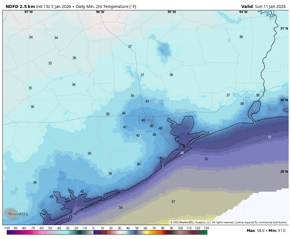
The weekend will see partly to mostly cloudy skies, with a slight chance of showers on Saturday. Highs on Saturday and Sunday will likely top out at around 60 degrees, with overnight lows in the 40 to 45 degree range. Winds will be fairly brisk from the north on Saturday, perhaps up to 20 or 25 mph. However I expect these to die down a bit by Sunday morning (for the start of the Houston Marathon). Start-line temperatures in Houston will likely be in the 40 to 45 degree range, so chilly with a bit of a northerly breeze, but not outright cold, especially for long runs.
Next week
Most of next week looks to see near-normal conditions, with highs in the 60s and lows in the 40s. We may see some additional showers in the Tuesday timeframe. Temperatures could warm up a bit toward the following weekend, but that will depend on the timing of the next front.