In brief: After stunning weather across Houston this weekend, we return abruptly to reality this week with rising humidity levels and warmer weather. Beginning on Wednesday we’ll also see rising rain chances that may linger into next weekend.
Peak weather
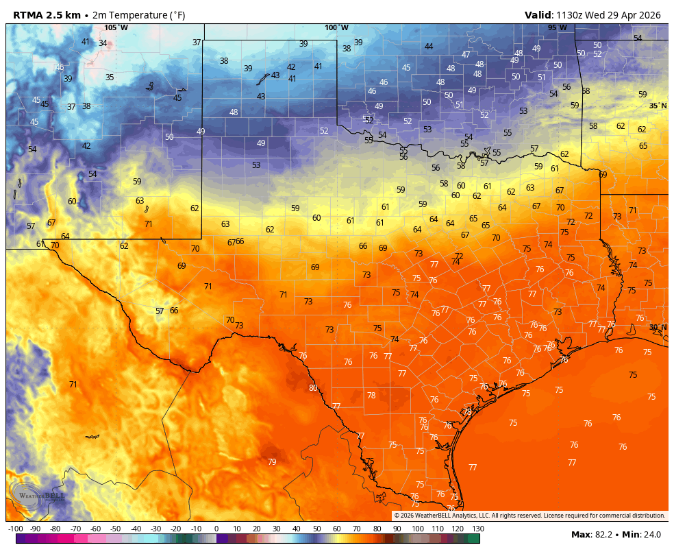
This weekend’s weather was not perfect for everyone, or every activity. For a beach day, you might want it a little warmer. For long-duration running, maybe you’d want things a little colder. But for being outside, for working in the yard, taking a walk, or watching the sunset—this weekend was perfect. We had clear skies, low humidity, cool mornings and pleasant days, and after Saturday morning modest winds. With these four conditions, Houston hit the quadfecta. Not only that, the weekend came after some super helpful rainfall that knocked most of the region out of a months-long drought. It felt good.
I am confident in saying this will be Houston’s nicest weekend for at least the next five months, and probably longer. Given that both Saturday and Sunday had exceptional weather, it was probably was the nicest wall-to-wall weekend we will have all year. I hope you found some time to spend outside.
Monday
We are going to have one more sunny day before our skies turn mostly cloudy for awhile. Winds have already shifted to come from the southeast, and this morning’s light breeze will pick up this afternoon to come from the southeast, gusting up to 25 mph. Expect sunny skies with a high temperature of around 80 degrees, or perhaps a touch warmer. Humidity will steadily rise throughout the day and accordingly our lows tonight will only drop to around 70 degrees in Houston, with slightly cooler conditions for outlying areas.
Tuesday
A warmer and more humid day with high temperatures generally in the mid-80s. Skies will turn partly to mostly cloudy. The onshore flow will become even a little stronger, with southerly wind gusts up to 30 mph. As a result of this flow the moisture levels in our atmosphere will increase, but I think any rain showers will hold off until at least Tuesday night or Wednesday. Lows on Tuesday night will only fall into the mid-70s.
Wednesday
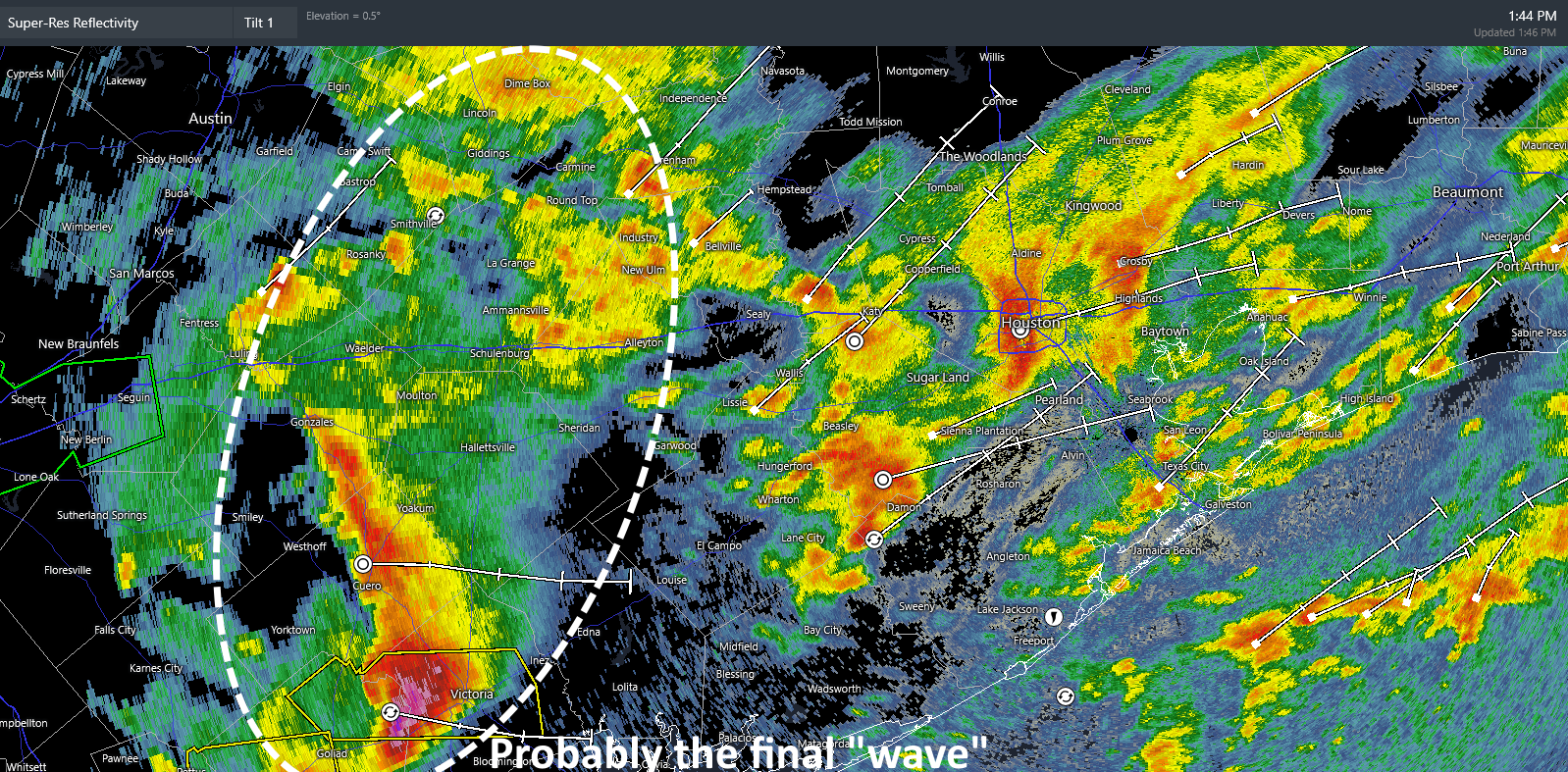
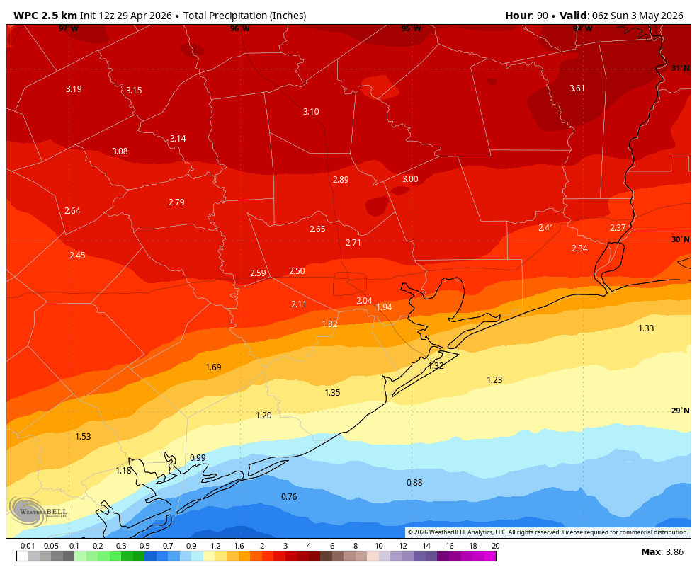
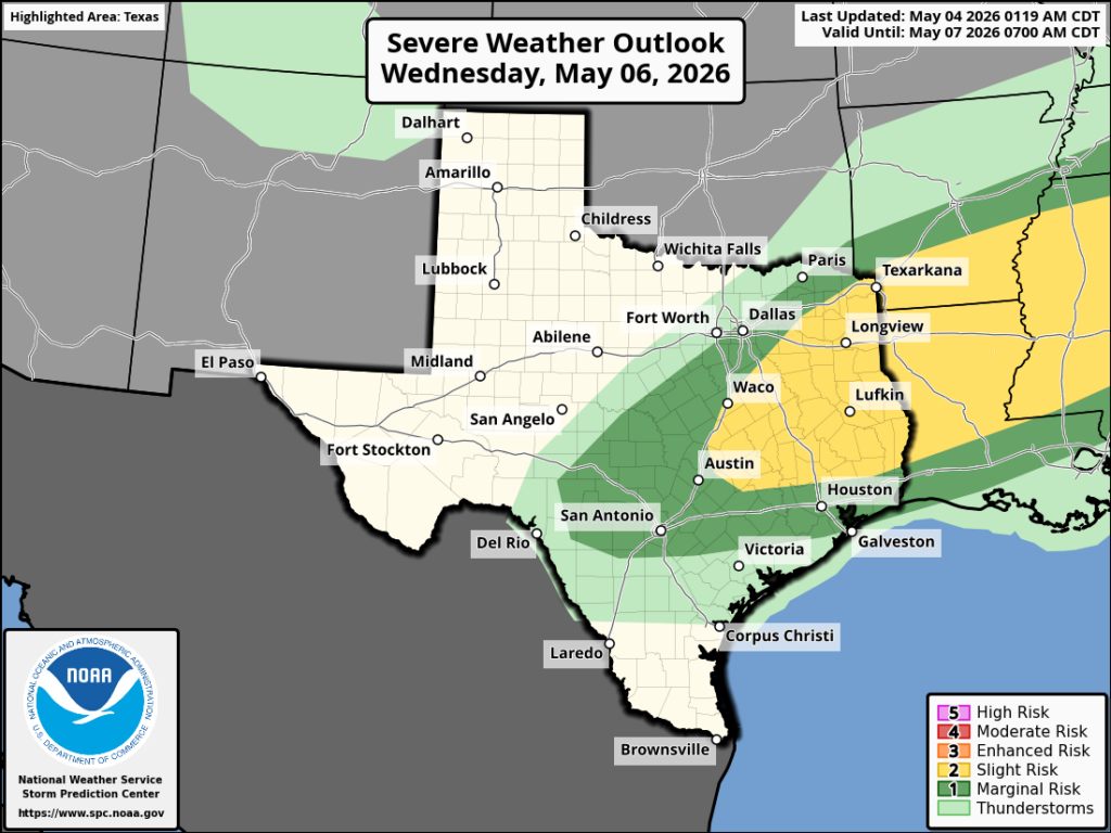
A cool front will approach the area from the north, and if you read ‘Tuesday’ section of today’s post you’ll know that with all the southerly winds we’ve been pumping up the available moisture for showers and thunderstorms. The front will disturb the atmosphere enough such that there is a low-end chance for some severe weather later on Wednesday, especially for areas north of Interstate 10. So there’s the possibility of some showers and storms on Wednesday afternoon and evening, and then the front itself will probably sag into the region Wednesday night. Bottom line: there’s a fair bit of uncertainty in rain amounts and temperatures. For now I’ll predict highs in the mid-80s on Wednesday, with overnight lows dropping to around 70.
Thursday and Friday
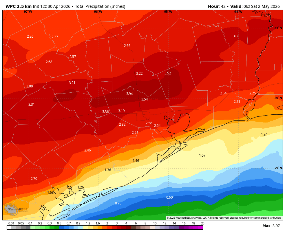
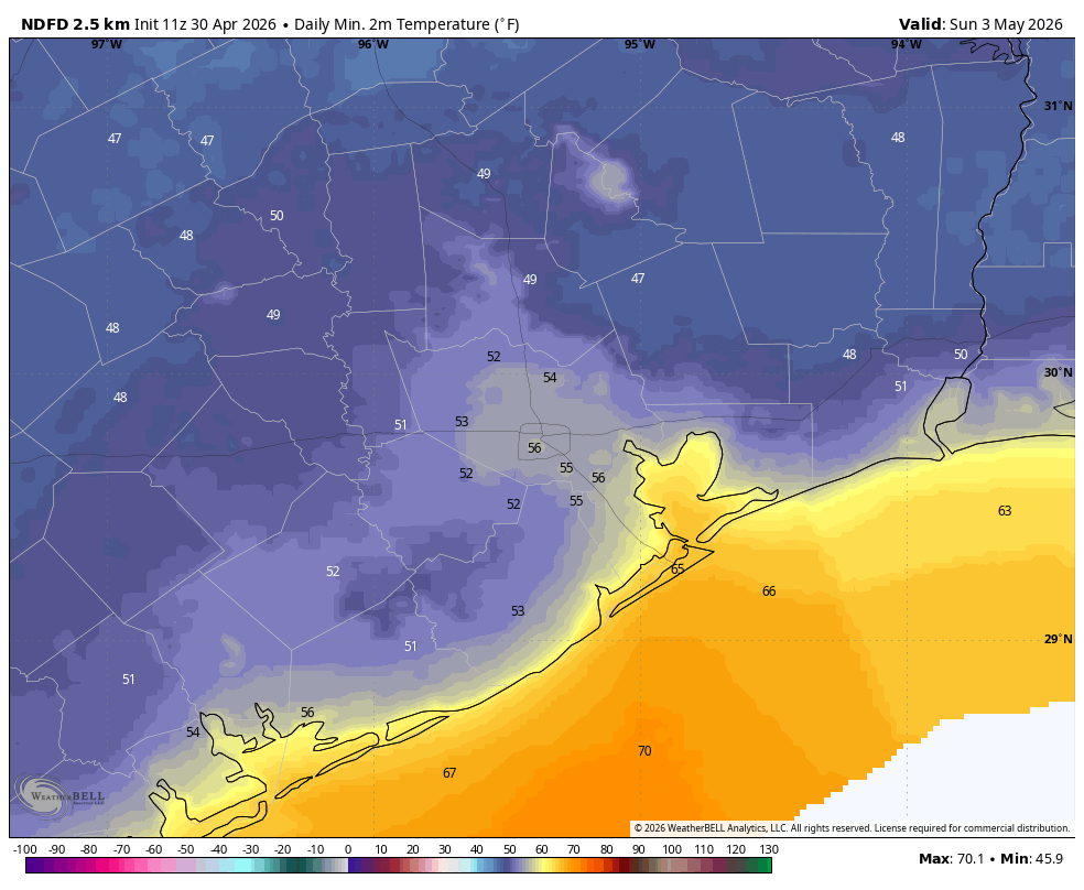
Our weather to end the week is going to depend where you live (i.e. further from the coast, a better chance of lower temperatures and slightly lower humidity). Basically I would expect highs in the vicinity of 80 degrees and lows in the 60s. Both of these days will also have a heathy chance of rain, perhaps 50 percent each day. Overall accumulations through Friday will probably be on the order of 1 inch for most of us, but there will be some wide variations. Anyway, if you have outdoor plans from Wednesday through Friday some caution is advised, as a lot of questions remain.
Saturday and Sunday
Rain chances are not going away this weekend, but whether they’re 20 percent for both days, or 50 percent, I just cannot say with this unsettled pattern. I think we’ll see a mix of clouds and sunshine. Highs will likely be in the vicinity of the low-80s with lows in the 60s or perhaps lower 70s. Stay tuned for a better weekend forecast, because we’re just not there yet.
Next week
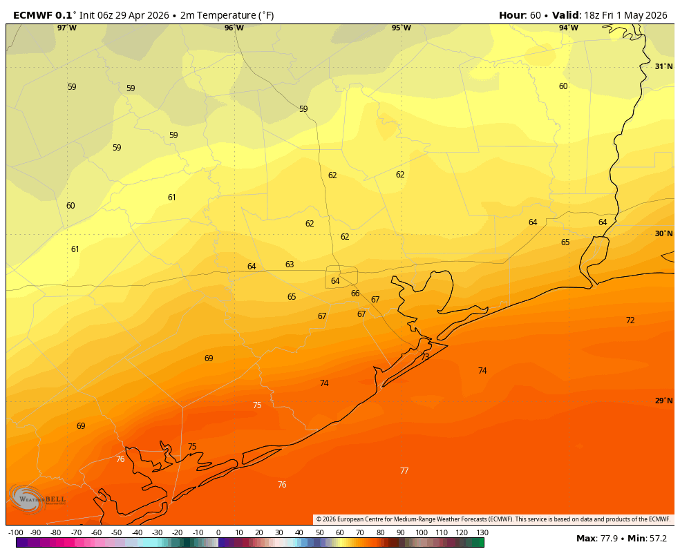
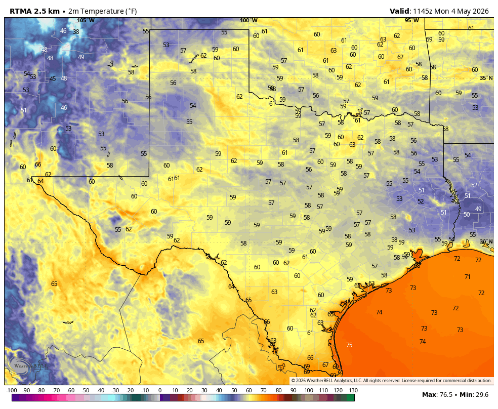
It’s possible that another weak front arrives early next week, and this should help keep our temperatures in the lower 80s, with maybe a cooler night or two. Daily rain chances do start to look lower after next Monday or so with the potential for more sunshine. We’ll see!