A combination of slightly cooler temperatures and slightly lower dewpoints means that the National Weather Service, for the first time in more than two weeks, has not issued a heat advisory or an excessive heat warning for today. These moderately cooler temperatures—mostly highs in the mid-90s instead of upper 90s to 100 degrees—will continue for the rest of the work week before nature’s thermostat rises again.
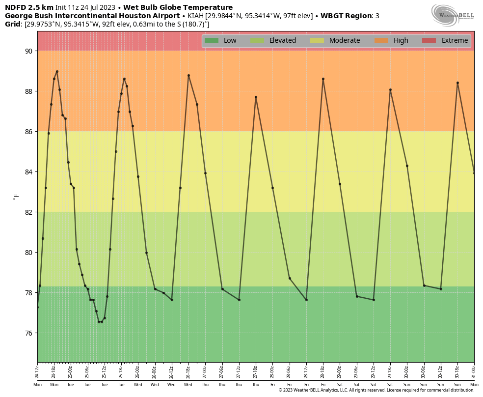
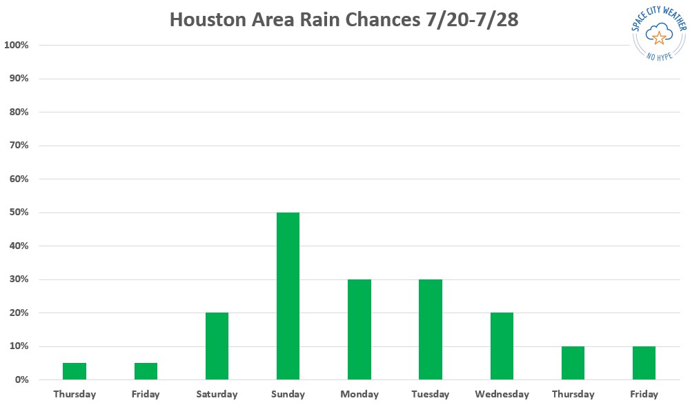
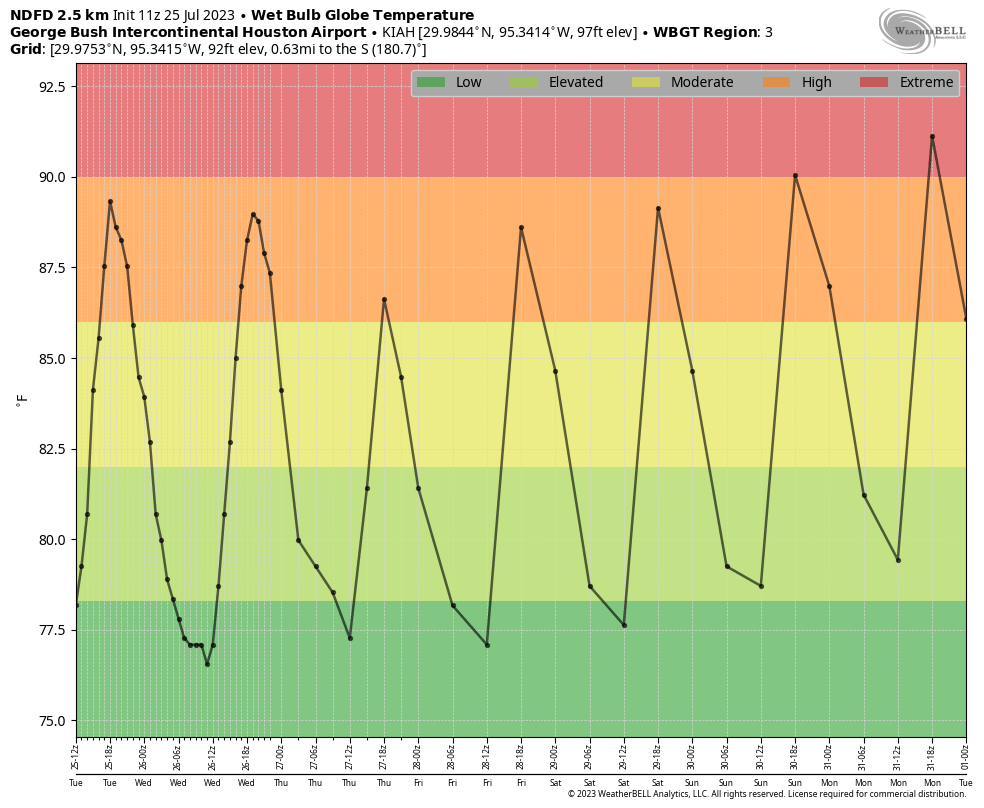
We can see this slight moderation in wet bulb globe temperatures, which we have been referencing during this summer’s heat wave. They will remain at high, but not extreme levels, until this weekend. One reason for the slight diminution in temperatures is the presence of Saharan dust in the atmosphere, roughly 1 to 3 miles above the surface. This reflects a bit of sunlight, decreasing the amount of energy reaching the ground. Unfortunately this increase in drier air may also wipe out chances for meaningful rainfall, which is badly needed.
Tuesday
Highs today will reach into the mid-90s for most of the region, with mostly sunny skies this afternoon. As we have experienced for a couple of days, rain chances will increase during the afternoon hours, particularly closer to the coast and along the sea breeze. However, I think chances will only be about 30 percent south of Interstate 10, and lesser for inland areas, partly due to the Saharan dust (levels of drier air make it more difficult for rain to reach the ground). Overnight lows may briefly drop into the upper 70s. Winds will be light, out of the south.
Wednesday, Thursday, and Friday
More typical, late-July-like conditions will continue through the end of the week, with highs in the mid-90s, and slight chances of rain along the afternoon sea breeze. If you’re looking for the “coolest” day in a while, that may be Thursday, when highs may not reach the mid-90s in parts of Houston, even away from the coast.
Saturday and Sunday
The weekend should bring us back into highs in the upper 90s, with coastal shower chances in the vicinity of 20 percent. So hot and sunny, for the most part.
Next week
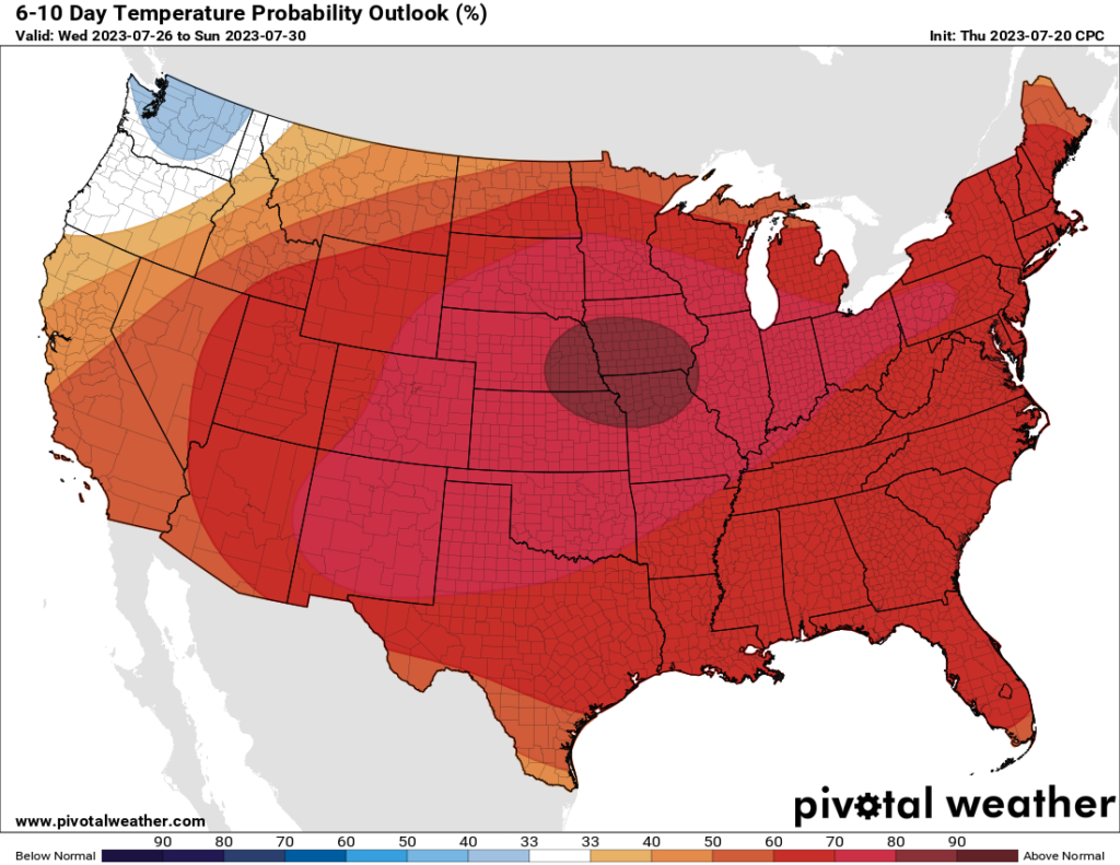
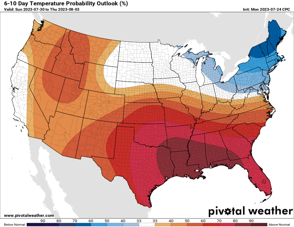
This weekend and the early part of next week, truth be told, look pretty hot. I expect we may see another 100-degree day, or two. However, if I squint into the future I can see perhaps a return to slightly more moderate conditions by the middle of next week, with perhaps some healthier rain chances. That is part hope, and part science, however, as we’re talking about a forecast 7 to 10 days from now. As noted in the headline, don’t break out that sweater just yet.