Good morning. Houston’s last truly extreme drought came during the torrid summer of 2011. Not only was that summertime period exceptionally hot, the months leading into the warmest time of the year were very dry. During the first six months of 2011, Houston received just 7.88 inches of rain. It was the driest January through June in city history. By the end of June, 2011, the vast majority of Texas was under “exceptional” drought conditions, and that was before the heat hit.
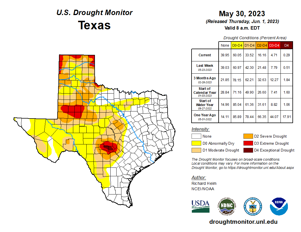
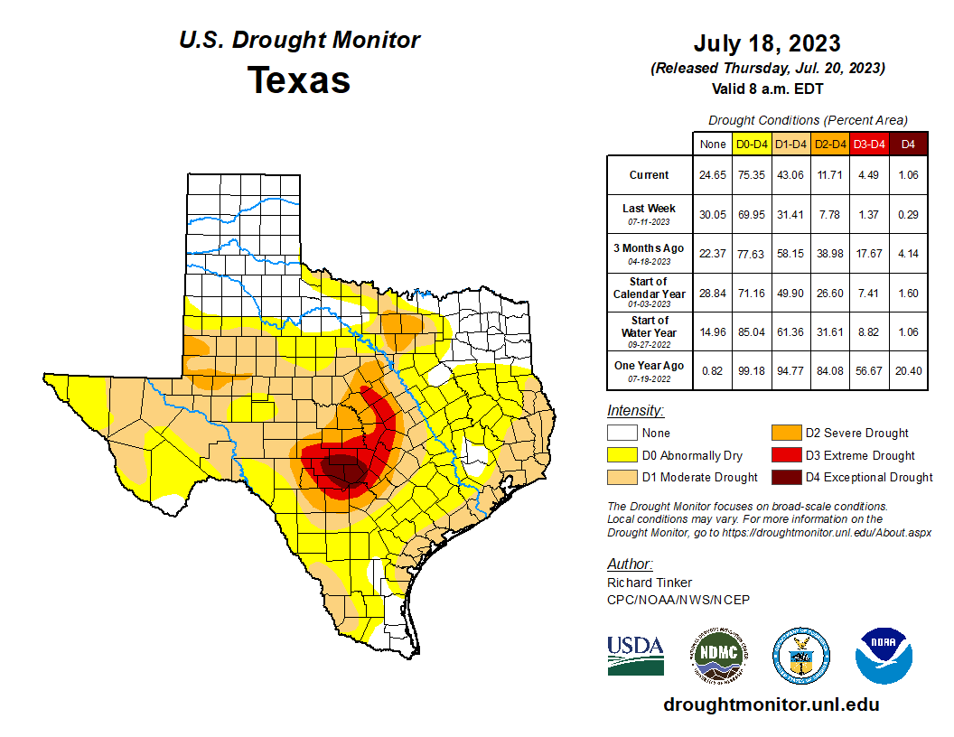
Fortunately, this year, we started summer in a good posture. At the end of May, pretty much the entirety of the eastern half of Texas was drought free after a spring of moderate temperatures and healthy rains. That began to change pretty quickly in June, of course, and July has been the same through its first three weeks; very hot and, for the most part, very dry in terms of rainfall. As a result of this, a “moderate” drought has reemerged for coastal Texas, including Galveston and Brazoria counties, as well as part of southeastern Harris County. In the absence of substantial rainfall, we can expect this drought to worsen in the coming weeks. Any rains this weekend, of course, will help.
Friday
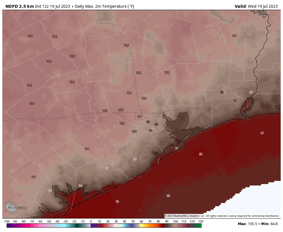
Today will be very hot and sunny, much as the rest of this week has gone. Expect high temperatures of around 100 degrees, very high humidity, and only very light winds from the south. Temperatures on Friday night will, again, only drop down to around 80 degrees.
Saturday
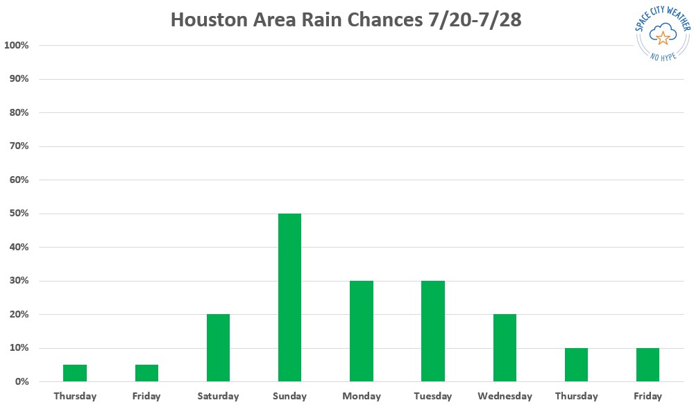
Change is on the way for the weekend, as high pressure shifts westward and opens our region up to precipitation from atmospheric disturbances and the sea breeze. This means our best chance for rain will come during the afternoon hours. For Saturday, I’ll peg rain chances at 30 percent, with the possibility of a few areas seeing decently strong thunderstorms. Rain chances look highest on Saturday north of Interstate 10. Otherwise, skies will be mostly sunny with high temperatures near 100 degrees.
Sunday
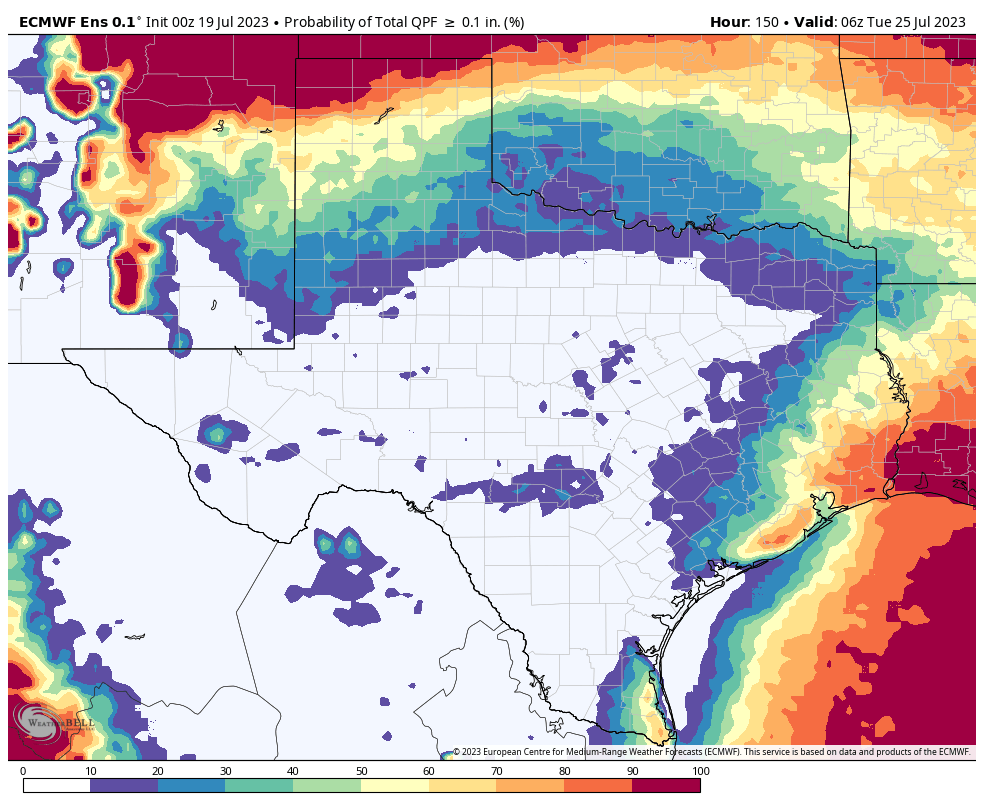
This day will probably offer our region its best chance of rainfall for awhile, with perhaps as much as 60 percent of the Houston metro area seeing light to moderate rainfall. Don’t expect a soaking, as briefly heavy thunderstorms will likely be fairly isolated. Most of Houston should only receive a tenth of an inch of rain, or two. When it’s not raining, it should be mostly sunny and hot, with highs at least in the upper 90s. Note that I cannot rule out more widespread, heavier rainfall on Sunday at this point. If the forecast changes, I’ll provide a brief update this weekend.
Next week
Rain chances in the vicinity of 30 percent, daily, will hold on during the early part of next week. We will see a few more clouds next week, and some slightly drier air this should help bring down the heat index just a bit. So while temperatures will still be in the upper 90s to 100 degrees, it should feel a little bit less hot during the daytime.