Good morning, and I hope this Tuesday is terrific for you. As for our what to expect from Mother Nature, Houston faces a pattern ahead with a little bit of unsettled weather, a little bit of warmer weather, and a little bit of fine, springtime weather. So it goes for April.
Tuesday
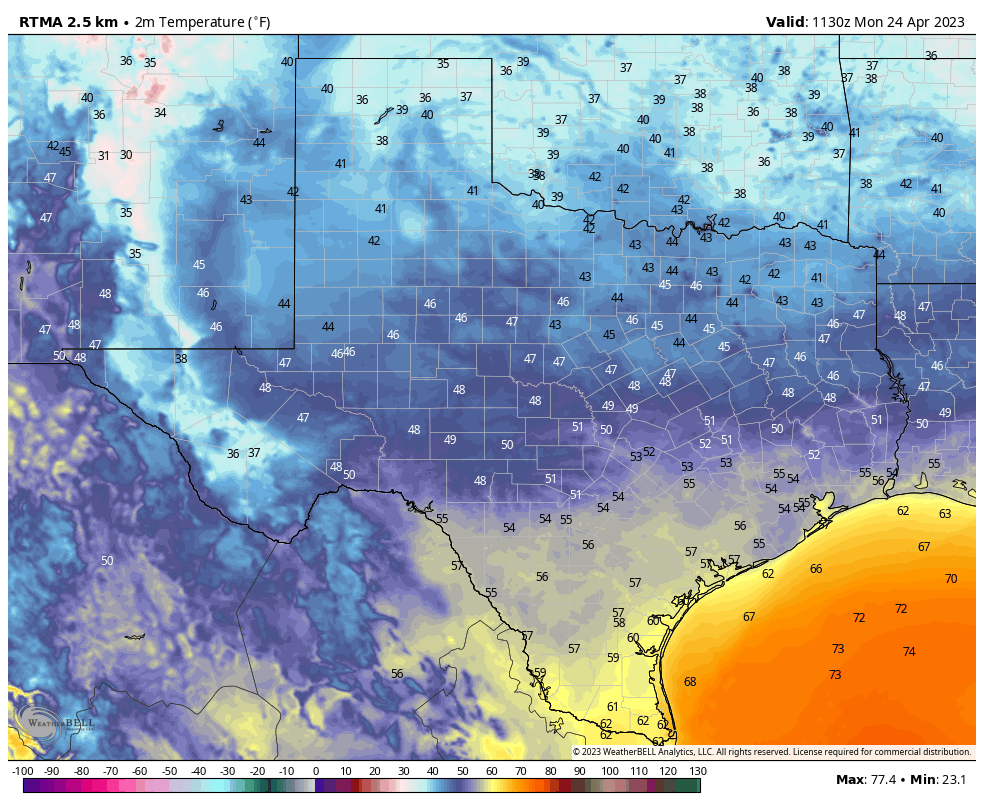
Temperatures are warmer this morning, having bottomed out at about 60 degrees for most of the region except for the coast where conditions are warmer. Humidity levels will continue to tick upward today as light winds turn easterly. Expect partly cloudy skies, with high temperatures ranging from the upper 70s to about 80 degrees. The more difficult question is rainfall. I would say the area has about a 30 percent chance of mostly light, scattered showers today.
As we get into this evening and the overnight hours, things get a little more interesting. There is plenty of moisture for the atmosphere to work with, but it’s not clear how much instability there will be. The bottom line, I think, is that there is about 30 or 40 percent chance of rain this evening and during the overnight hours. For most of us, this will be a non-event. But for a few neighborhoods, at least, there likely will be some fairly decent thunderstorms. So while the vast majority of the area is probably a 1 or a 2 on the excitable dog index, a few areas may be closer to a 6 or 7 later today and tonight.
Wednesday
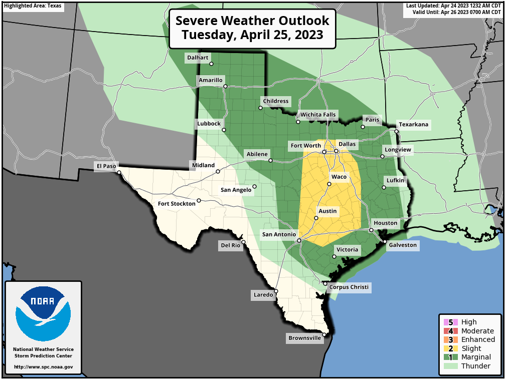
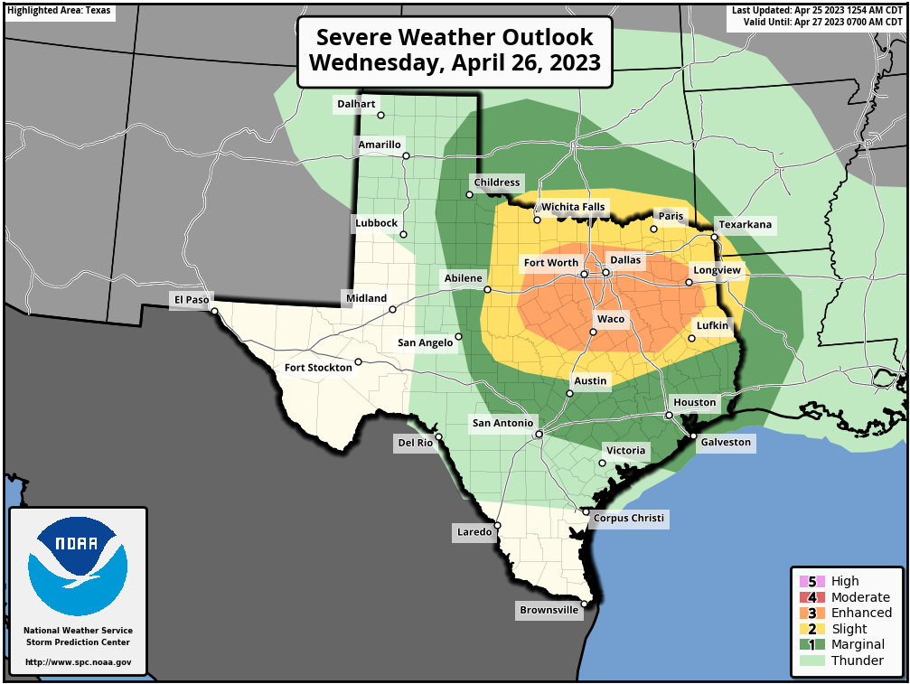
This day will be partly sunny and warmer, with highs in the low 80s. Rain chances aren’t zero, but they’re probably on the order of 10 to 20 percent. A word of warning if you’re traveling north on Interstate 35 Wednesday. A front will be moving through the state, and North Texas, including the Dallas-Fort Worth area, faces a healthy risk of thunderstorms and severe weather. I don’t think these storms will propagate all the way south to the Houston area, however. Lows on Wednesday night will be warm, dropping only into the upper 60s.
Thursday
A weak front pushes into Houston on Thursday morning, and we probably will see a round of showers with it. How much activity is going to occur is a little fuzzy, but my guess is that rain chances will be highest from about midnight to noon on Thursday, with clearing skies afterward and highs around 80 degrees. Lows Thursday night will drop to around 60 degrees.
Friday
This looks like a mostly sunny day, with highs popping up into the mid-80s, with slightly drier air.
Saturday
A second, stronger front looks set to arrive late Friday night or Saturday morning. The models are a bit unclear, but it is possible that a line of showers accompanies this front. In any case, this looks to clear out pretty quickly on Saturday morning. The story afterward is going to be northerly winds behind the front—something to definitely consider if you’re participating in the MS-150 bike ride. Highs should reach the mid-70s on Saturday, with mostly sunny skies. Winds could gust up to about 30 mph during the afternoon hours. With clear skies look for lows to drop into the 50s on Saturday night. There won’t be too many more of these chilly nights this season, so if that’s your jam, you best get jamming this weekend.
Sunday
A pleasant, sunny day with highs likely in the low 80s. As the onshore flow returns, Sunday night will be a touch warmer, with lows perhaps around 60 degrees.
Next week
Most of next week should see highs somewhere in the 80s. It looks like the next chance of rain will return on Tuesday or Wednesday.