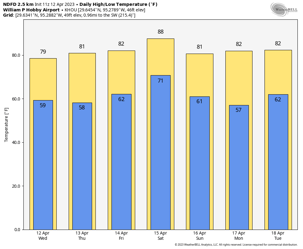
After an absolutely lovely Monday, Houston’s weather will now begin to do Houston things again, which means the return of an onshore flow, the potential for rain showers, and warmer and more humid conditions. But fear not, my friends, this forecast has something for everyone, with highs in the mid-80s, then some healthy rain chances on Thursday night and Friday, followed by cooler and drier air this weekend.
Tuesday
Winds are light this morning, out of the south and southeast, heralding the return of a warmer flow off of the Gulf of Mexico. This will help push high temperatures into the upper 70s today, along with mostly cloudy skies. We’re also going to see a decent chance—40 percent, maybe?—of some light to moderate rain showers today as an upper-level disturbance moves through from west to east. Some of these showers are already kicking off west and southwest of the city. For the most part, rain accumulations should be on the order of a few tenths of an inch of rain, give or take. Skies will remain mostly cloudy tonight, with lows dropping only into the upper 60s.
Wednesday
A little warmer, a little more humid, and with rain chances a little lower, perhaps only 10 or 20 percent. Look for highs somewhere around 80 degrees, or a touch higher if we get a decent stretch of partly to mostly sunny skies during the afternoon. Winds will be a bit more blowy, gusting to perhaps 20 miles out of the southeast. Wednesday night will be warm and cloudy.
Thursday and Friday
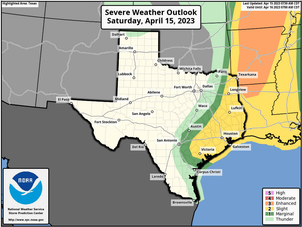
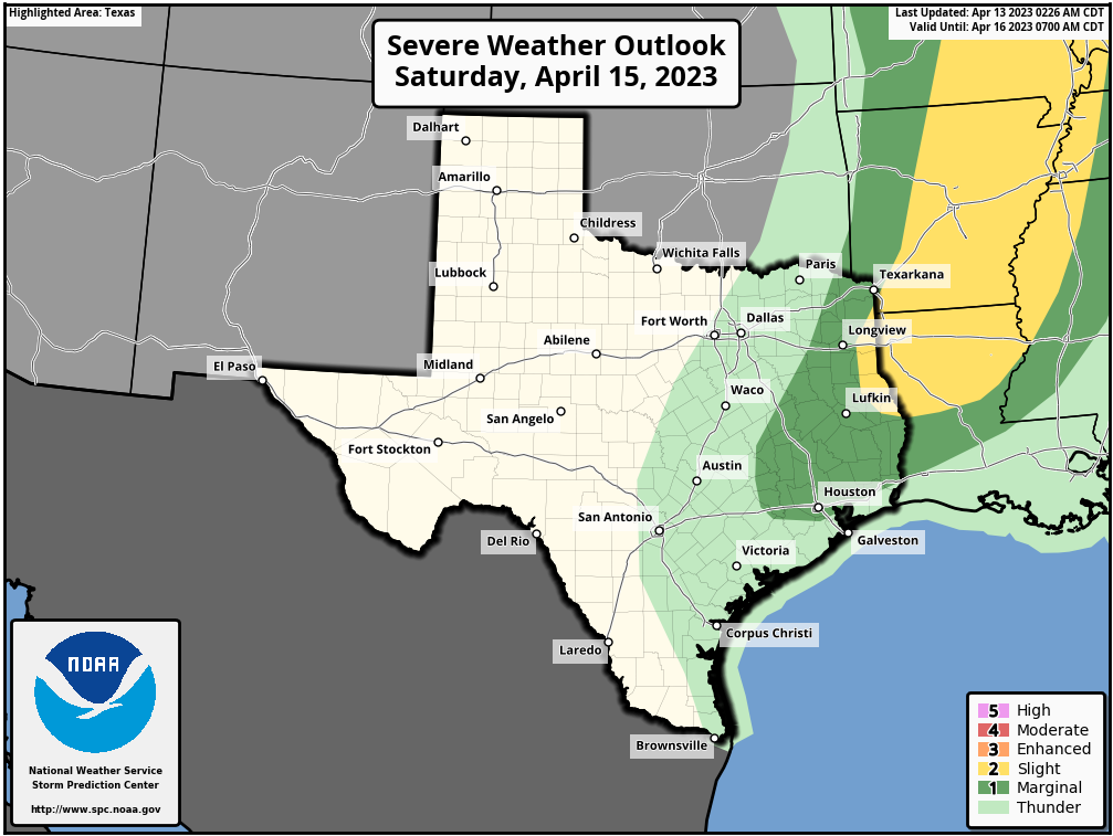
This will be a warm and potentially wet period ahead of a cold front on Friday, likely during the evening hours. Both days should see highs in the low- to mid-80s, with partly to mostly cloudy skies. The real question is how much rain we’re going to see from Thursday evening through Friday night. Models have gotten a little more bullish on factors such as instability, so I think we’re looking at a solid 0.25 to 1 inch of rain for most of the area, with higher totals possible to the northeast of Houston. Cooler and drier air should start arriving some time on Friday night.
Saturday and Sunday
Oh, hello. Did you DoorDash a gorgeous spring weekend from Mother Nature? Because you are in luck. As of right now, I think we’re looking at mostly sunny skies, with highs in the neighborhood of 70 degrees, on both weekend days. Lows will bottom out on Saturday night, perhaps hitting the upper 40s for areas well inland. Saturday should be breezy in the wake of the front, but right now those winds don’t look too crazy.
Next week
We’ll start to warm up by Monday or Tuesday, and the middle of next week looks fairly humid and fairly warm. So if you like cooler weather, please do enjoy this weekend.