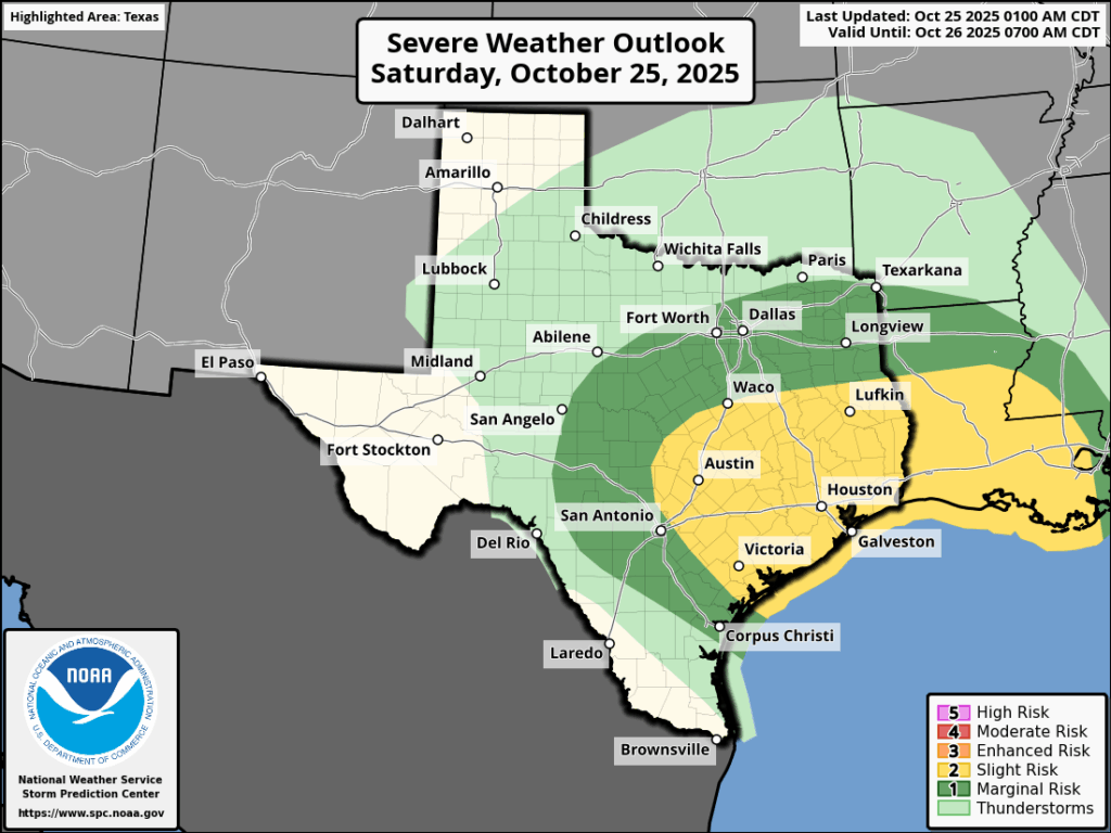
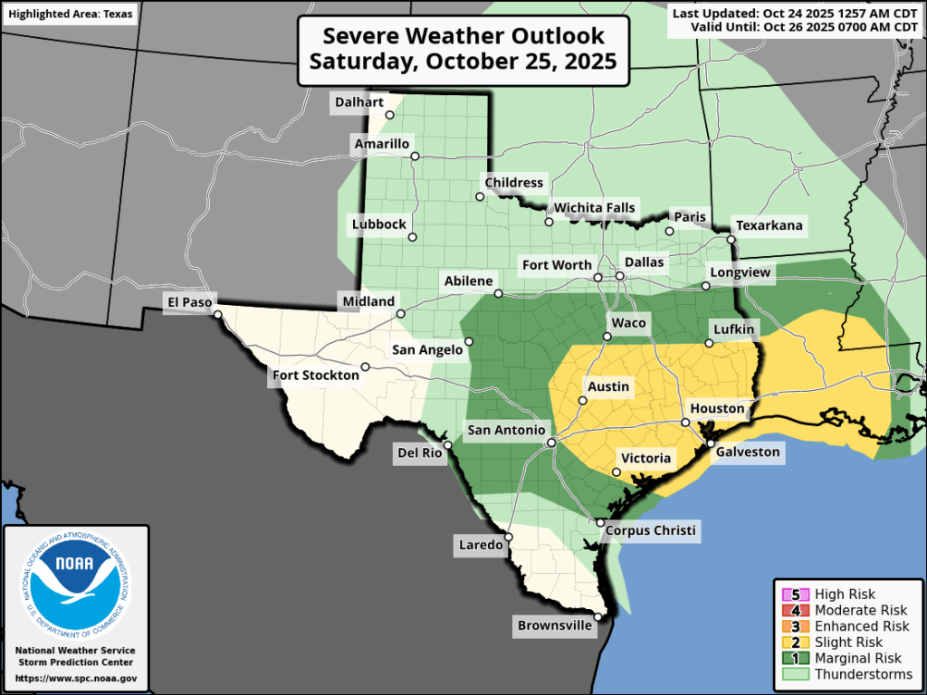
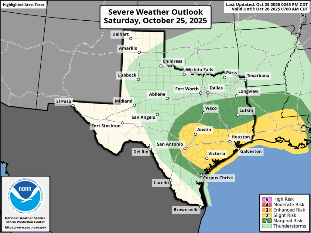
In brief: After Saturday morning’s storms the atmosphere needed some time to recharge. It appears that is now happening, raising the possibility of more storms tonight. Here’s what we know, and what we don’t, about what to expect.
Fall Day
I’ll have some photos to share early next week, but I just wanted to thank the hundreds of people who came out to Midtown Park this morning to say hello, shake our hands, and share some kind words. It was wonderful to see everyone and share a few hours of lovely fall-like weather. Thank you also to Reliant for the hard work in setting it all up.
Saturday night
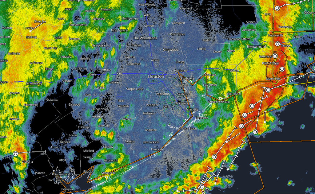
After this morning’s rollicking storms the atmosphere was pretty well worked over. This is why we had some confidence in several hours of calmer weather, and even some clear skies. However, factors such as atmospheric instability are now recovering, and by this evening the overall setup will become more conducive to the development of thunderstorms. With that said we still have some questions about how severe the storms will become. So what follows is our best guess, rather than a high confidence forecast.
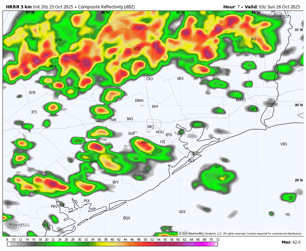
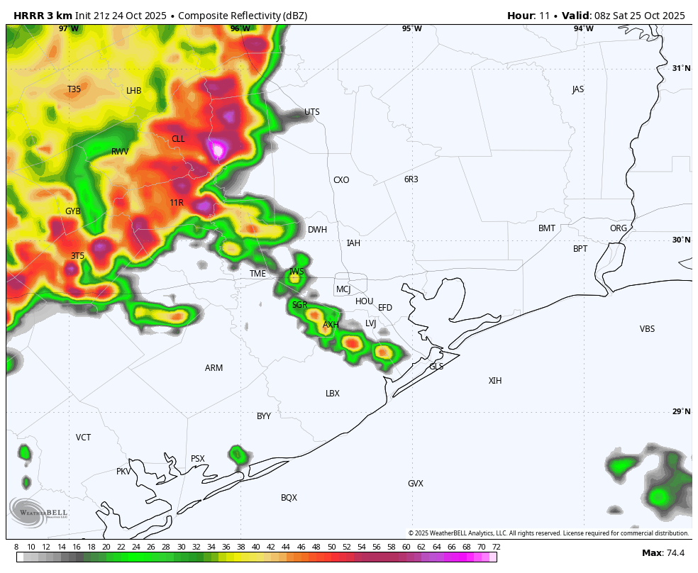
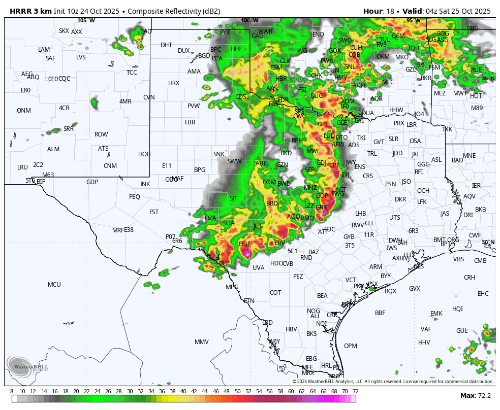
Some time after sunset, perhaps in the range of 8 to 10 pm CT, a cluster of storms will develop northwest (near College Station) or north (along Highway 105). This line will then descend into Houston between 10 pm and early Sunday morning, bringing the threat of heavy rainfall, thunder and lightning, damaging winds, hail, and a very slight chance of a tornado. However, unlike the storms early on Saturday I think these will be less of a single line and more of a diffuse mass.
To that end I think these storms will be more hit or miss, but where they hit they could do so hard. Some areas may get less than 0.5 inch of rain, and some areas may get 3 inches or more. The higher totals are more likely south of Interstate 10. For the most part this should not be enough rainfall to cause significant flooding problems. The majority of the storms should have moved off the coast a couple of hours before sunrise.
In short there’s plenty of potential for storms to hit tonight, but unlike the guaranteed squall line on Saturday morning, there is a little more uncertainty.
Sunday and beyond
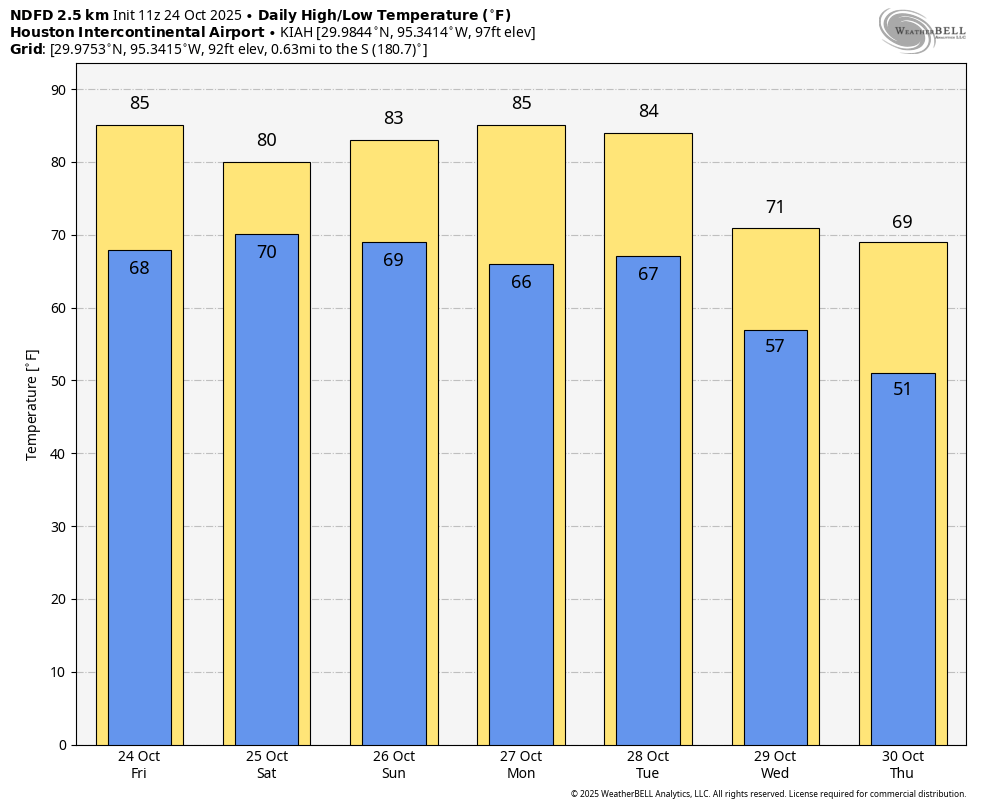
We could see a few isolated showers on Sunday, but for the most part I expect sunshine and a high near 80 degrees. With moderately drier air it should be a pleasant day, with lows Sunday night dropping to around 60 for much of the region. A stronger front arrives later on Tuesday, ushering in truly fall-like weather. We’ll talk about just how cold it’s going to get in Monday morning’s post. Until then, have a fine rest of the weekend.