In brief: Today’s post discusses the difference between ‘humidity’ fronts we’ve had so far this fall, and a stronger front that ushers in colder air. We think Houston may get its first stronger front of the season later next week, but cannot yet guarantee this.
Fall, finally (probably)
We have had several fronts this fall, beginning back in late August if you recall. For the most part these have been humidity fronts in the sense that they have knocked out some of the moisture from the atmosphere. But they have not brought large amounts of significantly colder air into the region. (There is no technical definition for this, but let’s go with nights in the 50s in Houston).
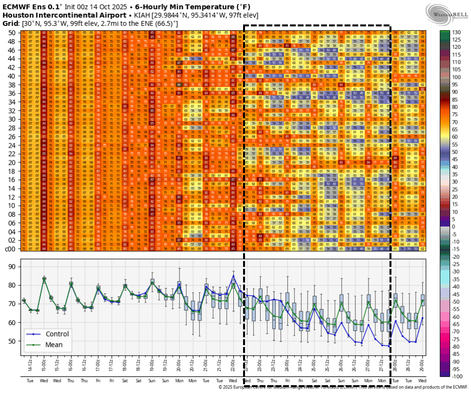
We have another ‘humidity’ front in the cards for this weekend. However after that, there is an increasingly strong signal in the global models for a stronger front in the range of 8 to 10 days from now. (Perhaps it is no coincidence that we scheduled Fall Day for October 25, months in advance?) Of course there is no guarantee this will happen as forecasts that far out are far from certain. But the time of year is right, and a pattern change appears likely. So Fall, finally? Probably.
Tuesday and Wednesday
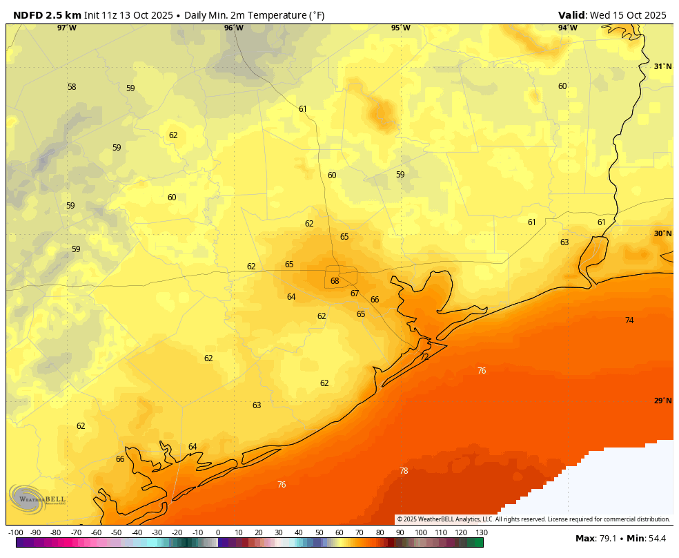
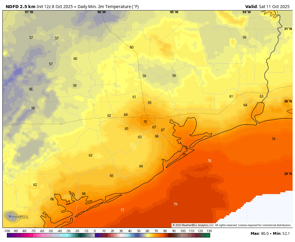
In the meantime Houston will continue to see warmer than normal weather. Highs today will be in the upper 80s (some inland areas probably will hit 90). The upside of this pattern for the next two days will be a drier northeast flow, so humidity levels will be lower. Expect sunny skies and generally light winds. Lows will fall into the upper 60s for central Houston, with cooler conditions for outlying areas.
Friday and Saturday
Heading into the weekend the onshore flow will become more pronounced, and this should introduce a few more clouds and somewhat higher humidity. This may help to limit high temperatures to the mid- to upper-80s. We also will have some low-end (20 percent?) daily chances for light rain. Any showers should be fleeting. Lows will only drop into the 70s for most locations with the more humid air.
Sunday and Monday
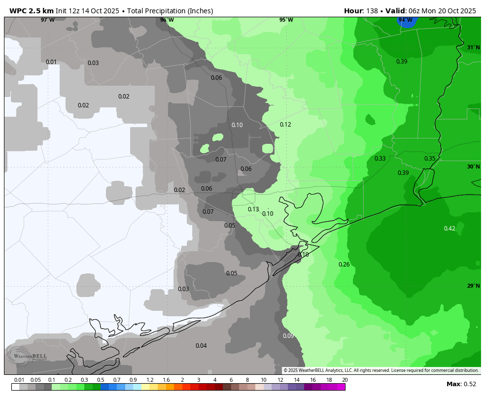
On Sunday we should see a front drag into the area. At this point it appears it won’t bring too much cooler air with it, but there is a decent chance of some showers on Saturday night and Sunday. Again, accumulations don’t look overly impressive, perhaps a tenth of an inch of rain, or two for most locations. Not everyone will see rain. Highs on Sunday should be in the upper 80s, with lows dropping into the 60s on Sunday night with drier air. Monday should see highs in the mid-80s or thereabouts, with sunny skies.
The rest of next week
After that point we’ll be in the waiting room for a stronger front. This could arrive as early as Wednesday, or maybe a day or two later. But most our guidance suggests we could see cooler weather (days in the 70s, nights in the 50s, maybe?) toward the end of next week. With some luck we will also get a decent shot of rain with the stronger front. But again, no guarantees at this range I’m afraid.