In brief: As we experience the coldest weather of this winter outbreak, Houston’s coming through without any significant power issues. Roads, too, are mostly passable with a little care in the metro area. We have one more cold night before a modest warmup ensues. And what of that second Arctic front next weekend?
Winter storm status
As we noted yesterday, Houston never received the amount of freezing rain necessary to present problems for power lines and other means of distributing electricity. And based on ERCOT’s latest projections for this morning, there should be no electricity supply crunch. Therefore we have no meaningful concerns about power during the current cold snap.
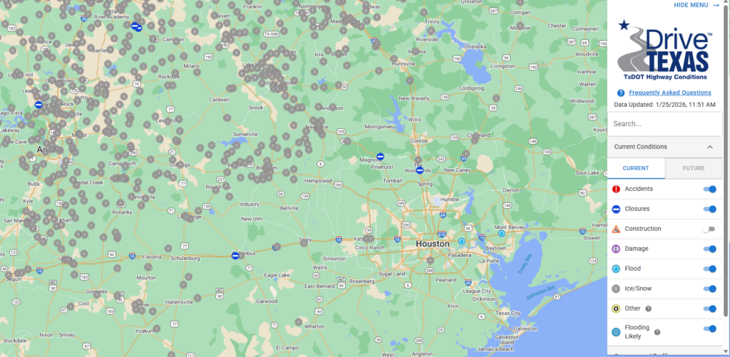
Roads, too, are mostly fine. There have been some reports of ice on roadways where standing water froze over night. Be sure to check Houston Transtar’s list of icy roadways before heading out this morning. However if you take a little time, and a little extra care, you should be able to get most locations in the metro area this morning. Road conditions rapidly worsen to the north of Houston, such as north of Conroe, and to the northwest, near Hempstead, on Highway 290. More information can be found on Drive Texas.
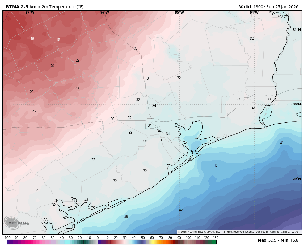
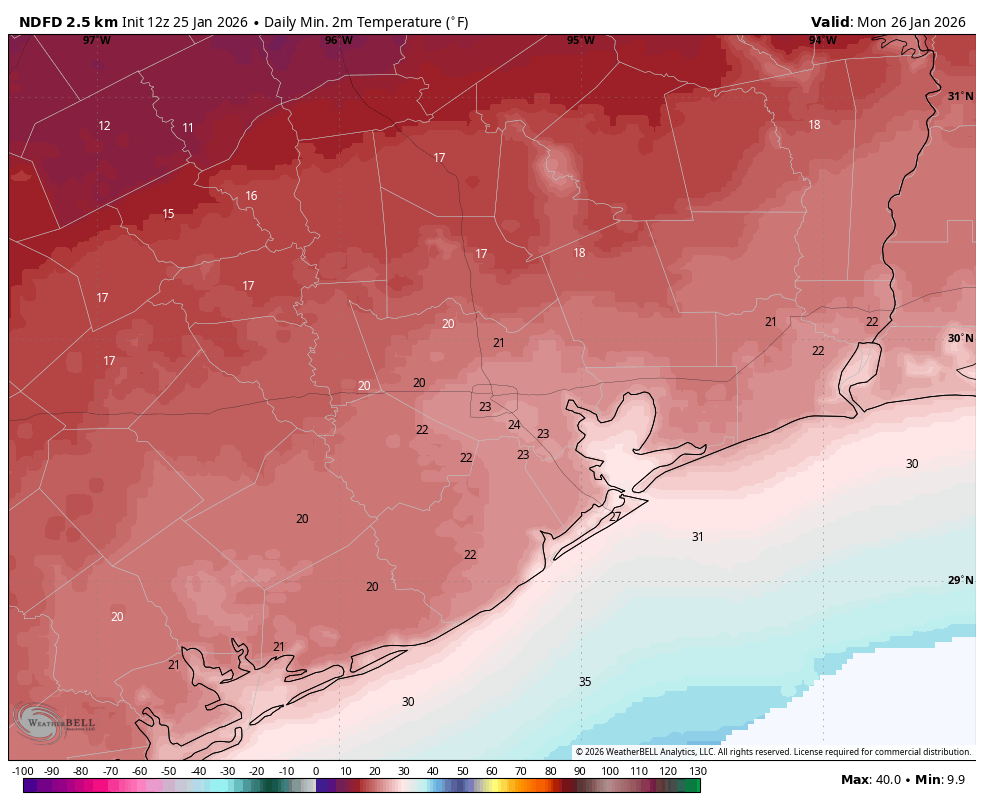
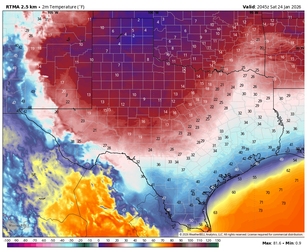
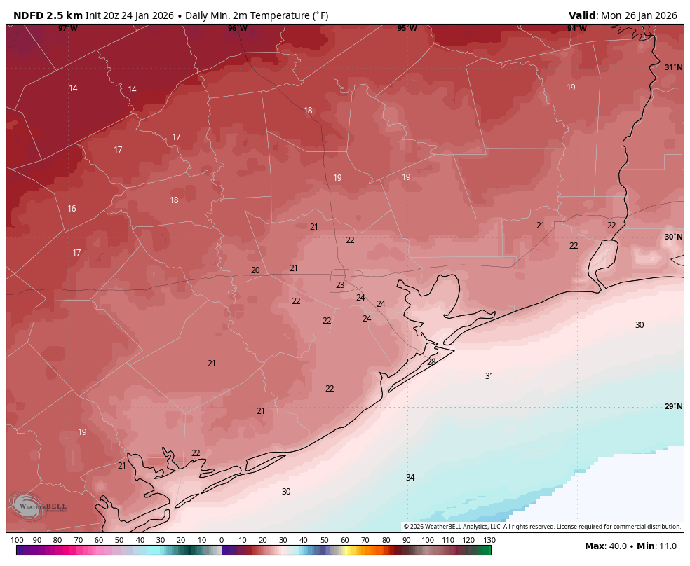
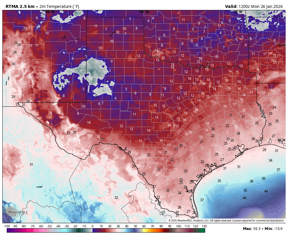
As for temperatures, lows have fallen generally into the mid-20s this morning in Houston and surrounding areas. Even Galveston Island has dropped into the upper 20s. Overcast skies have helped prevent colder temperatures. I expect lows to reach similar levels tonight, with temperatures perhaps a few degrees warmer or cooler.
Monday
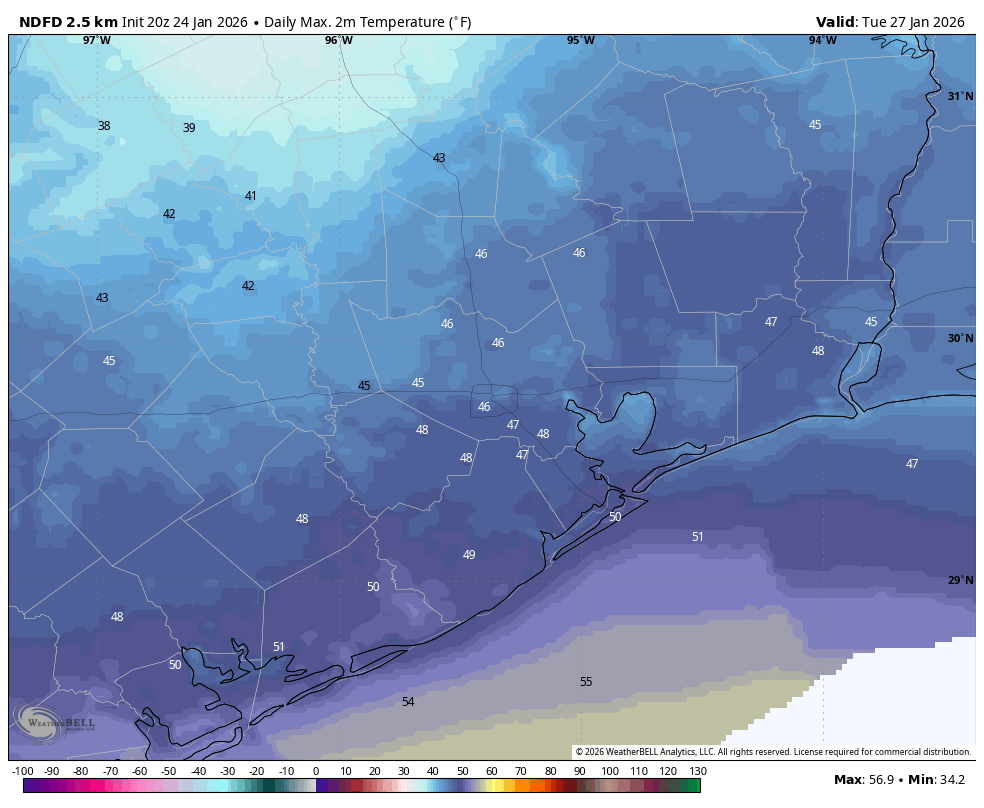
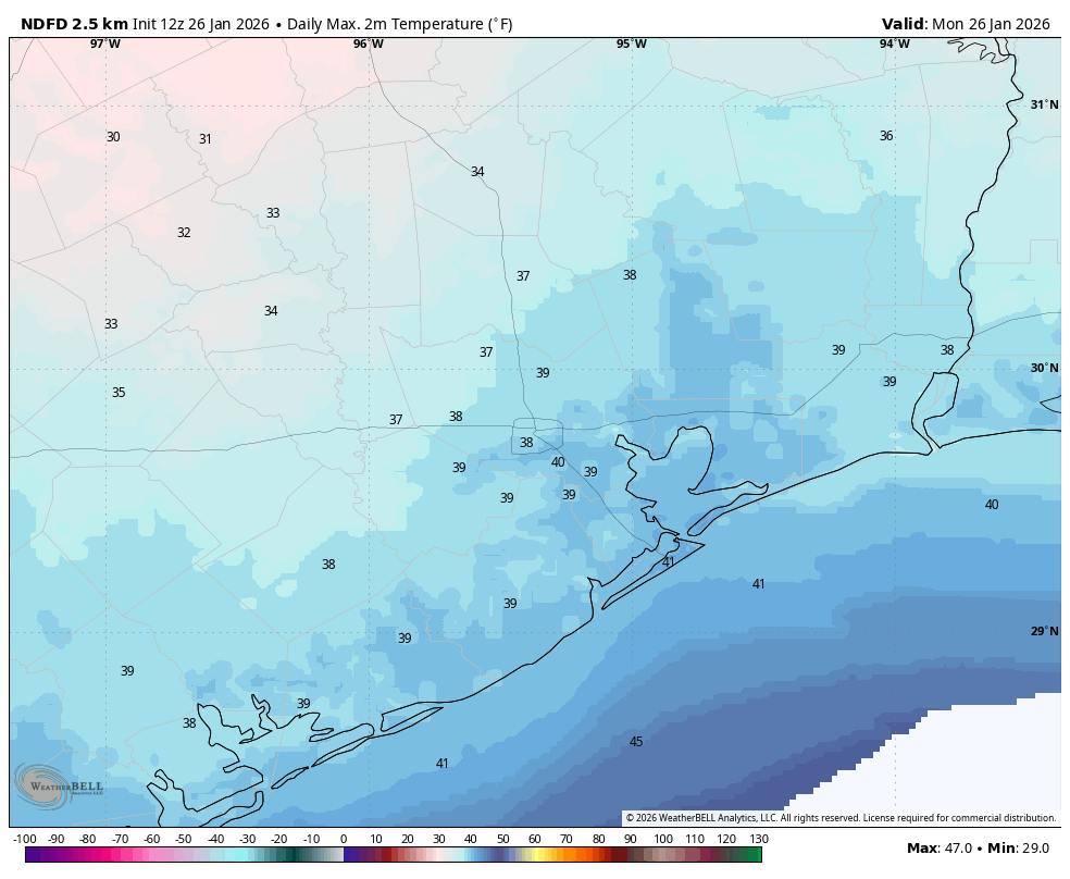
Job number one this morning is to stay warm. Winds are still frisky, from the north at 10 to 15 mph, and that is making a very cold morning worse. Wind chill temperatures are in the low teens out there. We’ll be slow to warm up this morning, but by this afternoon with clearing skies we should see highs reach into the mid- to upper-30s for most locations. For a few hours at least. The combination of lighter winds and clearing skies will lead to ideal cooling conditions tonight. Expect lows similar to what we’re experiencing this morning, give or take.
Tuesday, Wednesday, and Thursday
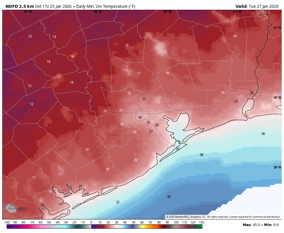
Houston will slowly emerge from the ice box this week with highs on Tuesday in the upper 40s, and reaching the mid- to upper-50s by Thursday. A light freeze will be possible on both Tuesday and Wednesday nights for central and further inland parts of the area. Skies should be mostly sunny.
Friday, Saturday, and Sunday
Another strong cold front is in the cards for this weekend, likely arriving on Friday. This may bring some precipitation with it. Although we cannot rule out some of this rain turning into snow or sleet, it looks like the colder air will arrive after the precipitation ends. We’ll be watching things closely, all the same. Friday will probably see highs in the 50s, but the weekend looks cold with high temperatures in the 40s. What of lows? It’s a good question, and I could see them falling anywhere in the 25 to 35 degree range for Houston. So worst case, probably about what we’re experiencing this morning. But there’s still some wiggle room, so I want to wait for more clarity before making bold predictions.
Stay warm out there, and thanks to everyone who is getting out and about this morning to make Houston’s fair society—from grocery stores and airports to hospitals and law enforcement—function despite the inclement weather.