In brief: Today’s post discusses a weak front arriving by Thursday or so, and explains why this is called a backdoor front. After this we have zero weather concerns for the weekend before calm weather persists for most of next week.
What is a backdoor front?
We are not speaking here of “backdoor” in the sense sometimes alluded to in popular music, from the Doors to Sabrina Carpenter. After all, this is a family friendly website. No, when we talk about a backdoor front it refers to the direction that a cold front typically arrives from.
Most commonly we observe fronts coming out of the north or northwest as a frontal systems drops into Texas from the Great Plains, and down to the Gulf coast. The strongest of these kinds of fronts is sometimes called a “blue norther,” but we usually don’t see these until December, if at all during the winter.
By contrast, a backdoor cold front is a front that approaches from the east or, more commonly here, the northeast. We often see these during the early fall and late spring time frame. And so it will go this week, as a high over West Texas drags drier air into the eastern part of the state. At this point it looks as though the greater Houston area will see a decent shot beginning Thursday evening.
Tuesday and Wednesday
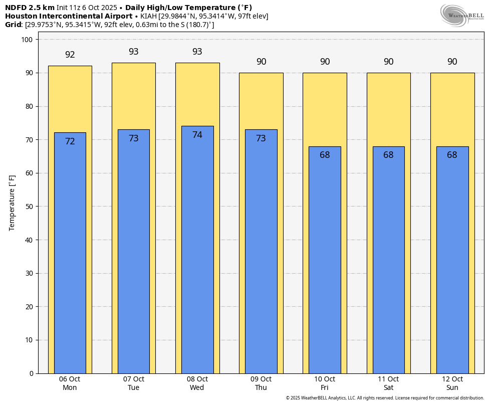
Skies will be mostly sunny for the next two days, with much of Houston reaching the lower 90s during the afternoon hours. Areas far to the west and north of Houston may reach the mid-90s, whereas the coast should be a few degrees cooler. Winds, generally, will be light from the east. On Monday afternoon we saw a few isolated pockets of showers, and I think that will again be the case today and Wednesday, although overall chances are likely 20 percent or less. (Crazy to think, but these are probably our best chances for rain until at least early next week). Lows will only fall into the mid-70s, with a fair bit of humidity.
Thursday
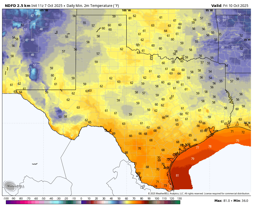
The aforementioned front arrives on Thursday, and it likely will bring no precipitation with it. However, it will usher in drier air from the northeast over time. We’ll feel that in the form of northeasterly winds on Thursday, perhaps gusting up to 20 mph. Highs will be about 90 degrees, with lows Thursday night likely dropping into the 60s (see forecast map below).
Friday
This day should see the driest air of the week, with relatively low humidity and highs in the upper 80s for most locations. Skies will be pure sunshine. Lows Friday night should again drop into the 60s.
Saturday and Sunday
The weekend should bring more sunshine, with highs in the upper 80s to 90 degrees. If you have plans for outdoor events you have zero weather concerns aside from the need for sunscreen. Lows will drop to the vicinity of 70 degrees. Humidity is not exactly low, but it won’t be high, either.
Next week
Most of next week should bring more sunshine, with highs of around 90 degrees, lows around 70, and moderate humidity. Rain chances look to be near zero before next weekend, when some kind of pretty decent front could arrive. We don’t have any firm details or high confidence yet, I’m afraid.