In brief: We have a shorter post today, because there are only so many ways one can slice and dice our repetitive weather this week. A strong front arrives Sunday or Sunday night to return us to winterlike conditions.
Holiday plans
Given the Christmas Day holiday, our plan is to take Thursday off this week. (And really, our forecast is not going to change much between now and then). Some of our daily posts during the holiday week will also be a little shorter because really, there is just not that much to say. However that does not mean we will be bereft of gifts. To mark the Festivus holiday, we are publishing a special Q&A this morning at 10 am CT. So be sure and check back for feats of strength and airing of grievances from readers.
Tuesday through Saturday
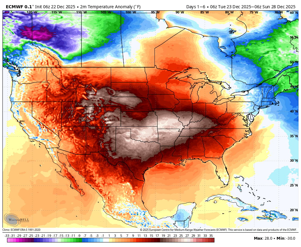
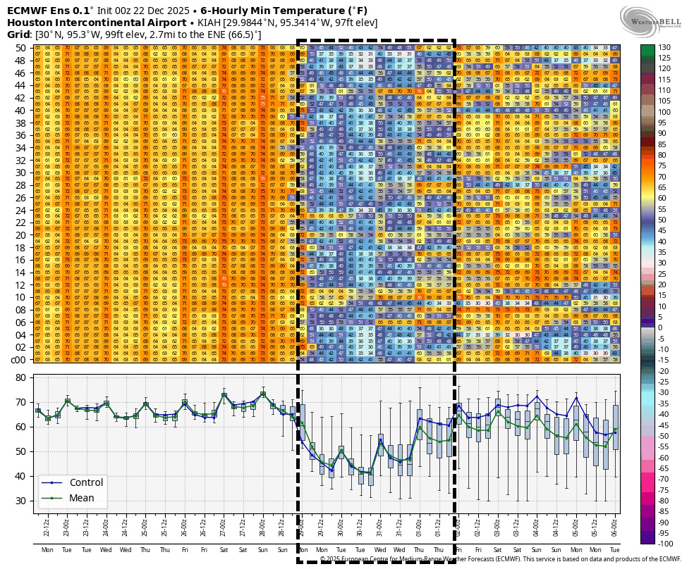
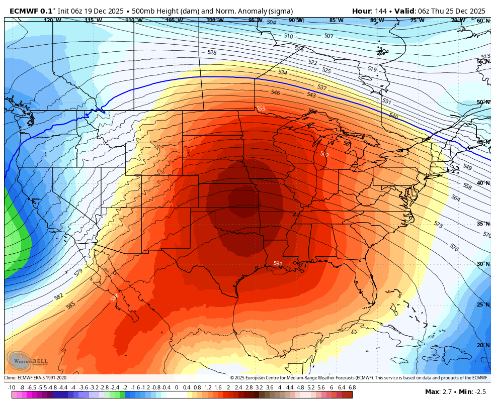
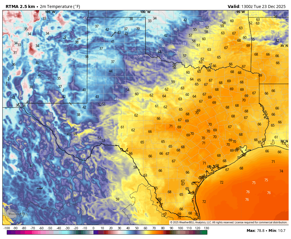
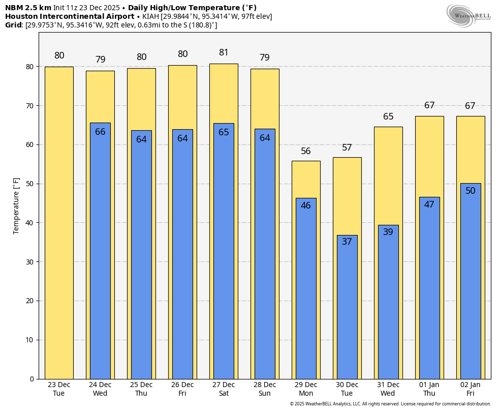
Yes, we can confidently forecast the weather for the next six days beneath a single heading. The days really will be that repetitive due to a persistent ridge of high pressure. Each day will start out with a healthy chance of fog, especially closer to the coast. We will then see partly sunny skies. The only difference this week is that the next couple of days may see a few more clouds, and Friday and Saturday a little more sunshine. Either way we will see high temperatures in the vicinity of 80 degrees, with plenty of humidity. Lows will drop into the mid-60s in Houston, with slightly warmer conditions near the coast, and slightly cooler inland. Morning winds will be light, with some moderate gusts building during the afternoon. And that’s it, rinse and repeat through Saturday.
Sunday
Change finally arrives on Sunday or Sunday night. Accordingly I think Sunday will start out as another warm day before a shot of colder and drier air arrives. Our lows on Sunday night will depend on how much time there is for the cooler air to push in, but 50 degrees seems about right. Rain chances with the front, and yes I know we could use some, are pretty low—something on the order of 20 percent perhaps.
Next week
Monday Tuesday and Wednesday look chilly, with daytime highs perhaps in the 50s or 60s, and lows in the 30s or 40s. We may see a bit of a warming trend by New Year’s Eve and New Year’s Day, but I’m not particularly confident in that. I’ll take a closer look at conditions surrounding New Year’s in tomorrow’s post.