In brief: Summer is by no means over, but based on climatological temperatures we have now crested the peak heating for this year. And there’s no sign of extreme heat any time soon, with highs in the 90s for the foreseeable future and daily rain chances. As Cypress and Klein saw Wednesday, isolated thunderstorms are a possibility as well.
Past the peak
Don’t look now, but fall is on the horizon. We are still about one month away from having any real expectation of a decent cold front, but Houston has passed over the ‘hump’ of summer. The traditionally hottest time of year comes from late July through the first 12 days of August. This is when the average high is 96 degrees. As of today, the average high is 95 degrees. So we are taking baby steps.
I don’t want anyone to be fooled, of course. These are climatological averages, and individual years can bring significant variability. Often times the city of Houston sees some of its hottest daytime temperatures of the year in late August and early September. However, the average temperature is lower due to shortening days and the occasional weak front. All of this is to say that we are getting through summer, y’all. And the good news is that, for now, we don’t have any 100-degree weather in the forecast.
Thursday
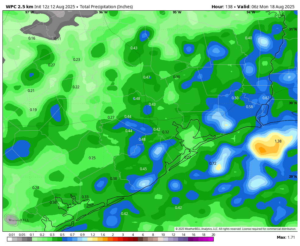
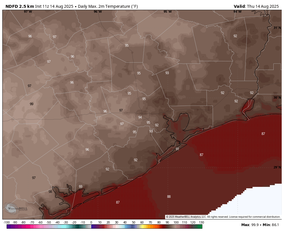
What we have in the forecast for today is a decent chance of showers, especially closer to the coast. By now you’re familiar with this pattern. Somewhere in the region this afternoon, or early evening, we’re likely to see a decent cluster of showers and thunderstorms. Most of the area won’t see any rain, or just some light sprinkles. But a few places—yesterday it was Cypress and Klein—might pick up 1 to 2 inches. This is likely to be the setup later today as well, and it’s precisely what I mean when I say we will have scattered showers and isolated downpours.
High temperatures will depend on the extent of shower coverage later this afternoon, but most of us should see highs in the low- to mid-90s, with plenty of humidity of course. Nights have been really warm of late, and I expect most of the city will not drop below 80 degrees tonight. Winds remain light, outside of thunderstorms in which there can be strong gusts.
Friday and Saturday
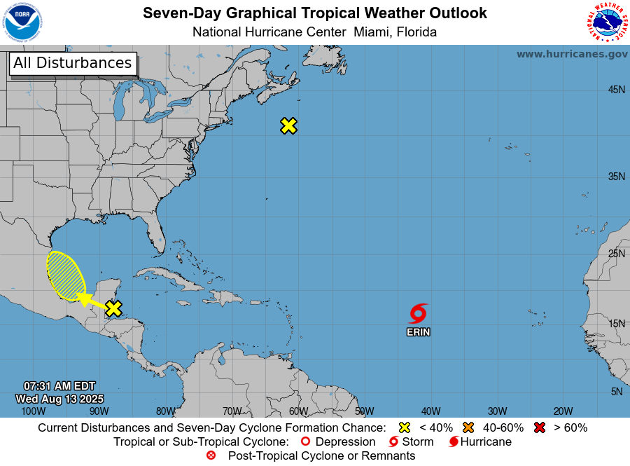
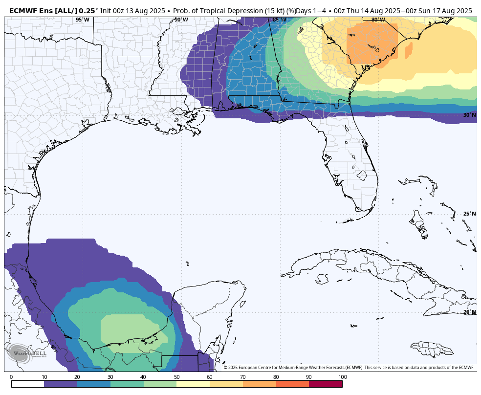
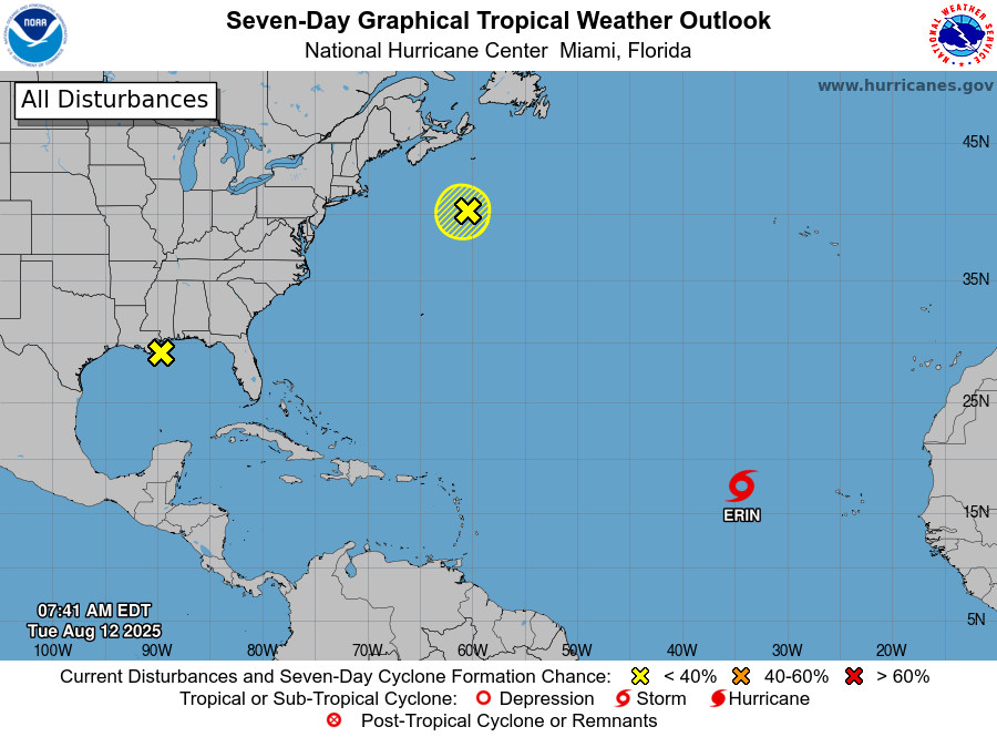
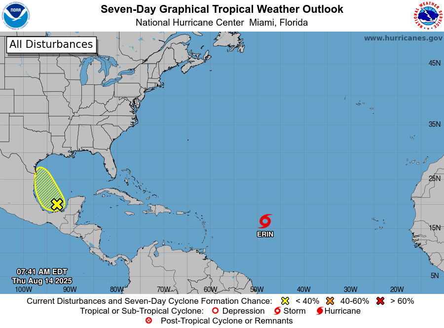
You may have noticed a ‘tropical blob’ highlighted in the Gulf by the National Hurricane Center. This remains unlikely to develop into a tropical depression or storm, and it has a limited window before moving into Mexico or southern Texas late on Friday. (If there’s a significant change to this outlook, we will update the site immediately. But we don’t expect this to happen).
Regardless of development, this system will inject a little more moisture into our area. This should raise rain chances to 50 or 60 percent on Friday and Saturday in the greater Houston area. Overall accumulations will still be on the order of one-half inch (or less) for most locations. But just know there could be some disruptive showers pulsing through. High temperatures for most of the region will top out in the lower to mid-90s on Friday and Saturday.
Sunday and beyond
By the second half of the weekend some high pressure is going to try and work its way into the area, but I don’t think our daily weather is going to change too much. We are likely to see high temperatures generally in the low- to mid-90s (a few far inland areas may push into the upper 90s) with a smattering of afternoon showers and thunderstorms. It should be fairly typical for mid-August in Houston, and as we’ve discussed before, any time we get ‘boring’ weather during this time of year we’re doing very well.
Atlantic tropics
I’ve already mentioned the Gulf tropical low above: It’s not a major concern for us, or probably anyone. Then there is Tropical Storm Erin, which is on its way to becoming the season’s first hurricane. It is likely to pass north of the Caribbean Sea. It will approach the southeastern United States next week but probably (although not yet certainly) curve before reaching the mainland. Bermuda faces a definite risk next week from Erin. Beyond this there are no imminent threats and the Gulf looks quiet for the next 10 days or so.