In brief: Today’s post explains why boring and calm weather in August is the perfect ideal for Houston. This will never be a month for nice weather. But it is often a month for nasty weather. Fortunately, this year, we’re not seeing that. (So far).
August doldrums
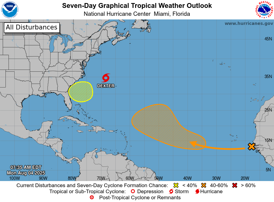
A lot of terrible, awful, no good weather can happen in August along the upper Texas coast. Historically this is when we have seen our most terrible heat. I think about the summer of 2023, when the average daily high temperature for August was 103 degrees. This is the month when we often seen our most entrenched high pressure systems and deepest droughts. Conversely, August and September are when the region is most vulnerable to powerful hurricanes. So we can see not just droughts but flooding rains. We often go from drought to flash flooding in a matter of minutes due to the nature of tropical rainfall. Fun times.

So when I look ahead to our forecast over the next 10 days and see highs generally in the low- to mid-90s, with enough of a splash of rain—but not too much, mind you—to keep the drought at bay, I’m happy. It may be boring to forecast. It may mean no one is reading about, or really cares about the weather. But boring weather in August beats almost any conceivable alternative. So I say, with pride, that today’s forecast post is boring.
Thursday and Friday
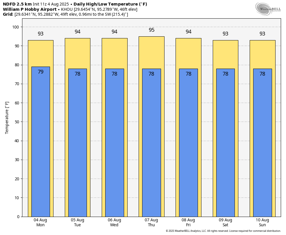
The end of the work week will bring some of our warmest weather. Daytime highs will push into the mid- to upper-90s (for inland areas), with mostly sunny skies. We will see some showers offshore during the morning hours, and I expect these to develop over land later this morning and during the afternoon with daytime heating. Generally I expect about 10 percent of the region to see moderate to heavy rains, another 20 percent or so to see light rain, and then the rest of us nothing. So these will be very much hit or miss rains. Winds will be light, generally from the southeast. Overnight lows are very warm and muggy.

Saturday and Sunday
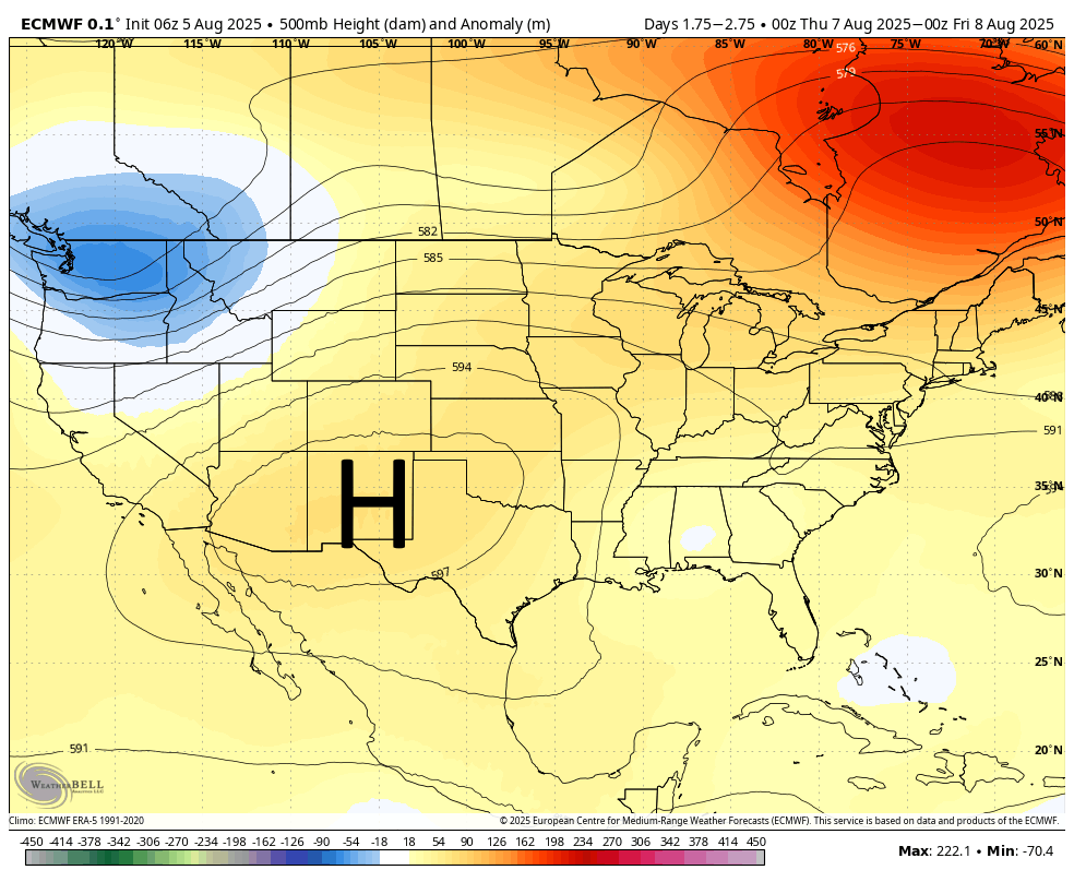
As the high pressure system over the Southwestern United States retreats a little bit this weekend, we will see slightly increased rain chances. Overall daily coverage will be about 40 percent, and again these should be very much hit or miss showers, with a few isolated pockets of heavy rain, and most areas seeing much less. A few more clouds should help limit high temperatures this weekend to the low- to mid-90s. Which, for the deepest dog days of summer, is not half bad.
Next week
This pattern of boring weather: highs generally in the mid-90s, low-end daily rain chances, and plenty of humidity, should continue for the majority of next week. It’s not glamorous, but for me in August, in Houston, every day is one of survive and advance toward fall. And we’re getting there folks.