In brief: After a very cold beginning of winter, temperatures will moderate today before another front arrives Thursday. In addition to falling temperatures we’ll see falling rain, with the period from Wednesday evening through Thursday bringing widespread showers. The weekend still looks nice.
Chilly start to December
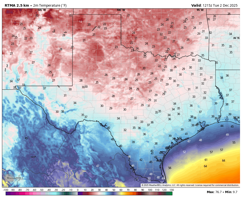
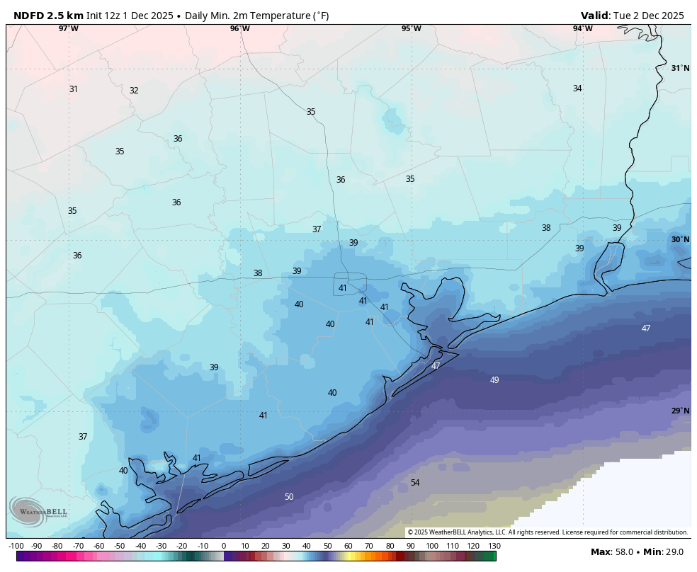
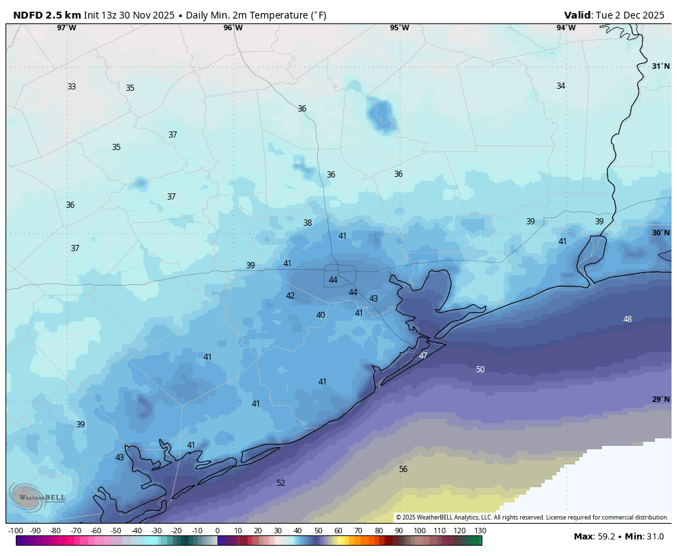
So far the warmest temperature in the month of December has been 55 degrees, which was briefly reached shortly before 3 pm on Tuesday afternoon. We’re going to go a good 10 to 15 degrees warmer today, as a ‘warm’ front moves onshore and briefly brings a surge in temperatures and humidity. That moisture is important, because it will support widespread showers beginning this evening, and for much of Thursday across the area.
Wednesday
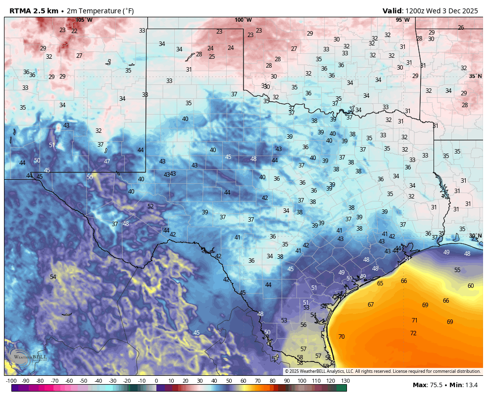
Temperatures this morning are running about 5 degrees warmer than on Tuesday, but it remains rather chilly across the metro area. We should still see a bit of sunshine this morning, but a more southeasterly flow is going to quickly build a cloud deck over the area. This warmer flow will push high temperatures into the 60s across the area this afternoon (upper 60s for coastal areas, lower 60s further inland). Rain chances remain low during the daytime hours today, but by this evening we should start to see some light showers to the southwest of Houston, and these will build into the area overnight. Lows will be in the 50s.
Thursday
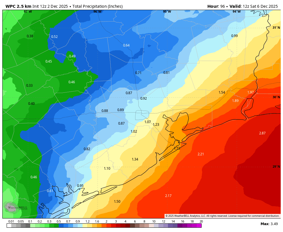
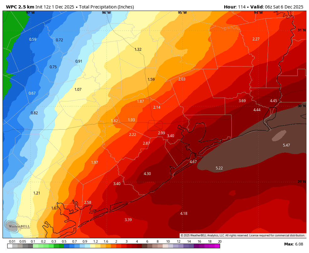
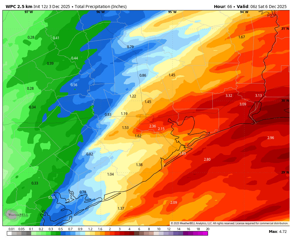
Rain chances will be elevated throughout the daytime on Thursday, with accumulations adding up over time. I think much of the area will pick up 1 to 2 inches, but there will be the potential for isolated, higher totals. Overall I’m not particularly concerned about flooding, but this is something Matt and I will be closely monitoring. Temperatures will probably peak at around 60 degrees on Thursday morning, and then fall slowly throughout the day as a colder air mass sags into the area. My sense is that rain chances will fall off into 10 to 30 percent range overnight on Thursday, with lows dropping into the 40s.
Friday
We are going to see the potential for some additional, mostly light showers on Friday, especially near the coast as a disturbance passes. Look for daytime highs in the mid-50s, with lows likely in the upper 40s.
Saturday
Saturday is likely to start out cloudy, but we should see clearing skies, and this will probably help push daytime highs into the mid-60s. Lows on Saturday night, with mostly clear skies, should drop to around 50 degrees.
Sunday
This will be a pleasant day, with sunny skies and a high around 70 degrees. Throughout the day we should see a reinforcing front, but at this time conditions don’t look too windy on Sunday. With the drier air, I expect lows to drop into the 40s on Sunday night.
Next week
We probably will start next week with days in the 60s and lows in the 40s, warming to 70s and 50s for the second half of the week. Rainfall potential looks low. I’m not seeing much in the way of inclement weather, so all in all it looks like a rather nice week of December weather.