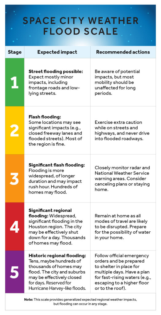
In brief: In today’s post we reveal the new design and content for our flood scale. We have made changes based on research conducted by the University of Houston. Although rain chances will increase later this week, we also anticipate no need to use the new flood scale any time soon.
Updated flood scale
This morning we are pleased to announce an update of our flood scale, which is intended to help guide expectations for people in the greater Houston region when it comes to the potential for flooding. We first introduced our flood scale in 2019, after Hurricane Harvey, and have used it dozens of times since then. But we really did not understand how people were using it.
Now, with the help of some researchers from the University of Houston, we do. A professor of
Psychology, Steven Paul Woods, reached out to Matt a couple of years ago, and together they and one of his doctoral students, Natalie C. Ridgely, worked to perform a study of the scale and whether it was effective at communicating risk. Later this morning we will publish a summary of the study, and its results, written by Woods and Ridgely. (Here it is).
As a result of this study, we have made some changes in the structure of the scale to simplify it, and added recommended actions. Reliant provided a cleaner design. What thrills me the most is that this scale was created here in Houston, and improved by local researchers who care about this community just as much as we do. It is by Houston, for Houston.
Our new scale appears below:
Tuesday
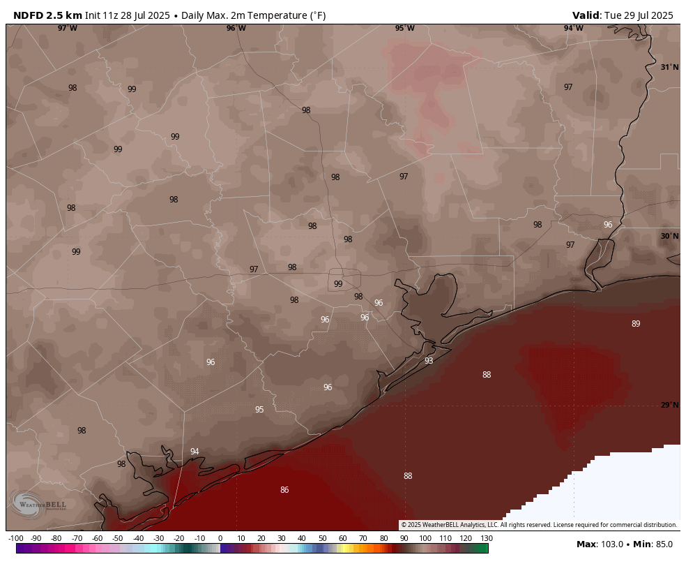
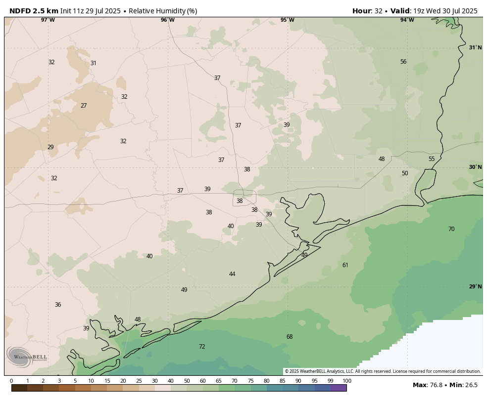
Well, we won’t need the flood scale today. With high pressure firmly in place, Houston is going to have one of its hottest days of the year. With sunny skies, look for high temperatures to push into the upper 90s across most of the region away from the immediate coast. Some inland areas may reach 100 degrees. Winds will be very light, from the west mostly. Lows tonight will only drop into the upper 70s.
Wednesday
This will be another hot and mostly sunny day, with highs in the upper 90s. However there will be a couple of subtle differences. One is that dewpoints may drop into the mid-60s across the region. This is not “dry” in any great sense, but these dewpoints are lower than normal for this time of year. So humidity will be lower than we have been often experiencing this summer, especially for inland areas. There also will be a very slight chance of showers later on Wednesday afternoon or evening.
Thursday and Friday
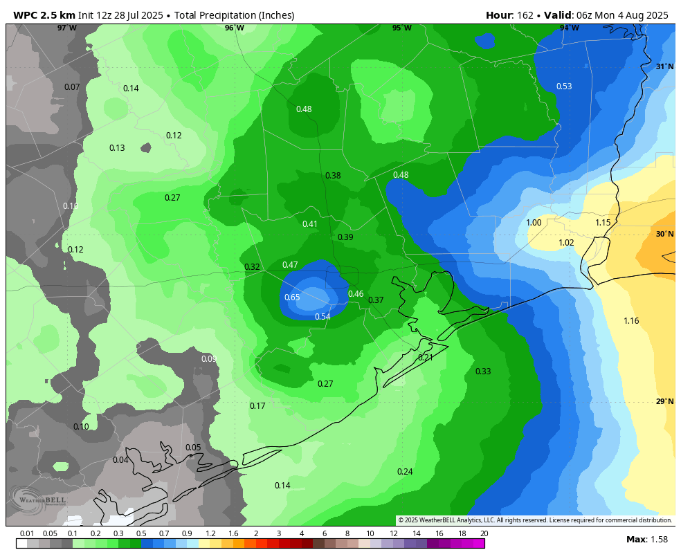
Low pressure stretching across the Gulf will bring increased rain chances into the area for several days. On Thursday and Friday the likelihood of rain will be somewhere between 30 and 50 percent, with low-end accumulations for most. Depending on the timing of rain (if any) highs will vary between the low- and upper-90s, with partly to mostly sunny skies.
Saturday and Sunday
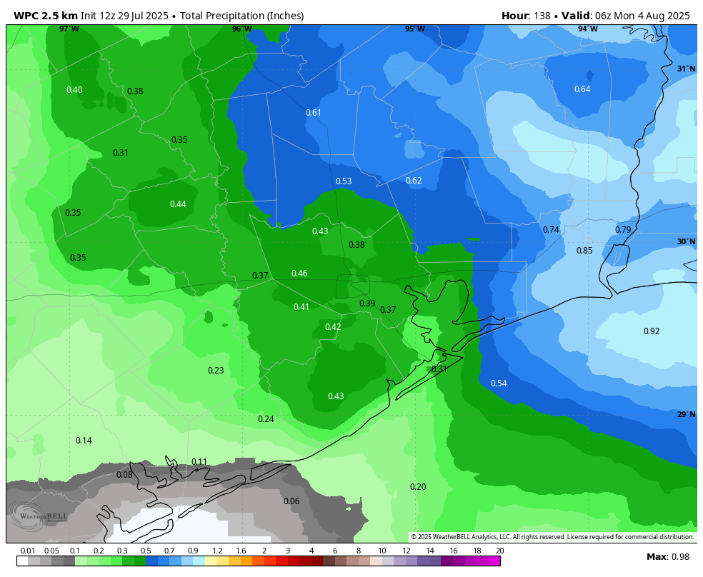
Better rain chances will arrive this weekend, with both days bringing about a 50 percent likelihood of showers. For now we don’t see too much of a risk for really heavy rainfall, and my expectation is that most locations will pick up between 0.25 and 0.5 inch of rain. Since this is summer and tropical rainfall is possible, we’ll be on the lookout for higher totals, but for now this looks more like a splash of rain rather than a deluge. Highs will generally be in the low- to mid-90s with partly sunny skies.
Next week
The first full week of August does not look to be excessively hot. Temperatures probably will be in the mid-90s for the most part, with a smattering of daily showers driven by the sea breeze. Beyond that, we shall have to see.