In brief: Temperatures in the Houston region soared into the upper 90s this weekend, but with the departure of high pressure our atmosphere has now been cracked open to storm activity. There will be a healthy chance of showers and thunderstorms all week, which will help keep a lid on temperatures.
Weekend heat
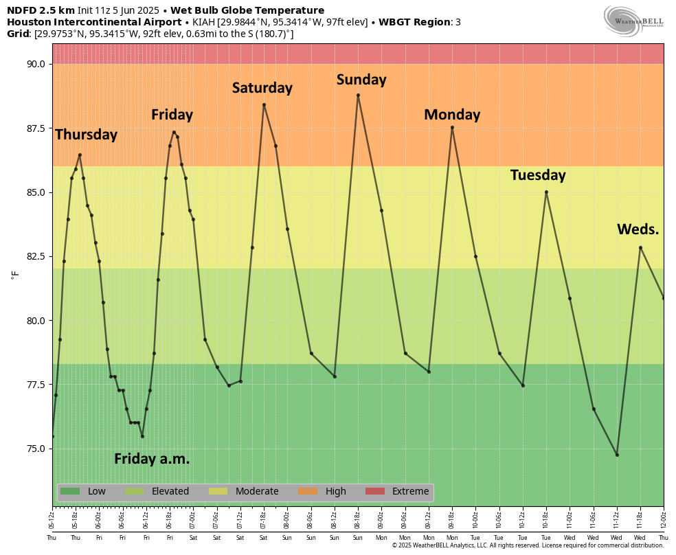
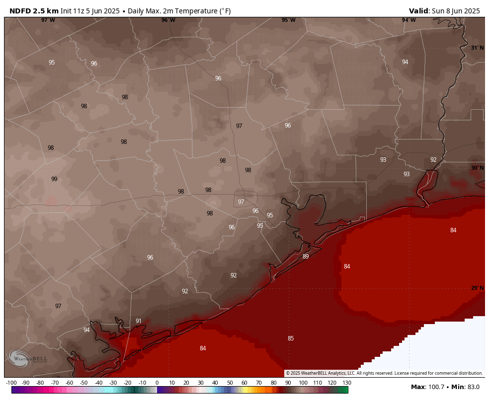
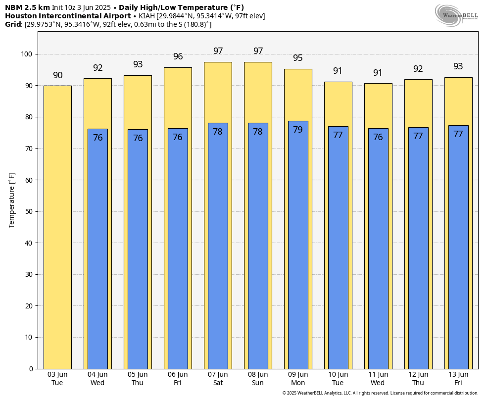
The city of Houston did not set heat records this weekend, but we came close and the temperatures outside offered a preview of what we can expect later this summer. The record highs for both Saturday and Sunday were 99 degrees (set in 1903 and 1980, respectively), and we hit 97 degrees on Saturday and 98 on Sunday at Bush Intercontinental Airport. Combined with humidity and warm nights, it felt like deep August out there. Alas the climatological ‘peak’ of summer heating in Houston is still about two months from today. Now, at least, a reprieve.
Monday
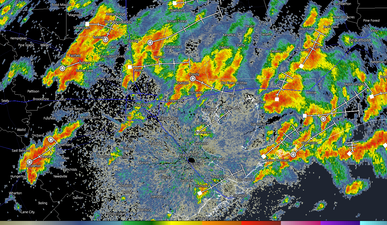
A line of storms is advancing upon the Houston region from the north, and as of sunrise it is moving into the central metro area. These storms are relatively slow-moving, and will work their way through the city and down to the coast by around noon. We are not seeing too much in the way of severe weather with these thunderstorms, but they could certainly produce some ponding on roadways and cause some brief street flooding issues.
Skies should clear out later this morning, and this should allow high temperatures this afternoon to push into the low- to mid-90s. With this daytime heating we may, in turn, see the development of some additional showers and thunderstorms this afternoon or early evening in central Houston. Lows tonight will only drop into the upper 70s.
Tuesday, Wednesday, and Thursday
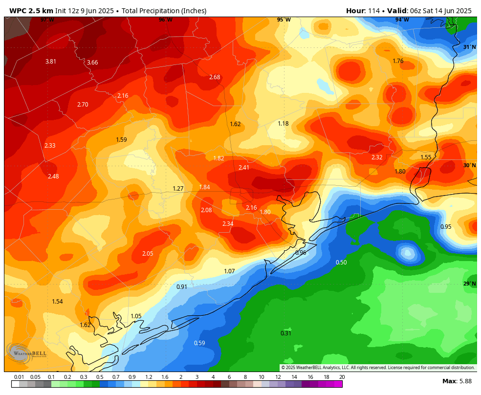
This period should see unsettled weather. In the broader picture, with high pressure having departed, a series of disturbances will produce healthy rain chances each day. Again, we cannot entirely rule out the possibility of some damaging winds or other severe weather, but the primary threat during this period will be the potential for heavy rainfall.
Overall, I think this will be manageable, with most of the area picking up between 1 and 3 inches between now and Thursday. But this is Houston, we’ve reached summer, and there is always the potential for heavy rainfall that briefly backs up streets. This is a function of a) living near a very warm body of water in the Gulf of Mexico and b) living in a relatively flat city where it takes time for tropical rains to drain. But I don’t expect it to rain all the time, and some locations probably will not see rain some days.
Daily high temperatures will be dependent up cloud cover, and when and how much it rains during the afternoon hours when it typically is hottest outside. But each of these three days should see highs in the vicinity of 90 degrees, with some locations a bit above, and others a bit below. Although daytime temperatures will be a bit cooler, humidity will be plenty high, and you know those nights will be warm and muggy.
Friday
Skies should turn a bit more sunny as we get toward the weekend. Expect highs in the lower 90s. Rain chances will still be decent however, at least 50 percent for much of the area.
Saturday and Sunday
Daily rain chances remain on the menu this weekend, probably about 50 percent each day. Overall accumulations should be quite a bit lower this weekend, i.e. I think the potential for street flooding will diminish. Probably. Expect highs generally in the lower 90s, with partly sunny skies. Nights will only fall into the upper 70s.
Next week
This overall trend should persist into next weekend; that is temperatures probably will remain the lower 90s with a decent chance of showers each day. If you’re bummed about the rain, I get it. But this is the kind of pattern that really helps set our region up nicely for the typically hot and dry patterns we can get locked into in July, or August, or both.