In brief: Houston’s weather has been largely unchanging in recent weeks, but that pattern is about to break. We expect widespread rain showers this weekend, and this will be our best chance of denting Houston’s emerging drought in a long time. We also are looking at the likelihood of fall-like weather later next week.
A forecaster’s lament
I have a love-hate relationship with boring weather in Houston. On one hand, it’s extremely easy to forecast conditions when you have high pressure sitting on top of your head in October. Basically, every day features sunny and warm-to-hot conditions, with warm nights. So yeah, it’s easy to be right. And who doesn’t like to be right?
However, it becomes pretty boring to write about that kind of a pattern every day (sometimes we must take drastic measures to relieve the tedium, like a GIF-based forecast). Moreover, as someone who lives in Houston, it is boring to experience the same weather every day, especially when we are supposed to be transitioning from summer to fall. Variety is the spice of life, and all that. Well, I’m here to tell you that this transition is happening finally, so buckle up.
Tuesday
We’re going to see another partly to mostly sunny day today, with high temperatures likely reaching 90 degrees for most of the region. (There’s a non-zero chance this is our final 90-degree day of 2025, but I don’t want to jinx anything so pretend I did not write that). A weak front will arrive later today, and it will bring a slight chance of showers and isolated thunderstorms with it. The best chances will be east and southeast of Houston, particularly in areas near Galveston Bay, this afternoon and early evening. The front will usher in some drier air, and lows tonight will drop into the upper 60s in Houston, with cooler conditions for outlying areas.
Wednesday
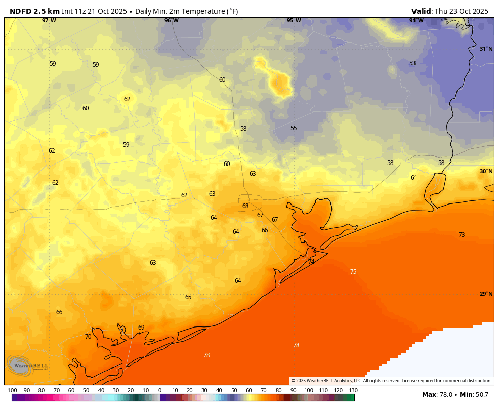
This will be a sunny and pleasant day, with mostly dry air and highs of around 80 degrees. It’s not precisely clear how long the drier air will hold over Houston, and this means we have some uncertainty about how chilly Wednesday night will be. I’m going to be optimistic and say much of Houston drops to around 60 degrees by Thursday morning, but if our dewpoints rise more quickly, it’s going to be a more humid and warmer night.
Thursday
This should be another mostly sunny day, but highs will be a little warmer, likely in the mid-80s for most locations as the onshore flow resumes. Lows on Thursday night will drop into the lower 70s.
Friday, Saturday, and Sunday
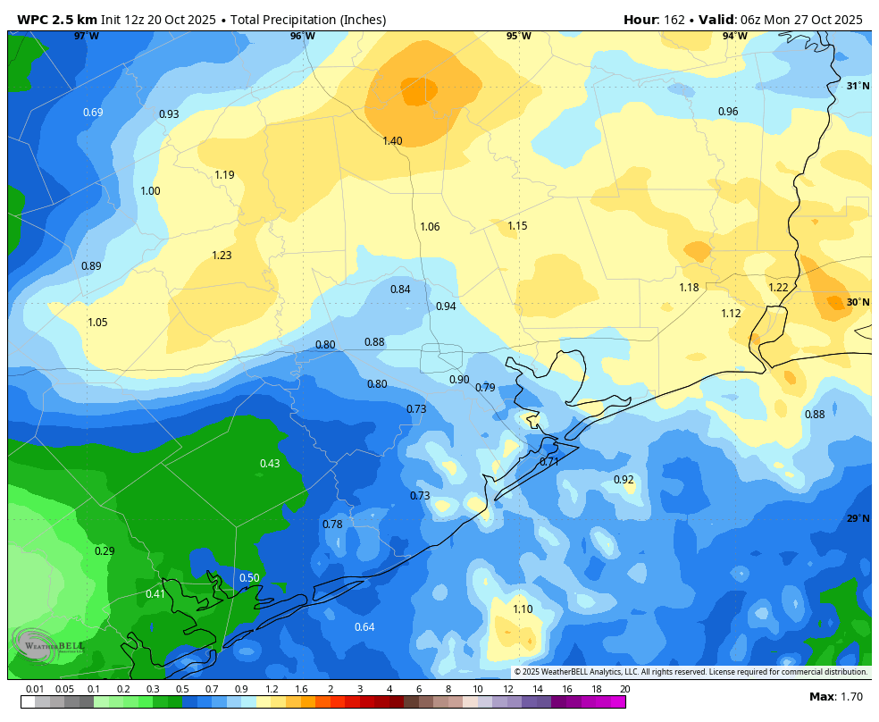
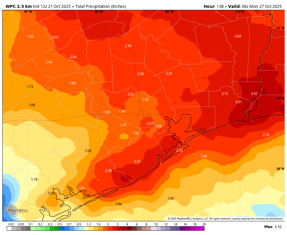
An upper-level low pressure system will approach, and move through the region this weekend, and with abundant atmospheric moisture to tap it is going to bring our best chance of rain in many weeks. Friday should start out mostly sunny, but we’ll see building clouds during the afternoon. Late Friday night through Saturday night is when I expect to see the best chance of rain, with the potential for some thunderstorms. The entire region should see precipitation, and the models have become more bullish overnight. I’m projecting about 2 inches of rain for most people, but totals will vary widely and there is the potential for higher accumulations. Rain chances will fall on Sunday, perhaps to around 40 percent, before things clear out. The weekend will see highs in the vicinity of 80 degrees with mild nights near 70 degrees.
Next week
Most of our model guidance is still pointing toward the arrival of a fairly strong cold front by around next Wednesday or so. Would I etch this forecast in stone, since it is eight days out? No I would not. But I’m rather hopeful that truly fall-like weather is coming during the second half of next week. Details to come as our confidence increases.