In brief: Monday will be calm, but you should anticipate the potential for showers, thunderstorms, and heavy rainfall on Tuesday and Wednesday in the Houston metro area. We don’t have high confidence in the timing yet, but with the atmosphere in place we can be pretty confident in disruptions, and have put a Stage 1 flood alert in place through Wednesday. Things calm down after that.
Weekend review
You would be hard-pressed, I think, to expect a finer weekend in early May than we just experienced. My wife and I were at a choir event on Sunday evening at the Willowynn Barn in Santa Fe—a gorgeous place for events by the way, I joked with Amanda that I would like to have my next wedding there—and you just had to stand outside and soak it up. Summer is on the horizon.
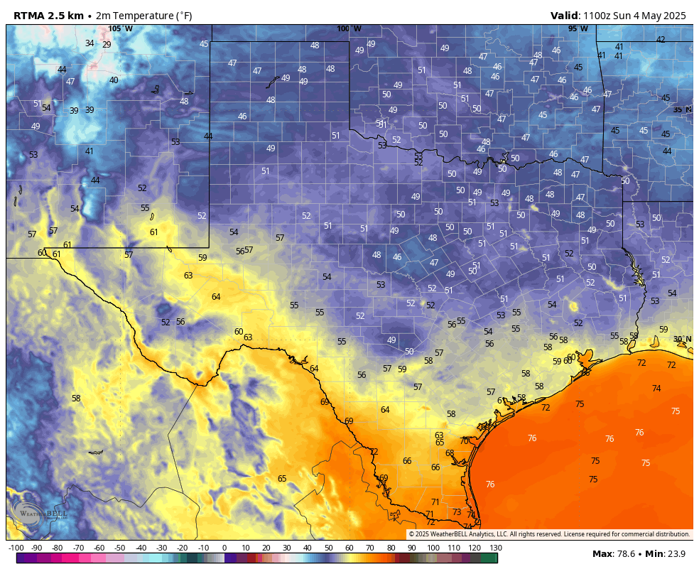
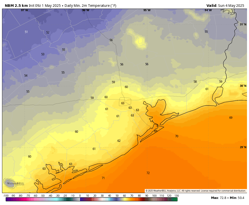
Inland areas got into the 50s on Sunday morning in Houston, and most of the rest of the area enjoyed the lower 60s with drier air with dewpoints in the 40s. That’s really pleasant for May. I do think we’re going to see another weak front for next weekend, but unfortunately it’s unlikely to pull as much drier air with it. And first we’ve got to get through another stormy pattern.
Monday
Humidity is already on the rise this morning, and we’ll see southeasterly winds gusting up to 25 mph that will set the stage for more moisture in the air. We’ll start out with partly sunny skies this morning, but by some point this afternoon we should see mostly clouds. High temperatures will reach the vicinity of 80 degrees. By this afternoon and evening we will see some scattered showers, mainly located to the west of Interstate 45. A chance of light rain will spread into the entire region during the overnight hours as lows fall to around 70 degrees.
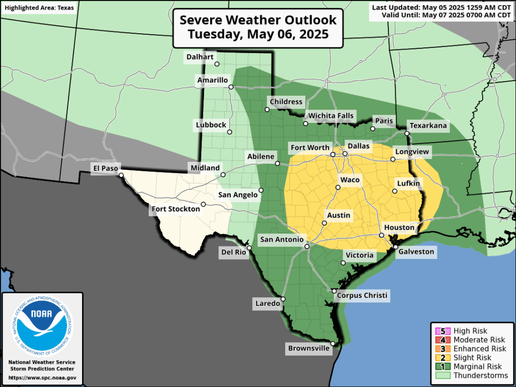
Tuesday and Wednesday
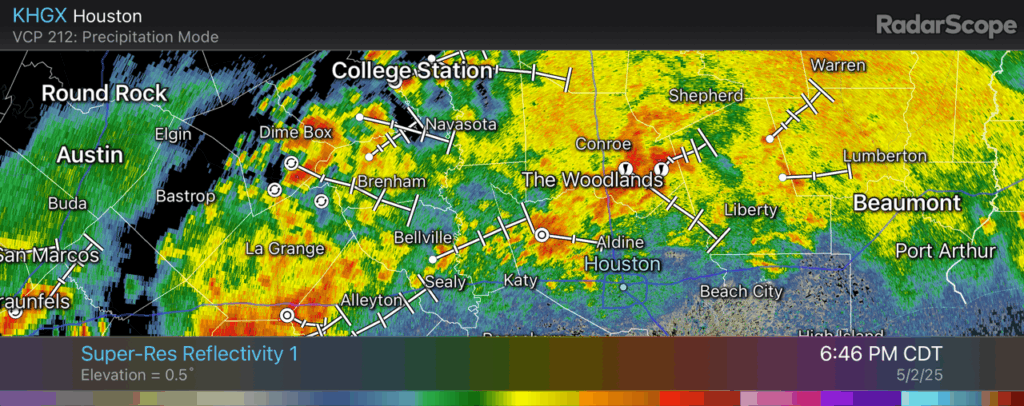
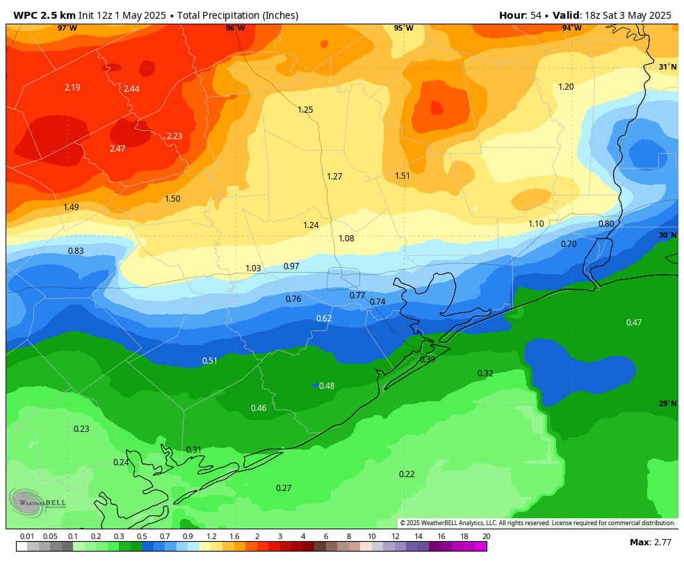
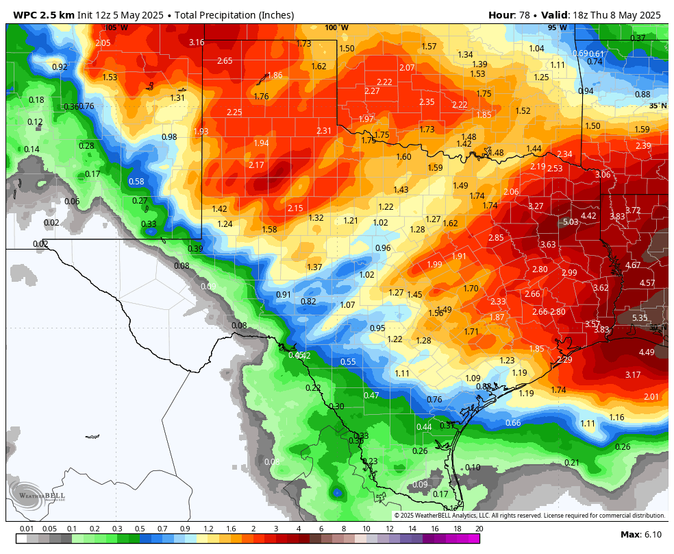
The moisture that moved inland on Monday was a “warm” front, and it will set the stage for the possibility of heavy rainfall and storms on Tuesday and Wednesday in the Houston metro area. Our various high resolution models still have some discrepancies, but right now I would predict that the greatest potential for inclement weather will occur from late Tuesday morning through Wednesday morning across the region.
There will be the usual threats: damaging winds, hail, and possibly a tornado. We are also concerned about the potential for heavy rainfall. Most areas are likely to pick up 1 to 3 inches of rain through Wednesday, but we could see some higher bullseyes of 5 inches or more. For this reason we are going to institute a Stage 1 flood alert from Tuesday at noon through Wednesday. In terms of temperatures, Houston should reach the lower 80s on both days with plenty of humidity. We’ll have more on this later today and plenty of coverage the rest of the week.
Thursday
Rain chances should diminish by Thursday, but will perhaps not go away entirely until the afternoon. Expect partly sunny skies and high temperatures in the low- to mid-80s. Lows on Thursday night should drop into the upper 60s.
Friday, Saturday, and Sunday
As a weak front drifts into the area we should see another nice weekend. I don’t know if we’re going to run it back and have things as nice as we just experienced, but as of now I anticipate mostly sunny skies with highs in the low 80s, overnight lows in the 60s, and modestly drier air. So if it is not cool as this past weekend, it will hopefully at least be somewhat pleasant.