In brief: Although there will be differences in humidity and nighttime lows, Houston will predominantly see high temperatures in the 70s for the next week or so. This period will include some absolutely gorgeous weather days, including Friday and Saturday of this week. We are watching for the possibility of some storms with a front next Tuesday.
Thursday
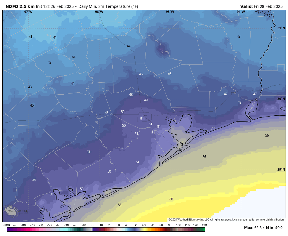
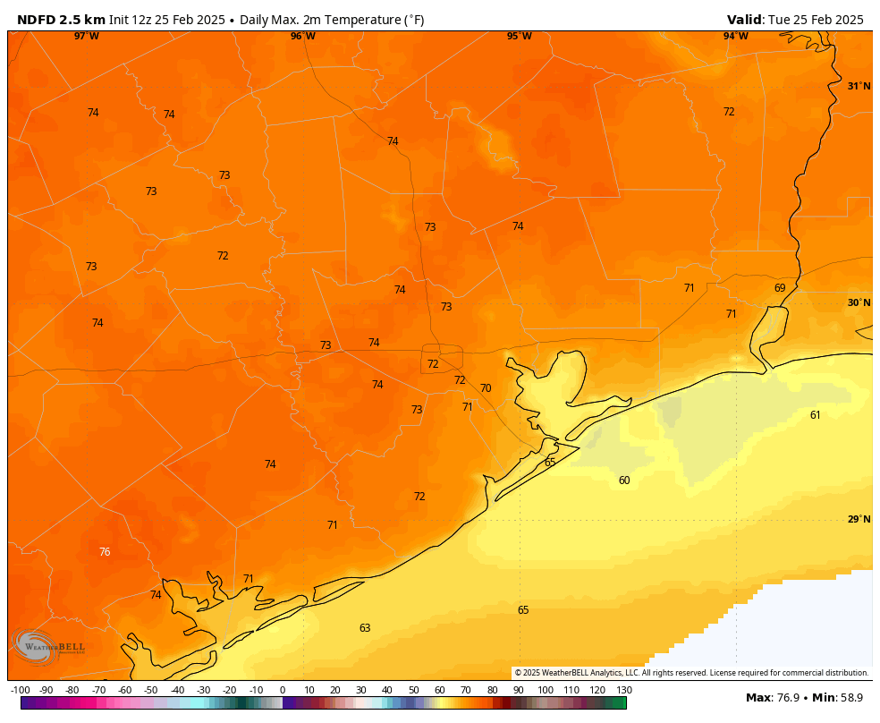
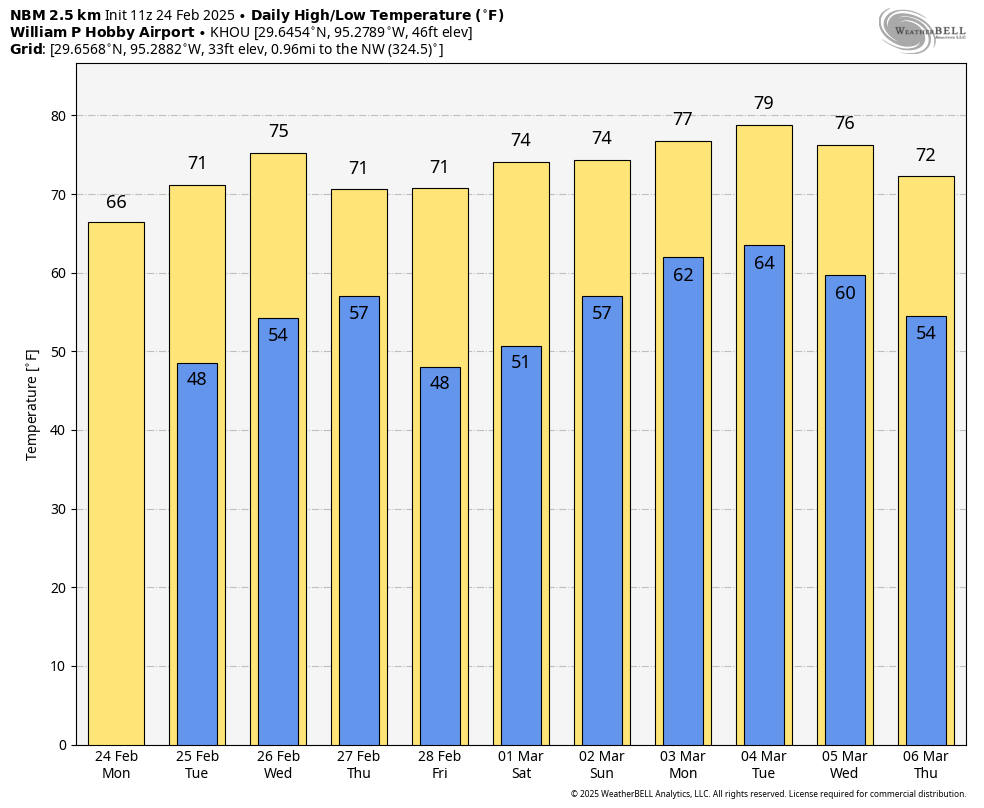
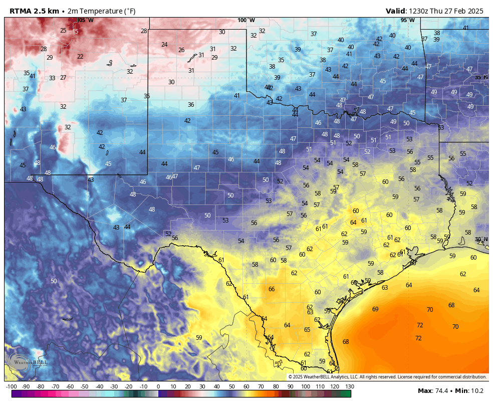
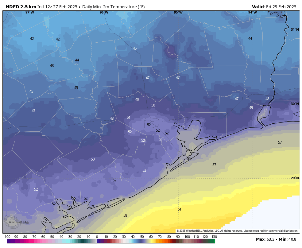
Houston is experiencing its warmest morning in weeks, with low temperatures generally only in the lower 60s across the metro area. However, a modest cool front is on our doorstep, and it will move into the region today. As a result we will see partly to mostly cloudy skies, although likely no rain showers. Highs today will be slightly cooler, in the mid-70s. Cooler and drier air pushes in this evening, allowing low temperatures tonight to fall to around 50 degrees in Houston.
Friday
This will be a truly splendid day, with high temperatures in the low 70s, light northerly winds, and fairly dry air. Like, it will be just about perfect. Friday night will be cool again, with lows in the lower 50s.
Saturday
Expect more sunshine on Saturday, with high temperatures a bit warmer, in the upper 70s for much of Houston, but possibly the lower 80s for a few inland areas. With a more southeasterly flow, lows on Saturday night will only drop into the mid-50s.
Sunday
Another day with mostly sunny skies. Highs will likely be a few degrees lower on Sunday, in the low- to mid-70s, with perhaps a few clouds arriving during the afternoon hours. There will be a slight chance of rain on Sunday night into Monday morning, but only a slight one. Beginning on Sunday we are also likely to see a more pronounced southerly wind, so conditions could be a bit gusty at times. Lows on Sunday night should remain in the 60s.
Next week
Monday and Tuesday of next week look to bring cloudier and more humid weather, with highs in the upper 70s to possibly lower 80. We’re starting to see some indications that a cool front next Tuesday or Tuesday night may bring with it a chance of storms as it rumbles through Houston. At this vantage point we don’t really have many details or any certainty, so we can’t say much more. But it is something we’ll keep an eye on as that’s the opening night of the Houston Livestock Show and Rodeo. After the front’s passage we’ll see high temperatures in the—you guessed it, 70s—and cooler nights.