In brief: In today’s post we review the (very) windy conditions experienced by the region on Tuesday, and look ahead to a week of exceptionally fine spring-time weather. We also discuss why March, for our money, is the nicest month of the year in Houston.
Tuesday’s winds
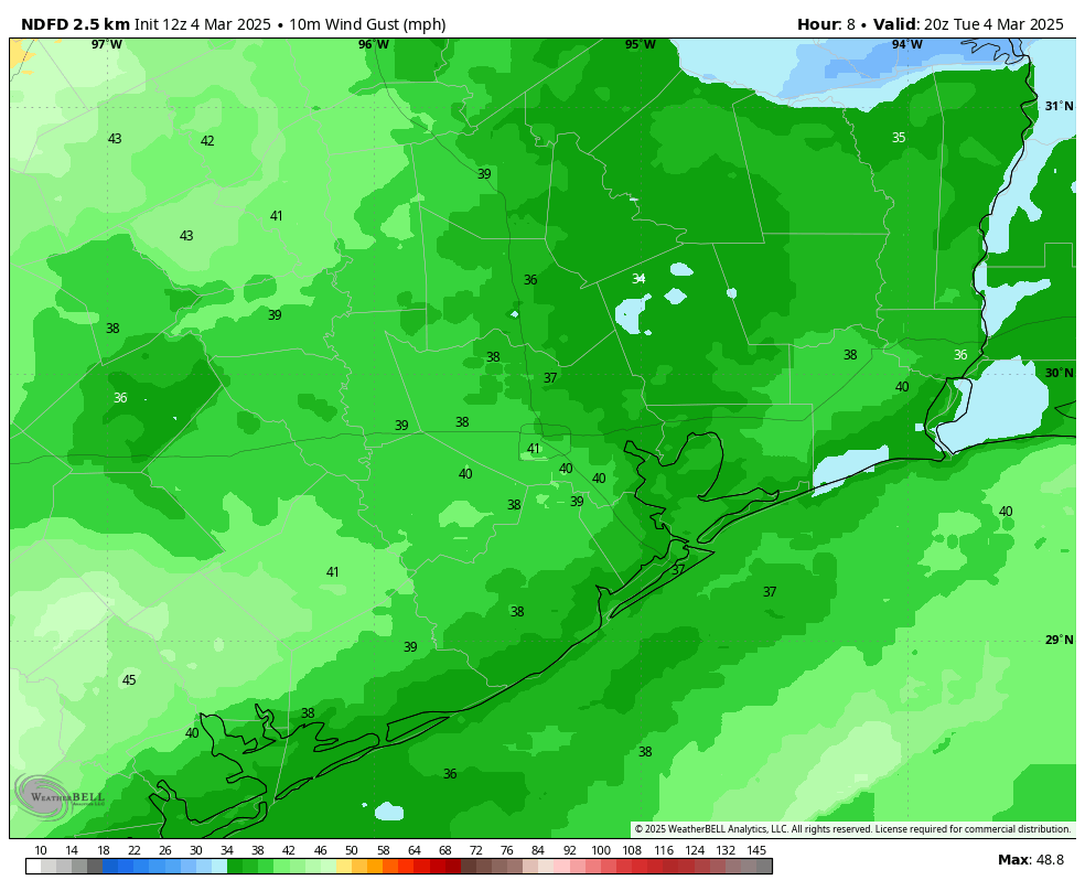
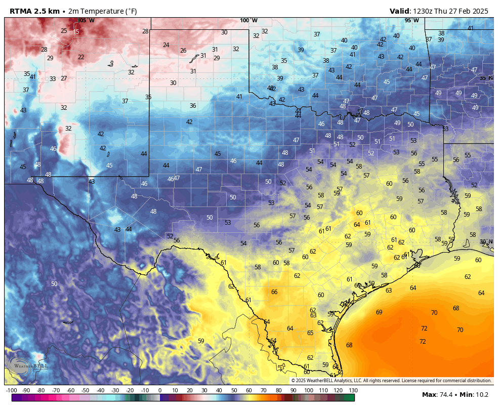
As anticipated, winds on Tuesday were excessive in the wake of a robust cold front that moved through the area and produced a sharp pressure gradient. The dry air and strong winds led to several wildfires over central and southern Texas. In addition, the winds picked up a large amount of dust form west Texas and transported it into central and eastern parts of the state. It is still present in the Houston area this morning and can be seen in the form of dull skies.
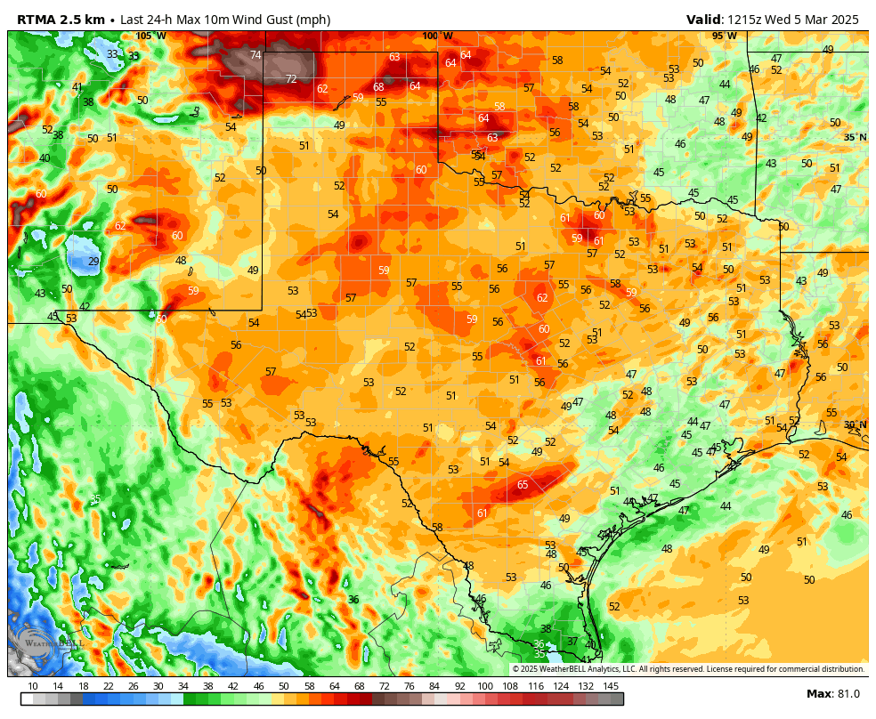
According to Jeff Lindner, of the Harris County Flood Control District, these are the peak wind gusts observed on Tuesday afternoon and evening across southeast Texas:
- Victoria: 63
- Palacios: 56
- Hempstead: 54
- Navasota: 54
- College Station: 53
- Texas Medical Center (elevated): 53
- Lake Livingston: 53
- Conroe: 52
- Huntsville: 51
- Cat Spring: 51
- Baytown: 50
- Ellington: 49
- Galveston: 49
- Wharton: 48
- Bush Intercontinental Airport: 47
- Hobby Airport: 46
- LaPorte: 46
- Sugar Land: 46
- Brenham:45
- Cleveland: 44
- Cypress: 44
- Bay City: 44
- Friendswood: 43
- Morgans Point: 41
- Tomball: 40
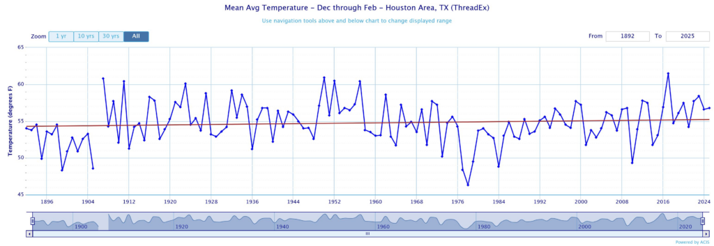
March is nice
A few years ago I did an analysis of Houston’s weather to identify the nicest time of the year to hold an outdoor wedding here, and found that the answer is the second half of March. Tuesday’s strong winds not withstanding, the month of March offers the best chance for sunny and storm-free weather, moderate temperatures, and low humidity out of any time of the year. All of that to say, it looks like the forthcoming forecast period will deliver in terms of mild and pleasant weather.
The only downside to this time of year is pollen, as our plants start to awaken from their winter slumber. Tree pollen, in particular, peaks for most species of trees in March and April in Houston, and is already starting to show up in the metro area. So while you’re enjoying the sunshine over the next couple of weeks, you may be doing a little sneezing as well.
Wednesday

We are still seeing some wind gusts in the 25 to 30 mph range this morning, but they should begin to ease off before really dropping by this afternoon. Temperatures this morning are generally in the 50s, and with sunny skies we’ll be going into the mid- to upper-60s today.
If you’re heading out to the rodeo this evening, expect light winds and temperatures in the lower-60s ahead of the show. The only (slight) concern I would have is cooler temperatures after the concert, with may be in the mid-50s. So that’s a bit of a chill. With light winds and clear skies tonight, expect low temperatures to drop into the mid- to upper-40 by Thursday morning.
Thursday
Expect another sunny day, with highs generally in the upper 60s. By Thursday afternoon, however, we’ll start to see a more pronounced southerly wind, and this will introduce some clouds. As a result of this, Thursday night will be warmer, with temperatures likely dropping into the upper 50s in Houston.
Friday
This looks to be a warmer, moderately humid day with partly cloudy skies and highs in the vicinity of 80 degrees. Friday night will be mild, with lows in the 60s.
Saturday
This will be another warm day, likely with highs in the upper 70s to 80 degrees. We’ll see a low-ish chance of some light rain showers as a cold front approaches the area, and pushes through around noon, or during the afternoon hours. I don’t think these showers will prove too disruptive, but we could see some moderately gusty northerly winds (not like Tuesday, however). Low temperatures on Saturday night should drop into the lower 50s.
Sunday
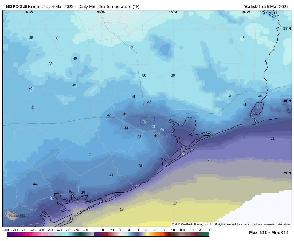
This should be a sunny, cooler day with highs in the 60s. Lows on Sunday night may drop into the upper 40s for much of Houston.
Next week
We’ll warm up by the middle of next week, with highs possibly in the lower 80s, to go along with a fair bit of sunshine. Rain chances appear low throughout the period before possibly we see some showers along with a front ahead of next weekend. We’ll see. Enjoy the great spring-time weather, y’all.