In brief: Houston is seeing some of its coldest weather of the season this morning, but the good news is that we are going to get no colder than this. Also, some places across the state are much colder this morning. We’ll experience a slow warming trend into the weekend, with a rainy Saturday, before spring arrives next week.
Cold status
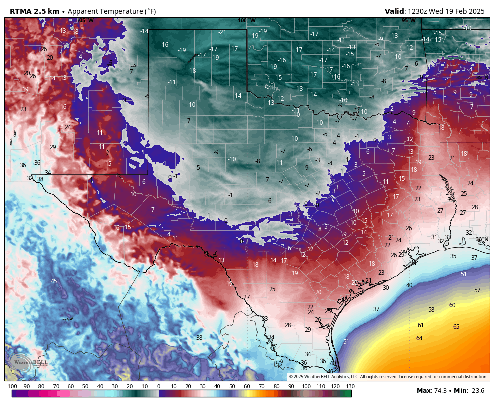
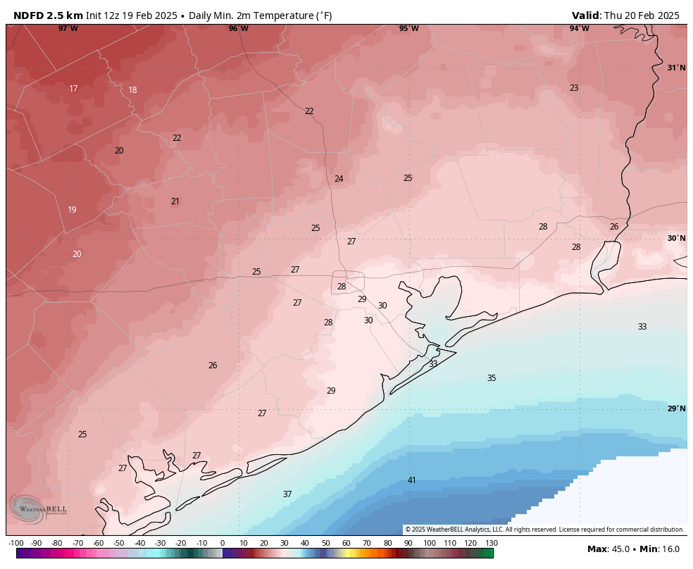
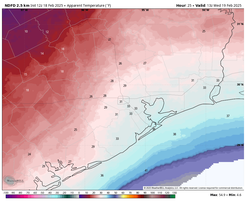
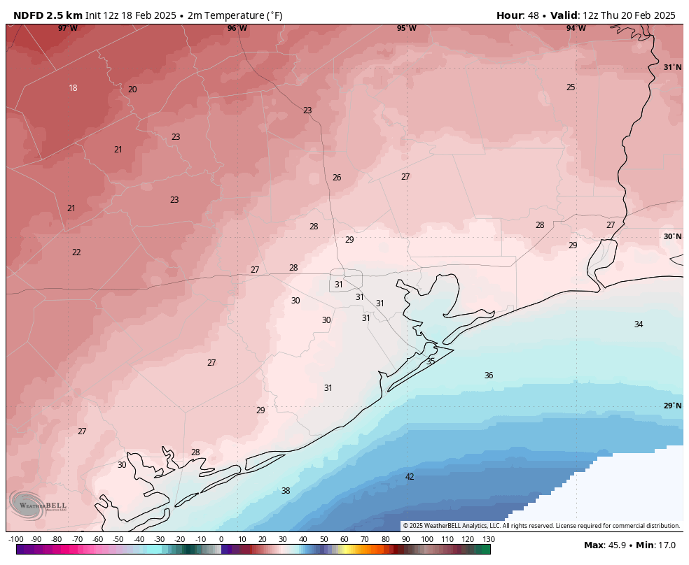
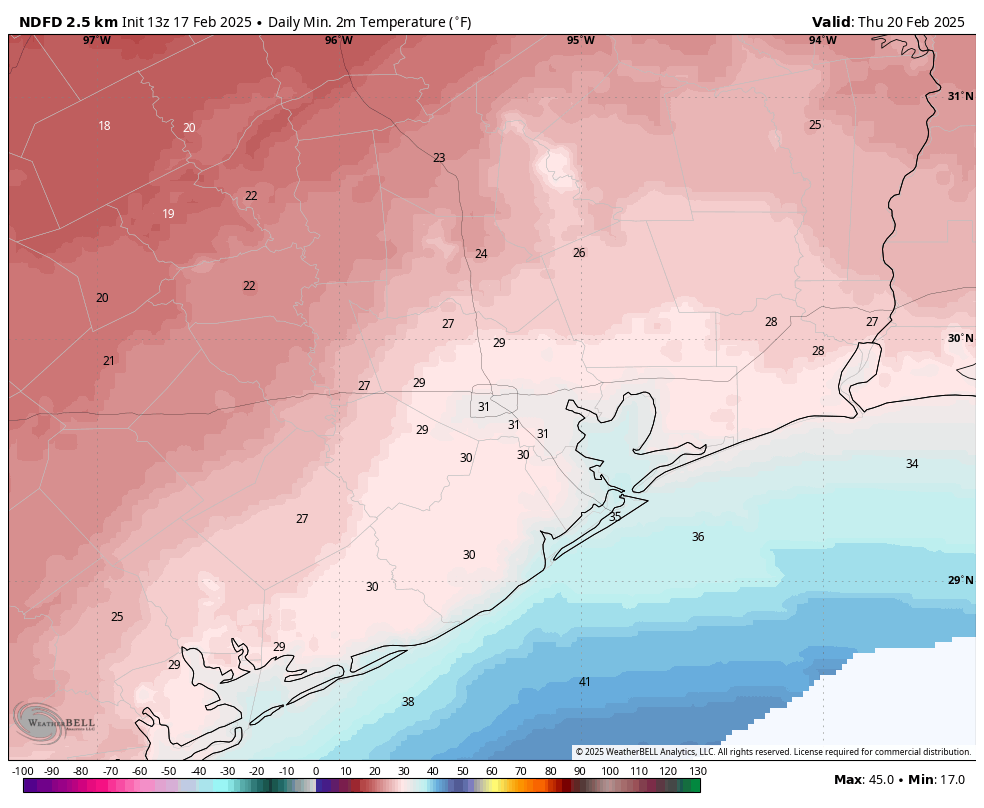
As anticipated, much of the Houston region has seen temperatures fall to between 25 and 30 degrees this morning, with only the coast remaining at or just above freezing. Daytime temperatures on Wednesday were colder than expected, hovering around the freezing mark all day, but persistent clouds overnight helped prevent lows from dropping too severely this morning. We have one more freezing night in Houston before nights become a little bit warmer.

Thursday
High pressure continues to reign over the region. And while that means sultry temperatures in the summer here in Houston, during the winter it typically means we’re seeing cold air advection from the north. With mostly cloudy skies this morning we will be slow to warm, although most of the region should reach above freezing by around noon today. Highs will generally be in the mid- to upper-30s for most, although some far inland areas may only briefly reach above-freezing this afternoon. At least winds will be lessening, as gusts finally die down later today. Expect another cold night, with temperatures 1 to 3 degrees warmer than Wednesday night.
Friday
This will be a mostly cloudy and cold day, with highs in the upper 30s to 40 degrees. Temperatures won’t fall much on Friday night, with lows in the upper 30s.
Saturday
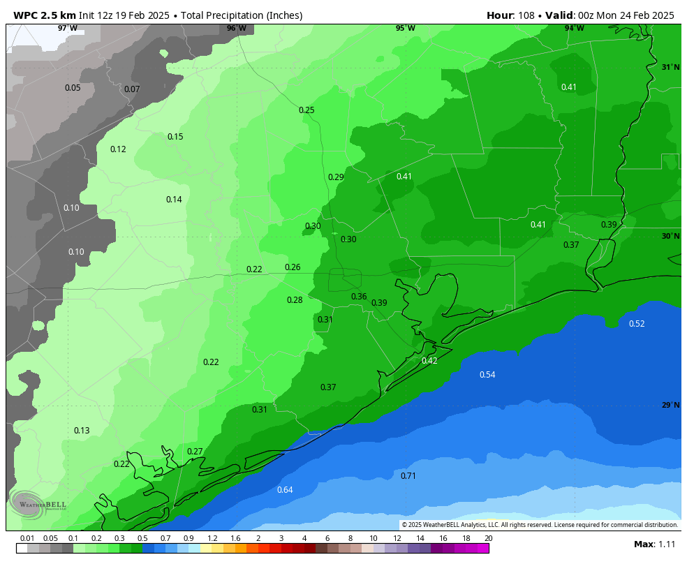
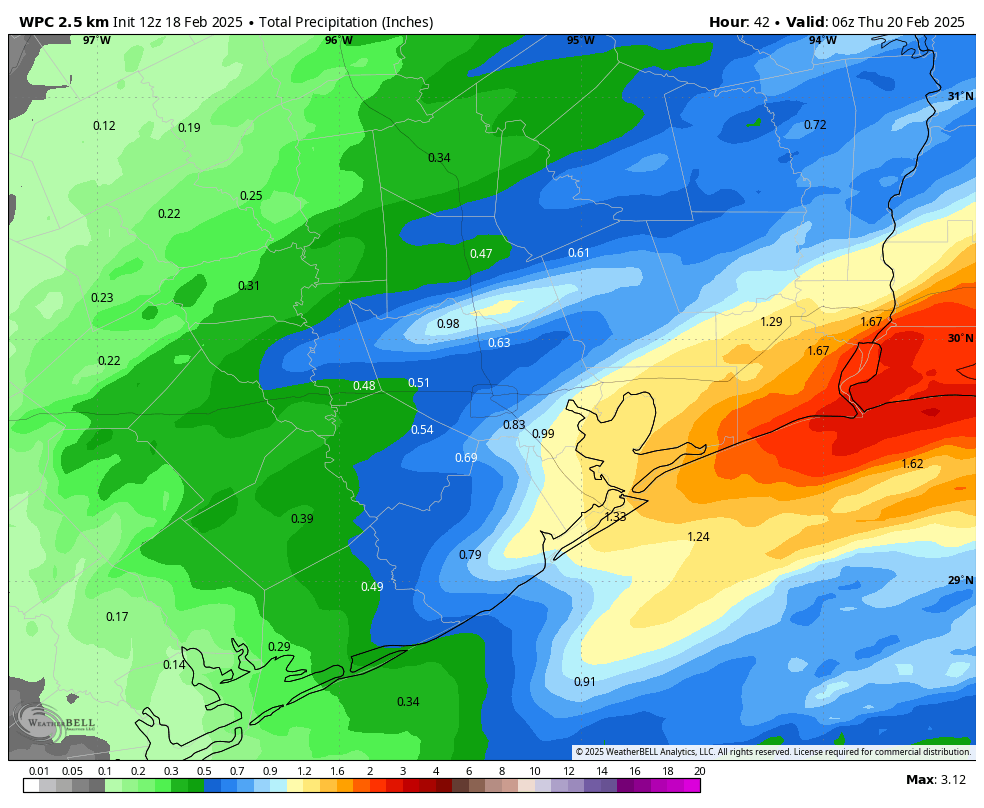
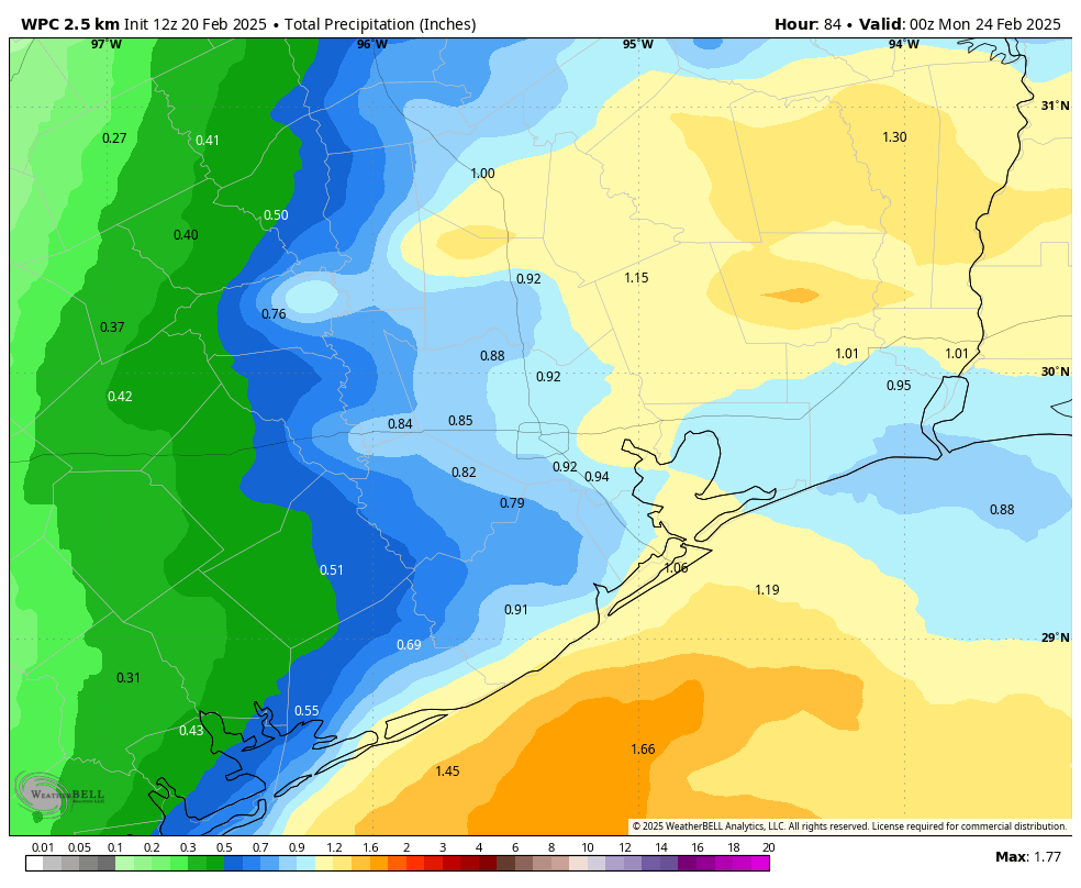
I’m afraid the first half of the weekend looks rather dreary. Temperatures on Saturday should, at least, push into the mid- to upper-40s. But we’re going to see continued cloudy skies, and a coastal low is going to bring a healthy chance of rain into the area. The most likely time for rain will be Saturday after noon, Saturday night, and Sunday morning. In terms of accumulations, most areas are looking at 0.5 to 1.5 inch. So I don’t anticipate severe storms, just some cold and unpleasant rain. Lows on Saturday night should fall into the low- to mid-40s for most locations.
Sunday
After a potentially wet start, Sunday may see a few breaks in the clouds during the later afternoon hours. Expect high temperatures in the mid- to upper-50s, with lows on Sunday night in the 40s.
Next week
Sunshine arrives on Monday, and we should see a pleasant week with highs in the 70s, generally, and lows in the 50s. Just as we’re pushing up toward 80 degrees mid-week, a weak front may arrive by Wednesday or so to cool us down slightly. But it’s all going to feel fairly spring-like, and the sunshine should be grand. Early next week we’ll take a look at whether we’re done with freezes in Houston for this year, but I think the answer is that we likely are after this week.