In brief: Temperatures are generally a few degrees below freezing this morning across the metro area, and you’ll want to look out for a few icy patches on area roads. But Houston is well on the way to putting this Arctic freeze behind us. So what does the rest of winter look like here?
Cold update
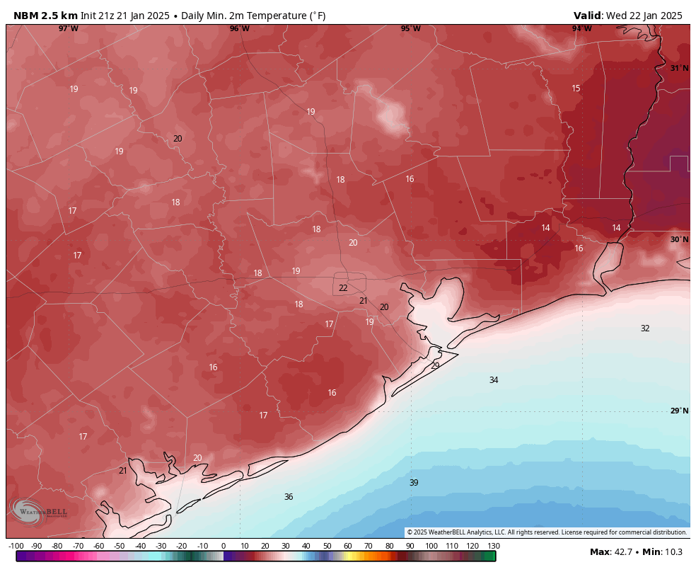
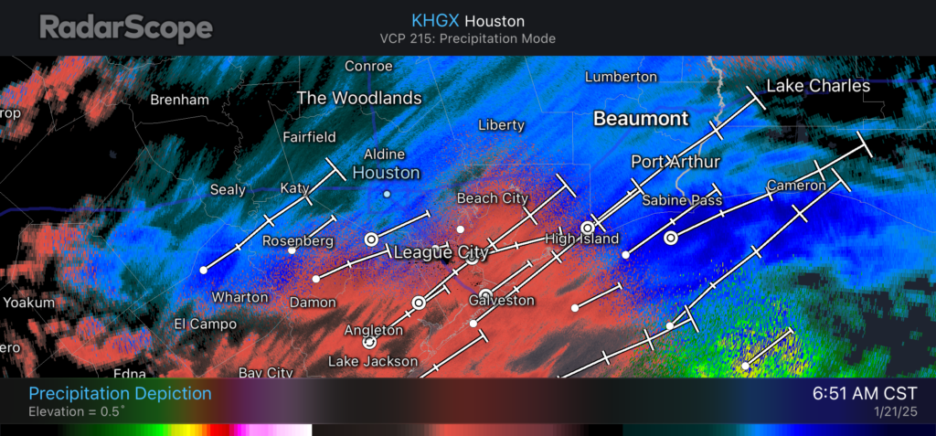
Most of Houston is experiencing a light freeze this morning, but temperatures are generally about 10 degrees warmer than they were on Wednesday morning. As a result there likely are still a few slick spots on roadways around Houston, including a few freeway bridges and ramps. However, these are mostly navigable if you just take a little more time and care driving this morning. For locations where temperatures are below freezing, they will rise above freezing between 9 and 10 am CT today.
The ghosts of Winter past, present, and yet to come
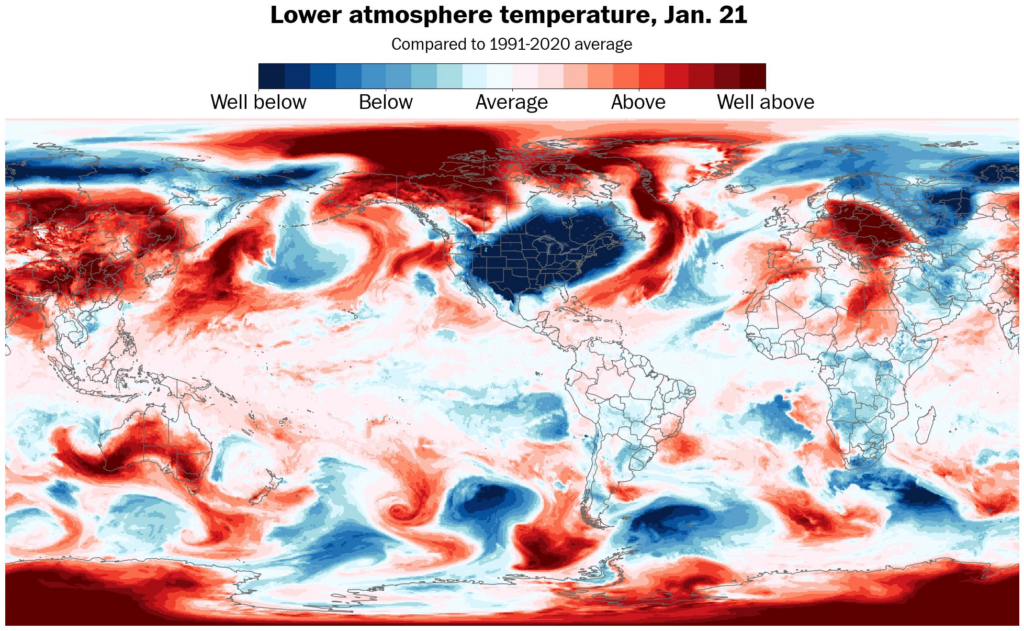
Now that we’re putting a significant Arctic blast in the rear view mirror, I want to take stock of the rest of winter in Houston. We’re much closer to the end than the beginning, as it is January 23. So far we’ve seen one much warmer than normal month in December, and one much colder than normal month in January. However, the final week of January looks to be fairly mild, with near normal temperatures after Friday.
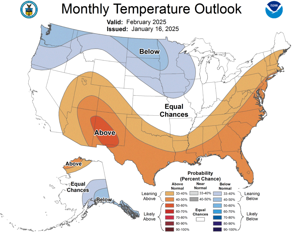
Looking ahead to February, I expect we will slot back into a somewhat warmer than normal pattern in which the overall flow is more westerly (i.e. more moderate Pacific air masses) rather than northerly (i.e. Canadian and Arctic air masses) in nature. As a result the likely outcome for southern US states is warmer, according to NOAA’s monthly outlook. Although this does not mean we’re necessarily done with freezes for this year, it also would not shock me.
Thursday
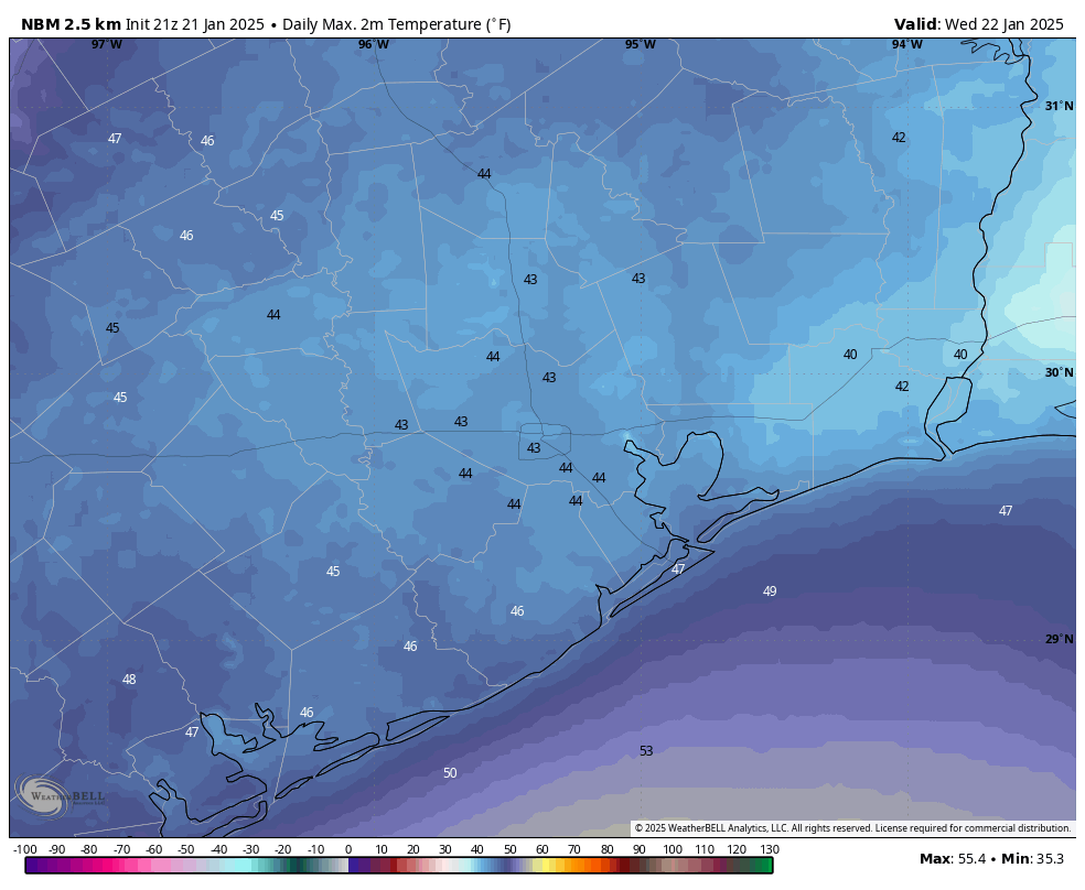
We’ll see more sunshine today, and this should push high temperatures up to about 50 degrees for most of the area. Winds will be light, out of the north at 5 to 10 mph. I’d expect one more light freeze in Houston tonight, with the possibility of highs in the upper 20s for outlying areas.
Friday
This will be another fine, sunny day with highs perhaps a couple of degrees warmer, say in the lower 50s. As winds turn to come from the southwest, overnight lows will likely stay above freezing on Friday night for pretty much the entire metro area. However it will still be chilly, with temperatures dropping into the 30s for most locations.
Saturday
The overall pattern starts to change in a big way as high pressure shifts to the east, and we see an increasing onshore flow. This will allow for the development of some clouds on Saturday, and we’ll say goodbye to sunshine for awhile. Highs will reach about 60 or 65 degrees. Some light to moderate rainfall may approach the area by Saturday evening or Saturday night.
Sunday
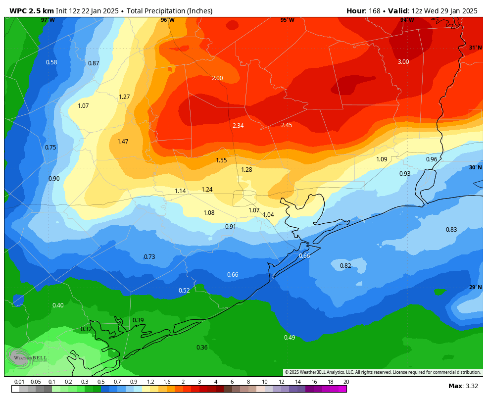
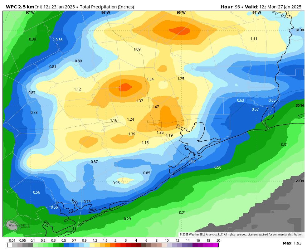
This looks like a wet day as a slow-moving, weak front moves into, and stalls over Houston. Although we cannot rule out some briefly heavy rain, for the most part this day should just deliver a good soaking, with much of Houston picking up between 0.5 and 1.5 inches. Rain chances will probably be best in the middle of the day. Highs will reach the mid-60s. Rain chances continue, at a lower rate, overnight. Lows drop into the 50s.
Next week
Monday may see a bit of a cessation in rain, but the rest of next week should bring healthy chances each day as we enter a pattern dominated by an atmosphere with more moisture. Highs for the most part look to be in the 60s next week, with lows in the upper 40s to lower 50s.