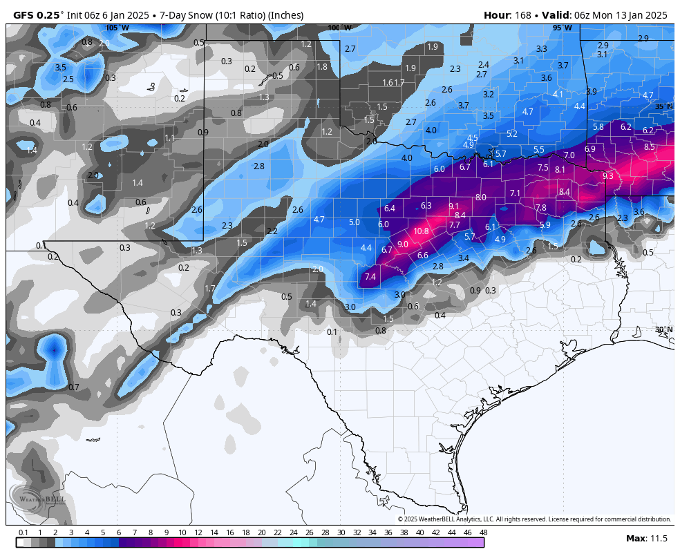
In brief: Houston is not done with the colder weather, but our low temperatures will now moderate slightly for the next couple of days. As a coastal low pressure system approaches we’ll see increased rain chances on Thursday, and the potential for heavy rainfall Thursday evening and during the overnight hours into Friday. Sunshine returns on Friday.
Wednesday
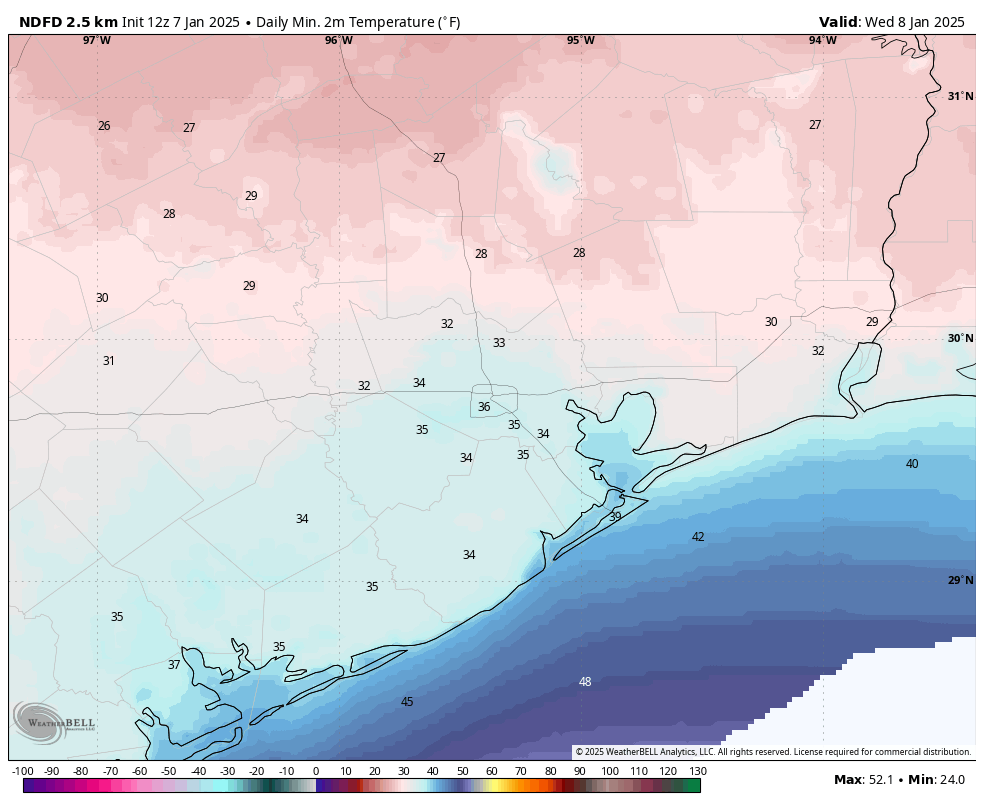
Temperatures, generally, are in the mid- to upper-30s across most of the Houston region this morning. This is due in part to increasing cloud cover, which will also limit high temperatures today to the lower 40s. It will still feel quite chilly outside, however, as winds from the north gust up to 20 mph. So although we’re done with freezing temperatures for a bit, the brisk conditions are not going away. Lows tonight will drop into the upper 30s again for much of the region.
Thursday, Thursday night, and Friday morning
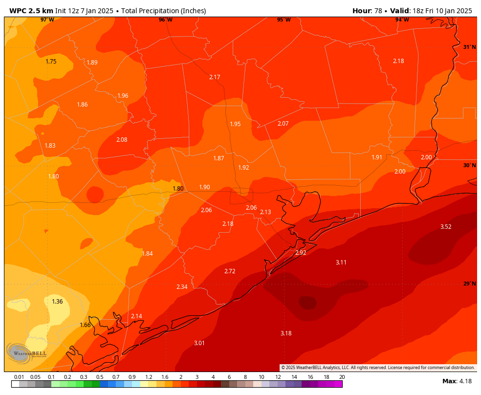
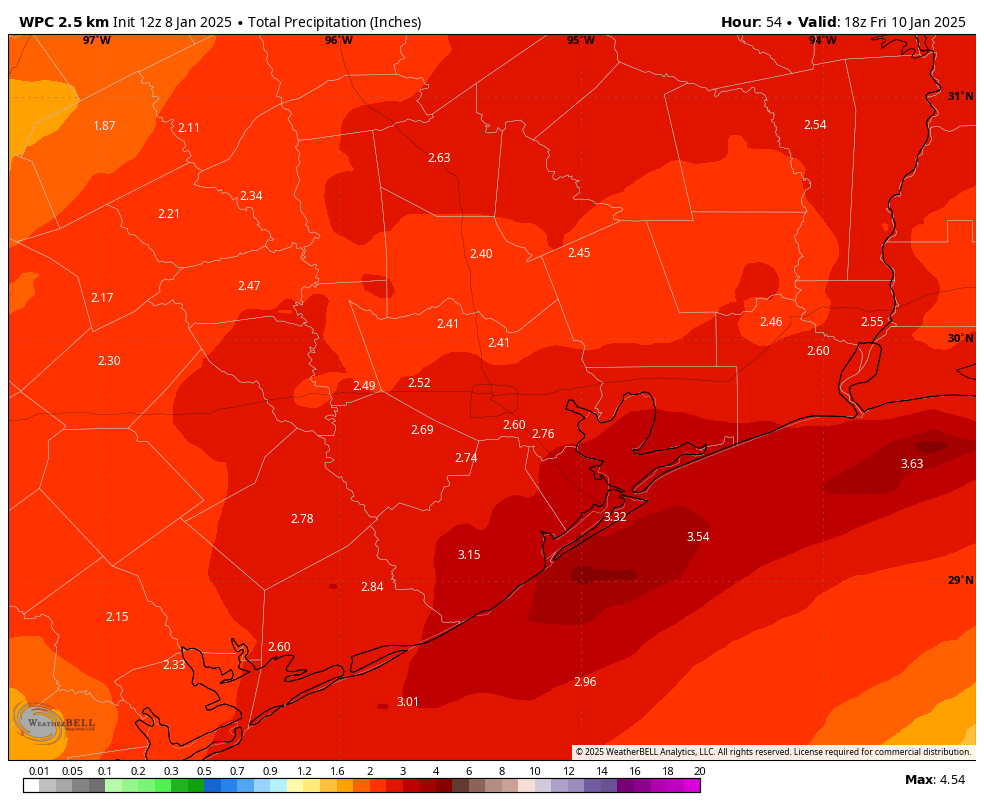
By Thursday morning we’ll start to see the possibility of light showers developing across Houston, and this pattern will continue through much of the day. With high temperatures in the mid-40s (even warmer near the coast) there is no threat of freezing rain or sleet in the Houston area. It appears as though the main impulse of showers and storms, due to a low-pressure system in the Gulf of Mexico, will move in on Thursday night. The best chance for heavy rain will therefore occur during the overnight hours, and closer to the coast. Much of the area is likely to pick up 2 to 4 inches of rainfall, with higher isolated totals possible. This system should push east of the area by Friday morning, (mostly) bringing an end to rain chances before noon.
Friday
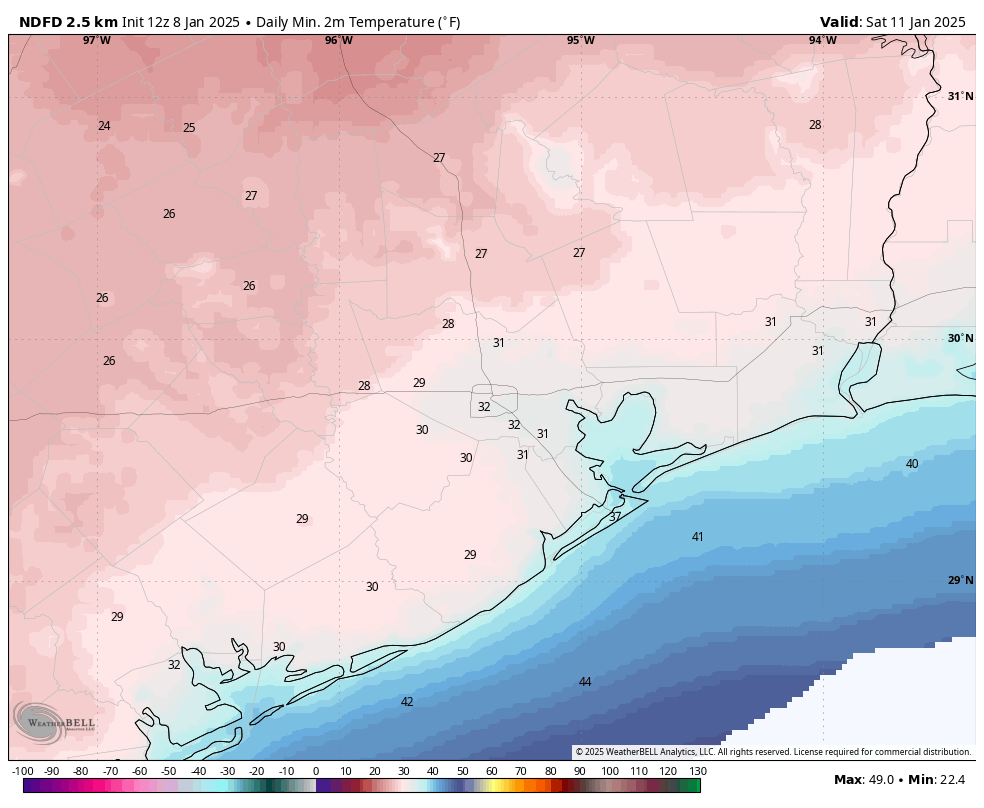
Another pulse of colder and drier air will push in as the coastal low exits, and Friday looks to be a breezy and cool day with mostly cloudy skies and temperatures in the 40s. With skies likely to start clearing out on Friday night, expect a chilly night, with parts of Houston likely seeing a light freeze again, and far inland areas possibly experiencing a hard freeze.
Saturday and Sunday
The weekend should bring mostly sunny and milder conditions back to Houston. Expect highs of around 50 degrees on Saturday. Lows on Saturday night should remain comfortably above freezing, with highs on Sunday possibly reaching as high as 60 degrees.
Next week
We’re not going to warm up much next week, with highs likely in the 50s and lows in the 40s. There’s still not a whole lot of clarity for the Houston Marathon forecast. I expect next Friday and Saturday to see a warming trend, but there’s a chance another front comes through by or before Sunday morning to cool things down. Of course a front could mean rain so yeah, the forecast remains uncertain.