In brief: Today’s post discusses the ‘why’ of yet another weak front on the way for Houston this weekend, and the potential for some healthy rain chances on Friday night and Saturday morning as it pushes into the region. Sunday and the first half of next week should bring fair weather before another, stronger front likely arrives about a week from now.
Why have we been getting weak fronts?
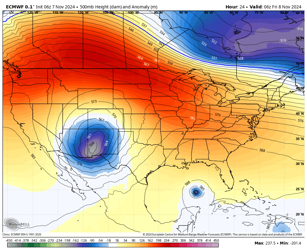
So far this fall we’ve yet to really get a strong cold front, which brings in a concerted push of colder and drier air down from the north and northwest. I call these “in-your-face” fronts, which you can literally stand outside and feel as they move in. One of the reasons for the lack of these fronts is that the overall pattern has favored glancing blows, which bring in more Pacific air rather than dragging colder Canadian air down into the region.
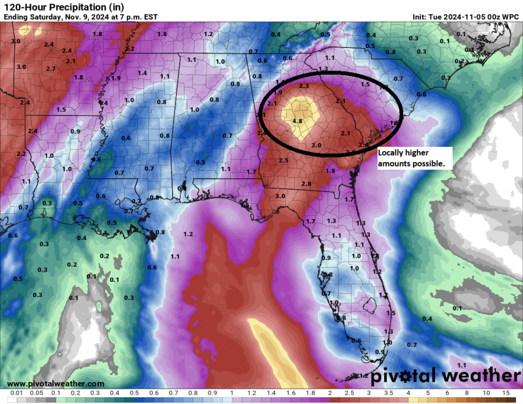
The GIF image below showcases what will happen this weekend, when a very weak front arrives. The dark blue area over New Mexico is the low-pressure system in the upper level of the atmosphere what will drive the front. Instead of moving due west, it instead goes across the Midwest of the United States and ends up in Michigan by Sunday. This we are getting the tail end of the front’s energy, rather than its full impact. And this translates into a weak push of cooler and drier air.
Thursday
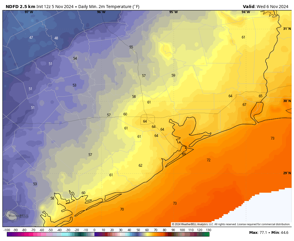
“Low” temperatures this morning across the Houston area are generally in the mid- to upper-70s, which are running nearly 20 degrees above normal. This is because the earlier week front that moved offshore has moved back onshore as a warm front, so we’re feeling the influence of the Gulf of Mexico. We saw some light, patchy showers overnight, but most of today should be rain-free, with partly sunny skies. Expect high temperatures in the low- to mid-80s. Winds will be light, generally from the east, at 5 to 10 mph. Lows tonight will drop into the mid-70s.
Friday
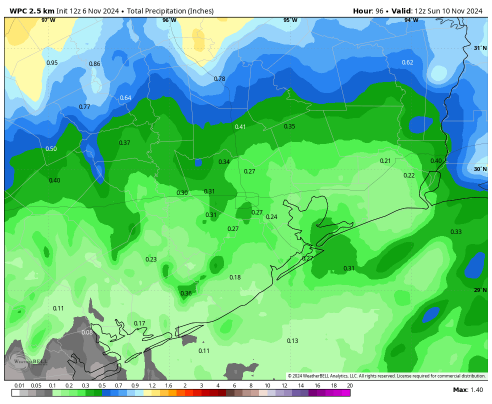
This will be another warm, and humid day. However, skies will be mostly cloudy, and we’ll see increasing rain chances during the afternoon hours. As a front approaches, and meshes with ample moisture in the atmosphere, we’ll see very healthy rain chances on Friday night into Saturday. We don’t anticipate any flooding, but if you have plans to be out and about on Friday evening or night, be prepared for the possibility of getting splashed on. Friday night will be warm and humid as well.
Saturday
As a weak front moves into the region, we’ll continue to see fairly decent rain chances on Saturday morning, probably about 50 percent area wide. With mostly cloudy skies, we can probably expect to see high temperatures in the upper 70s, with shower activity waning during the afternoon and evening hours—but we cannot rule out some isolated showers during this time period. Lows on Saturday night should get down to about 70 degrees.
Sunday
We should finally see a little (emphasis on little) bit of drier air on Sunday, but there’s still the potential for some isolated showers during the morning hours at least. Expect partly sunny skies during the afternoon hours, with high temperatures in the vicinity of 80 degrees. Lows on Sunday night should get into the 60s for most of Houston, which is probably about as best we can do with a dying front like this.
Next week
The first half of next week should see mostly sunny skies, with days in the mid-80s and nights in the upper-60s for the most part. Humidity will be present, but not excessive with slightly lower dewpoints. A stronger front looks likely to move in by Wednesday or so, but we’ll have to wait for the finer details with how cool things get. I’m hoping for some nights in the 50s, which is normal for this time of year.
Tropics
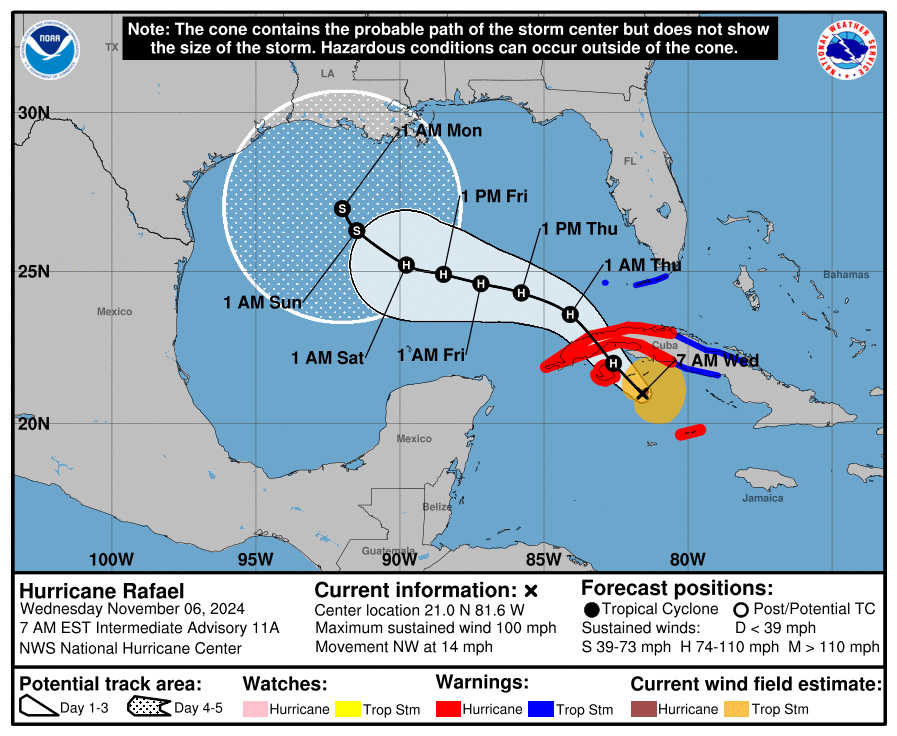
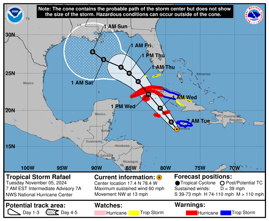
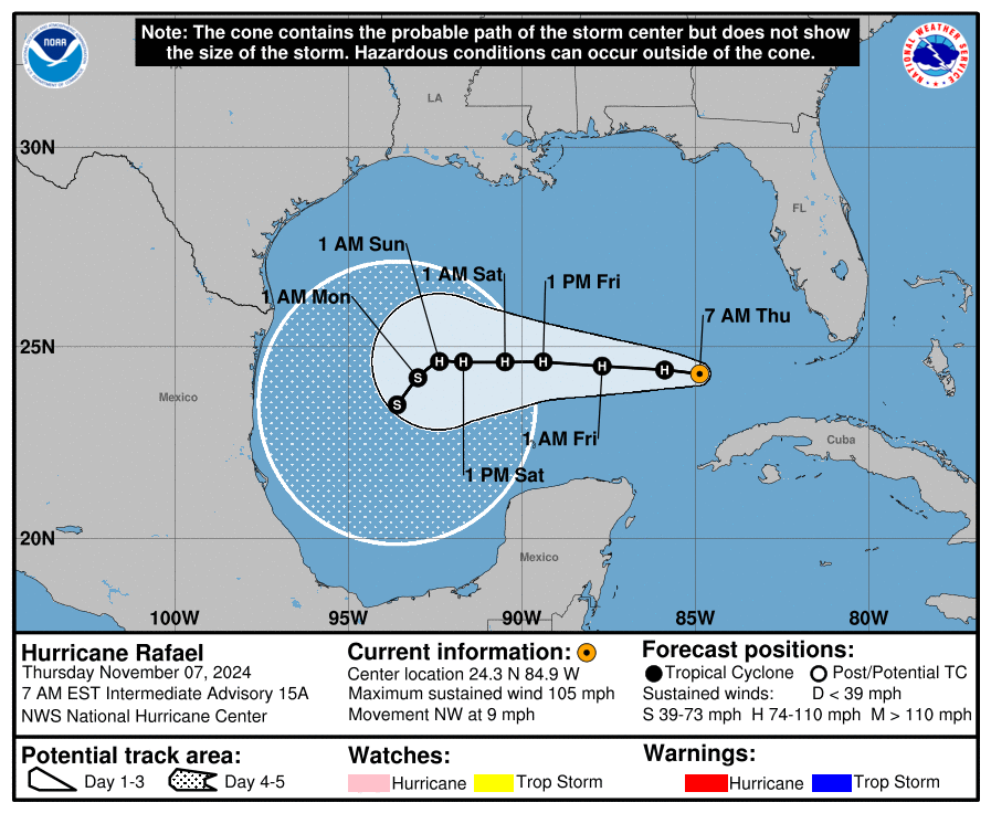
Hurricane Rafael crossed Cuba into the Gulf of Mexico on Wednesday, and it is now moving toward the central Gulf of Mexico. Eventually it is likely to be rebuffed by high pressure and steered southward toward Mexico. As we’ve been saying for some time, this system is of no real concern to Texas.