In brief: Today’s post assesses the emerging drought across the Houston region, and takes a peek at the winter outlook to see whether we are likely to see relief in the coming weeks and months. We also discuss the fine weather in store for this weekend, and the rather hot conditions expected next week.
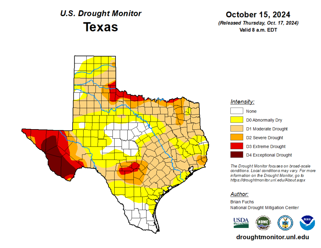
Houston enters drought
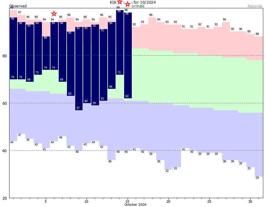
For the first time since last December, the majority of the Houston area has returned to drought conditions as measured by the US Drought Monitor. For now, most of the region has been classified as a “moderate” drought, but even with shortening days and cooler temperatures, the trend lines are not good.
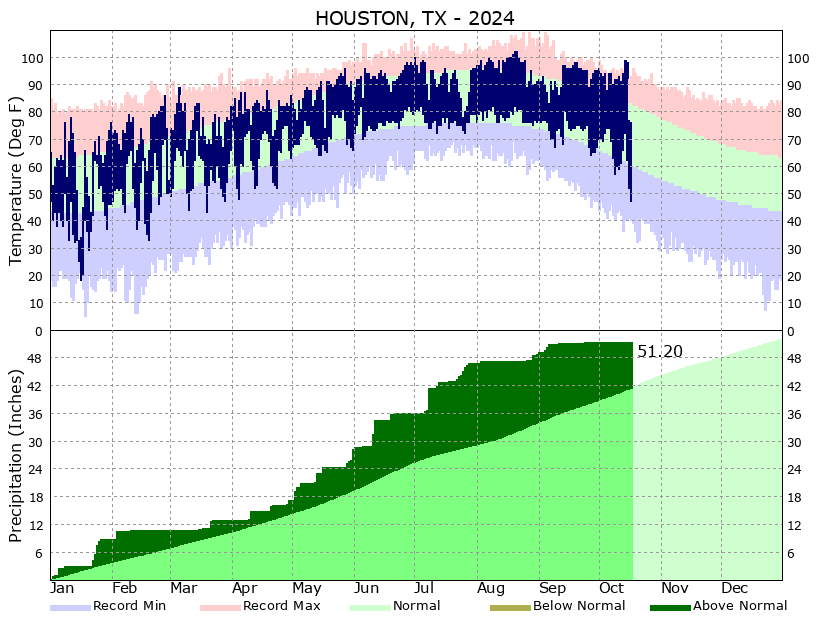
It’s been a weird year. Houston has fallen into a drought even though the region remains about 10 inches above normal rainfall totals for this year. That’s because we had an exceptionally wet spring and first half of summer, punctuated by Hurricane Beryl in July. But since the beginning of August, and especially since early September, Houston has been almost bone dry. This has coincided with almost uniformly sunny days and warm-to-hot temperatures. As a result, we’ve gone from very wet soils to increasingly dry ones.
So what happens next? The next week looks to remain dry, with only very low rain chances. Maybe the pattern changes after that, but at this point there is no strong signal in the models, and persistence is the most likely outcome. Maybe we’ll see a decent shot of rain around the end of the month, but again this is really at the limit of what our best modeling can predict.
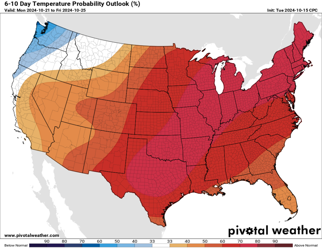
Looking deeper into fall and winter, we see a slowly developing La Niña in the equatorial Pacific Ocean. Historically, this favors a drier winter across Texas. The only good thing I can say about a drought during the winter months is that it does not take all that much rain to break it—with shorter days and a lower Sun angle, a little rain goes a long ways. Unfortunately, I don’t even see a little rain in the foreseeable forecast at this time. We’ll continue to look for signs that is changing.
Friday
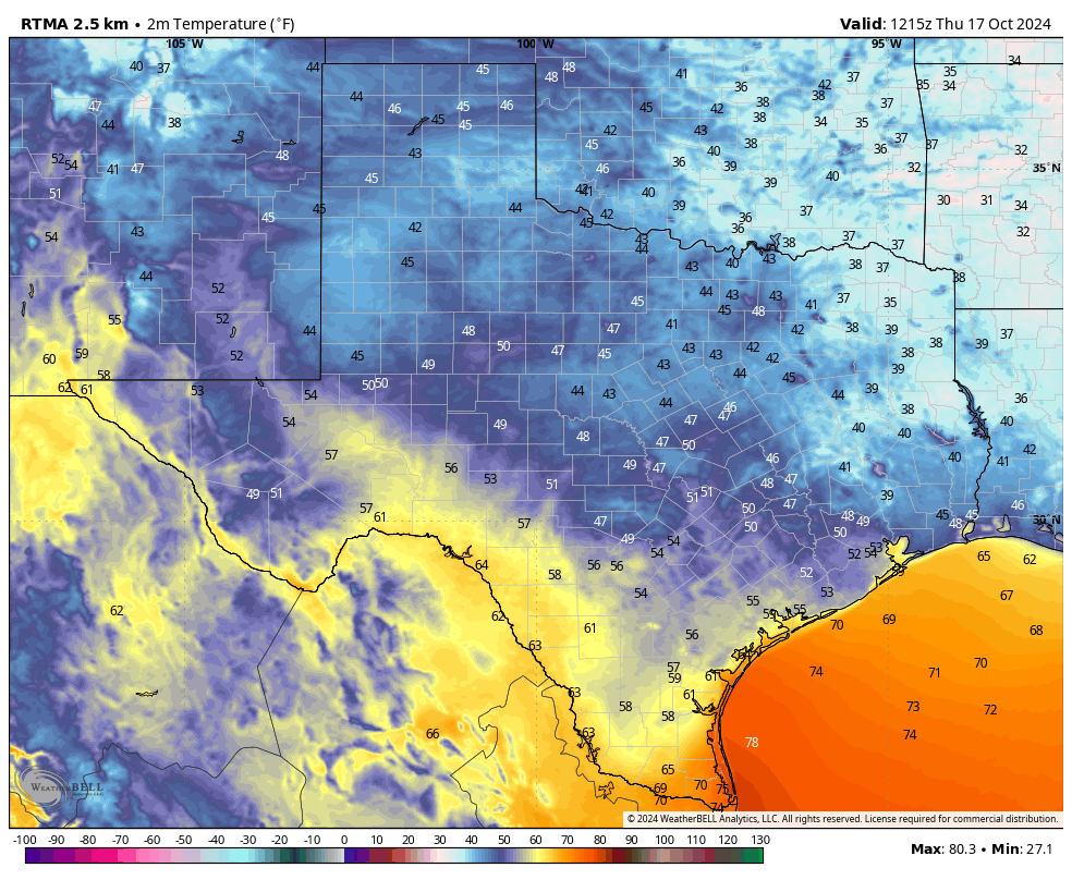
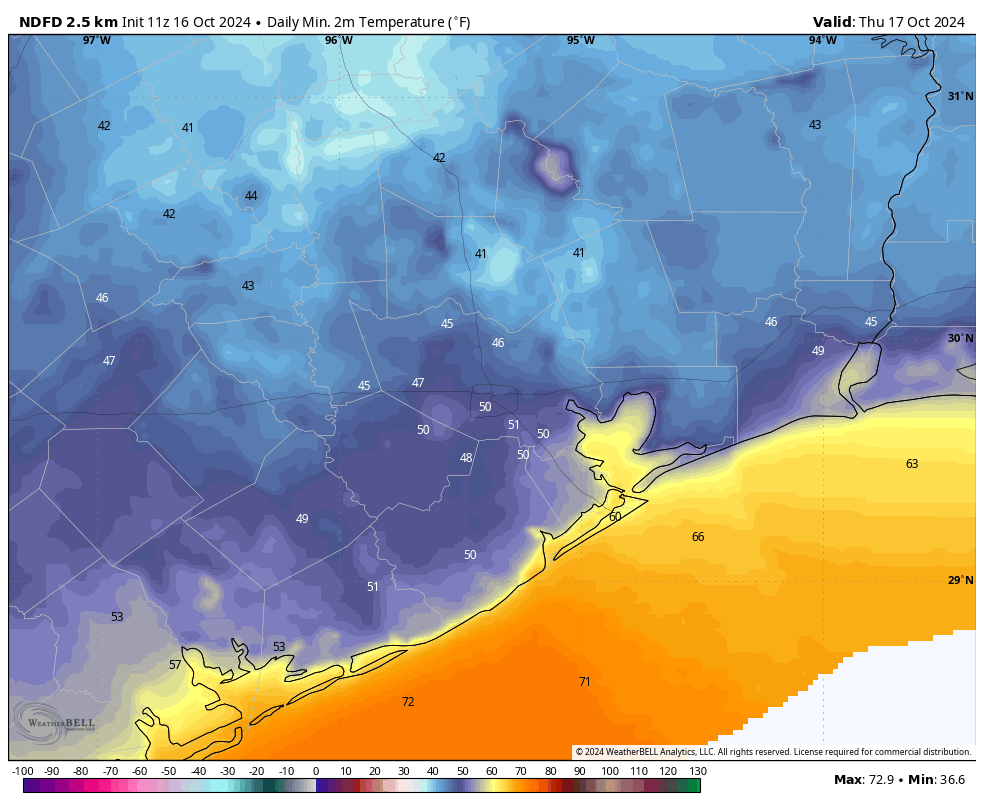
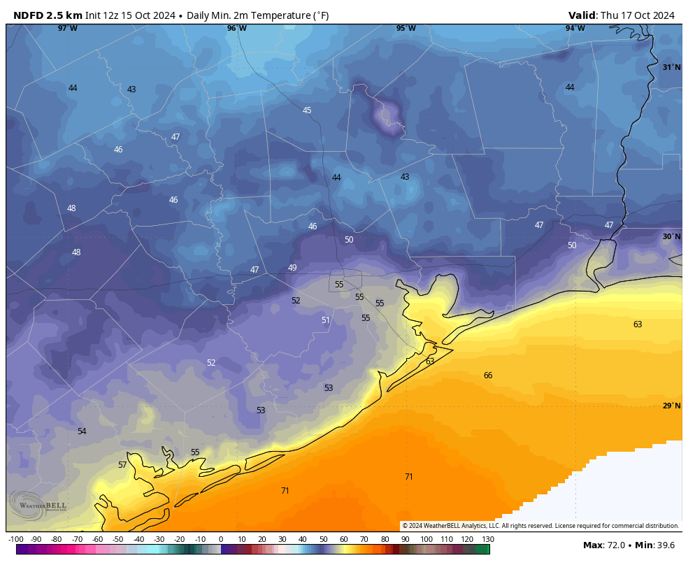
For my tastes at least, Thursday was one of the very nicest days of the year weather-wise. We’re now going to start warming up, but with dewpoints generally in the upper 50s the air will continue to feel comfortable. At least by Houston standards. High temperatures today will be about 80 degrees, with mostly sunny skies, and easterly winds at perhaps 10 mph with higher gusts. Lows tonight will drop into the low 60s for most locations away from the coast.
Saturday and Sunday
The weekend will see high temperatures in the lower 80s, for the most part, with sunny skies. Low temperatures should continue to drop into the lower 60s, which generally means comfortable if not cool weather. Really, we have no concerns for you if you’re planning any outdoor activities. Just be mindful of the increasing number of burn bans across the region, due to the emerging drought discussed above.
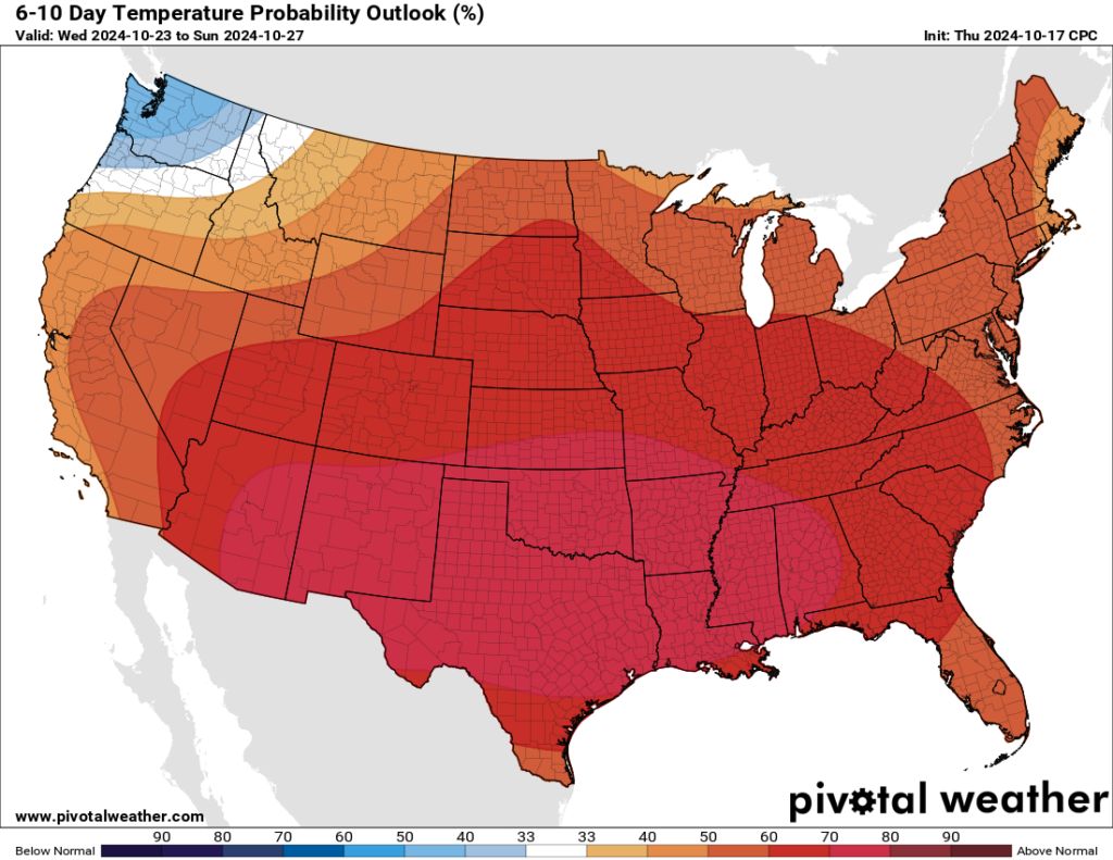
Next week
Pretty much all of next week looks warm, with highs starting out in the mid-80s and ending up in the upper 80s. Some locations probably will hit 90 degrees toward the end of next week. We’ll see a few more clouds in the sky, and rising humidity levels. Unfortunately, the last full week of October is unlikely to feel fall-like at all. The heat may extend into next weekend.

