In brief: Houston’s second cool front of the season has arrived and it will take our temperatures down a little bit. Long-time residents will know the primary benefit of September fronts is that they knock down humidity levels, rather than temperatures. And we should see drier-than-normal air through the weekend despite warm days. Enjoy!
Is this Fall Day?
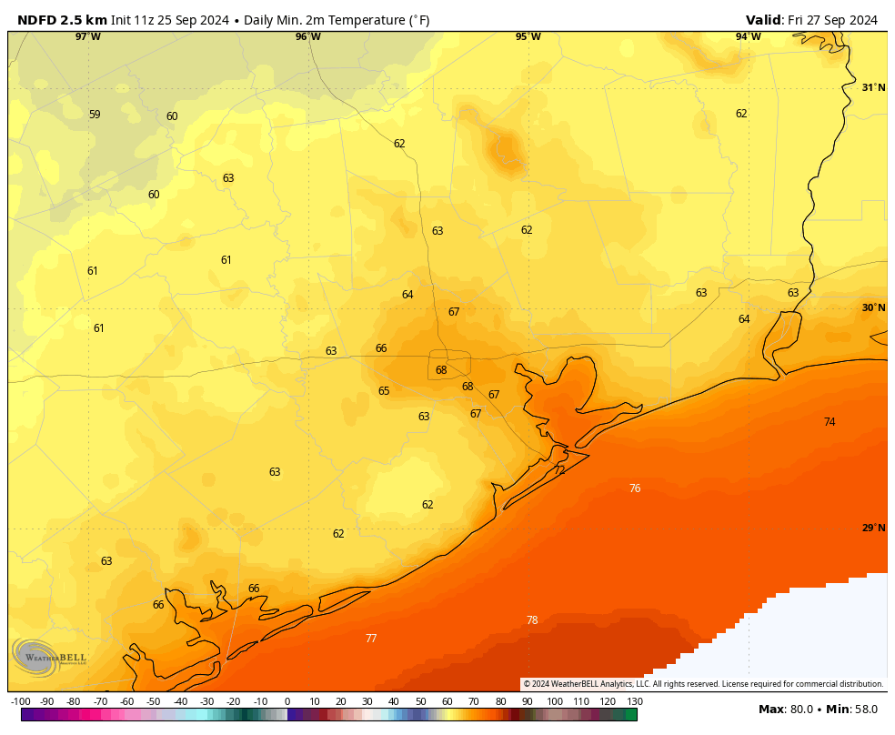
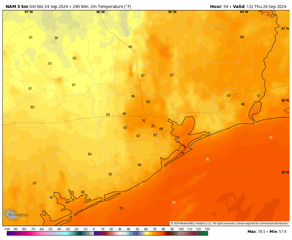
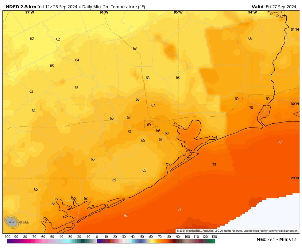
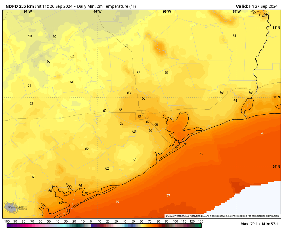
Typically, we designate the day after Houston’s first nighttime temperature of 65 degrees, or lower, as Fall Day. The coolest night of the season, so far, came on September 9, when low temperatures reached 67 degrees at Bush Intercontinental Airport. Low temperatures there tonight will get close, so there’s a chance that Friday will be Fall Day.
A few readers have asked whether we are going to have another Fall Day celebration this year. The answer is no, because we’re going to wait a year so that we might have a bigger event in 2025. Why? Because that will be the 10th anniversary of this website. I know, I can’t believe it either. If you have ideas for the celebration, let us know in the comments below. We’re working with our partner Reliant to do something special. Speaking of Reliant, be sure and stay tuned for a message from them at the end of the post.
Thursday
Skies will be sunny today, with a northerly wind at 10 to 15 mph, which may occasionally gust up to 20 mph or a bit higher. Those winds are bringing in drier air that will help dewpoints drop into the 50s later this morning or by the afternoon hours. Drier air warms more quickly, so air temperatures are likely to get into the upper 80s. But it will feel noticeably drier, and temperatures will cool more quickly this evening as the Sun sets. Lows tonight will drop into the upper 60s in Houston, and low 60s for most outlying areas away from the coast. It’s going to be delightful, and I can’t wait.
Friday
Another day with nice, dry air and plenty of sunshine. Expect highs to reach about 90 degrees as a result. Winds will be less, probably about 10 mph. Lows on Friday night will likely be a degree or two warmer than Thursday night. Still pleasant. (Note: Tomorrow’s post may be an hour or so late due primarily to my desire to take a long run with the drier air in the morning. It won’t matter, since the forecast for the next several days is not going to change much. In fact, you can pretty much ignore us tomorrow and that wouldn’t hurt my feelings.)
Saturday and Sunday
Expect plenty of sunshine, with highs in the low 90s. The dry air is going to modify somewhat, but we’re still going to see fairly low humidity levels all things considered. Low temperatures will reach about 70 degrees. There are zero weather concerns this weekend beyond the potential for a sunburn.
Next week
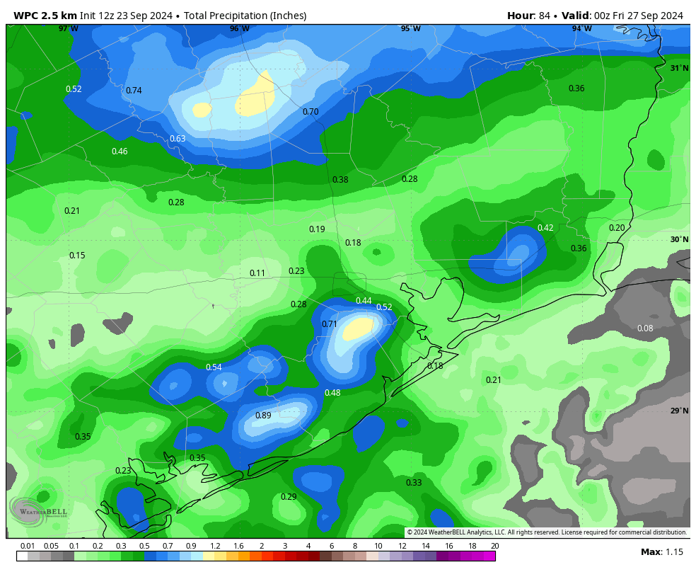
The first half of next week will see continued sunny weather, with high temperatures mainly in the low 90s. Dewpoints will recover into the 60s, so the air will feel more humid, but it’s likely going to be less humid than typical summer conditions in Houston. Nighttime temperatures will probably reach the low 70s. Some chance of a front, with our next real shot of rainfall, arrives by Thursday or Friday, but that part of the forecast remains hazy.
Tropics
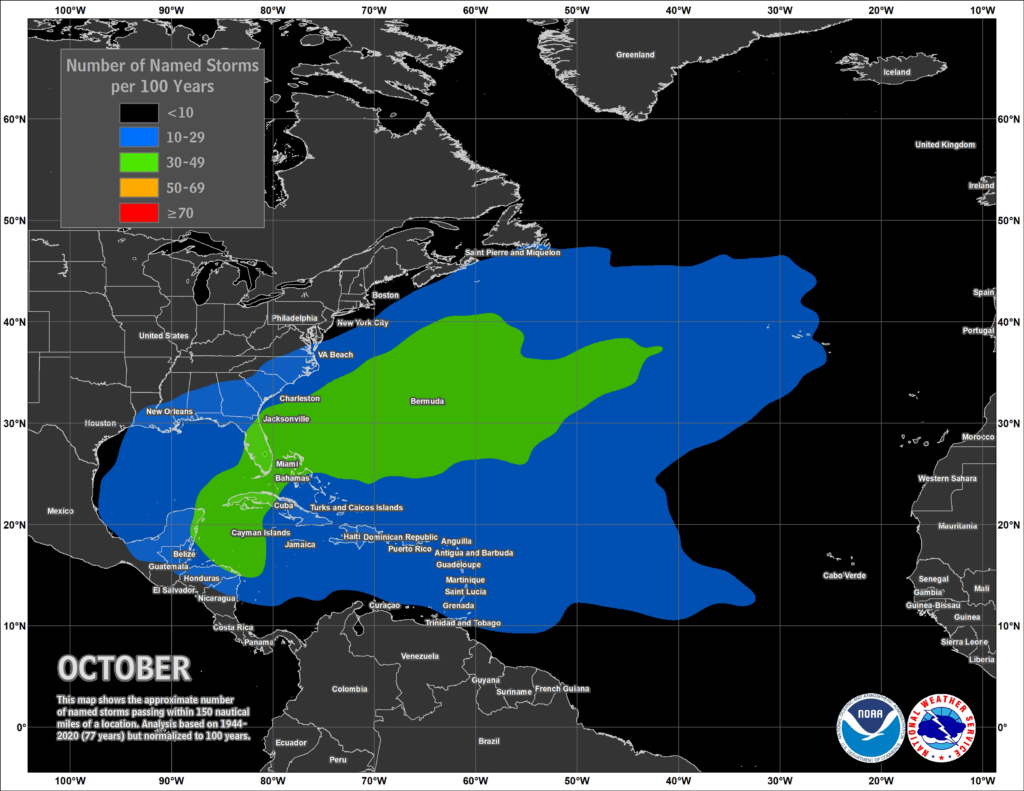
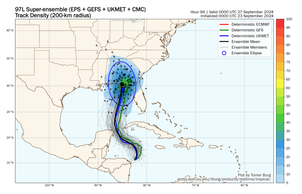
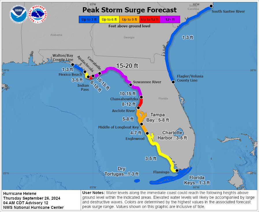
Hurricane Helene is on the way to likely become a major hurricane today before striking the northern coast of Florida tonight. It is similar to Hurricane Ike in that, due to its large size, Helene is likely to pack a broad and very damaging storm surge. Another factor with this storm is the potential for heavy rainfall far inland, in such areas as northern Georgia and western North Carolina. We’ll continue tracking the system on The Eyewall.
A note from our partner, Reliant
At Reliant, our commitment to making a positive impact on the communities we serve is as strong as our Texas roots. Through our Choose to Give program, we empower our customers to join us in that commitment and help us support Texas nonprofits one kilowatt at a time.
When customers enroll in a Choose to Give plan, we provide a $100 contribution up front, in
addition to 5 percent of the customer’s annual energy charges to the nonprofit – providing both immediate and ongoing funding.
In honor of Pediatric Cancer Awareness Month, we recently announced Texas Children’s Hospital has joined as our newest Choose to Give partner! Texas Children’s Hospital is the nation’s largest pediatric health care system with 600 new cancer patients diagnosed each year. Reliant customers can now support the lifesaving pediatric cancer research, treatments and services that Texas Children’s provides by simply flipping their light switch, while also receiving an affordable energy rate for the length of their term and our award-winning, 24/7 customer service.
To learn more about supporting pediatric cancer care through the Choose to Give plan, visit
reliant.com/texaschildrens.