In brief: Houston will continue to see unseasonably warm weather, with high temperatures in the low- to mid-90s for most locations. The sunny pattern continues this weekend, with more late summer weather. There is the possibility of a cool front in about 10 days, but it is far from locked in. We also discuss potential tropical activity in the Caribbean Sea next week.
Tuesday
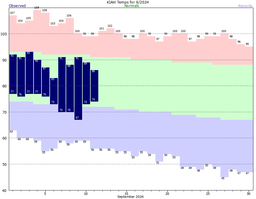
With high pressure in place, you pretty know what to expect with Houston’s weather this week, which is plenty of heat, humidity, and sunshine. High temperatures reached 96 degrees on Monday at Bush Intercontinental Airport, and that’s a good predictor of what will happen today, with mostly sunny skies, and light northeasterly winds. Rain chances are essentially zero, but there is a very slight chance of some brief showers along the sea breeze. Low temperatures tonight will drop into the mid- to upper-70s for much of the region.
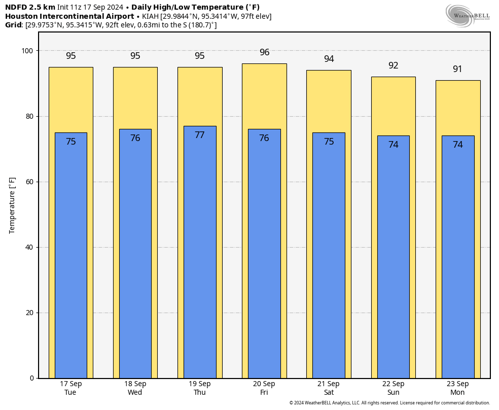
Wednesday, Thursday, and Friday
More of the same. We’re going to see sunny and hot weather for the remainder of the work week. Need I say more?
Saturday and Sunday
The pattern continues into the weekend, however as the intensity of the high pressure system wanes some we’ll see a slight moderation in temperatures. Don’t expect much, but daily highs could drop into the low-90s, with plenty of sunshine. Nighttime lows may fall into the mid-70s. Skies still should remain partly to mostly sunny, with very low rain chances.
Next week
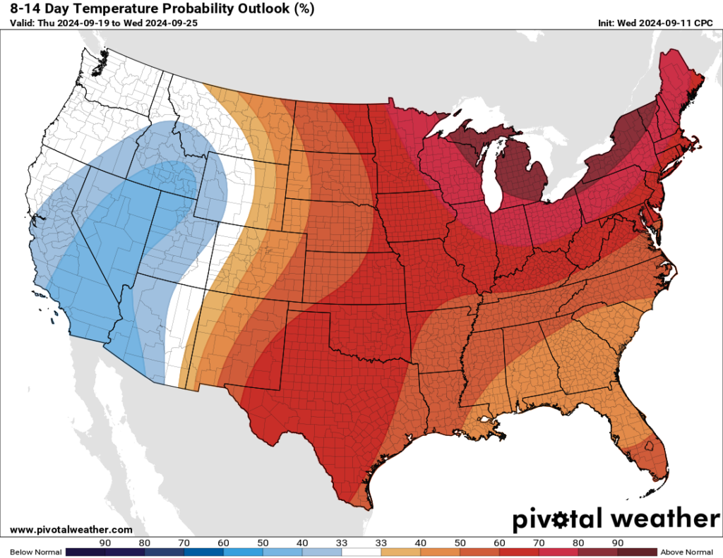
There’s not a whole lot of change next week, with fairly warm temperatures. Perhaps we’ll see slightly better rain chances to start next week, in the vicinity of 20 or 30 percent, I’m not sure. Some of the global models are indicating that a front may arrive by around Thursday or Friday of next week, but the signal is not yet strong enough that I’m buying it. However, it is possible. We’ll see.
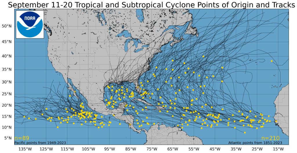
Tropics
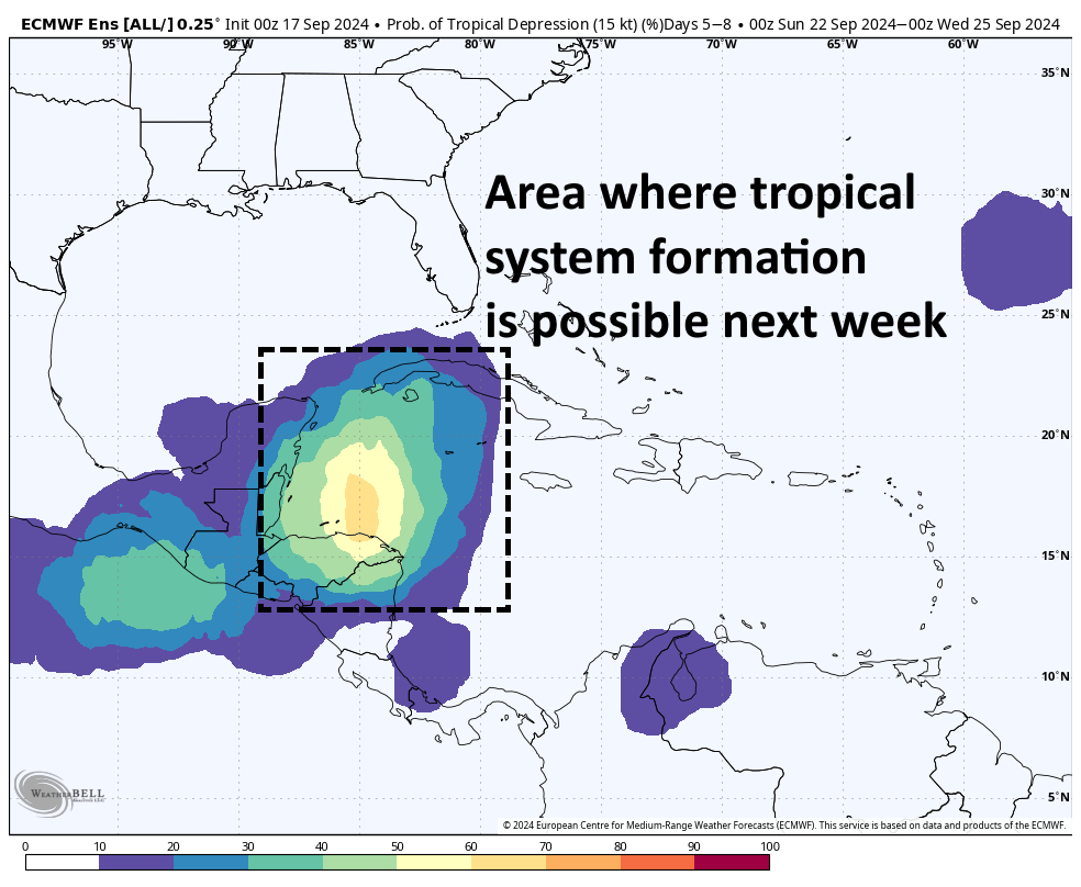
A tropical system that has been absolutely soaking North Carolina has finally moved inland. Beyond that there’s not much to note that is presently active. However, most of our modeling guidance continues to highlight the western Caribbean Sea as a location where we can expect to see the development of a tropical low in about a week or so.
Beyond that there is not much sensible to say. This system could then track into the Yucatan Peninsula or turn north toward Florida or the eastern Gulf of Mexico. Yes, it could even move toward Texas, but at this point there is little model support for such an outcome—especially if the aforementioned front materializes. Nevertheless, at this time of year in the tropics we watch everything.