In brief: Houston faces a stretch of considerably warmer than normal weather that will last into the weekend. However by early Sunday we should see a return to more typical conditions for February, with some cold nights to follow early next week.
Warmer through Saturday
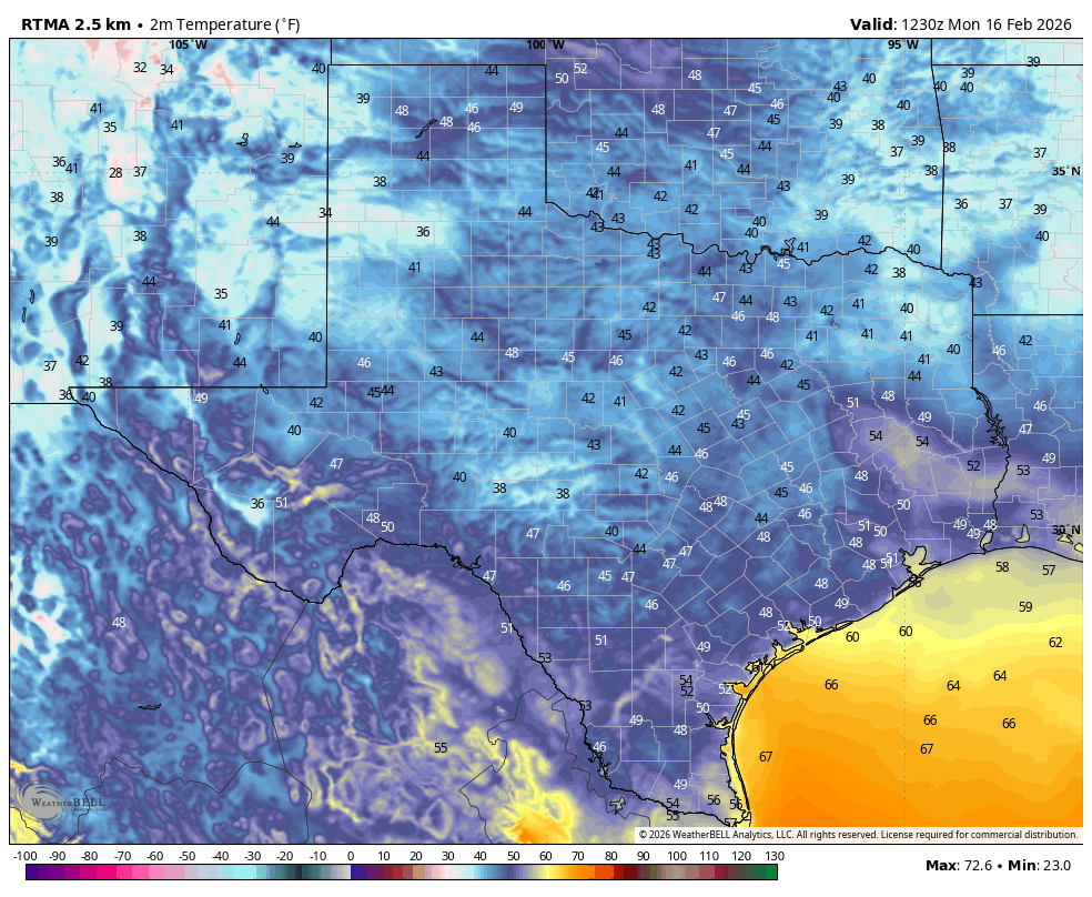
Temperatures are generally in the 50s this morning, but this is the last time Houston will see the mercury dip below 60 degrees until Sunday. Lows this week will be in the mid- to upper 60s, which is remarkably warm for this time of year, when overnight temperatures normally fall into the upper 40s. If you’re wondering when the region will start to feel more like late February, the answer is Sunday, when colder and drier air from our next front should arrive in force.
Tuesday
High pressure and a southerly flow will lead to warmer temperatures into the weekend. Highs may remain below 80 degrees this afternoon, but most locations will be in the upper 70s at least, with rising dewpoints and partly sunny skies. Southerly winds will be fairly robust, gusting up to 20 or 25 mph this afternoon. Lows tonight will drop into the low- to mid-60s, with winds dying down enough such that fog is possible in some locations.
Wednesday and Thursday
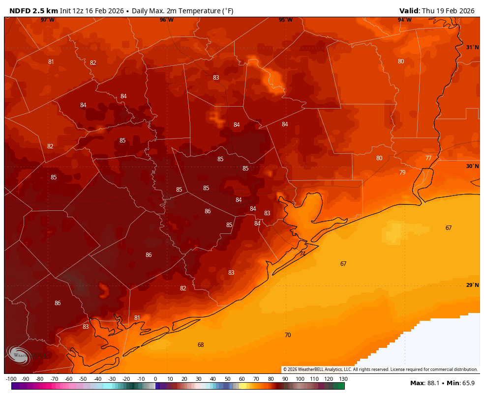
These will be a pair of warmer days, with partly sunny skies and highs in the low 80s. Afternoons will continue to feature fairly strong southerly winds, bringing in that humid Houston air we all know and love. As a result lows will be warm overnight, in the upper 60s.
Friday
This will be another warm and humid day, albeit with a few more clouds. As atmospheric moisture levels continue to nudge up, we may see some very light, scattered showers. Accumulations look slight, accordingly.
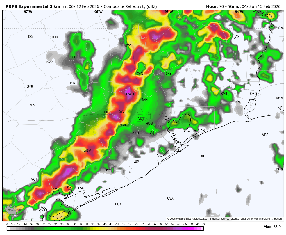
Saturday
This day will be similar to Friday, in terms of starting out warm and muggy. However at some point, likely during the afternoon hours, a front will drop into the city from the northwest. We still don’t have details, but I think it’s possible we see some more light showers (there remains no indication of storms) along with and ahead of the front. Again, accumulations don’t look impressive at all.
Sunday
A cooler air mass should follow the front, and by Sunday morning most of the region should see lows in the upper 40s with sharply drier air. Skies should be sunny on Sunday, with highs in the mid-60s, so pretty typical for winter in Houston. Lows on Sunday night will drop into the lower 40s, or thereabouts.
Next week
We should stay on the chilly side of things through Tuesday of next week, with lows perhaps in the vicinity of 40 degrees (we’ll have to see about that). I don’t think a freeze is in the cards for the Houston metro area, but locations further inland may briefly see temperatures dip toward that level. For the second half of next week we should see highs recover into the upper 70s or so. Rain chances, overall, look to remain on the low side.