In brief: We will continue to see the potential for showers and thunderstorms in Houston over the next couple of days, but the main threat for heavy rainfall will remain largely confined to the coast. In fact, to account for this threat, we’re reinstated a Stage 1 flood alert for coastal counties through Friday morning. This post also discusses the deliciously dry air on the way this weekend with the season’s first front.
Coastal flooding threat
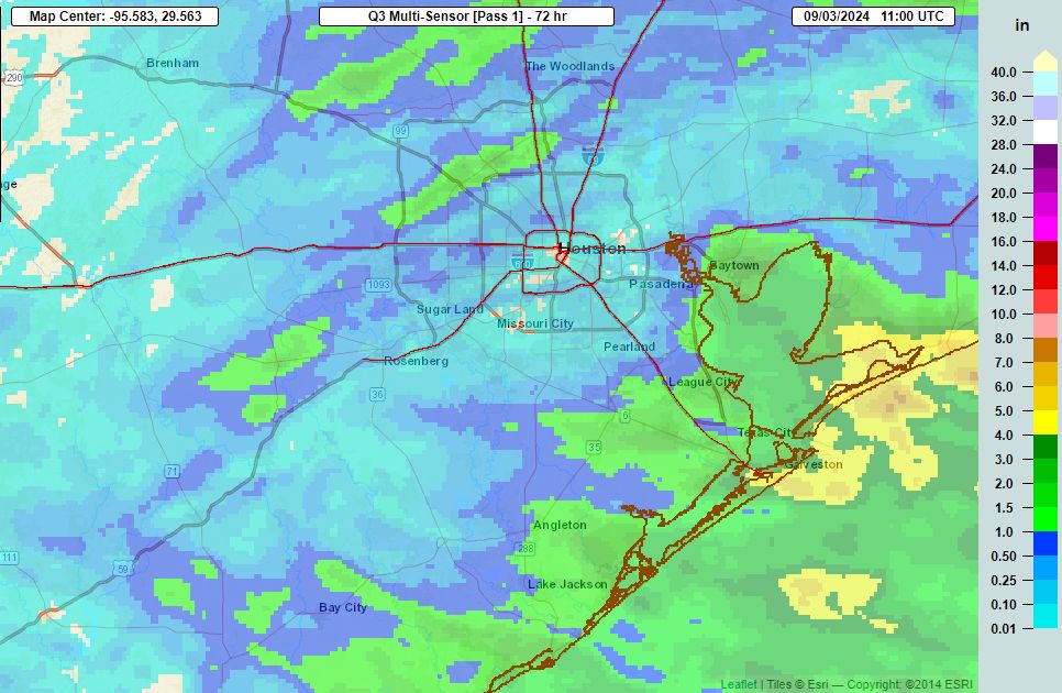
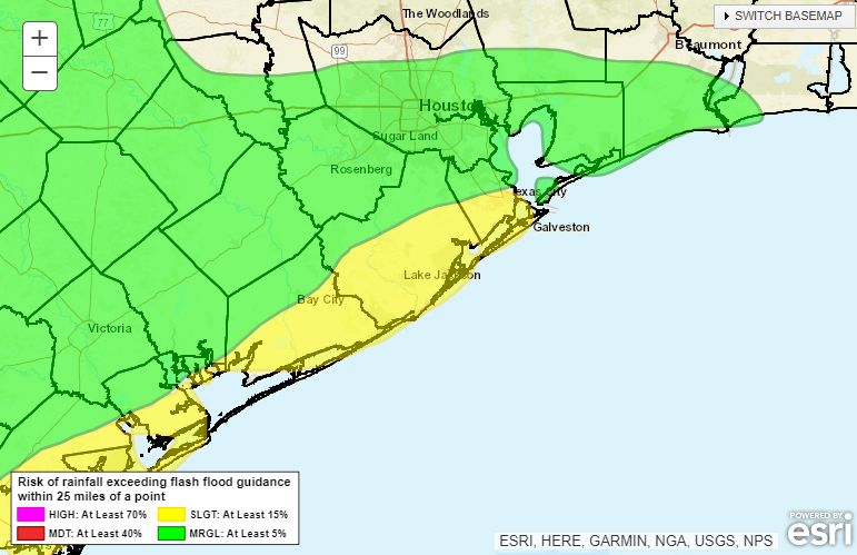
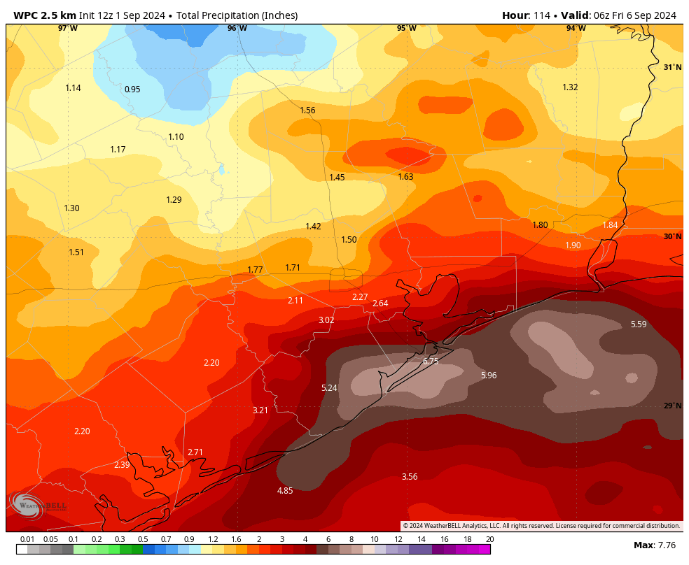
Instead of slowly fading away, a coastal low pressure system now seems likely to drift back northward toward the upper Texas coast and Louisiana during the second half of this week. Although most of the heaviest rain should fall offshore, coastal counties along the upper Texas coast—Matagorda, Brazoria, Galveston, Chambers and Orange—could pick up an additional 3 to 6 inches of rainfall, with the possibility of higher isolated totals. For this reason we are putting a Stage 1 flood alert back into place for these areas for the time being. This mess should definitively move away by some time on Friday.
Early season front
My general rule for cold fronts, in Houston, is that we can generally expect one by the third or fourth week of September. This is not a hard and fast rule. If you recall last summer—the hottest summer on record in Houston—the first front did not arrive until October 7. This year a front will arrive on Saturday, one month earlier. In fact, this front will be our earliest since the year 2017, a year when I guess Mother Nature felt as though she owed us one after Hurricane Harvey.
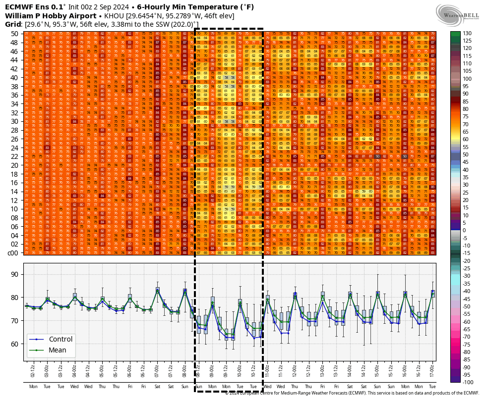
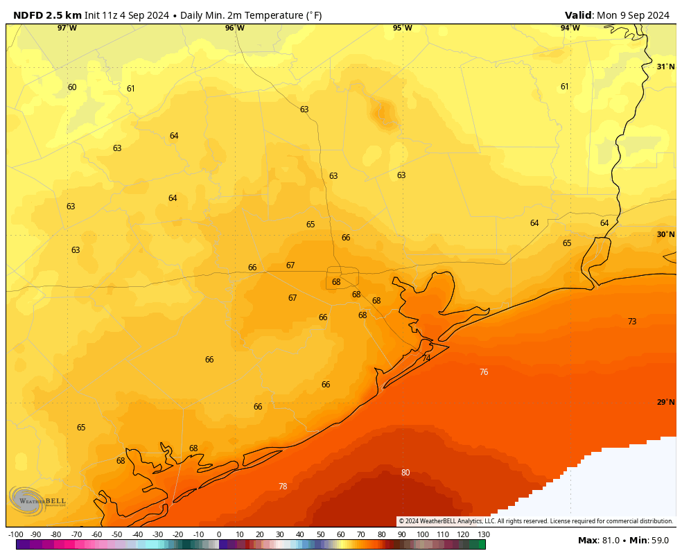
This front will not barrel into Houston, but drier air should percolate into the area over the weekend, beginning on Saturday and continuing into Sunday and Monday. Some areas, particularly away from the coast, may see dew points dropping into the 40s at times, which is really dry air for this time of year. Lows on Sunday and Monday mornings should drop into the 60s for most of the region and, combined with the drier air, it will feel really pleasant. The first fall fronts never last very long, so enjoy the cooler weather while it lasts.
Wednesday and Thursday
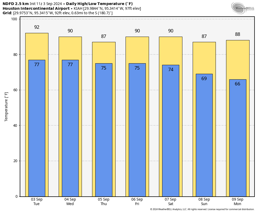
Both today and Thursday will see elevated rain chances due to the presence of the coastal low pressure system. As noted above, rain showers will be hit or miss for inland areas, but there is a decent chance for some street flooding along and near the coast. Highs will range from the mid-80s for coastal areas to about 90 degrees inland, with mostly cloudy skies. Winds will generally be from the east or northeast, at about 10 mph, with gusts up to 20 mph.
Friday
Some additional showers are possible, particularly for coastal areas. However, we’ll also start to see some sunnier skies mix in, especially for inland areas. High temperatures should be in the upper 80s.
Saturday and Sunday
Sunny skies will prevail, with highs near 90 degrees on Saturday, and perhaps the mid-80s on Sunday in the wake of the front. Low temperatures and the extent of dry air will depend on how far you live from the coast, however the entire area should enjoy at least some relief from humidity. This will be a splendid weekend for outdoor activities, although Saturday will be breezy as the front pushes through, with gusts up to 25 mph or so.
Next week
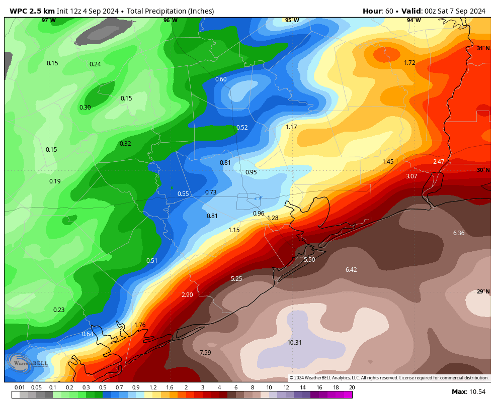
The dry air hangs on through about Monday before we start to see a southerly flow return. Highs will likely return to around 90 degrees, and rain chances are back on the menu beginning Tuesday or Wednesday.
Tropics
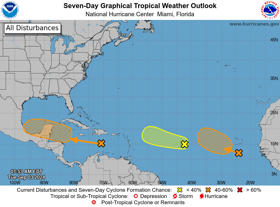
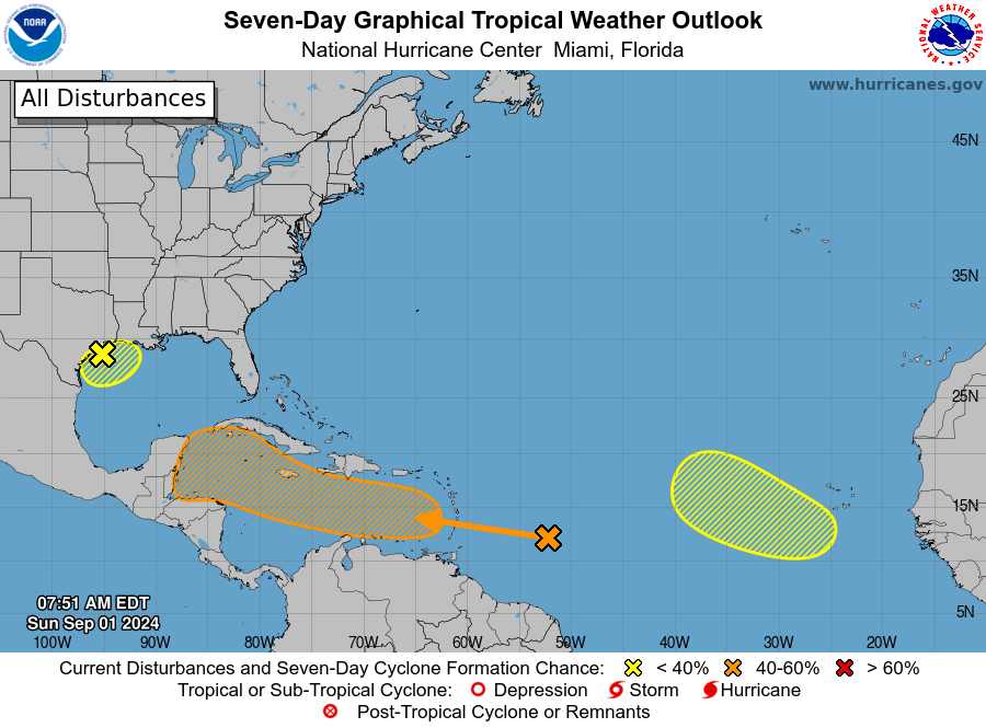
There’s a lot to watch in the tropics over the next week or 10 days, but beyond the low pressure system bringing us rain over the next couple of days, it is nothing I’m too particularly concerned about at the moment. The Eyewall will have more later today.