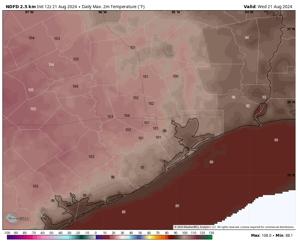
In brief: We’re nearing the end of peak summer in Houston, but today is still going to be excessively hot with temperatures in the low 100s. By Thursday we’ll see the start of a slow cooling trend, which will eventually bring us cloudier skies and improved rain chances by early next week.
Wednesday
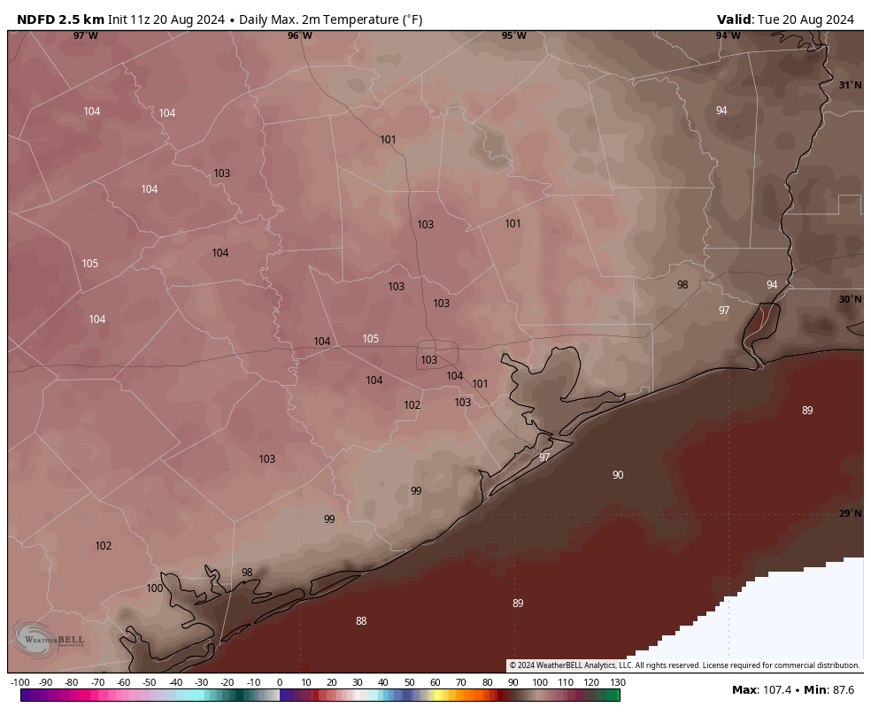
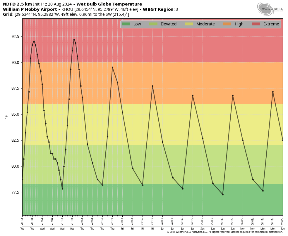
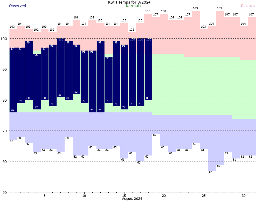
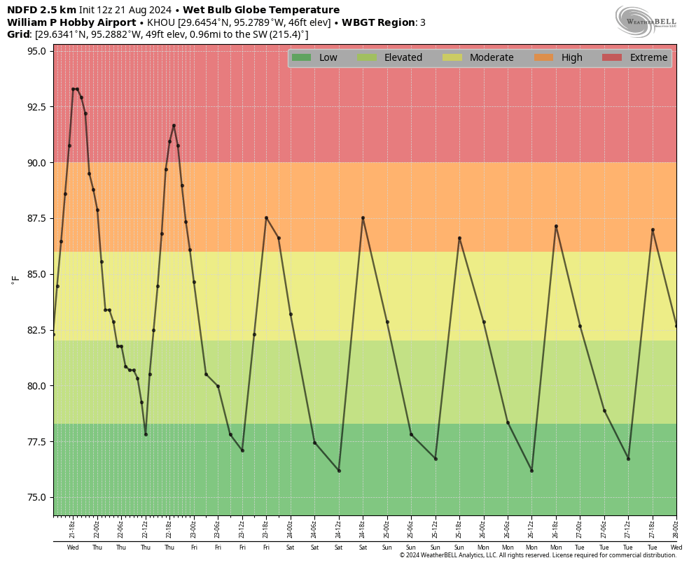
High temperatures on Tuesday officially reached 102 degrees at Bush Intercontinental Airport, the warmest temperature recorded so far this year. Conditions today will be similar, with mostly sunny skies and very hot temperatures. Winds will be light, from the southeast. Lows tonight will provide scant relief, likely falling only to about 80 degrees. The good news is that today will probably be the hottest day for the rest of 2024. I cannot guarantee that, of course. But probably.
Thursday
High pressure that’s been situated over West Texas will finally start to back away, and this will slowly start to moderate our conditions. It won’t happen right away, of course, as highs on Thursday could still reach 100 degrees in some locations. But it’s a start. I think there also will be a chance of some isolated showers and thunderstorms, although overall chances will remain quite low, on the order of maybe 10 percent.
Friday
Expect sunny and hot weather, with highs in the upper 90s. Rain chances will be about 20 percent, with isolated to scattered showers possible along the sea breeze.
Saturday and Sunday
Highs this weekend will be in the mid- to upper-90s and precise temperatures at your location will depend on the extent of cloud cover and whether any showers pop up during the afternoon hours. The bottom line is that it will be hot, but not excessively so. Low temperatures should fall back into the upper 70s.
Next week
As high pressure moves further away, our weather will become increasingly influenced by the Gulf of Mexico. This means we should see partly cloudy days next week, with high temperatures likely in the vicinity of the mid-90s. Daily rain chances will increase throughout the week, starting in perhaps the 40 percent range on Monday, and rising to likely by the second half of the week. We’re not looking at a total washout by any means, but hopefully we’ll see some cooling rains that bring needed moisture to our soils. As I was discussing with a friend yesterday, it really does not get a whole lot better than that in Houston, in August.
Tropics
Nothing is happening. Later this morning we’ll have a post from Matt to explain why that is—during a season which seasonal hurricane forecasters predicted a hyperactive year in the Atlantic.