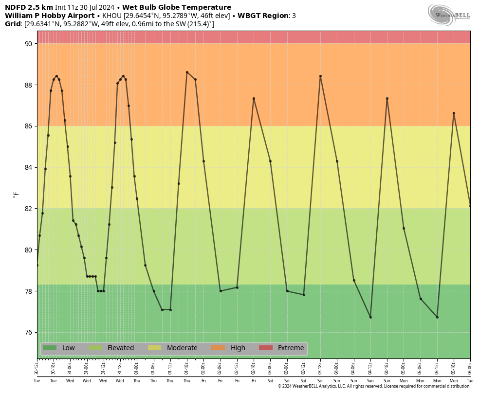
In brief: With high pressure in place this week, expect hot temperatures, mostly sunny skies, and few if any stray showers. The only real feature of note, beyond the heat, will be hazy skies due to the influx of Saharan dust into the atmosphere. Rain chances increase slightly by Sunday as a weak front stalls north of the metro area.
Wednesday
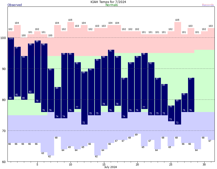
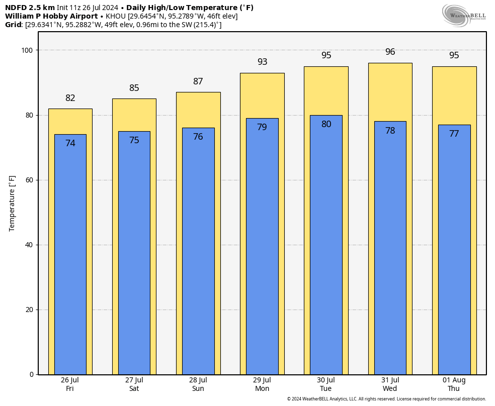
Weeks like these, which often come during the summertime months in Houston, are easy to forecast in Texas. With high pressure more or less in place we can expect sultry but calm weather. And that will be the case today, with mostly sunny skies and high temperatures generally in the mid-90s. Winds will be from the south at about 5 to 10 mph, with some higher gusts this afternoon and during the early evening hours. Low temperatures will briefly drop into the upper 70s tonight for inland areas. Rain chances are below 10 percent.
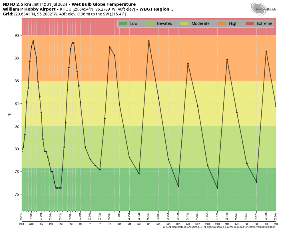
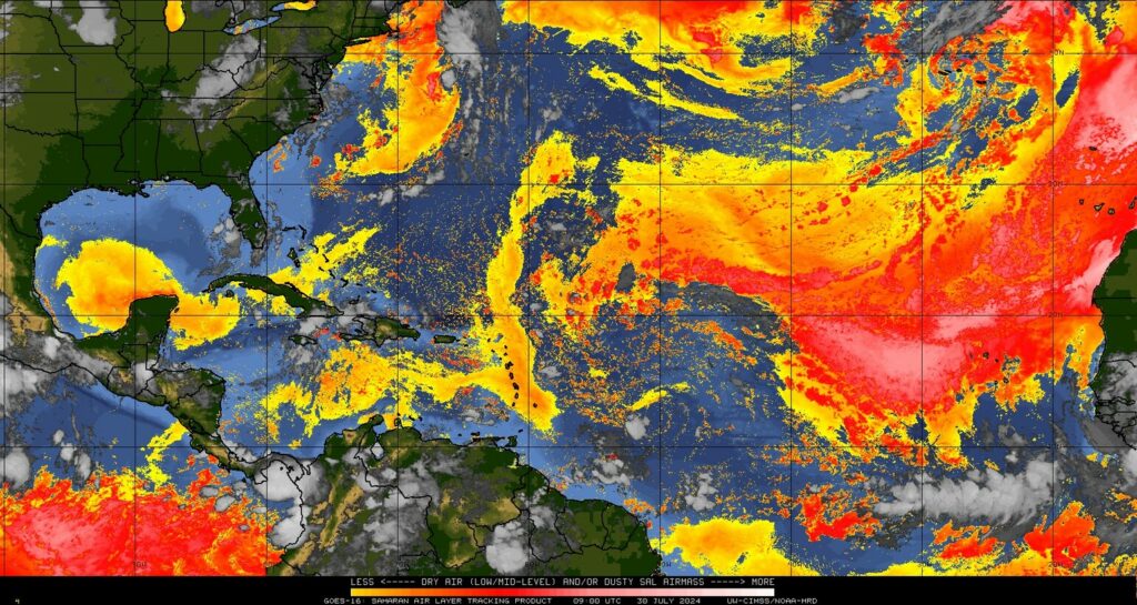
The main novelty for today, and much of the rest of this week, will be the presence of haze due to the Saharan air layer. These are fine particles of dust from Africa, transported across the Atlantic Ocean all the way to Texas. This pattern typically peaks during July so it is not abnormal to see this dust, nor particularly harmful. Sunsets will appear a deeper red.
Thursday
A day a lot like Wednesday.
Friday
We may start to see a bit less dust in the atmosphere, and with sunny skies most of the area could see highs push into the upper 90s.
Saturday and Sunday
High pressure will retreat some this weekend, and a weak front will approach the region but stall out well north of us. With that being said, I’m not sure there will be a whole lot of sensible change in our weather. Saturday will be sunny and hot. We may see the return of some African dust for a bit, we’ll see. Sunday looks sunny and hot as well, but due to the presence of the front we could see some isolated to scattered showers develop during the afternoon hours.
Next week
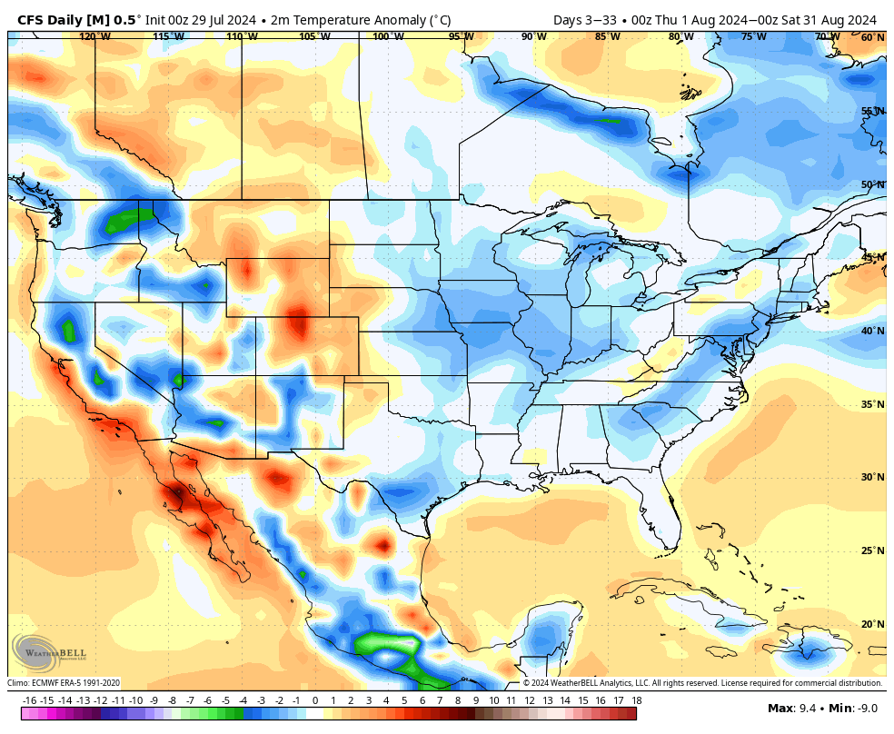
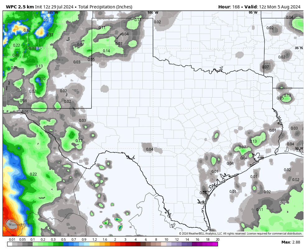
High pressure appears to be back in play next week, so we can expect to see continued temperatures in the mid- to upper-90s as we get deeper into August. There does appear to be some support for higher rain chances during the latter half of next week, but when we get into these drier patterns these kinds of showers are sometimes a mirage in the models. We’ll see.
Tropics
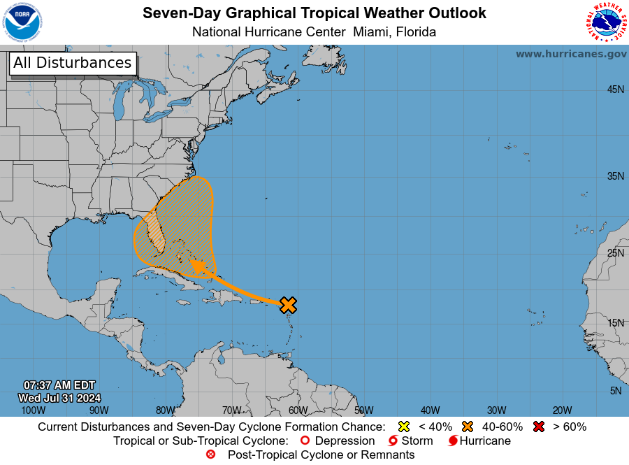
The main focus continues to be on a tropical wave approaching the Caribbean Sea, which is likely to near the Bahamas in a couple of days. It may take some time, but forecasters at the National Hurricane Center expect this system to eventually get its act together and become a tropical depression or storm during the next week. The primary threat in terms of winds and rains looks to be across Florida, but there’s not a lot of certainty in the models.