In brief: Scattered showers and some embedded thunderstorms will dot the Houston area today and Saturday, although we really, really need some rain. A generally pleasant stretch of weather will follow, with periodic cool fronts reinforcing warm but mostly comfortable autumn weather. Our first real big front of the season may be on the horizon before Halloween.
The first 16 days of October have ended with Houston recording a top 10 warmest front half of the month on record. It’s not just us either. Chicago’s had a top 10 warmest October so far. Atlanta is in the top 20. Miami is in the top 25, and St. Louis ranks third warmest right now. While the West has been cooler and the East Coast near average, the center of the country has remained toasty so far this month. That may be about to change a bit. We may be in line for more fairly nice mornings, warm to perhaps hot daytimes but I think at levels below what we’ve seen so far this autumn. In other words, we’re getting there.
Speaking of temperatures…
If you use the Space City Weather app (and you should), and if you set your city to Houston, those observations come from Bush Airport. If you’ve followed along this summer, you know that the official Houston temperature sensor at IAH has been a source of confusion, amusement, annoyance, conspiracy theories, outrage, and curiosity. To that end, out of an abundance of caution, the temperature sensor at IAH was replaced this week. The previous sensor was reading within what was expected, but given the wide ranging displeasure that has been shared, including by some credible folks on the matter, it’s been replaced. As I noted earlier this summer, we can quibble with the choice of IAH to represent Houston’s official temperature, but that doesn’t mean the sensor itself is wrong. It’s a temperature at IAH, not in your backyard. How that impacts how we view records is perhaps a bit more complicated and contentious but after looking at summer’s data, it does not seem to have made IAH a distinct outlier in the region by any means.
Anyway, for those of you scoring at home, there’s a new temperature sensor in town. Have at the data.
Friday through Sunday
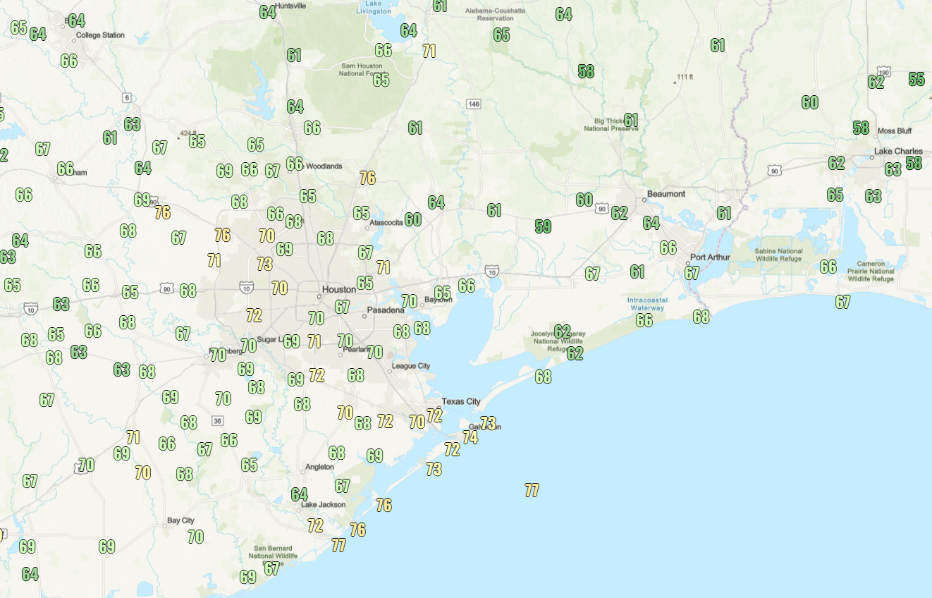
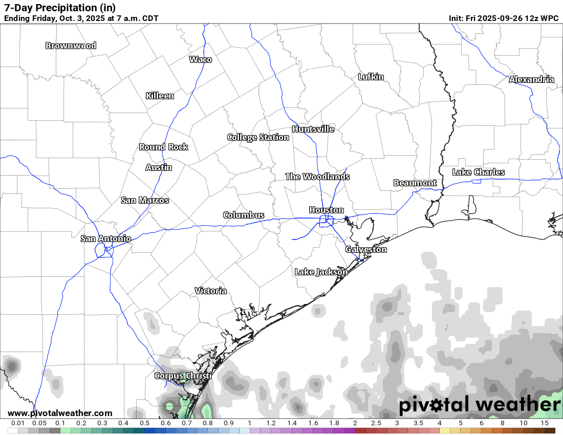
Scattered showers are going to pop up today across the region. We need the rain.
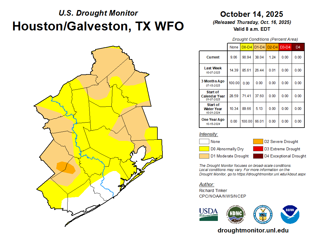
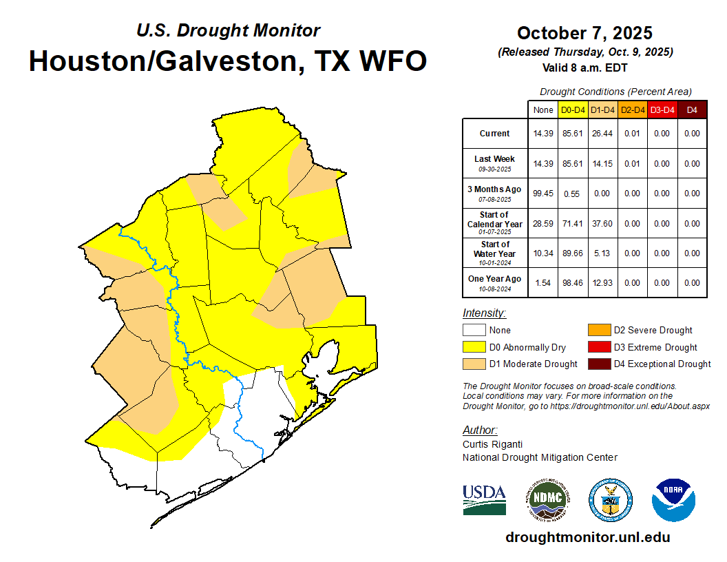
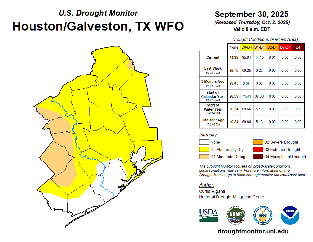
Drought now covers nearly 40 percent of the Houston area, with severe drought now showing up in parts of Colorado and Wharton Counties. If you get a passing shower today or tomorrow, consider yourself fortunate. Expect showers today to behave with the heating of the day, increasing in coverage from morning through afternoon, then diminishing after dark. Showers should maneuver farther inland today so hopefully other parts of the area away from the coast could pick up a scattered quarter to half-inch of rain.
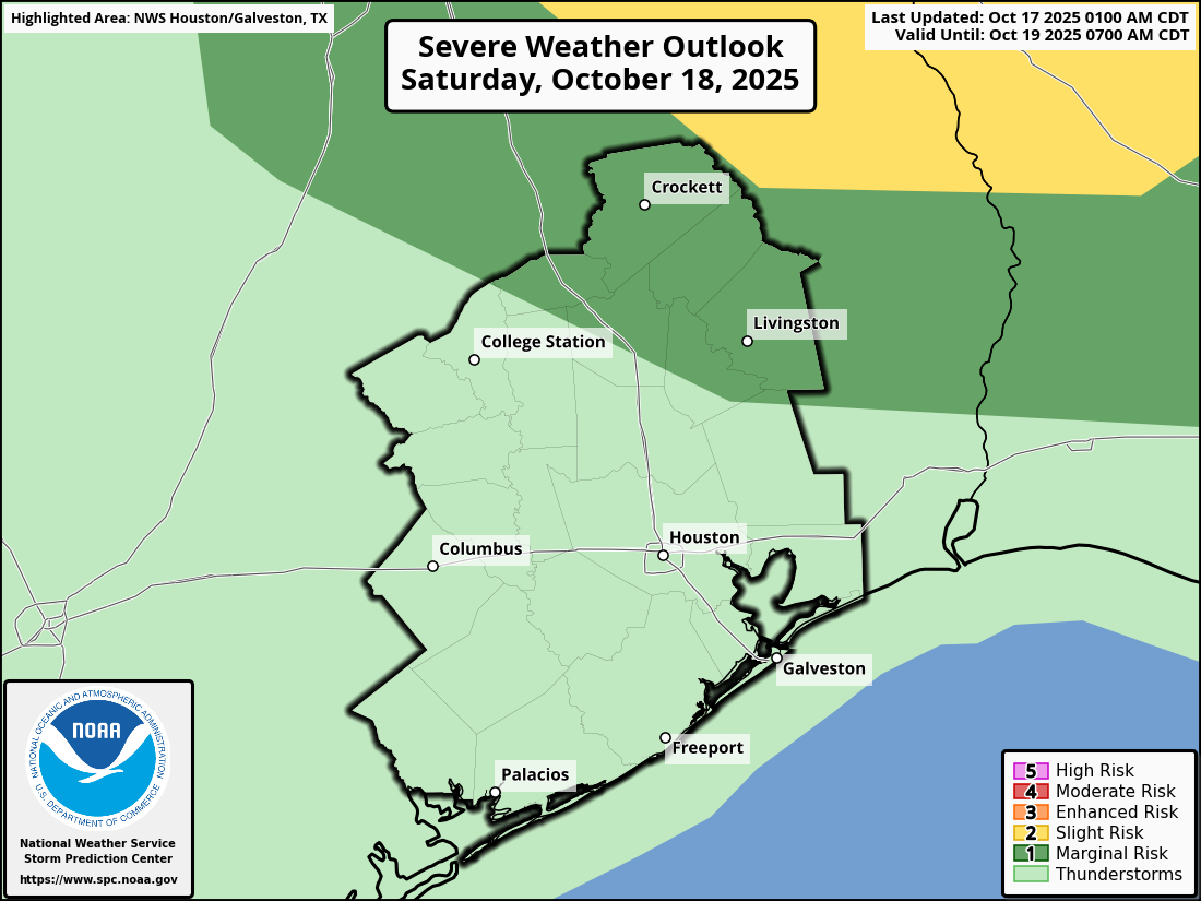
On Saturday, showers will start in the morning again, initially mostly near the coast and west of I-45 out across Katy into Fort Bend County. By the time we get to midday, the focus of the activity should migrate eastward toward I-45 and perhaps east of downtown Houston. Include an umbrella in your plans both Friday and Saturday anywhere in the area, but it is unlikely you’ll need one all day or even most of the day. We probably won’t see severe weather on Saturday, but to our north, there is a slight risk (level 2 of 5) in place up toward Lufkin and a marginal risk (level 1 of 5) closer to Lake Livingston.
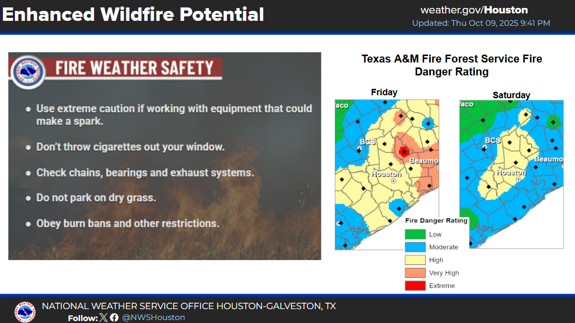
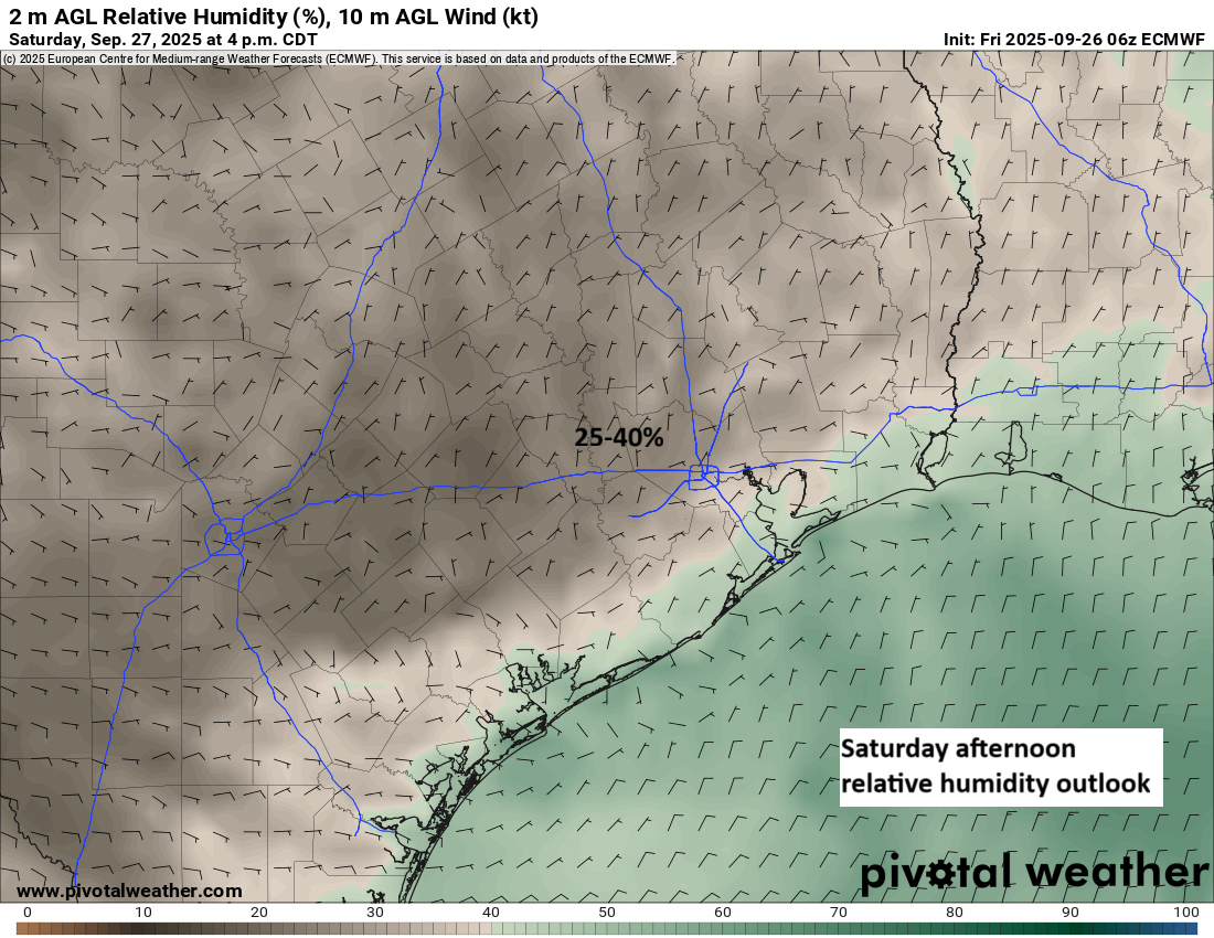
The front itself passes on Sunday morning around sunrise. Right now, we aren’t expecting much fanfare with the front; it looks like a dry passage. We’ll see temperatures and humidity drop off a bit as it does so. The rest of the day looks breezy with sunshine and highs in the upper 80s. It will feel much more comfortable. Some wildfire risk is in place in the area Sunday afternoon, but it does not appear any worse than previous wildfire risk days we’ve had so far this autumn. Just use caution with anything flammable outdoors.
Early next week
Monday looks sunny and pleasant with highs in the upper-80s and morning lows in the 50s and 60s. Another front should reinforce this pleasant but not quite “cool” air mass on Tuesday night. It may bring a few showers out ahead of it as humidity attempts to return, but the odds look minimal right now. We’ll hold with mid to upper 80s for highs and generally 60s for lows.
Later next week
I’m with Eric that we could very well see another weak cold front later in the week. It does not appear to be THE fall front just yet, however. There is increasing signal in the modeling that that front will wait until right before Halloween. We’ll either be celebrating the arrival of fall or celebrating its imminent arrival at our Fall Day celebration next weekend. Stay tuned.