In brief: Strong to severe thunderstorms are likely this afternoon and evening in the Houston area, especially north of I-10. Hail and strong wind gusts are the main concerns. Heavy rain is also likely in spots, so a stage 1 flood alert has been posted. After today, we get some quiet, if not absolutely beautiful weather this weekend.
Today/tonight
So, let’s get this out of the way first: This morning looks fine. No issues.
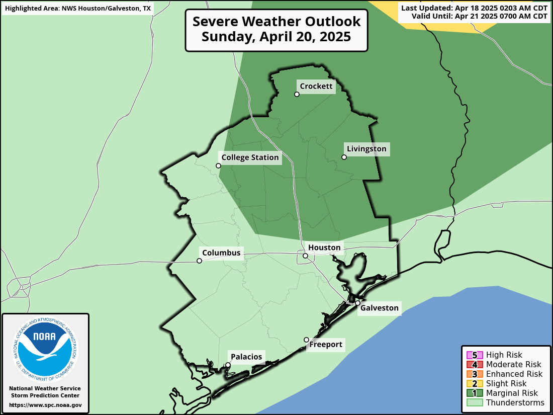
Starting this afternoon, probably not long after lunchtime, numerous showers and thunderstorms are likely to begin developing north of I-10. The environment over Houston looks conducive for virtually any storm to become strong to severe today. As such, we are now in an enhanced risk (3/5) of severe weather this afternoon and evening.
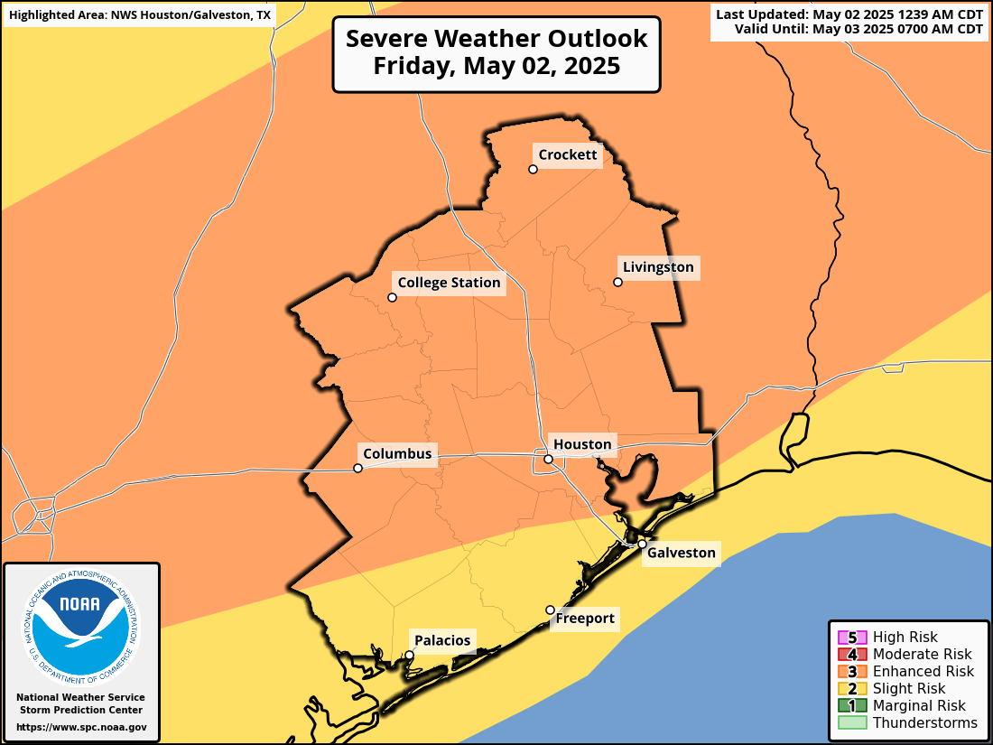
The two main threats today will be pockets of strong wind gusts in excess of 40-50 mph and the potential for hail. An isolated tornado cannot be entirely ruled out, but the bigger risks are damaging wind and hail today. The evolution of storms today will probably be individual cells eventually congealing into a line that lingers for a bit over much of the Houston area, again focused near or north of I-10. The severe storm threat should begin to wane after sunset, but additional thunderstorms are likely, especially south of I-10 overnight. So, almost everyone should get a chance to participate today with the nastier storms north this afternoon and evening and less intense storms south this evening and overnight.
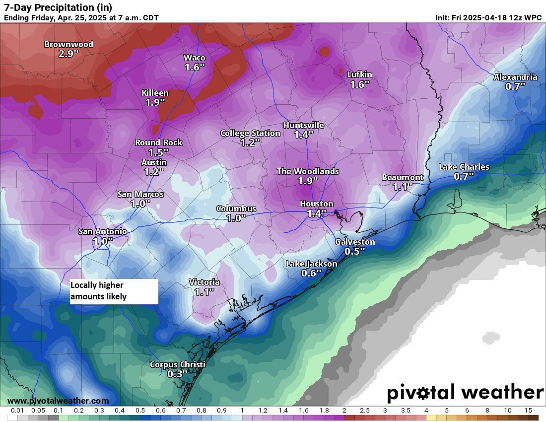
In addition to the hail and wind, these storms could produce torrential rainfall, with totals of up to 3 or 4 inches possible in isolated pockets. Street flooding could easily crop up with storms like this. So, with that in mind, we are issuing a stage 1 flood alert for this afternoon and evening across the area, mainly north of I-10.

There are always fail modes on days like this, and it could be that we end up with heavy rain and generic thunderstorms more so than severe weather. But the environment today is definitely primed for some strong to severe storms, so particularly between about 1 PM and 8 PM, you’ll want to remain tuned into what’s happening.
Eric will have the latest for you around midday with a fresh update. We will follow with further updates as needed thereafter.
Saturday and Sunday
After some lingering showers well south of Houston or near the coast in the morning, Saturday itself looks like a fine day. Actually, it may end up being an absolutely spectacular day, but I want to keep expectations a little in check. But expect a return of some sunshine, noticeably lower humidity, and highs into the low 80s. Morning lows should be in the lower 60s. Look for much the same on Sunday without the morning shower chance.
You never know when you’re going to get your last really, really nice day before summer sinks in, so take advantage of tomorrow and Sunday if you’re able!
Next week
After another decent day Monday (albeit a bit warmer), we will re-emerge into an unsettled weather pattern for much of next week. Day by day details are tough to pin down right now, but look for at least a chance of thunderstorms on Tuesday, Wednesday, and Thursday. Some of the storms could be strong, and some of the rain could be heavy.
More data!
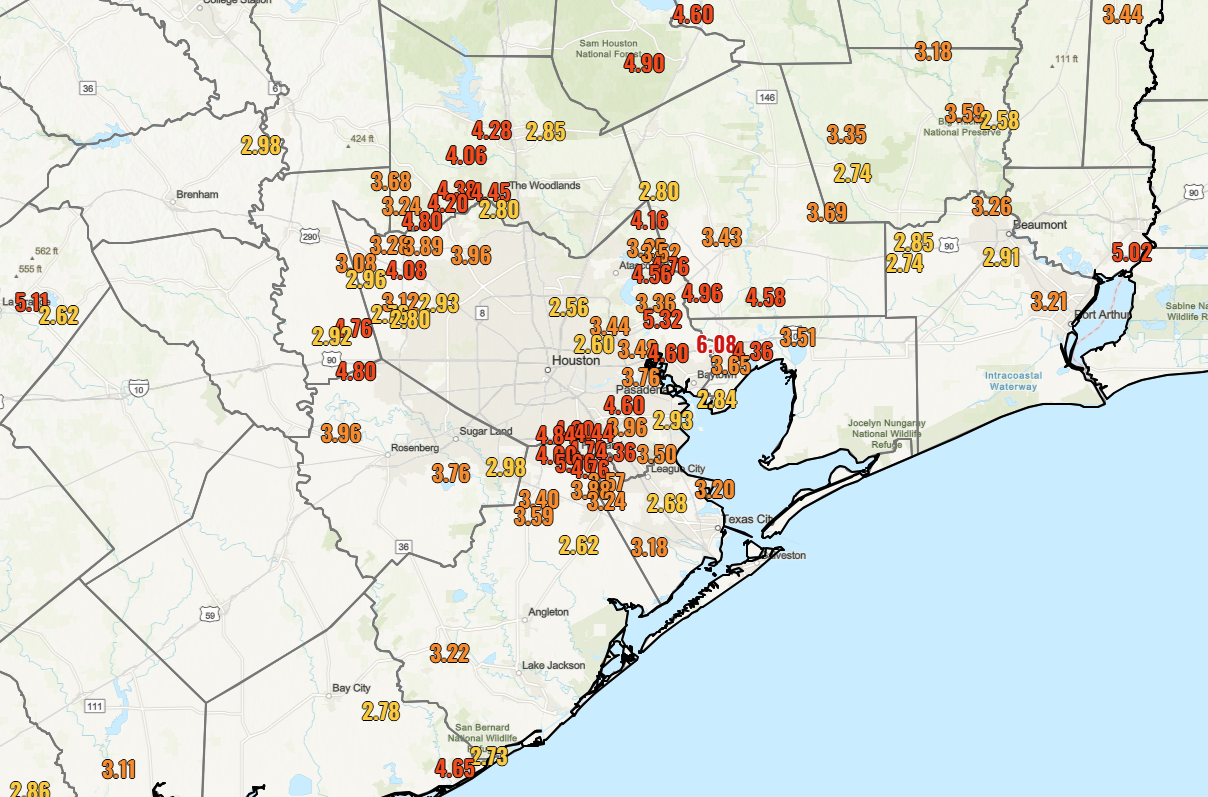
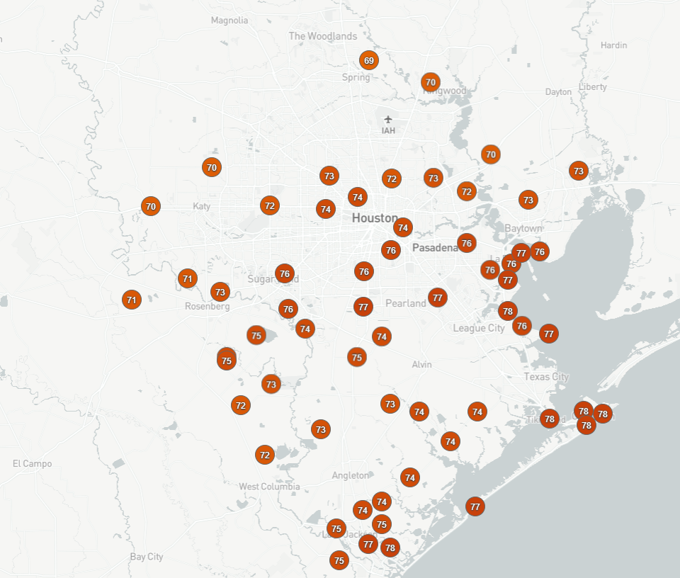
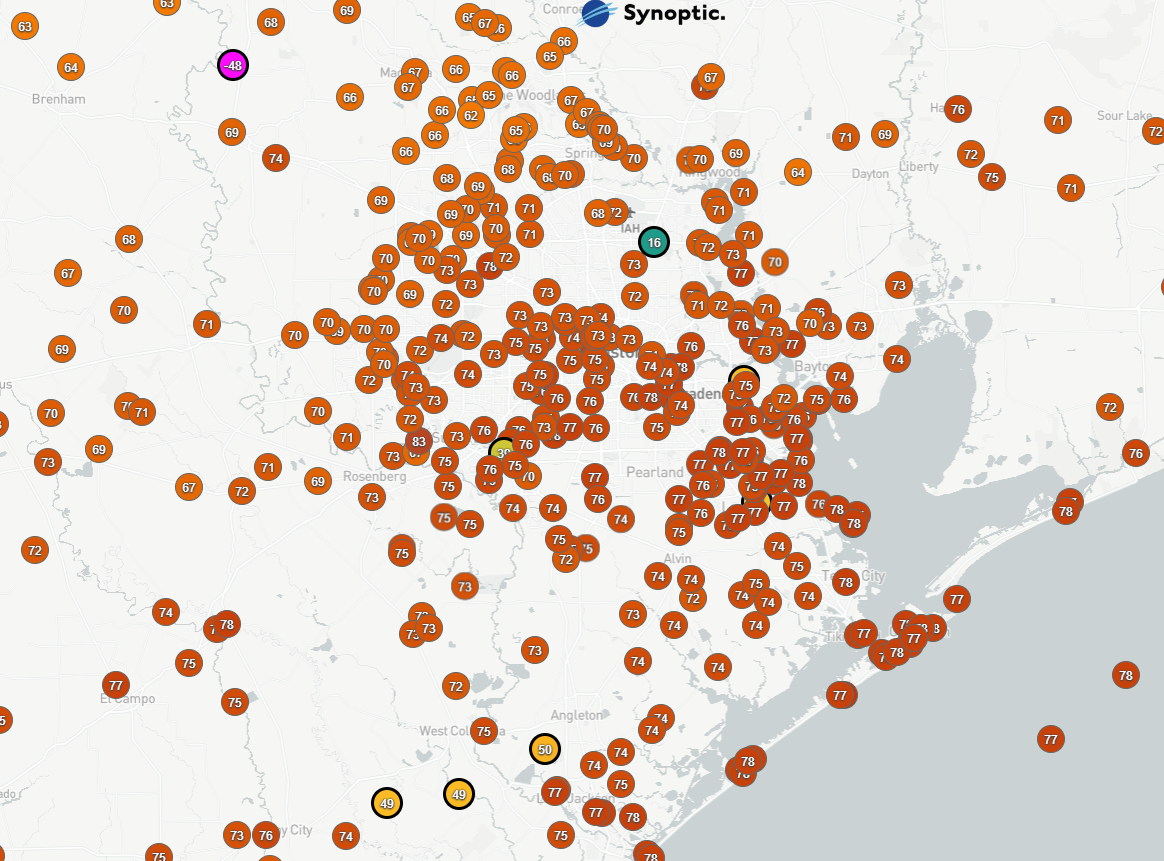
I generally abide by a separation of church and state when it comes to my day job and my work with Space City Weather. However, I am going to make a minor exception in this case. For those that do not know, I was hired in November to be CenterPoint Energy’s new manager of meteorology. Among the many things I was tasked with out of the gate was siting and launching a network of 100 weather sensors across the Houston area, as part of the company’s commitments in the Greater Houston Resiliency Initiative. In case you had not seen earlier this week, that process is now underway, and you can see the data from over 60 new weather sensors across the area here!
You may ask, “Well aren’t there already a lot of weather sensors reporting here?” The answer is yes. There are. But even when you plot virtually every network of weather stations, there are still some data gaps, there are periodically reliability issues, and most of you know how the weather goes in Houston where it rains at your neighbor’s house but not yours.
I’m hoping we can fill some of those gaps, assist with improving weather forecasting in the Houston area, and add additional data to be used by the NWS, flood control agencies, etc. to assist in understanding or researching weather in the Houston area. More data is good for everyone. So this project has excited me, I’m glad we can share this data with the weather community, and I look forward to seeing it grow further.