In brief: Houston’s rinse and repeat of periodic fog and very warm, humid conditions will continue through at least Sunday. Rain chances nudge up a bit next week, and we still suspect a front may eventually, possibly arrive here later in the week. We also dive in further on sea fog today.
More on sea fog
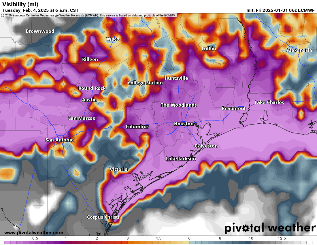
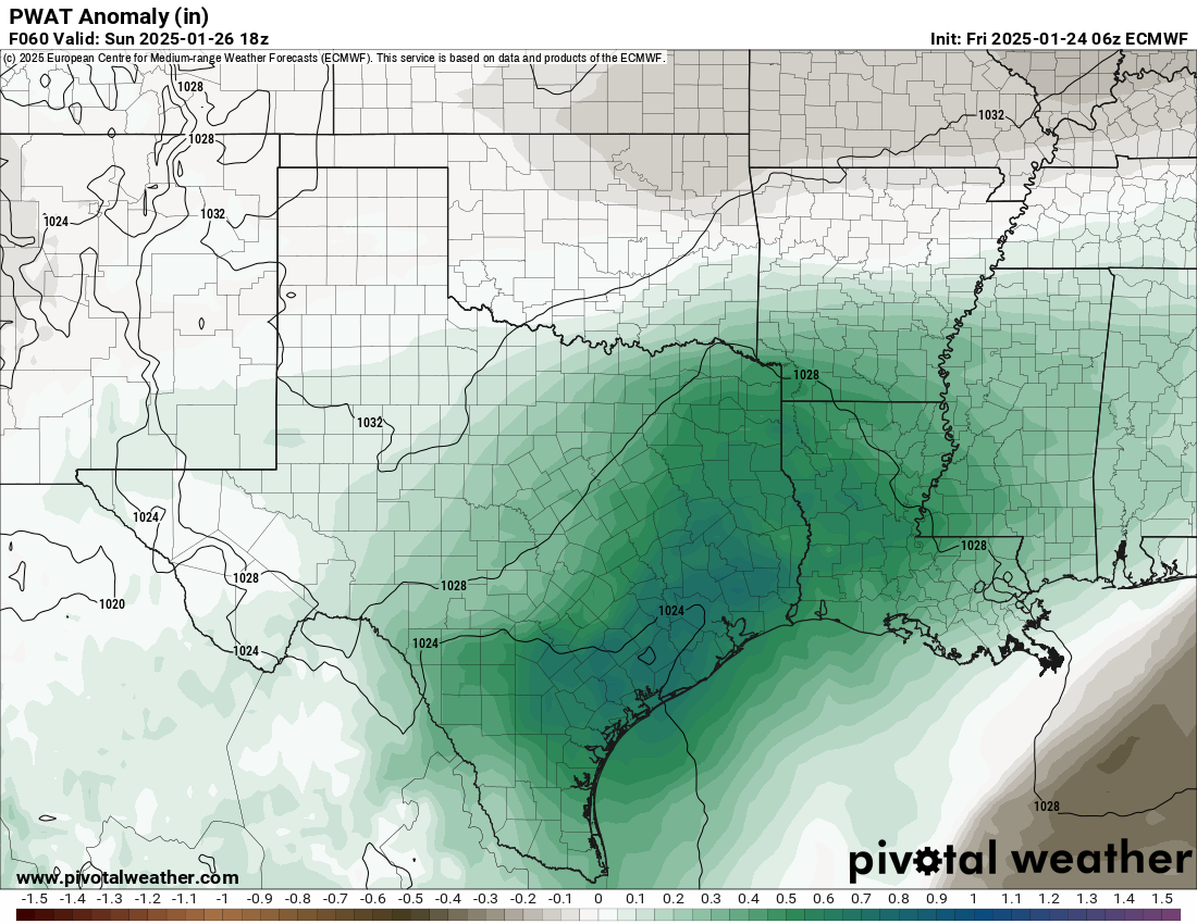
Eric’s talked a lot about sea fog this week, and it remains a pestilence across the coastal waters. Galveston finally broke free of fog for a while late yesterday. But, it’s back now. And if you’re asking yourself whether or not this is normal, the answer is actually yes. February and December are our two biggest fog months in Houston, particularly near the coast. Why? As Eric explained earlier this week, the process of sea fog involves cool shelf waters and warm, humid air crossing over them. In December, it’s a combination of our first cold of the winter, followed by a warm-up. Or it could be driven by non-sea fog, or what we call “radiation fog,” which is just fog that happens over land due to radiational cooling under clear skies at night, not the advective sea fog. The key difference? Radiation fog usually dissipates by mid to late morning. Sea fog may stick around or appear at random points during the entire day.
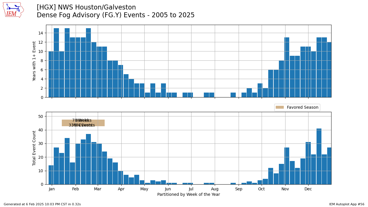
February usually marks the transition to spring, and the cold of winter has taken its toll on the shelf waters just offshore. The combination of that first taste of spring-like warmth and the cold Gulf water happens most often between February and early March. Once we get to mid-March, the cold spells usually relax, the shelf waters begin to warm, and the mechanism for sea fog disappears. Thus, the frequency of dense fog advisories plummets.
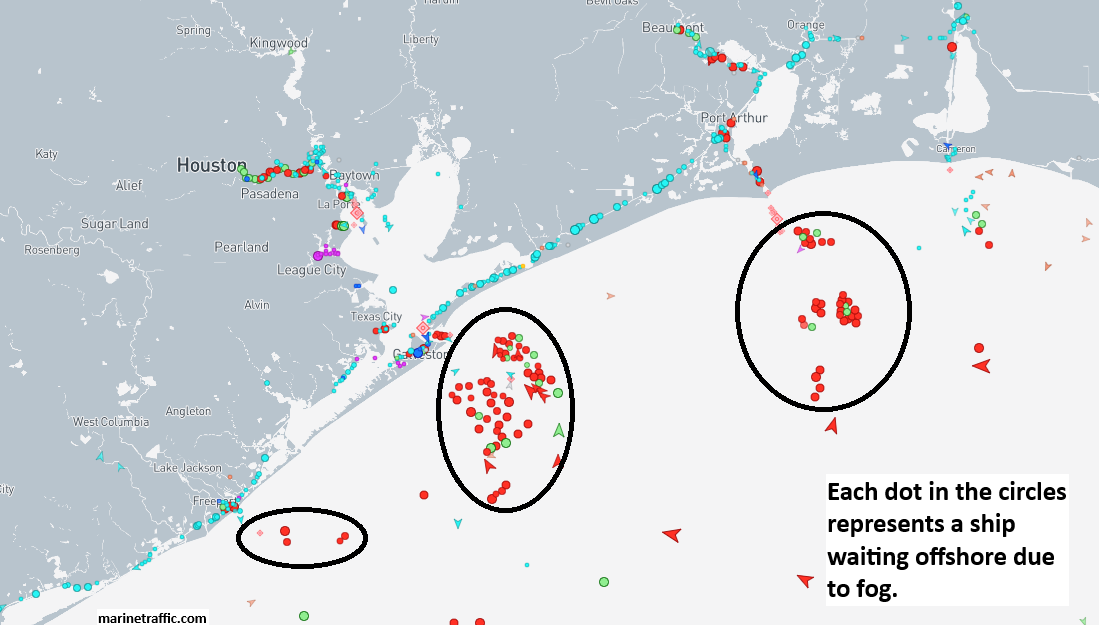
My previous day job role in the LNG industry required some serious fog forecasting chops, and let me tell you, for those operating or running critical businesses in Gulf Coast ports or forecasting for them, these events are full of stress. I have likened the stress of working a one-week fog event to that of the stress involved with forecasting a hurricane. You can click here to view a near-real time ship traffic map. Notice the clusters of ships amassing off the coast? They’re waiting to arrive in ports like Houston, Beaumont-Port Arthur, Sabine Pass, etc. Harder to see are the numerous vessels also “stuck” in port that have to depart. Each day lost to fog can cost companies tens of millions of dollars or more. Stack it up over a week, and you can do the math. It’s a lot of money. No pressure.
Today through Sunday
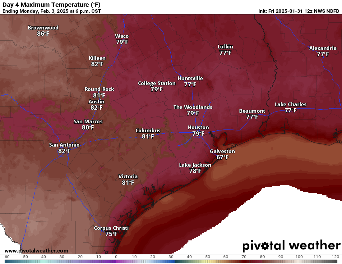
Does it end? How many more records can we break? This is the 6th warmest four day stretch on record in winter (December through February) in Houston. We’ve averaged about 75.1° so far this week. The record for four days is 76.4° set back in December of 2021. Yesterday was our fourth consecutive record high (83°), breaking 2019’s 82°.
Today’s record of 86° from 2017 seems safe. Clouds and fog should again hold us back a bit, so again look for low-80s for highs. Tomorrow? It may be a tick or two warmer, but the record of 87°, also set in 2017 would appear safe at the moment. Let’s not forget Super Sunday! More of the same. Another day in the low-80s, which is hopefully around the same value as Patrick Mahomes’s passer rating. Fly Eagles, Fly!
As for the fog, look for continued chances of afternoon or early evening clearing at the coast and a bit less inland fog than we’ve seen this week. Still, it will be around, and it will be dense at times, so use caution driving particularly in the morning hours.
Next week
The first attempt at a cold front will actually occur Sunday. The front may sneak into the Brazos Valley or as far south as Huntsville or even Conroe. It won’t severely knock back temperatures, but it could cool things temporarily up that way by 10 degrees or so. It appears that the front retreats back north Monday and Tuesday before maybe finally making a swipe at the area Wednesday or Thursday.
We may begin to see more showers crop up each afternoon starting Tuesday. That could transition into a better chance of showers and storms by Thursday, pending an actual front getting here. I would not get too worked up about rain chances at this time; they don’t look too exciting. Still, we’ll see how the weekend changes affect that story Monday.
How cold will it get behind the front? Well, at this point, we’re fighting a battle between very, very warm conditions over the Southeast and very, very cold conditions up north. Western Canada looks to get punished next week. The forecast high temperature in Calgary from the European ensemble next Friday is -22 degrees. It may not get any warmer than minus 20 degrees there on a couple days. Will any of that cold get down here? A modified version of it might later next week, but I don’t know that we see even a widespread light freeze at this point. For now, expect a couple rounds of more muted cold here into mid-February with details to be sorted out next week.