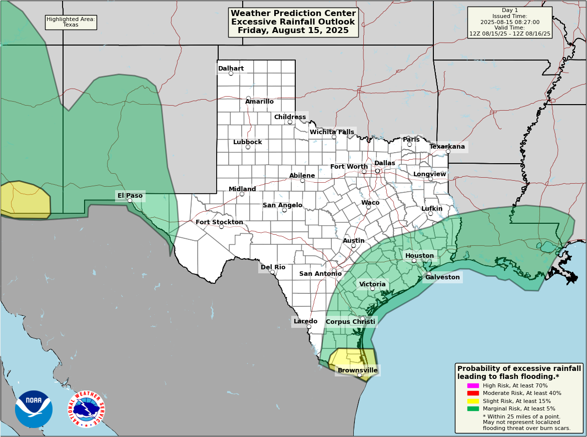
In brief: Another round or two of showers and storms will pelt many parts of the Houston area today, with some locally heavy rain possible. Rain chances will start to slow this weekend into early next week before the next round of rain chances kicks off around midweek. There are no current tropical concerns for the Houston area.
Yesterday’s storms were relatively squirrely, especially down in Brazoria and southern Fort Bend Counties. There was a 66 mph wind gust reported from a CenterPoint weather sensor at Brazos Bend State Park. Fascinatingly enough, the radar looked rather innocuous with the storm at the time, but some strong wind gusts elsewhere, including nearly 50 mph just west of Damon seem to back that reading up. That’s just the thing with storms this time of year in Houston: If you catch one at the wrong point in its life cycle in the wrong way, it can produce some pretty quick, short-lived but nasty impacts.
Today
Already today we’ve seen plenty of thunder and some wind gusts up near 50 mph near San Luis Pass. As of this writing, the heavier storms are all offshore, with some isolated downpours and lightning outside the Beltway in western Harris County back through Sealy and Columbus.
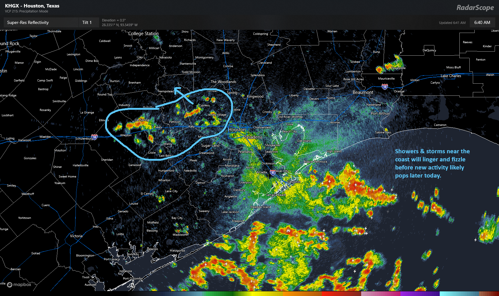
As the day goes on, we may actually see things calm down a bit for a time before ramping back up again this afternoon or this evening. I’m not entirely confident on the timing of the next wave; some modeling is quick and quite aggressive with coverage of the next wave of showers as early as late morning. Others hang development back until late afternoon. But we do know a second wave of scattered downpours is likely later today. Expect a very sporadic pattern of coverage with some places seeing squat and others seeing as much as 2 to 3 inches in short order.
Weekend
A continued chance of showers and thunderstorms will be with us on both Saturday and Sunday, as is typical for August. We do think coverage and some of the intensity of the storms will wane a bit on both weekend days, with perhaps Sunday having even less coverage than Saturday. We may see another rude early wake up in spots on Saturday morning as some nocturnal storms could pop up after midnight between Houston and the coast. Then I think we’ll see a summer pattern of mid to late afternoon isolated to scattered downpours resume.
Look for highs in the mid-90s, with a few isolated upper-90s possible.
Monday and Tuesday
We think things will be similarly subdued like Sunday to start next week. Rain chances certainly are not zero, but they’ll remain lower. Highs should again be in the mid-90s.
Midweek next week
We should see another boundary drop in or develop over the region around midweek next week. This should mean an increase in shower and thunderstorm coverage once again. Look for cooler daytime highs as a result.
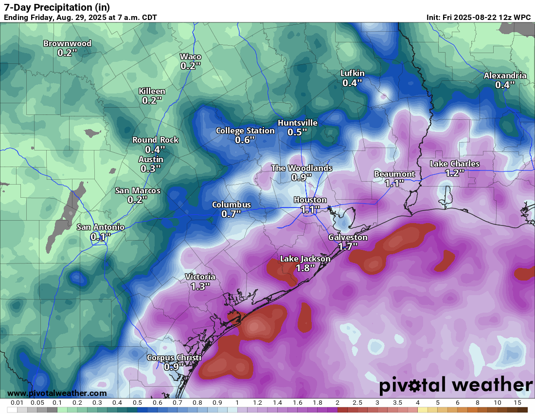
Total rainfall between today and next week is likely going to be around 1 to 3 inches near the coast, with lesser amounts inland. Isolated higher amounts are possible anywhere in the area, and yes, some isolated places will see lower amounts too.
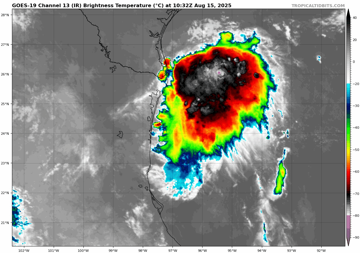
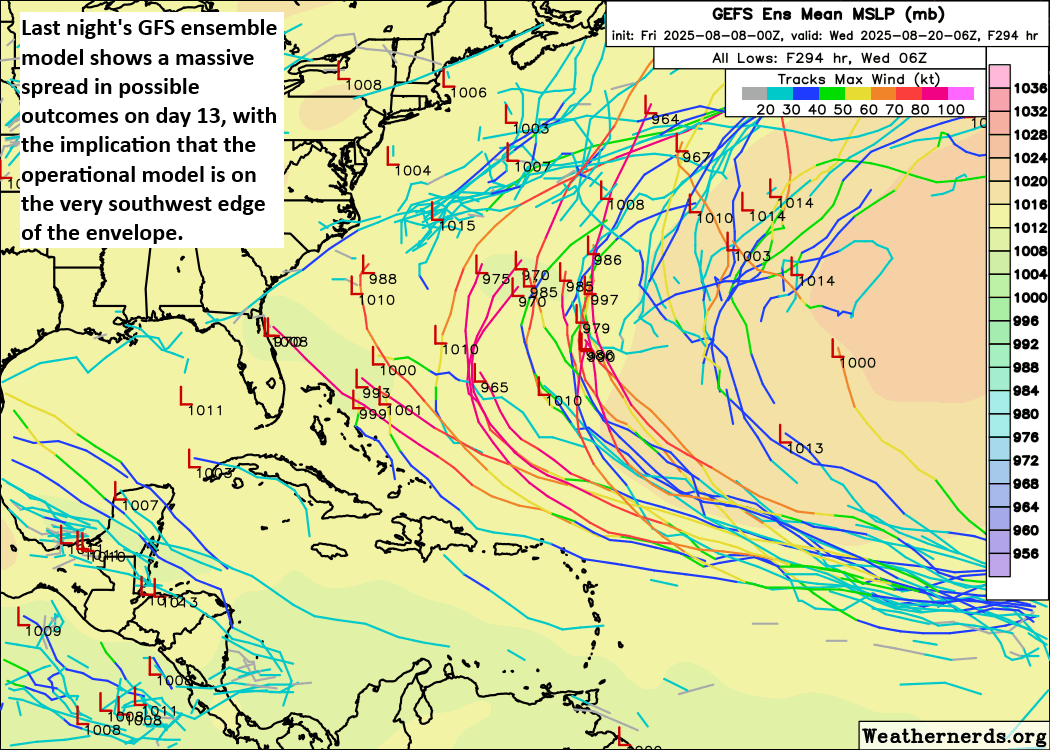
Tropics
The map currently favors us for the most part.
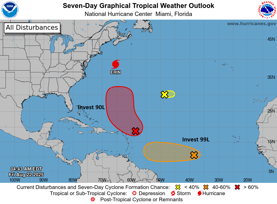
Of the activity out there today that we’re monitoring, only Invest 99L is worth keeping an eye on. No reliable model guidance is bringing it to the Gulf, but just out of respect for the calendar and history, it’s important to just check in and see if southern tracking waves like this one heading for the Caribbean can survive enough to get closer. Even if it were to do that, I’m not sure that the upper pattern would allow it to come north much, if at all. So either way, this probably ends up buried in Central America ultimately. But we’ll babysit it anyway. Other than that, you can continue to assume the brace position as we navigate the final 5 to 6 weeks of our peak hurricane season. We’re all just trying to get to the finish line.