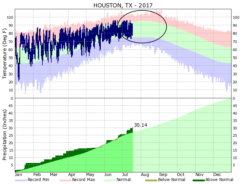
We’ve reached the dog days of summer, and it sure feels like it across Houston. Traditionally the period of mid-July through the end of August is the warmest period for the region, with average high temperatures around 95 degrees, and overnight lows in the mid- to upper-70s. We’re now in that stretch of weather, and barring heavy rainstorms daily temperatures will be sizzling for the next six weeks or so. If we all hold hands, we just might make it to fall, because it’s not so terribly far away now.

Today
High pressure has begun to build to the north of the region, but there’s enough moisture near the coast to still produce some isolated downpours south of Interstate 10. For the most part, however, expect partly sunny skies, scattered light to moderate rain showers, and highs in the low to mid-90s.
Thursday through Sunday
We’re going to fall into typical summer-time weather for Houston. This means highs in the mid-90s for most of the area, with highs in the upper 90s likely for inland areas where there will be fewer clouds. Sea breeze showers will be possible for coastal areas, with accumulations likely around a tenth of an inch of rain. Probably the most likely day for rain is Sunday, but even the majority of people likely won’t see any, and for the most part we should see sunny skies and hot weather. Ahh, summer in Houston.
Next week
The forecast models don’t show much of a change in the overall pattern next week, with the last full week of July producing typically hot and likely mostly sunny weather, and only isolated to scattered showers. We’ll keep an eye out for any changes.
Posted at 7:30am CT on Wednesday by Eric

That is a fantastic graphic showing normal range and above/below normal temps. Really puts the year in perspective, and I daresay, it gives me a little hope that it might cool off someday. Great work as usual