In brief: Houston will continue to see cool and dry weather through the weekend. There are some slight rain chances today, but most of what’s on radar appears to be virga. We also take a sneak peek at Texans playoff weather in Massachusetts this weekend.
Texans playoff weather
The Houston Texans football team advanced to the Divisional Playoff round after a thorough beating of the Pittsburgh Steelers on Monday night. The Texans, which have the best defense in the franchise’s history, will now play the New England Patriots at their home stadium in Foxborough, Massachusetts next Sunday. This can be a forbidding place, weather-wise, in January. But an early look at the forecast is not too intimidating.
The game starts at 2 pm CT, and temperatures will likely be in the upper 30s, with partly sunny skies. Winds, at this time, look manageable at 10 to 15 mph. Snow is not out of the question, but for now most of the models keep a low pressure system just north of the area, ruling out any accumulations. The bottom line, for late January near Boston, the forecast is one in which the Texans can thrive.
Tuesday
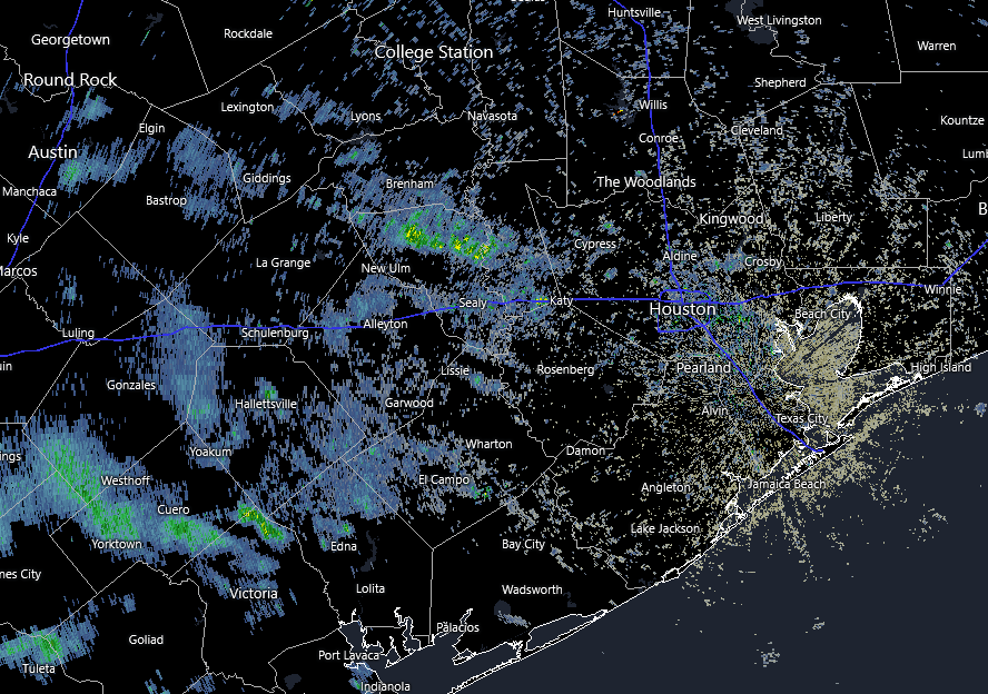
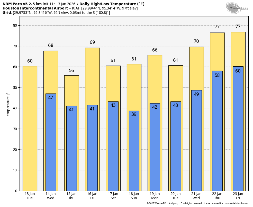
Returning closer to home, temperatures this morning are generally in the upper 40s for much of the Houston metro area. In response to a weak upper-level low pressure system we are seeing some light showers on the radar this morning to the west and southwest of the Houston area. Much of this is likely virga, which is precipitation that falls from clouds but evaporates before hitting the ground. This is occurring because the rain is light, and the air near the surface is very dry. It’s possible that some of these showers will be come a little bit stronger later today, so there is about a 20 percent chance of light sprinkles or showers reaching the ground as this system moves into the Houston region. Skies, otherwise, will be partly to mostly cloudy today with highs of around 60 degrees. Lows tonight will again generally drop into the upper 40s.
Wednesday
The first of two reinforcing fronts this week will arrive on Wednesday. Ahead of the front skies will be clear, and highs could reach about 70 degrees. However at some point, probably around noon or shortly after, winds will pick up from the north, gusting up to 25 mph or higher. These winds will eventually slacken some by Wednesday night, with lows dropping into the lower 40s, with cooler conditions for outlying areas. The front will be a dry passage, with no precipitation expected.
Thursday
This will be a sunny, cool day with highs of around 60 degrees. Lows on Thursday night will fall into the low- to mid-40s.
Friday
Temperatures will rebound to around 70 degrees on Friday, with ample sunshine. Another front later on Friday will bring more colder air in, dropping temperatures into the low 40s Friday night.
Saturday and Sunday
The weekend looks clear and cool, with highs generally in the 60s (probably mid-60s, but we’ll see) and sunny skies. Overnight lows will probably fall to around 40 degrees in Houston (although there is a chance for slightly colder nights). Overall rain chances are close to zero. Really we have zero weather concerns locally this weekend. Enjoy the winter-like weather!
Next week
The early part of next week looks to bring continued cold for a few more days. There is some “noise” out there about a hard freeze early next week, but at this point most of our modeling keeps things at, or above freezing. We’ll keep an eye on this. After about Tuesday we are likely to warm up for a few days, perhaps reaching the mid-70s toward the end of next week. This may change with another front by or before the weekend. Rain chances, alas, continue to look really low as we dry out. That is the only unfortunate element of this otherwise splendid winter weather forecast.
