In brief: Today’s post rants a little bit about August weather in Houston, and proceeds to talk about a weak (emphasis on weak, y’all) front moving into the region. This is mostly just going to drive increased rain chances on Thursday and Friday as we stay uncomfortably in the 90s, temperature-wise.
August rant
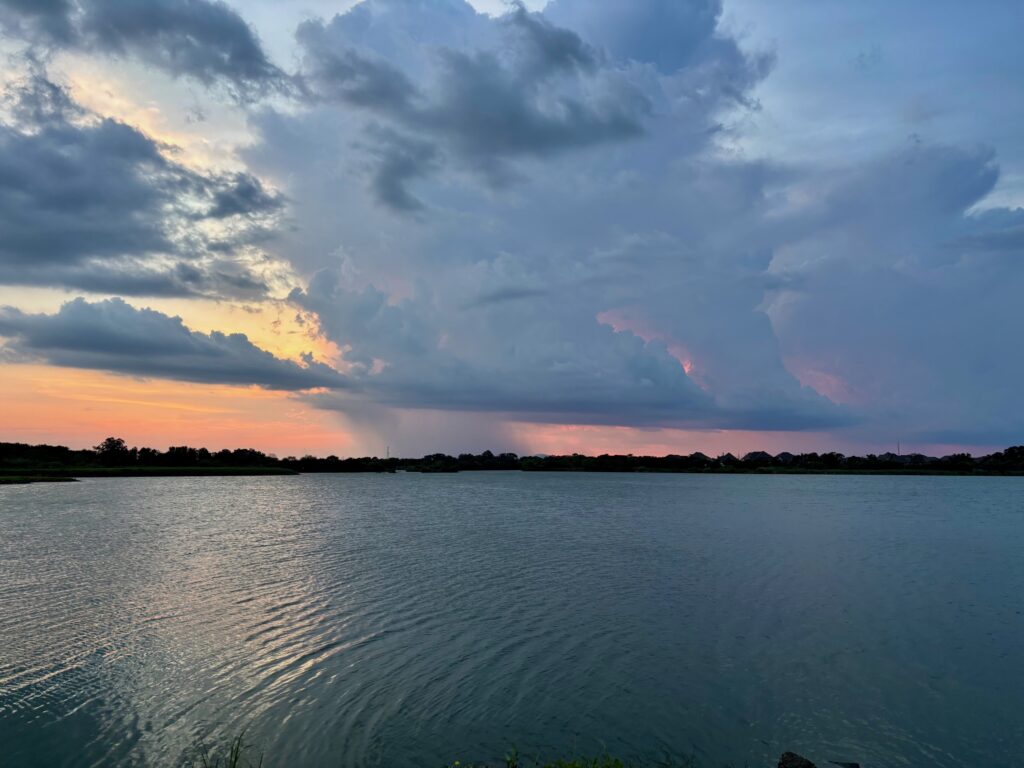
There is never any good weather in August in Houston. As I’ve written before, it’s either blazing hot with a burgeoning drought, or some tropical system is bearing down on the region. This month has been, shall we say, not terrible as daytime temperatures have been a little more reasonable and there has been some on-and-off again rain showers to help with our soils. (Although yes, angry person on Facebook, not everyone has gotten rainfall every day).
As expected, some scattered thunderstorms developed on Monday afternoon and evening, and indeed we anticipated that some of these would bring (briefly) heavy rainfall and strong winds. However I did not expect serious hail, but this being August of course that’s what happened. In areas such as Champion Forest and Jersey Village there was half-dollar and golf ball-sized hail reported. We cannot rule this happening again, elsewhere, for the rest of the week.
The point I’m trying to make is that there really is no helping August weather in Houston. The only thing one can do is survive and advance. The good news is that we’re doing that. Today is August 19, and there are just 12 days and 20 hours until September 1.
Tuesday
The pattern today should be a little bit different, with shower and thunderstorm developing a little bit earlier in the day. It will be driven more by a weak disturbance moving through than the sea breeze, and accordingly showers will be most likely from mid-morning through the early afternoon hours. Storms have already initiated north of the area, in Conroe, and I expect these to drop down into the city and coastal areas over the next few hours. Highs will generally be in the mid- to upper-90s for much of the region, especially with the likelihood of clearing skies this afternoon. Lows tonight will only drop to about 80 degrees.
Wednesday
This will be a hot day, and I suspect we’ll be back to showers and thunderstorms later in the day, during the afternoon and early evening. You know the drill, rains will be hit or miss. Look for highs generally in the upper 90s away from the coast.
Thursday and Friday
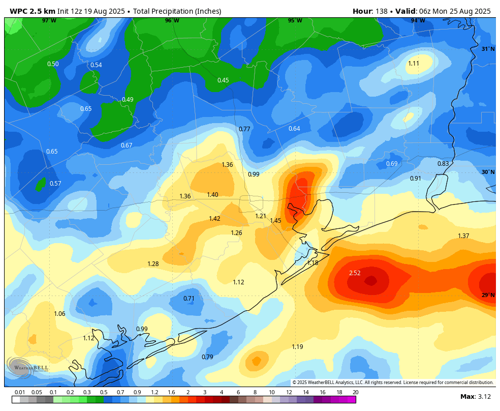
I’ve been hesitating to call it a “front,” because people have reasonable expectations for a cold front moving into Houston. However, meteorologically speaking, a front will push into the area on Wednesday and Thursday. Alas we’re not going to see some grand influx of drier air and cooler temperatures. A front at this time of year mostly just perturbs the atmosphere, so we’ll see increased rain chances (perhaps 70 percent daily) to end the work week. We can expect daily highs in the low- to mid-90s, with nighttime temperatures in the upper 70s.
Saturday and Sunday
The front should stall around the coast, so we are likely to see an unsettled pattern persist into the weekend. Expect highs in the low- to mid-90s, with high rain chances on Saturday, and perhaps lesser coverage by Sunday. I would not characterize the weekend as a total washout, but there definitely will be the chance of showers and thunderstorms, especially on Saturday. Overall accumulations for most locations through the weekend will probably be on the order of 1 inch. However, there probably will be a few bullseyes that accumulate 3 to 4 inches of rain over the next few days, and this may lead to some spotty street flooding.
Next week
Overall next week should bring lower rain chances and partly to mostly sunny days as we transition back to a more typical late August-like period. My expectation is for highs in the mid-90s, but we’ll see what happens.
