In brief: In today’s post we discuss the fire risk for Houston posed by the influx of drier air today and Friday in Houston. A weak front will lead to modestly drier air and cooler nights this weekend, and a continued pattern of late-summer weather next week.
A backdoor front arrives
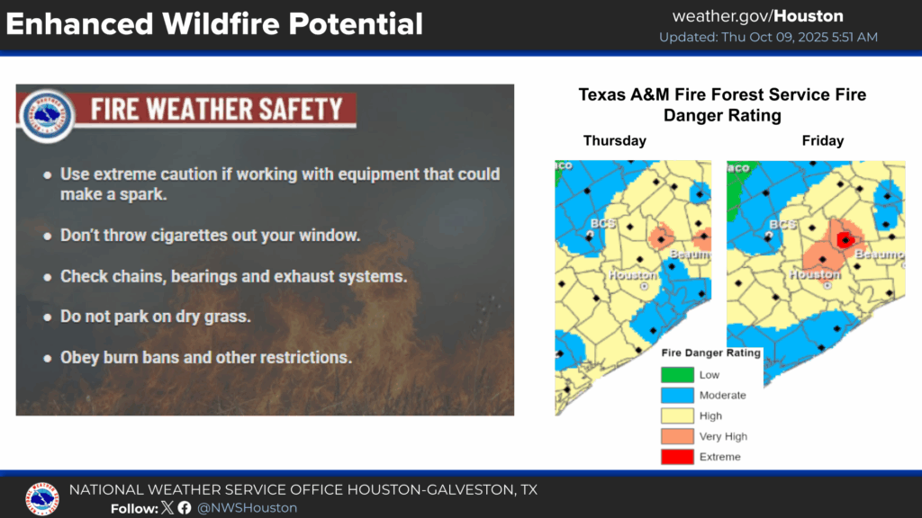
A modest pattern change will set the tone for Houston’s weather for at least the next week. A modest front bringing drier air from the northeast, along with expanding high pressure, will drive dewpoints lower and lead to slightly cooler days and nights. This weekend will see the driest air, but even into next week we are going to see less humidity than Houston has experienced the past several days. Rain chances are basically zero for at least the next seven days. The drier air will come with the increased potential for wildfires, especially on Thursday and Friday as winds from the northeast pick up.
Thursday
Winds have already started to increase from the northeast this morning, and will gust up to 20 mph today. Accordingly, we should see a slow influx of drier air over the next 24 hours or so. Houston will see sunny skies today, and highs generally in the lower 90s. For much of the area, appreciably drier air is unlikely before later tonight, when lows should drop into the upper 60s for most locations.
Friday, Saturday, and Sunday
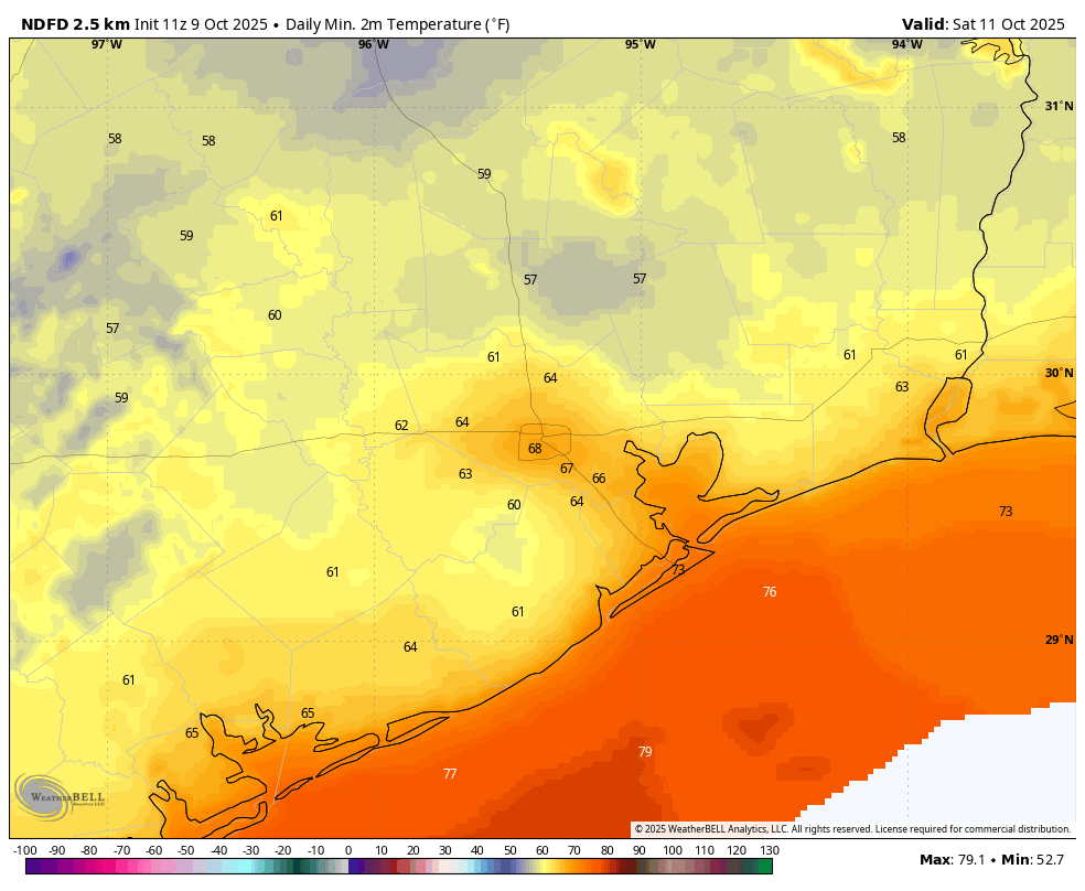
These three days will be similar, with highs around 90 degrees, and most of the region experiencing lows in the 60s (urban Houston and coastal areas in the upper 60s, with cooler conditions further inland), and sunny skies. Humidity looks to be lowest on Friday, but moderately drier air will hang around through the weekend.
Next week
With high pressure in place, most of next week will continue to bring sunny skies, with highs around 90 degrees, and nighttime lows in the vicinity of 70 degrees. Humidity will be present, but not at summertime levels. We continue to see some evidence for some kind of front by next weekend, but how strong, and whether it brings meaningful rain, is impossible to say.
