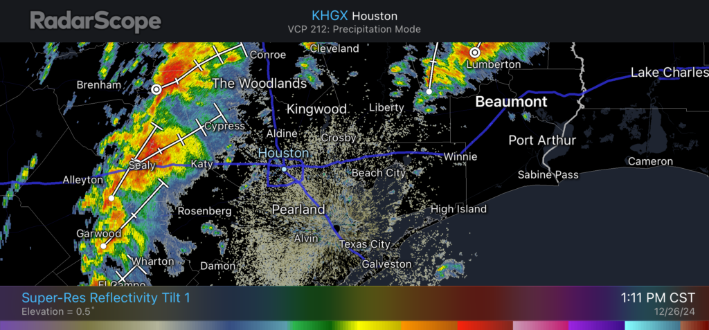
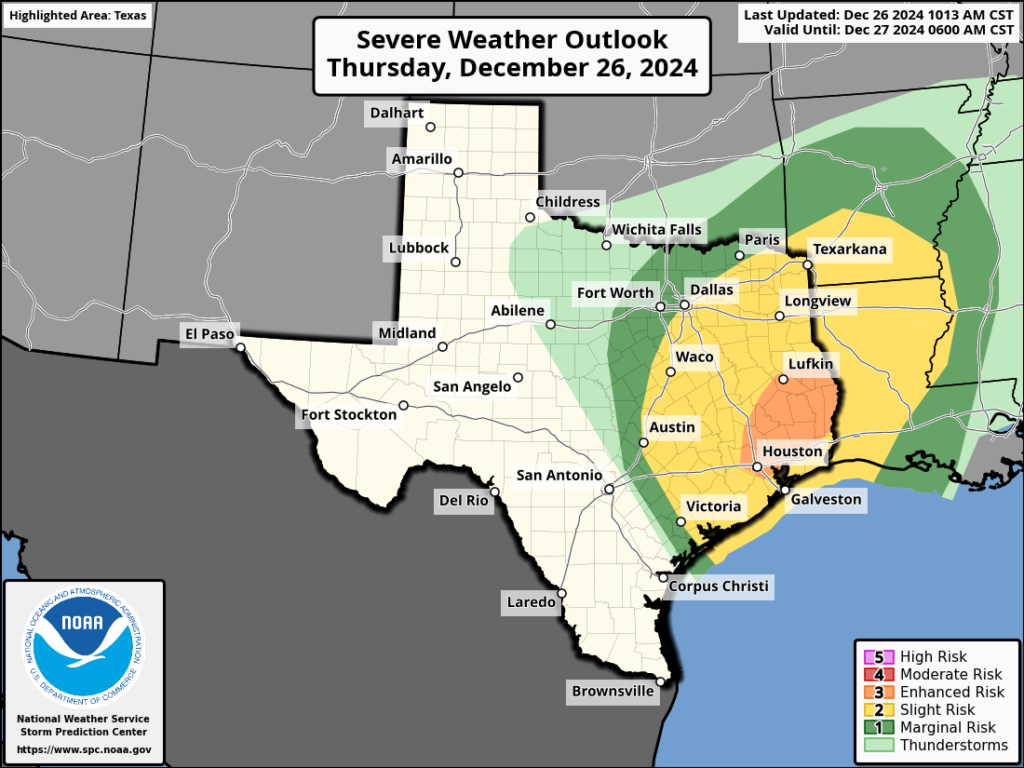
In brief: This short update is to inform you that potentially severe thunderstorms are on Houston’s doorstep, and will be impacting the region this afternoon. Please be weather aware for the next several hours.

Good afternoon. This is just a short post to note that, as expected, a line of strong thunderstorms is advancing into the Houston metro area as of 1:15 pm CT. We anticipate the period of most threatening and severe weather will occur from now through about 7 pm CT. Here’s what to expect during that time:
- A line of storms presently from El Campo to Sealy to Navasota will steadily progress eastward, likely reaching central portions of the Houston metro area between 2 and 4 pm CT
- These storms will then push steadily eastward, pushing offshore and to the east of Houston by 6 to 8 pm CT
- The primary threats from these storms include heavy rainfall that may briefly flood streets, damaging winds, hail, and possibly tornadoes
- To account for the threat of tornadoes, the National Weather Service has issued a Tornado Watch for the entire Houston metro area through 7 pm CT this evening.

Drier air will be moving in behind the storms as a weak front pushes into Houston overnight. Friday morning will (briefly) feel cooler and drier with temperatures in the lower 50s. Don’t get used to the cooler weather, as the onshore flow returns pretty quickly, with Saturday climbing back into the upper 70s. We’ll have full details in our forecast tomorrow morning, but until then, please be weather aware this afternoon and early evening!

It rained really hard for about 30 seconds in Sweeny. That is all we’ve had so far today.
“I’m not convinced these storms will be as organized as what we saw early on Christmas morning, but there’s the potential for some damaging winds, more hail, and briefly heavy rainfall. They might also strike during rush hour.”
That was Eric’s post from yesterday. He was the only weather source I saw that even mentioned that it might not be as bad today as it was Tuesday night/Wednesday morning. In about another hour west and central Houston will pretty much be out of the woods and in the clear.
Out here in Sealy I’d say it wasn’t as bad as the storms Tuesday night, definitely didn’t last as long, the worst of it had cleared in about 15 to 20 minutes.