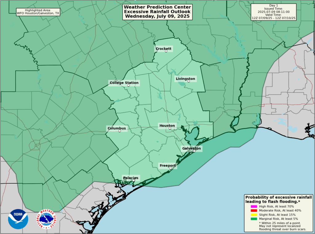
In brief: Houston will likely face additional showers and thunderstorms on Wednesday, with hit-or-miss coverage similar to what the region experienced on Tuesday. Looking ahead to the weekend, there is more rain in the forecast, although we don’t expect excessive totals.
Unsettled pattern continues
Houston’s weather will remain unsettled for a few more days as the region lies beyond the influence of high pressure. On Tuesday the region saw widely variable rainfall totals, with some areas near Sugar Land picking up in excess of 4 inches, whereas most of Houston received less than 0.5 inch. I expect another similarly active day today before things quiet down a bit, perhaps, ahead of the weekend. Speaking of which, after a couple of days of dithering about that forecast, it now appears that high moisture levels will drive a healthy chance of showers on both Saturday and Sunday.
Wednesday
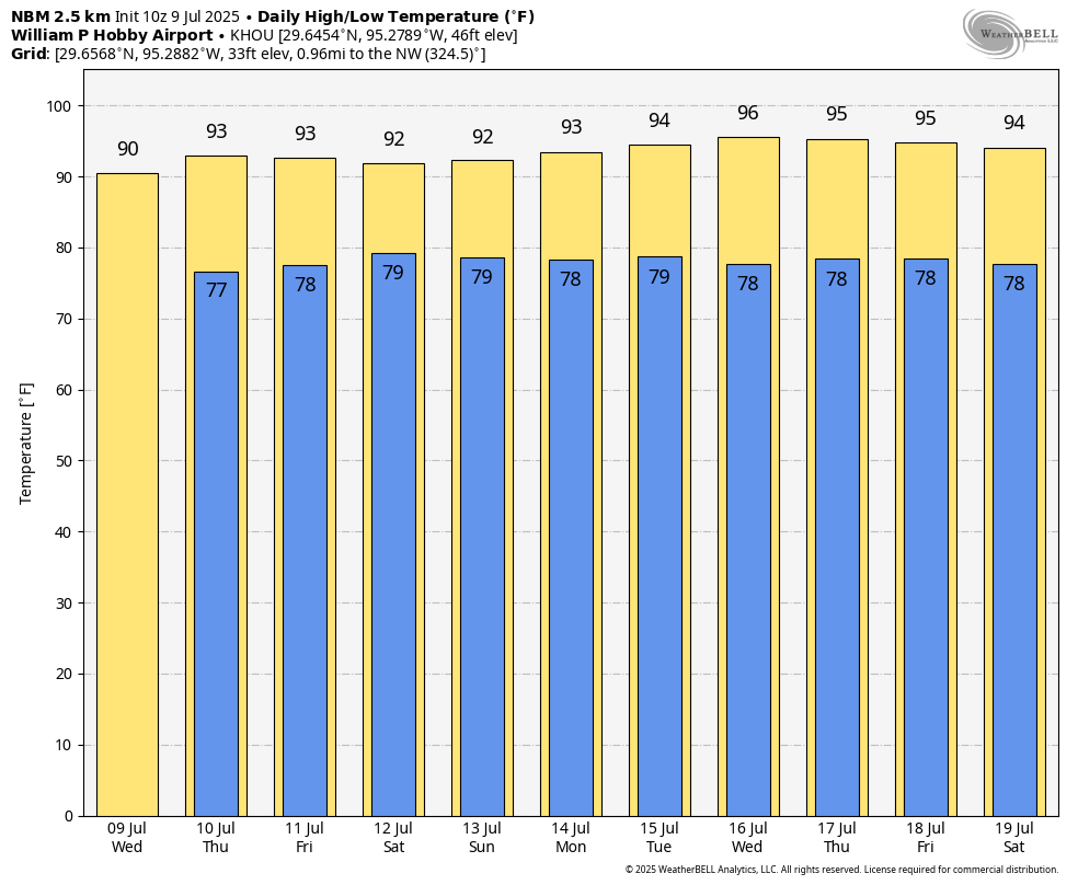
Today will be quite similar to Tuesday in that we see the development of showers and thunderstorms near the coast this morning (there is already activity offshore) that will spread inland today, through the afternoon and early evening hours before waning. Most of the region should pick up less than 0.5 inch, but there will be some locations that see in excess of that, and this may cause brief ponding on roadways. The upside of the clouds and rain is that temperatures will remain a bit lower than normal, with highs today likely to only reach about 90 degrees for most locations. Lows tonight should drop into the mid-70s.
Thursday and Friday
As a slug of slightly drier air moves into the region, we should see rain chances step back into the range of 30 to 40 percent daily, with a little bit more sunshine. This should allow high temperatures to reach the lower 90s for a couple of days. (The normal high for this time of year, in Houston, is 94 degrees). Friday may also be a bit windy, with southerly gusts perhaps reaching 20 mph. This is only notable because our winds have been fairly calm of late.
Saturday and Sunday
The weekend should see an increase in atmospheric moisture levels, and this will likely bring back better rain chances into the area. I’m not seeing any signal for widespread heavy rainfall, but both days should see a 60 percent chance (or so) of light to moderate showers. With the possibility of thunderstorms you should definitely have a backup plan for any outdoor activities. These showers and clouds should limit high temperatures to around 90 degrees. Overnight lows will be in the mid-70s.
Next week
At some point next week we should see high temperatures start to increase, probably into the mid-90s. Rain chances, also, should start to diminish. But I’m not ready to lock in such a forecast just yet.

My yard is loving these showers!
Got pounded in yesterday’s late afternoon encore of showers here in First Colony. Driving rain.
And ain’t complaining one bit…
Yesterday was crazy in its variability. In West U our street flooded to the point I needed to go out in it to move my car, but less than a mile away it barely rained and was under partly blue skies
Yeah isolated summer storms can be a trip like that. It literally can rain 3 inches in one area and 1 mile down the road gets sprinkles.
After the ridiculous summers we’ve had the past several years, we deserve a fairly temperate summer like what we are getting so far. Not very brutal temperates and just enough rain to help keep the grass green and the cracks from developing with no hurricanes.
For the past 10 years, our summers have been going from one dramatic extreme to the other, with 2021 being an exception. I know it’s always sorta been like that here, but the dramatic swings have been a bit excessive since 2015. It’s nice that we are finally experiencing a realitively tranquil summer for now anyway. I’ll enjoy it while it lasts. 👍👍
Yeah ⚘
July 9th
Record high: 102 1980
Record low: 64 1905
I got just under an inch in less than 30 minutes yesterday. Not complaining, this weather pattern is making the power bill lower.
This pattern should be archived and noted how we got here. I’m not sure it is simply a transition to neutral ENSO. 2024 queen palms survived the winter, a first since 2019. It rains 1/week. Haven’t used COH water outdoors since May 24, saving hundreds of dollars. KWHs down 10-20%. Zowee!
We need to get Eric and Matt working on how to transform our climate to Tennessee’s. That will save me a move when I retire.
Sounds like the plot of a netflix sci fi movie
What the hell is going on with the Houston-Galveston NOAA/NWS weather radio. It is an important lifeline. The station has been down for weeks due to a reported fire. We’re well into hurricane season and I’ve heard no news about when it might be operable again. We relied on it heavily during Harvey and Beryl.
Home just in time !! Got back from HEB about 45 mins ago, and the local storm arrived about 20 mins later here in Magnolia. Big rainfall with thunder and a bit of lightning.
It has calmed down now, but appears more to arrive.
The nice side effect ? It’s about 76°F right now (yes, seventy six)
Just had 2.7 inches of rain in barley 30 minutes in Sweeny.