In brief: The early part of this week will see some storm chances, especially Tuesday. After that we’ll be mostly sunny and increasingly hot through the weekend. Some slightly lower humidity is also in the cards, a real blessing in June. Finally, we’re following the possibility of heavy rain next week as a tropical disturbance develops in the Gulf.
Houston will see fairly normal weather this week for June, which is to say plenty of heat and some humidity, and scattered shower and thunderstorm chances. While that is far from pleasant, I consider this type of weather a win. Why? Because the summer months bring the biggest threats along the upper Texas coast. At this time of year, Houston could be facing significant flooding or a debilitating drought. Temperatures could be in the upper 90s or even triple digits. A hurricane could be forming in the Gulf of Mexico.
In short, boring and not blazing hot during the months of June, July, and August are just fine with me in H-town. However, if this is all too boring for you, be sure and check the outlook for next week at the end of this morning’s update.
Monday
We’ll start the week off with the potential for a few storms. I don’t expect anything crazy, but with fairly high levels of atmospheric moisture and a series of disturbances moving through we’ll see some rain chances through Wednesday. For today that means the development of some showers and thunderstorms during the afternoon and evening hours. I think these will be fairly scattered, so some areas may pick up a half an inch of rain, whereas much of Houston probably won’t see any meaningful accumulations. Skies will be partly to mostly sunny today, with high temperatures in the low 90s. Winds will be light, from the northeast at 5 mph. Rain chances slacken tonight as lows drop into the upper 70s.

Tuesday
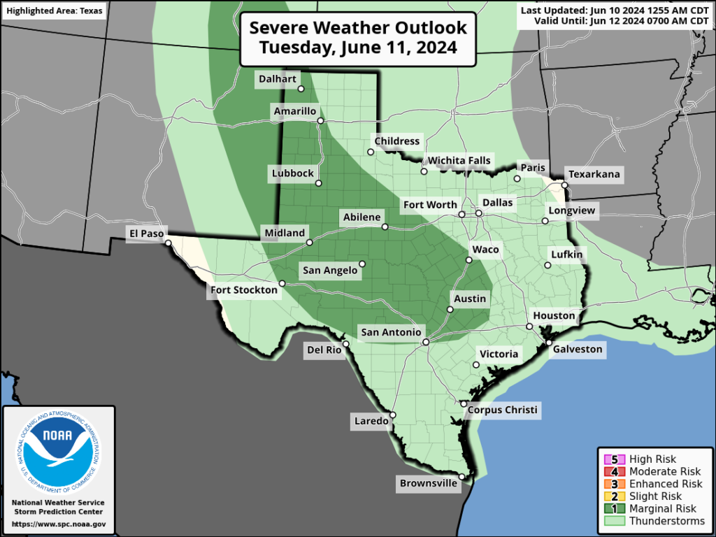
This day probably has the best storm potential of the week. It appears as though a complex of storms will develop in central Texas on Tuesday, and push toward Houston during the afternoon and evening hours. It’s not clear how well this line of storms will hold up as it approaches our area, but there’s a decent chance of some storms on Tuesday afternoon and evening for the western half of Houston, and lesser so for the eastern side. Otherwise, expect partly to mostly sunny skies on Tuesday with highs again in the lower 90s for most locations.
Wednesday
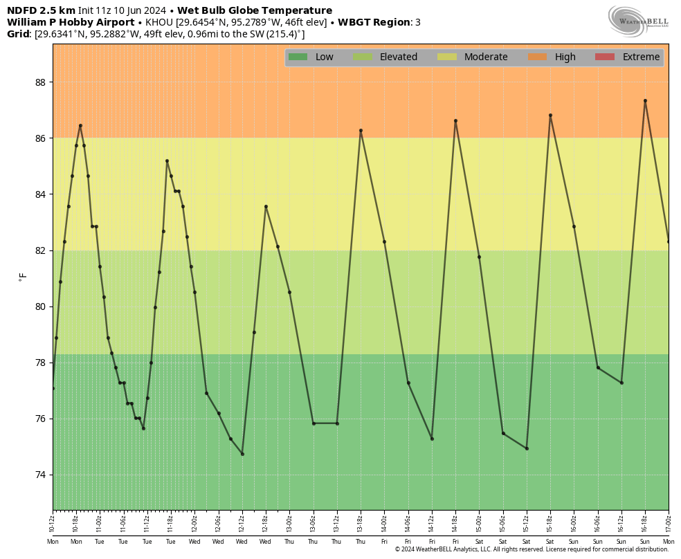
Another day with a slight chance of storms, but otherwise mostly sunny skies and highs in the low-90s. With a continued northwesterly flow we should see the influx of some moderately drier air during the second half of the week, which will push dewpoints down into the 60s. This is not dry air by any means, but the days should feel a little less humid than Houston typically feels during the summer. Mornings and evenings will be a bit nicer as well. This slightly drier pattern should hold through about Friday, or so.
Thursday and Friday
Storm chances should go away for the second half of the work week as high pressure builds over the southern United States. Both Thursday and Friday should see sunny skies with highs in the low- to mid-90s and some of that slightly drier air. Overnight lows will drop into the low- to mid-70s. So again, not at all bad for June.

Saturday and Sunday
The first half of the weekend looks sunny and hot, with high temperatures generally in the mid-90s although a few locations may reach the upper 90s. Sunday looks sunny and hot as well, although there’s the potential for some showers as moisture moves in from the Gulf of Mexico.
Next week
At some point later this week or over the weekend we are likely to see a tropical disturbance develop in the southern Gulf of Mexico. At this time I don’t think there’s much risk for a hurricane to form or anything menacing like that. However, this tropical system could be a heavy rainfall threat for the Texas coast beginning late this weekend and next week as it conveys moisture from the Gulf inland.
We are still at the point in the forecast where there is a ton of uncertainty. For our region, whether we see a little rain next week, or potentially a lot (i.e. 5 or more inches), will depend on the strength of high pressure over the southeastern United States. This will moderate how far north any tropical disturbance can move in the Gulf. (Further north and closer to Houston would increase the potential for heavy rain here). In any case, this is something we’ll be watching over the coming days.

Taking the last month into consideration I am going out on a limb and say the line of storms that develops on Tuesday in central Texas tomorrow is stronger than expected and push all the way down to the coast. Just a hunch…
Thinking the same
No guarantees what happened last month will repeat in June
Actually the weather does repeat. No guarantees, but I’d encourage you to check out the Wesh2 news Hurricane forecast that’s built on the basis of repeating weather patterns. I’ve been following it for 3 years now and it’s the most accurate Hurricane and weather forecast I’ve found to-date. Only one that correctly predicted average/below average season last year when everyone else predicted above average.
Last year had 20 named storms (4th most on record) and an ACE of 148, 50% above average.
It is pretty telling that we have to lower our expectations for a win to the level of “it is aw-right and not aw-ful”.
But, as a longtime Houstonian, I’ll take any amount of lower humidity in the summer that I can get. On the bright side, the tropical disturbance could cloud up our skies to block the sun. Just hope it is light rain.
I like this weeks forecast. Continued lower humidity is a WIN this time of year. Looking into next weeks possibility of tropical disturbance gives me something to keep an eye on. Thanks!
That half of inch of possible rain turned into about 3 inches in a one hour time here near Bingle and Tidwell….the last 3 weeks of weather here have been wild.