In brief: Houston survived the first round of storms, and we expect to see calmer weather for much of Saturday before another line of storms passes through the region later this evening. Come see us at Fall Day!
Round one, done
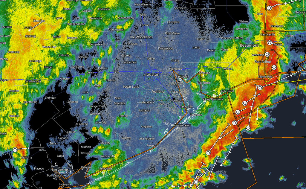
Well, did those overnight storms wake you up? The first round to pound Houston moved through during the wee hours of the morning, bringing plenty of thunder and lightning, some damaging winds, and generally 0.5 to 2 inches of rain. As of just before 6 am this morning, about 5 percent of customers are without power due to the storms. As anticipated, this line has now moved off to the east, with conditions improving behind it.
Saturday, daytime
So where does this leave us for the rest of today? There will be a continued chance of showers this morning, but coverage should be rather scattered for much of the day. So generally we expect to have clearing skies by late morning hours, with temperatures in the 70s. For much of the day, it should be pretty nice.
Speaking of which, please consider coming by our Fall Day celebration today from 10 am to noon at Midtown Park. We anticipate generally nice conditions, but if there is a stray shower there is plenty of cover at the park. We will have lots of fun activities for your family, and we will have special, 10th anniversary t-shirts for sale (exclusively) this morning. I must very sincerely apologize, however. The complementary tote bags that I ordered were delayed in shipping and now now not due to arrive until Monday. We will have to distribute them at a later date. I am very sorry about this (and believe me I have agonized about it). Fortunately Reliant has promised lots of other fun giveaways and activities. See you soon!

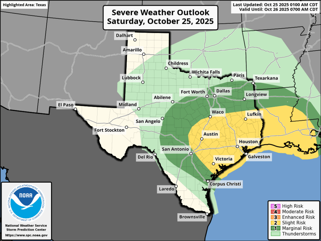
Conditions should remain pleasant through at least the early afternoon. However, later on we expect to observe the development of a second line of storms to the west of our region, which will potentially impact our weather on Saturday night into Sunday.
Saturday night
We’re still waiting to see exactly how this sets up, given the state of our atmosphere after Saturday morning’s round of storms. But generally we can expect to see a line or cluster of storms to develop near College Station around sunrise, give or take a couple of hours. Then this line of storms, in association with a weak front, should sag into the greater Houston region between 8 pm and midnight, likely moving off the coast during the wee hours of Sunday morning. These storms will carry similar threats to round one: heavy rain, thunder and lightning, damaging winds, possibly some hail and a very slight chance of a tornado. What will be different is that they’re likely come earlier in the evening, catching people when they might be out for dinner, a show, a sporting event, or what not. Please do be mindful of the weather this evening.
Sunday and beyond
After the early morning hours, Sunday should be mostly sunny and pleasant with the system moved offshore. Monday will be a little warmer, in the low- to mid-80s before a fine fall front arrives on Tuesday and ushers in some lovely weather.
