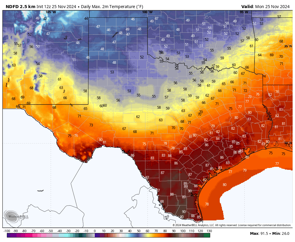
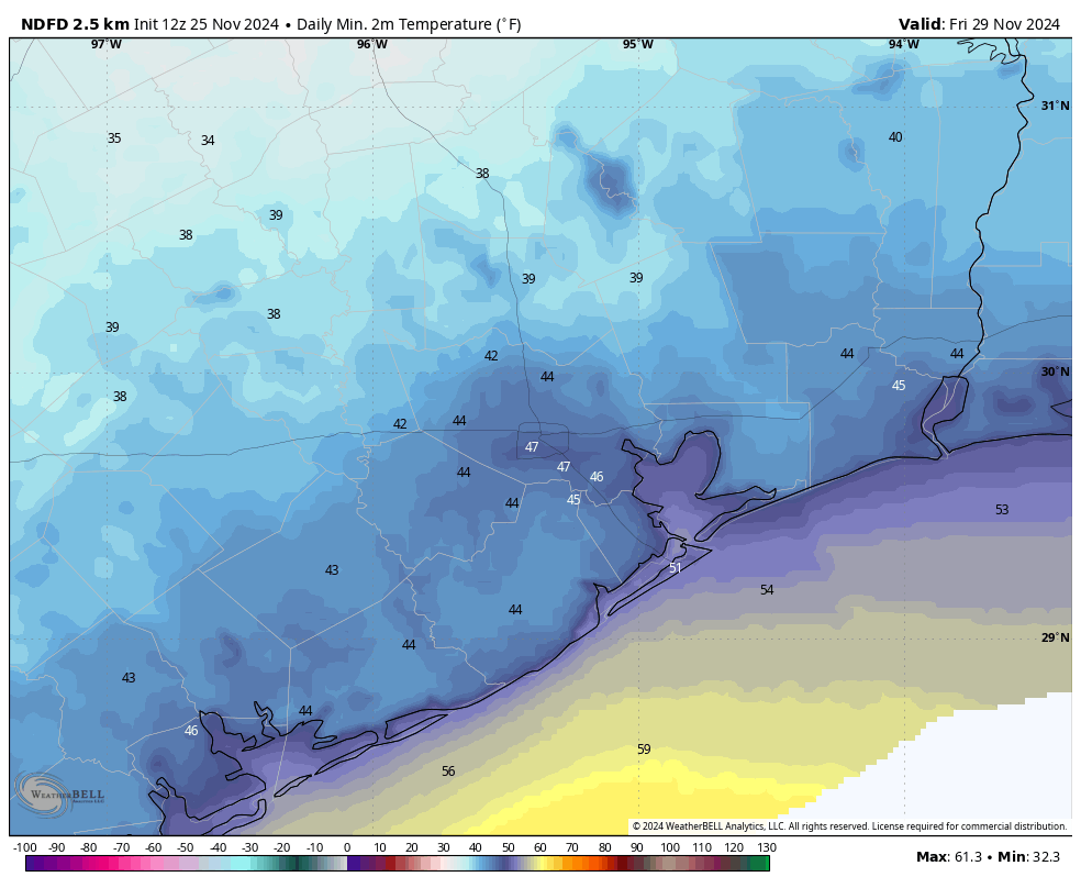
In brief: High temperatures on Monday and Wednesday will flirt with record highs before a front on Thanksgiving—likely during the morning hours—surges into Houston. This will bring us seasonal weather for the holiday, and likely keep us in a cool pattern well into December.
Late November heat
Sunday’s high temperature officially reached 83 degrees at Bush Intercontinental Airport, 1 degree below the all-time record of 84 degrees set back in 1910. Today should be slightly warmer across the metro area, with highs generally in the mid- to upper-80s. So the all-time record for today, 86 degrees (set in 1967) is definitely in play.
We could have one more chance to set a record high on Wednesday, when the daily record high is 84 degrees (set in 1989). The normal high temperature for this time of year, in case you were wondering, is 70 degrees. This November has a chance to be the warmest November on record, but a cold snap later this week could pull us back from the abyss. We’ll see.

Fundraiser
This is the final week of our 2024 fundraiser. If you appreciate the work we do, the sanity in the storm, this is your chance to support our site by donating or buying merchandise right here. Those who donate are ensuring that our work will be freely available for all. Thank you to everyone who has supported us so far during this annual campaign!
Monday
With a persistent onshore flow today, we’ll see warm and humid conditions, with highs in the mid-80s for much of the area, and a few locations likely reaching the upper 80s. Skies will be mostly sunny, with a southerly wind at about 10 mph. As noted above, this is abnormally warm for this time of year, but a front is coming to bring some short-lived relief. I cannot entirely rule out a very isolated shower with the front this evening, but for the most part we’ll just see drier air moving into the region by around sunset, and during the evening and overnight hours. Low temperatures will fall into the 50s tonight.
Tuesday
Our weather will be seasonal on Tuesday, with mostly sunny skies, drier air, and highs of around 70 degrees. Winds will be from the north, and perhaps a bit gusty. As winds turn easterly and then southeasterly overnight, lows will fall to around 60 degrees as humidity starts to return.
Wednesday
I’m going to make a bold prediction, and if I’m wrong I’m sure there will be plenty of people to point it out. However, I think Wednesday will be our last 80-degree day of the year. And it’s going to be a warm one, with highs in the mid-80s (and as noted above, with a record high in play). Mostly sunny skies will aid in the warming, and it will be plenty humid as well. Lows will drop into the 60s.
Thanksgiving
We can all give thanks that a stronger front will arrive in Houston on Thursday. The timing is still a little bit up in the air, but most of our modeling guidance suggests the front should reach Houston by around sunrise or shortly after. There is unlikely to be any rainfall with the front, but it will usher some stronger northerly winds into the area. We’ll likely see northerly gusts up to 20 or 25 mph. Skies start out mostly cloudy in the morning, but I expect some clearing during the daytime. Expect highs in the upper 60s for most locations, with overnight lows dropping into the 40s in Houston, with upper 30s possible for some outlying areas.

Friday
Friday, or for some dedicated shoppers Black Friday, will be clear and cool. Expect a breezy and chilly morning. Skies will be mostly sunny, likely with highs in the low 60s. Temperatures on Friday night should fall to around 50 degrees in Houston, with colder conditions in outlying areas.
Saturday, Sunday, and beyond
We’ll start to see a bit of a warming trend on Saturday, with highs probably in the upper 60s. However a reinforcing front (with a very slight chance of rain) is likely to keep a lid on temperatures. Highs on Sunday should be in the low 60s or thereabouts. Nights stay chilly.
Most of next week will remain on the cooler side, with highs in the 60s, and lows in the 40s to lower 50s. Beginning Sunday night or Monday we’ll also see an increased chance of rain and cloudier skies. Alas it will be December by then, so I won’t be able to describe it as a cold November rain …

This mid- 80s stuff in late November is getting old quick.
Getting? The “late heat” horse left the barn in October, IMO.
It’s going to get even older in December as well.
“However, I think Wednesday will be our last 80-degree day of the year.”
Gonna get burned again I see with this
We will most definitely hit 80 and above in December. Christmas eve and Christmas Day will likely be 2 of the days we hit 80 and above with overnight lows in the 70s. We have seen record high maximum and minimum temperatures throughout the entire fall and I don’t expect that to change as we head into December.
“Temperatures on Friday night should fall to around 50 degrees in Houston, with colder conditions in outlying areas.”
This isn’t even cold 😂
For SE TX, it is. See the reactions when there is a possibility of ice/snow
50 and humid is cold. my hands stop working well around that temp.
My grass is still green, it doesn’t know what to do.
I feel like we have already said like 4-5 times this fall that “fall” weather is finally here and staying for good. Then days after a cool front its in the mid 80s.
Let us all be safe and warm this Thanksgiving
🌬 🍂🍂💜🍂🍂
I love you all so much (^_^)
I love you too, Viv.
I can listen to Cold November Rain no matter what month of the year it is. 😉
Bold indeed.
I want you to be so right on the last 80 degree day Eric!
The front gliding in overnight is predicted to deliver upper 40’s up here in Magnolia, so our Tue morning walk should be pleasant.
Everyone is complaining about lack of cold. We motorcyclists and horse folks prefer the weather we’re stuck with. To be in a climate where one can only ride 6-8 months out of the year would be unappealing (to us) 👍
I like at least 4 months out of the year when my pansies can thrive…They don’t like daytime temps above 70… I have lost many in my raised bed thus far, I will go buy some more when we have sustained highs below 70 for more than two weeks, if that even happens this winter..
Also, I like my long morning walks better when it’s jacket weather with low humidity..
For me ideal is when it’s near the same T outside the house as in, plus a weekly or so rain day. Guess that’s Hawaii, but never been there. The past few weeks here have been ok tho…albeit a bit DRY
An 88-70-85 swing from Monday to Wednesday is no fun at all.