In brief: This post discusses our relatively mild start to the month of August, which is a nice change from some of our recent summers. And really the forecast does not offer much variability, with highs likely in the low- to mid-90s for awhile with a splash of daily rain chances.
It could be worse
The average high temperature during the sizzling first week of August, 2023, was 102 degrees Fahrenheit. (I felt a shudder as I wrote that). Last year it was 97.5 degrees. This year, so far, we’re running at 93.8 degrees. This is not exceptionally cool, but it is a little bit below the normal high for this time of year (96 degrees). As Matt has noted the moderate daytime temperatures we’ve been seeing this summer have been offset by extremely warm nights, but nevertheless it sure feels nice to go through what is typically the hottest time of the year and have days that aren’t at or near record high temperatures.
And I don’t want to jinx anything, but it looks like we should remain solidly in the low- to mid-90s through at least the middle of the month as high pressure appears unlikely to build directly over the region anytime soon.
Wednesday
We remain on the edge of a very potent high pressure system anchored over the Southwestern United States, and that will continue to bring warm, mostly sunny days with a low-end chance of showers and thunderstorms. With this pattern we should continue to see high temperatures in the mid-90s for areas along and north of Interstate 10, and lower 90s for areas closer to the coast. Rain chances will be on the order of about 30 percent daily, with totals probably at the higher end toward the coast, and lower further inland. Humidity remains high, with light southeasterly winds. Nighttime temperatures will struggle to fall much below 80 degrees.
Thursday and Friday
These days will see a similar pattern, although daytime highs should be 1 or 2 degrees warmer, with some inland areas potentially reaching the upper 90s. A chance of showers is possible during the afternoon along the sea breeze.
Saturday and Sunday
The song remains the same heading into the weekend, although daily rain chances may nudge up to 40 or even 50 percent closer to the coast. These showers are unlikely to last too long, and for most locations will only bring a tenth of an inch of rain or two. For the most part skies should be sunny, with high temperatures in the low- to mid-90s.
Next week
Honestly, at this point not much change appears to be in the forecast for next week. If we’re getting through August with temperatures in the low- to mid-90s and the occasional shower to keep things green, then we’re doing August in Houston about as good as one can.
Tropics
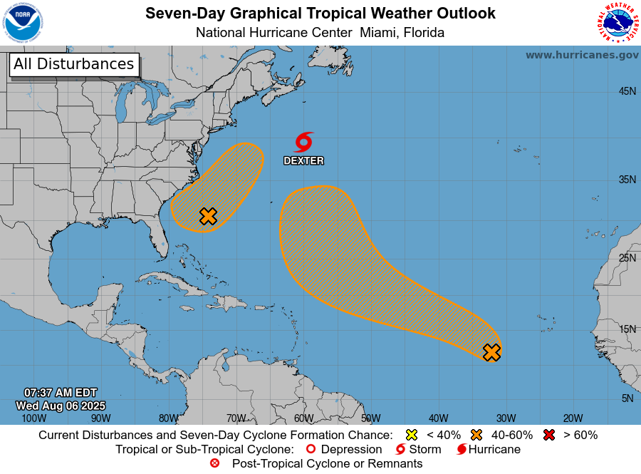
Dexter remains a weak tropical storm that is moving away from land, so no concerns there. Two other systems have a chance to develop, and one of them may bring increased rain chances to the southeastern United States over the next week. The Gulf looks clear for now, but we’re just about to begin a pattern of tropical systems forming in the “main development region” of the tropical Atlantic, and these will have a better chance of moving westward toward the Gulf, and potentially entering the body of water on our doorstep. Nothing is imminent, however. We’re just getting close to that time of year.
